Grafton is a city in and the county seat of Taylor County, West Virginia, United States, along the Tygart Valley River. The population was 4,729 at the 2020 census. It originally developed as a junction point for the Baltimore and Ohio Railroad, serving numerous branches of a network that was vital to the regional coal industry.
Grafton is the home of both of West Virginia’s national cemeteries, and was where the West Virginia Equal Suffrage Association formed in 1895. Mother’s Day was founded in Grafton on May 10, 1908, and the city is home to the International Mother’s Day Shrine. Grafton was also among the first cities in the United States to observe Memorial Day.
| Name: | Grafton city |
|---|---|
| LSAD Code: | 25 |
| LSAD Description: | city (suffix) |
| State: | West Virginia |
| County: | Taylor County |
| Elevation: | 1,024 ft (312 m) |
| Total Area: | 3.80 sq mi (9.85 km²) |
| Land Area: | 3.67 sq mi (9.51 km²) |
| Water Area: | 0.13 sq mi (0.34 km²) |
| Total Population: | 4,729 |
| Population Density: | 1,356.75/sq mi (523.77/km²) |
| ZIP code: | 26354 |
| Area code: | 304 |
| FIPS code: | 5432716 |
| GNISfeature ID: | 1554590 |
| Website: | www.graftonwv.org |
Online Interactive Map
Click on ![]() to view map in "full screen" mode.
to view map in "full screen" mode.
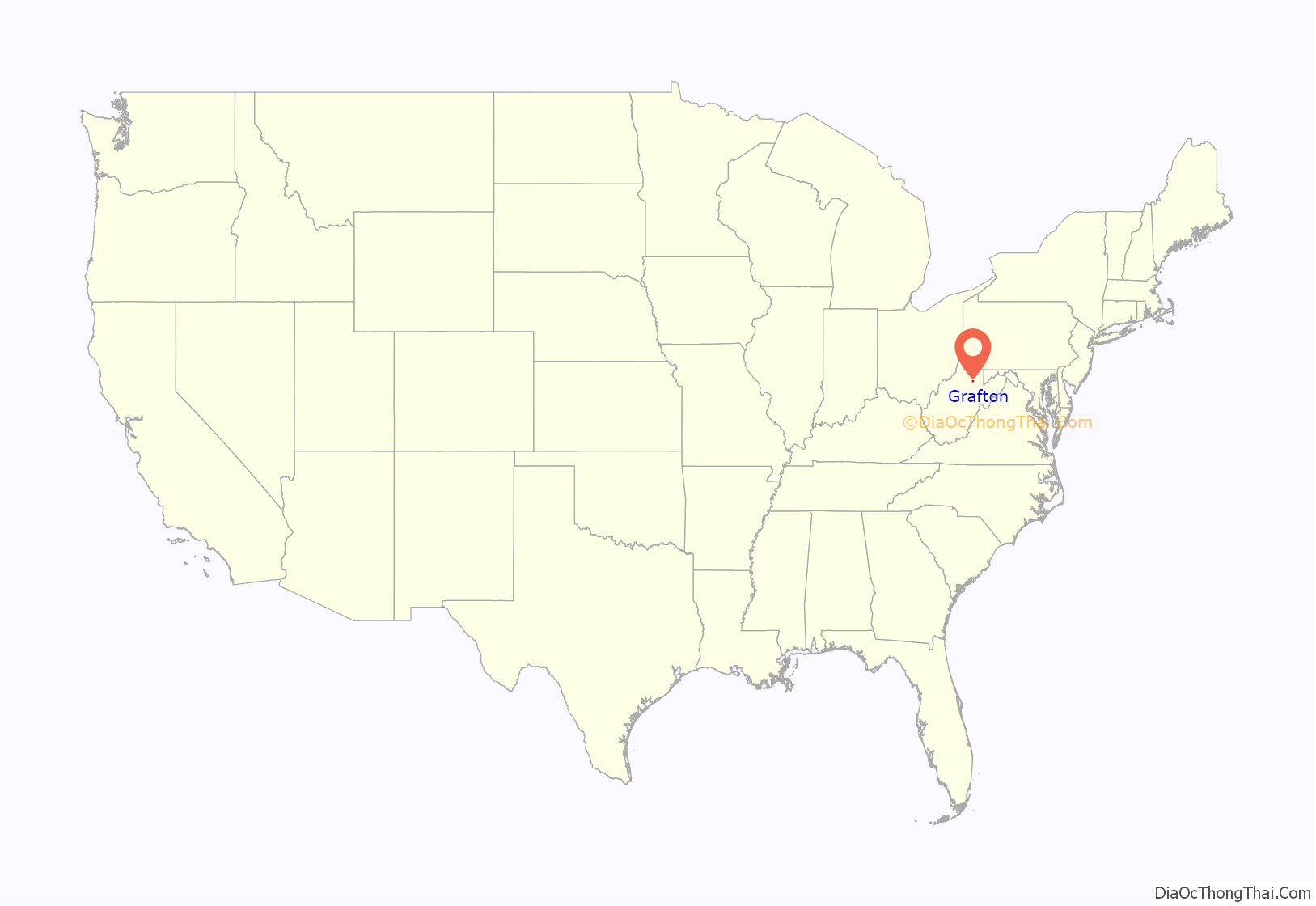
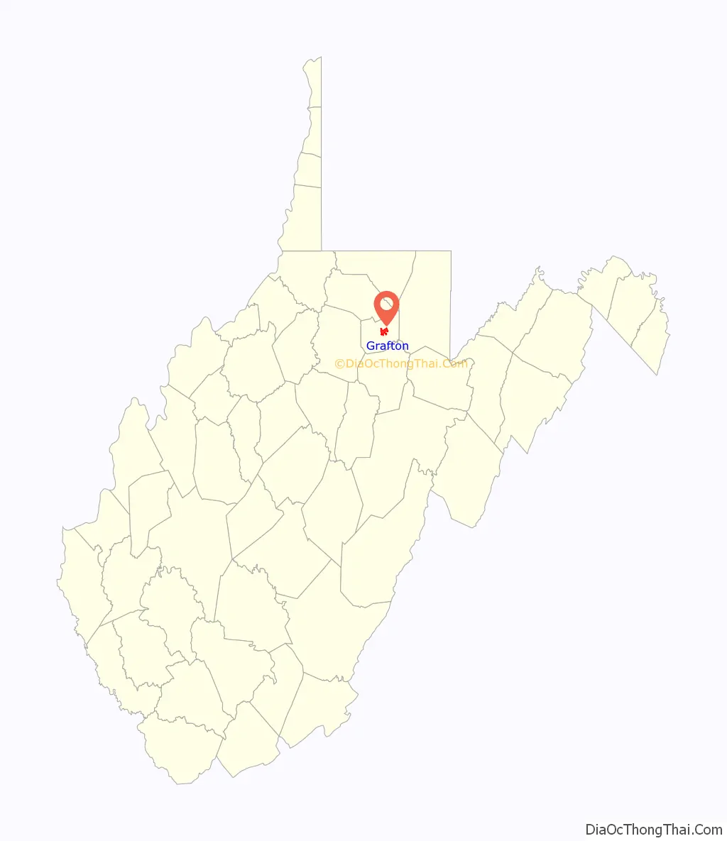
Grafton location map. Where is Grafton city?
History
Etymology
The origin of the name “Grafton” — originally Grafton Junction — is disputed. The city may have been named for John Grafton, a civil engineer of the Baltimore and Ohio Railroad. Alternatively, railroad crews may have referred to the town as “Graftin” because it was the point at which a number of branch railroad lines met (grafted to) the railroad’s mainline.
Earliest settlers
Grafton developed from early white settlements at the confluence of Three Fork Creek with the Tygart Valley River, part of the headwaters region of the Monongahela River watershed. In 1776, Virginia‘s remote District of West Augusta was divided into three counties, including Monongalia County, which included what are now Taylor County and Grafton.
Among the earliest settlers were James Current (ca. 1730–1822) and his family. He was a Scots-Irish immigrant who fought in the Revolutionary War in 1778, had landed in Maryland and moved into the interior. He was living in Monongalia County with his family by 1782 when he was recorded on a census there. According to family tradition, Current traded a “gray horse” for 1,300 acres of land located where present-day Grafton developed. James and his wife Margaret are buried in Bluemont Cemetery (part of his original property). Current’s grave is the only one in Grafton known to belong to a veteran of the Revolutionary War.
Turnpike and railroad
John Wolverton Blue (1803–1889) was in charge of the construction of Virginia’s Northwestern Turnpike from Aurora to the Tygart Valley. Visiting the future site of Grafton in 1833, he stayed overnight with the Currents. According to a local historian, “Blue, upon awakening the next morning, heard the wife of Current sobbing bitterly” over the impending loss of her “cabin home…[and] vegetable and flower garden” because of the planned right-of-way for the road. “Mr. Blue, a Virginian of the old school, was greatly moved…and…an offer of $300 for 900 acres…and their ruined home…was quickly accepted.”
This neighborhood (now a suburb of Grafton) became known as Blueville and it — along with the nearby area called “Valley Bridge” (present day Fetterman, or Ward 1) — began to grow after the Turnpike was completed in 1834. Blue also supervised the construction of a (now long gone) covered bridge over the Tygart here at this time.
In 1847, the Virginia General Assembly passed an act authorizing the Baltimore and Ohio Railroad Company to extend its line to the Ohio River at Wheeling. The city of Grafton owes its existence to the interventions of Thomas S. Haymond (1794–1869), a lawyer and U.S. Congressman (and future Confederate colonel) from nearby Marion County. According to another local historian, “Haymond never mentioned his county as desiring the [rail]road; but being well acquainted with the geography of north-western Virginia, he quietly got the following clause attached to the bill: ‘That the said railroad to be constructed through the territory of Virginia, shall reach or cross the Tygart’s Valley River at or within three miles of the mouth of Three Fork Creek in the county of Taylor'”. This clause effectively re-routed the line away from Morgantown and forced it to pass through Haymond’s hometown of Fairmont. Grafton, which is perched in unlikely fashion on a very steep hillside at the mentioned confluence, was the accidental beneficiary, also becoming the branch point for the side line north to Morgantown.
The B&O work crews completed the line on January 11, 1852, and the first “iron horse” arrived two days later. This was the first trans-Appalachian railroad. Within a year Grafton had emerged as a booming railroad town with several residences and stores. As the railroad facilities were developed, local land was surveyed for the new town, which was chartered on March 15, 1856, in the Virginia General Assembly.
Civil War
Due to the importance of the B&O and Northwestern Virginia Railroads for the movement of troops and supplies, Grafton became an early strategic target during the Civil War; both sides tried to control it. CSA General Robert E. Lee initially vowed to protect the railroad, and sent first CSA Major Francis M. Boykin Jr., then CSA Col. George A. Porterfield (a Virginia Military Institute graduate from Charles Town across from Harpers Ferry) to recruit at Grafton, but neither had much success. Most Grafton residents, immigrants brought in to work for the railroad, sided with the Union. The Grafton Guards led by Col. George R. Latham became Company B of the 2nd West Virginia Infantry Regiment days after Virginians (over the objection of most of western Virginia) voted for secession on May 23.
The previous evening (May 22, 1861), opposing factions skirmished in the Town of Fetterman (now a part of Grafton), resulting in the death of Thornsbury Bailey Brown, the first soldier killed in the Civil War. Southern supporters joined the Confederate Letcher’s Guard.
With the Grafton Guards in Wheeling, Porterfield occupied Grafton on May 25, but left three days later for Philippi, when he realized his vastly outnumbered forces were facing a pincer movement from troops under the Wheeling militia’s Col. Benjamin Franklin Kelley (soon to become a Brigadier General and who would station his Railroad Division at Grafton) as well as various Ohio and Indiana units sent by Union General George McClellan, a U.S. Army officer turned railroad man whom President Lincoln had placed in charge of the Department of the Ohio. Kelley planned to attack the Confederates and drive them away from the vital railroads. Although reinforced by about 400 men at Philippi, the Confederates, realizing themselves vastly outnumbered in the June 3 attack, fled, leaving more than 750 muskets, ammunition, wagons, horses, medical supplies and tents behind, so the Battle of Philippi (West Virginia) would sometimes be called the “Philippi Races.” Gen. Lee soon replaced Porterfield with CSA Gen. Robert S. Garnett.
Although the Union controlled Grafton, Confederates often raided and vandalized to disrupt railroad operations. The Northwestern Virginia Railroad and its rail yard and machine shops at Grafton were also a probable objective of the Jones-Imboden Raid in April 1863. Raiders did destroy the 3-span bridge across the Monongahela River at Fairmont due north of Grafton (the largest on the line) as well as several smaller bridges, but Grafton’s rail yards, which were protected by Mulligan’s Brigade, the First and Eighth Maryland, and Miner’s Indiana battery, were not attacked.
Post-war growth
Following the Civil War, Grafton continued to grow and prosper, developing into a major retail and industrial center for North Central West Virginia. Grafton was visited by President U.S. Grant on September 23, 1872, as part of his reelection campaign. Grant’s speech was interrupted several times by noisy southern sympathizers.
In 1878, Grafton was designated as the county seat, replacing Pruntytown in this role. A massive flood which swept through town in 1888 wrought many changes, including destruction of the historic (1834) covered bridge at Fetterman. Most of present-day Grafton was built during the period from 1890 to 1930. John T. McGraw, a financier and major contributor to most of Grafton’s buildings, was the principal town builder. Besides his bank, McGraw built a number of buildings along Main Street, and also the streetcar system that was used for many years.
20th century
Tygart Dam was constructed about 2 miles south of Grafton between 1934 and 1938, by the Works Progress Administration of the Franklin D. Roosevelt administration. President Roosevelt visited the city on a stump tour, and remarked on such projects on October 1, 1936; he gained a landslide re-election the following month. Upstream of the dam, Tygart Lake State Park was designated to preserve recreation areas around the man-made lake. The Tygart Valley River flows through Grafton.
Grafton continued to prosper throughout much of the early 20th century, based on the railroad’s importance in both the area and the national economy. But in the early 1950s, the Carr China Plant closed and left hundreds of residents unemployed. In the late 1950s, Hazel Atlas Glass Plant closed and also left hundreds of residents without jobs. In 1958, the women of Grafton organized a parade on Main Street to attract jobs for residents of the community. This parade received national attention. Grafton was the chosen site of a plastic baby toys manufacturer. Because of the residents’ efforts, Grafton was given an All-America City Award by the National Civic League in 1962, the smallest city that year to receive the award.
Although instrumental to the city’s early growth and economy, the railroad inhibited its expansion. In the 1920s smoke abatement experts reported that the combination of high hills, low wind velocity, and frequent railroad traffic, created air quality problems for the city and its business district, which was adjacent to the area of intense railroad activity. The resulting smoke from the railroad industry was a chief factor in hindering the growth of the city. Restructuring of the railroads and heavy industry through the late 20th century resulted in the loss of more jobs and, ultimately, population. People moved elsewhere for work.
In the early 1980s, the railroad relocated hundreds of jobs to Jacksonville, Florida, as the Chessie System aimed to form CSX. Grafton suffered a severe economic and emotional loss from these changes.
The 1985 Election day floods were notable in Grafton. Most of the 47 people killed in this incident were in Pendleton and Grant counties, according to the National Weather Service. Flooding in the Tygart Valley River basin (a tributary to the Monongahela River) set new records for peak discharge at all five of the long-term unregulated gauging stations in the basin. However, the peaks were not as extreme, relative to the previous peaks of record, as those in the Cheat River and South Branch Potomac River basins. Recurrence intervals for the peaks equaled or exceeded 50 years at all five of the aforementioned sites in the Tygart basin, and four were in excess of 100 years. Also, at one newly established gauging station, Three Forks Creek near Grafton, the peak discharge, 12,000 ft3/s, was estimated to exceed the 100-year recurrence interval.
Historic places
The Grafton Downtown Commercial Historic District was listed on the National Register of Historic Places in 1984 and the Grafton National Cemetery was listed in 1982.
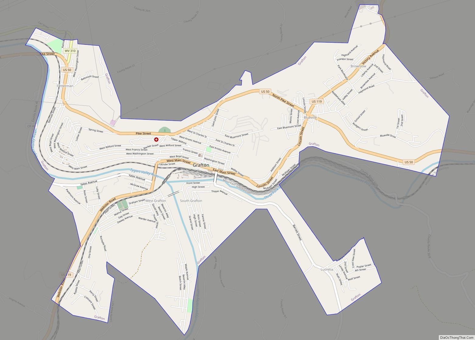
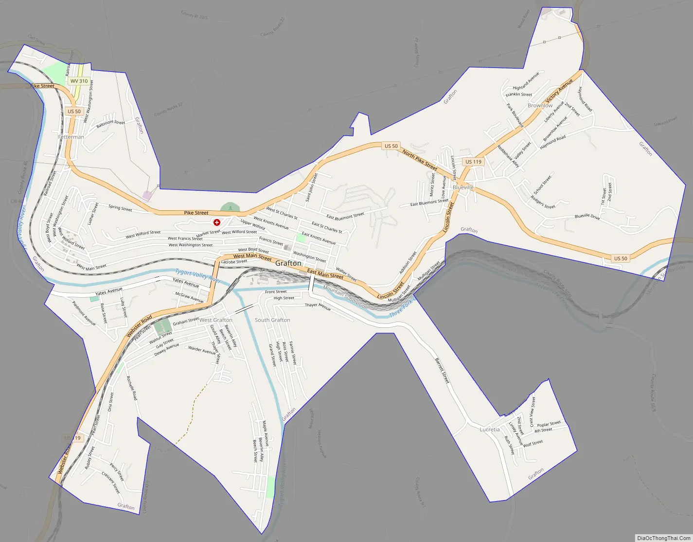
Grafton Road Map
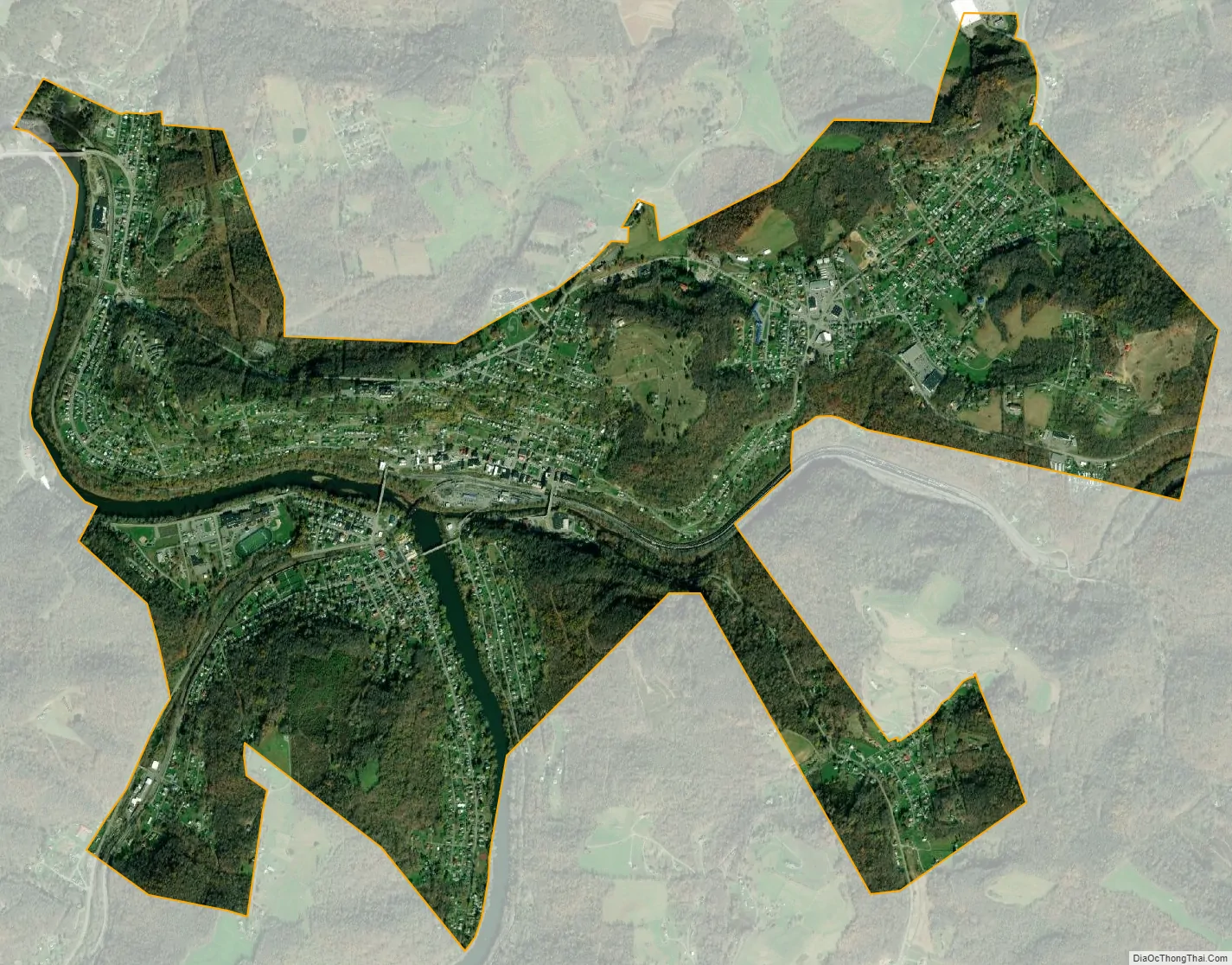
Grafton city Satellite Map
Geography
Grafton is located at 39°20′30″N 80°1′11″W / 39.34167°N 80.01972°W / 39.34167; -80.01972 (39.341757, −80.019817), along the Tygart Valley River. Tygart Lake State Park is a major nearby tourist attraction.
According to the United States Census Bureau, the city has a total area of 3.80 square miles (9.84 km), of which 3.67 square miles (9.51 km) is land and 0.13 square miles (0.34 km) is water.
See also
Map of West Virginia State and its subdivision:- Barbour
- Berkeley
- Boone
- Braxton
- Brooke
- Cabell
- Calhoun
- Clay
- Doddridge
- Fayette
- Gilmer
- Grant
- Greenbrier
- Hampshire
- Hancock
- Hardy
- Harrison
- Jackson
- Jefferson
- Kanawha
- Lewis
- Lincoln
- Logan
- Marion
- Marshall
- Mason
- McDowell
- Mercer
- Mineral
- Mingo
- Monongalia
- Monroe
- Morgan
- Nicholas
- Ohio
- Pendleton
- Pleasants
- Pocahontas
- Preston
- Putnam
- Raleigh
- Randolph
- Ritchie
- Roane
- Summers
- Taylor
- Tucker
- Tyler
- Upshur
- Wayne
- Webster
- Wetzel
- Wirt
- Wood
- Wyoming
- Alabama
- Alaska
- Arizona
- Arkansas
- California
- Colorado
- Connecticut
- Delaware
- District of Columbia
- Florida
- Georgia
- Hawaii
- Idaho
- Illinois
- Indiana
- Iowa
- Kansas
- Kentucky
- Louisiana
- Maine
- Maryland
- Massachusetts
- Michigan
- Minnesota
- Mississippi
- Missouri
- Montana
- Nebraska
- Nevada
- New Hampshire
- New Jersey
- New Mexico
- New York
- North Carolina
- North Dakota
- Ohio
- Oklahoma
- Oregon
- Pennsylvania
- Rhode Island
- South Carolina
- South Dakota
- Tennessee
- Texas
- Utah
- Vermont
- Virginia
- Washington
- West Virginia
- Wisconsin
- Wyoming