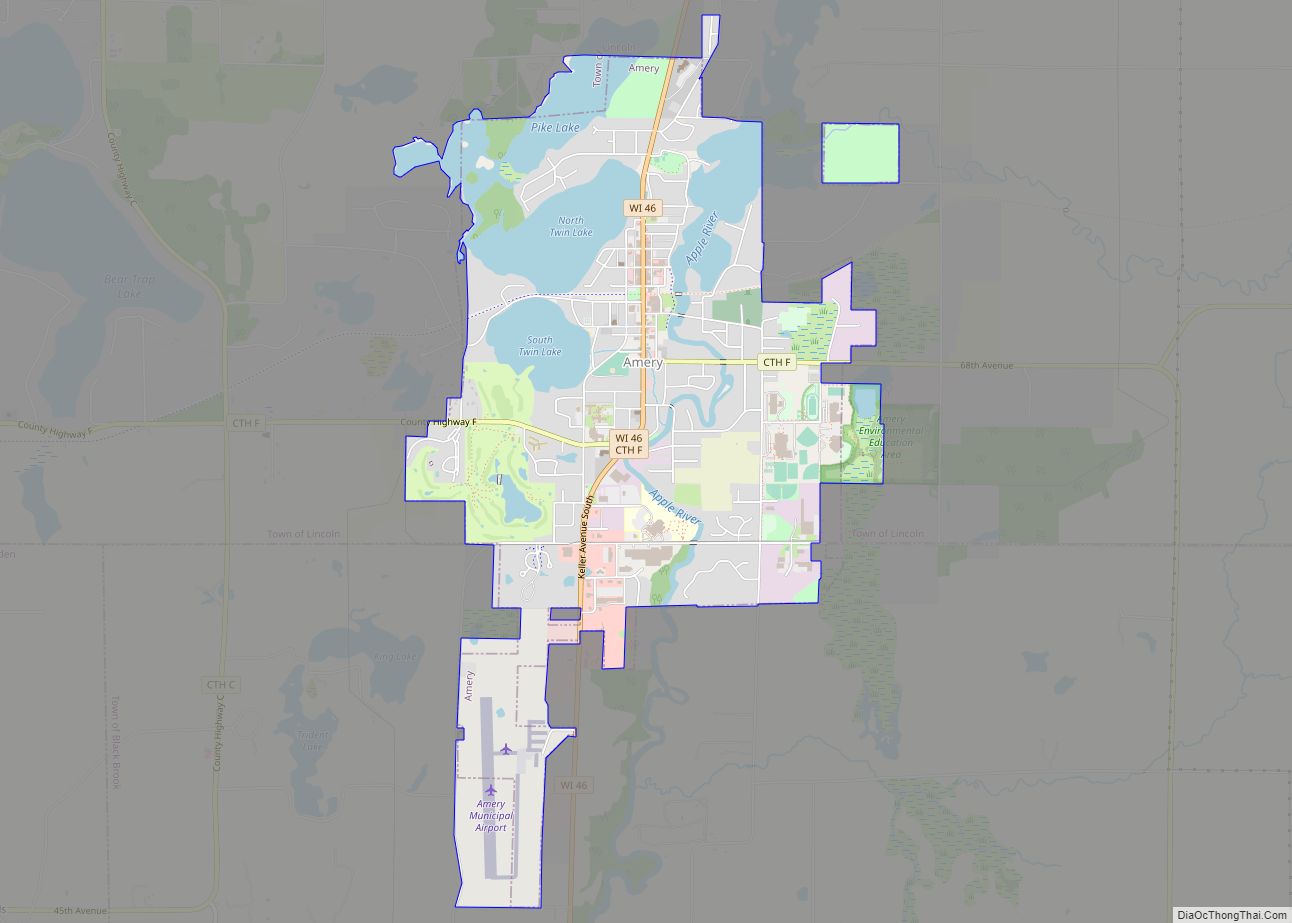
Map of Altoona city, Wisconsin

Map of Altoona city, Wisconsin

Altoona is a city in Eau Claire County, Wisconsin, United States. The population was 8,292 at the 2020 census with an estimated population in 2021 of 8,817. The city is a railroad terminal on the Union Pacific Railroad. Altoona city overview: Name: Altoona city LSAD Code: 25 LSAD Description: city (suffix) State: Wisconsin County: Eau … Read more

Map of Almond village, Wisconsin

Map of Almond village, Wisconsin

Almond is a town in Portage County, Wisconsin, United States. The population was 679 at the 2000 census. The unincorporated community of West Almond is located in the town. The Town of Almond was established in 1851. Almond village overview: Name: Almond village LSAD Code: 47 LSAD Description: village (suffix) State: Wisconsin County: Portage County … Read more

Map of Almena village, Wisconsin

Map of Almena village, Wisconsin

The Town of Almena is in Barron County in the U.S. state of Wisconsin. The population was 858 at the 2010 census. The Village of Almena is partially located within the town. Almena village overview: Name: Almena village LSAD Code: 47 LSAD Description: village (suffix) State: Wisconsin County: Barron County FIPS code: 5501325 Online Interactive … Read more

Map of Alma city, Wisconsin

Map of Alma city, Wisconsin

Alma is a city in and the county seat of Buffalo County, Wisconsin, United States. The population was 716 at the 2020 census. The motto for the city of Alma is: “Step into Living History.” Alma city overview: Name: Alma city LSAD Code: 25 LSAD Description: city (suffix) State: Wisconsin County: Buffalo County Elevation: 673 ft … Read more

Map of Alma Center village

Map of Alma Center village

Alma Center is a village in Jackson County, Wisconsin, United States. The population was 503 at the 2010 census. The village is located within the Town of Alma. Alma Center village overview: Name: Alma Center village LSAD Code: 47 LSAD Description: village (suffix) State: Wisconsin County: Jackson County Elevation: 981 ft (299 m) Total Area: 1.00 sq mi (2.60 km²) … Read more

Map of Allouez village

Map of Allouez village

Allouez is a village in Brown County in the U.S. state of Wisconsin. The population was 13,975 at the 2010 census. It is part of the Green Bay Metropolitan Statistical Area. Allouez village overview: Name: Allouez village LSAD Code: 47 LSAD Description: village (suffix) State: Wisconsin County: Brown County Elevation: 597 ft (182 m) Total Area: 5.21 sq mi … Read more

Map of Allenton CDP

Map of Allenton CDP

Allenton, Wisconsin is an unincorporated census-designated place in the town of Addison, Wisconsin in Washington County, Wisconsin. It is located near the intersection of Wisconsin Highway 33 and Interstate 41. It is on a line of the Canadian National Railway, parent company of the Wisconsin Central Ltd. railroad company. Allenton has a post office with … Read more

Map of Arcadia city, Wisconsin

Map of Arcadia city, Wisconsin

Arcadia is a city in Trempealeau County, Wisconsin, United States, along the Trempealeau River. The population was 3,737 at the 2020 census. Arcadia is a Latino-majority city and the largest city in Trempealeau county. Arcadia city overview: Name: Arcadia city LSAD Code: 25 LSAD Description: city (suffix) State: Wisconsin County: Trempealeau County Total Area: 3.27 sq mi … Read more

Map of Algoma city, Wisconsin

Map of Algoma city, Wisconsin

Algoma is a city in Kewaunee County in the U.S. state of Wisconsin. The population was 3,167 at the 2010 census. Algoma is part of the Green Bay Metropolitan Statistical Area. Algoma city overview: Name: Algoma city LSAD Code: 25 LSAD Description: city (suffix) State: Wisconsin County: Kewaunee County Elevation: 581 ft (177 m) Total Area: 2.50 sq mi … Read more

Map of Appleton city, Wisconsin

Map of Appleton city, Wisconsin

Appleton (Menominee: Ahkōnemeh) is a city in Outagamie, Calumet, and Winnebago counties in the U.S. state of Wisconsin. One of the Fox Cities, it is situated on the Fox River, 30 miles (48 km) southwest of Green Bay and 100 miles (160 km) north of Milwaukee. Appleton is the county seat of Outagamie County. As of the … Read more

Map of Albany village, Wisconsin

Map of Albany village, Wisconsin

Albany is a village in Green County, Wisconsin, United States. The population was 1,018 at the 2010 census. The village is located within the Town of Albany. Albany village overview: Name: Albany village LSAD Code: 47 LSAD Description: village (suffix) State: Wisconsin County: Green County Total Area: 1.29 sq mi (3.35 km²) Land Area: 1.27 sq mi (3.29 km²) Water Area: … Read more

Map of Antigo city

Map of Antigo city

Antigo (/ˈæntɪˌɡoʊ/ AN-ti-goh) is a city in and the county seat of Langlade County, Wisconsin, United States. The population was 8,100 at the 2020 census. Antigo is the center of a farming and lumbering district, and its manufactures consist principally of lumber, chairs, furniture, sashes, doors and blinds, hubs and spokes, and other wood products. … Read more