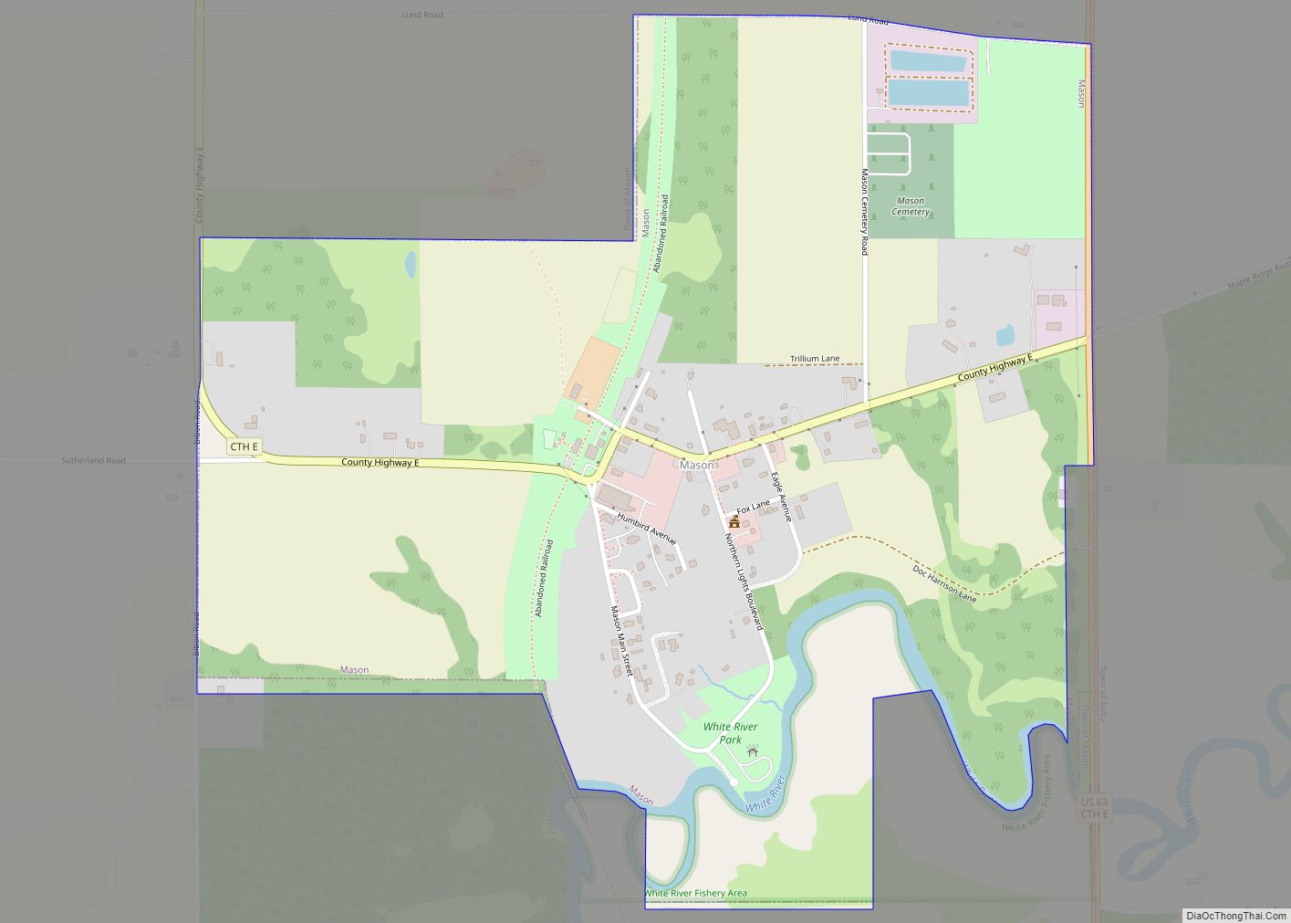
Map of Forestville village, Wisconsin

Map of Forestville village, Wisconsin

Forestville is a village in Door County, Wisconsin, United States, along the Ahnapee River. The population was 430 at the 2010 census. The village is located within the Town of Forestville. The village uses the 54213 ZIP code. The Ahnapee State Trail passes through the village on the southwest. Forestville village overview: Name: Forestville village … Read more

Map of Eureka CDP, Wisconsin

Map of Eureka CDP, Wisconsin

Eureka is an unincorporated census-designated place in the town of Rushford, in Winnebago County, Wisconsin, United States. It is located on the Fox River at the intersection of county highways K & E southwest of Omro. At the 2020 census, its population was 247. Eureka CDP overview: Name: Eureka CDP LSAD Code: 57 LSAD Description: … Read more

Map of Forest Junction CDP

Map of Forest Junction CDP

Forest Junction is an unincorporated census-designated place in the town of Brillion, Calumet County, Wisconsin, United States. As of the 2010 census, its population was 616. The community has its own water tower and utilities. Its ZIP code is 54123. Forest Junction CDP overview: Name: Forest Junction CDP LSAD Code: 57 LSAD Description: CDP (suffix) … Read more

Map of Ettrick village, Wisconsin

Map of Ettrick village, Wisconsin

Ettrick is a town in Trempealeau County, Wisconsin. The population was 1,284 at the time of the 2000 census. The town surrounds the village of Ettrick. The unincorporated communities of Beaches Corners, Chapultepee, Hegg, Iduna, and Upper French Creek are also located in the town. Ettrick village overview: Name: Ettrick village LSAD Code: 47 LSAD … Read more

Map of Footville village

Map of Footville village

Footville is a village in Rock County, Wisconsin, United States. The population was 772 at the 2020 census. Footville village overview: Name: Footville village LSAD Code: 47 LSAD Description: village (suffix) State: Wisconsin County: Rock County Elevation: 830 ft (253 m) Total Area: 1.12 sq mi (2.91 km²) Land Area: 1.12 sq mi (2.91 km²) Water Area: 0.00 sq mi (0.00 km²) Total Population: 772 Population … Read more

Map of Fontana-on-Geneva Lake village

Map of Fontana-on-Geneva Lake village

Fontana-on-Geneva Lake (locally known as “Fontana”) is a village located on Geneva Lake in Walworth County, Wisconsin, United States. The population was 3,120 at the 2020 census. Fontana-on-Geneva Lake village overview: Name: Fontana-on-Geneva Lake village LSAD Code: 47 LSAD Description: village (suffix) State: Wisconsin County: Walworth County Total Area: 3.39 sq mi (8.77 km²) Land Area: 3.35 sq mi (8.67 km²) … Read more

Map of Fond du Lac city

Map of Fond du Lac city

Fond du Lac (/ˈfɒndəˌlæk/) is a city in Fond du Lac County, Wisconsin, United States. The population was 44,678 at the 2020 census. The city forms the core of the United States Census Bureau’s Fond du Lac Metropolitan Statistical Area, which includes all of Fond du Lac County (2020 population: 104,154). Fond du Lac is … Read more

Map of Florence CDP, Wisconsin

Map of Florence CDP, Wisconsin

Florence is a census-designated place in and the county seat of Florence County, Wisconsin, United States. Florence is located in northern Florence County, in the town of Florence. Florence has a post office with ZIP code 54121. The community was named a census-designated place in 2010. As of the 2010 census, its population was 592. … Read more

Map of Fitchburg city, Wisconsin

Map of Fitchburg city, Wisconsin

Fitchburg is a city in Dane County, Wisconsin, United States. The population was 29,609 at the 2020 census. Fitchburg is a suburb of Madison and is part of the Madison Metropolitan Statistical Area. Fitchburg consists of a mix of suburban neighborhoods closer to the border with the city of Madison, commercial and industrial properties, and … Read more

Map of Frederic village

Map of Frederic village

Frederic is a village in Polk County, Wisconsin, United States. The population was 1,137 at the 2010 census. Frederic village overview: Name: Frederic village LSAD Code: 47 LSAD Description: village (suffix) State: Wisconsin County: Polk County Elevation: 1,214 ft (370 m) Total Area: 1.76 sq mi (4.56 km²) Land Area: 1.69 sq mi (4.38 km²) Water Area: 0.07 sq mi (0.18 km²) Total Population: 1,137 Population … Read more

Map of Franks Field CDP

Map of Franks Field CDP

Franks Field is a census-designated place in the town of Sanborn, Ashland County, Wisconsin, United States. Its population was 154 as of the 2010 census. Franks Field is located on the Bad River Indian Reservation. Franks Field CDP overview: Name: Franks Field CDP LSAD Code: 57 LSAD Description: CDP (suffix) State: Wisconsin County: Ashland County … Read more

Map of Franklin city, Wisconsin

Map of Franklin city, Wisconsin

Franklin is a city in Milwaukee County, Wisconsin, United States. It is a suburb of Milwaukee with a population of 36,816 as of the 2020 census. Franklin city overview: Name: Franklin city LSAD Code: 25 LSAD Description: city (suffix) State: Wisconsin County: Milwaukee County Founded: 1841 Incorporated: 1956 Elevation: 790 ft (241 m) Total Area: 34.68 sq mi (89.82 km²) … Read more