Middleton is a city in Dane County, Wisconsin, United States, and a suburb of the state capital, Madison. Middleton’s motto is “The Good Neighbor City.” The population was 21,827 at the 2020 census.
| Name: | Middleton city |
|---|---|
| LSAD Code: | 25 |
| LSAD Description: | city (suffix) |
| State: | Wisconsin |
| County: | Dane County |
| Land Area: | 8.94 sq mi (23.14 km²) |
| Water Area: | 0.14 sq mi (0.35 km²) |
| Population Density: | 2,242.19/sq mi (865.73/km²) |
| ZIP code: | 53562 |
| Area code: | 608 |
| FIPS code: | 5551575 |
| Website: | cityofmiddleton.us |
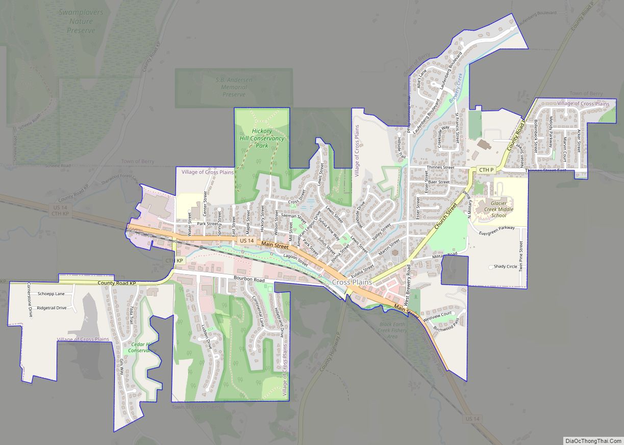
Online Interactive Map
Click on ![]() to view map in "full screen" mode.
to view map in "full screen" mode.
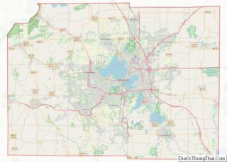
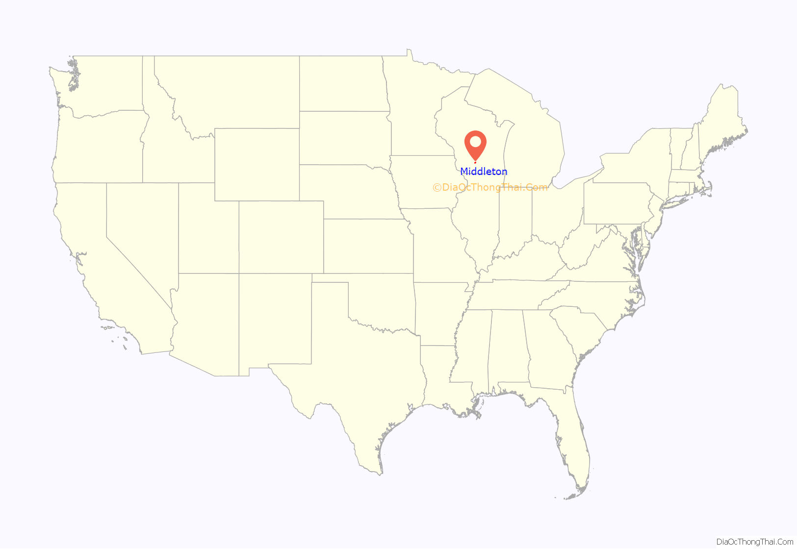
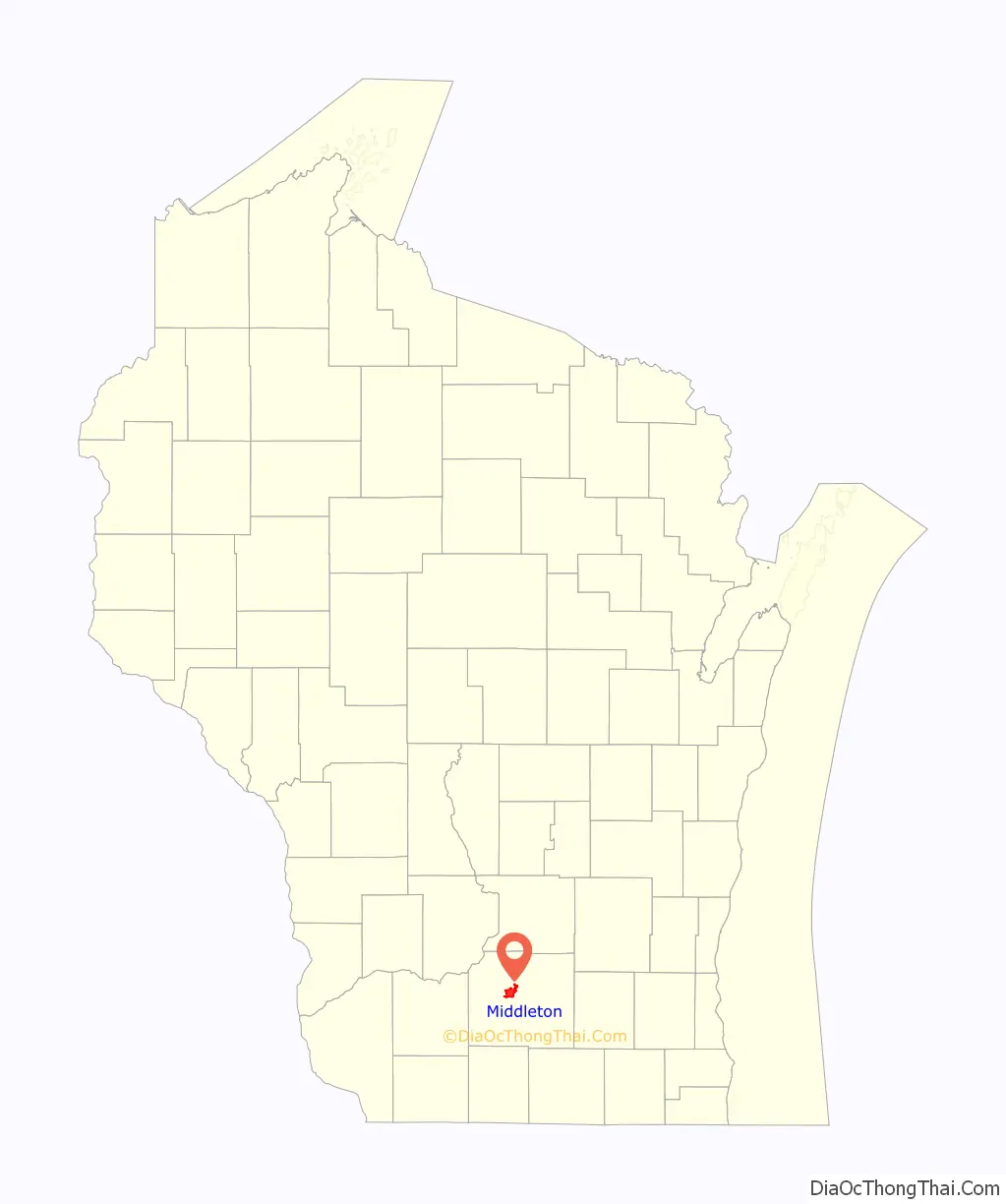
Middleton location map. Where is Middleton city?
History
The first settlers were mostly of English descent, and they came to Middleton in the 1840s. It was called Peatville for the large quantities of peat extracted from its soil. The village was renamed Middleton when it was separated from the town of Madison in 1848. Many German settlers arrived to Middleton in the 1850s, and after the year 1880, the population was largely of German descent. The first Lutheran Church was founded in the area in 1852.
Middleton incorporated as a village in 1905 and it became a city in 1963. At the suggestion of its first postmaster, Harry Barnes, it was named after a community in Vermont.
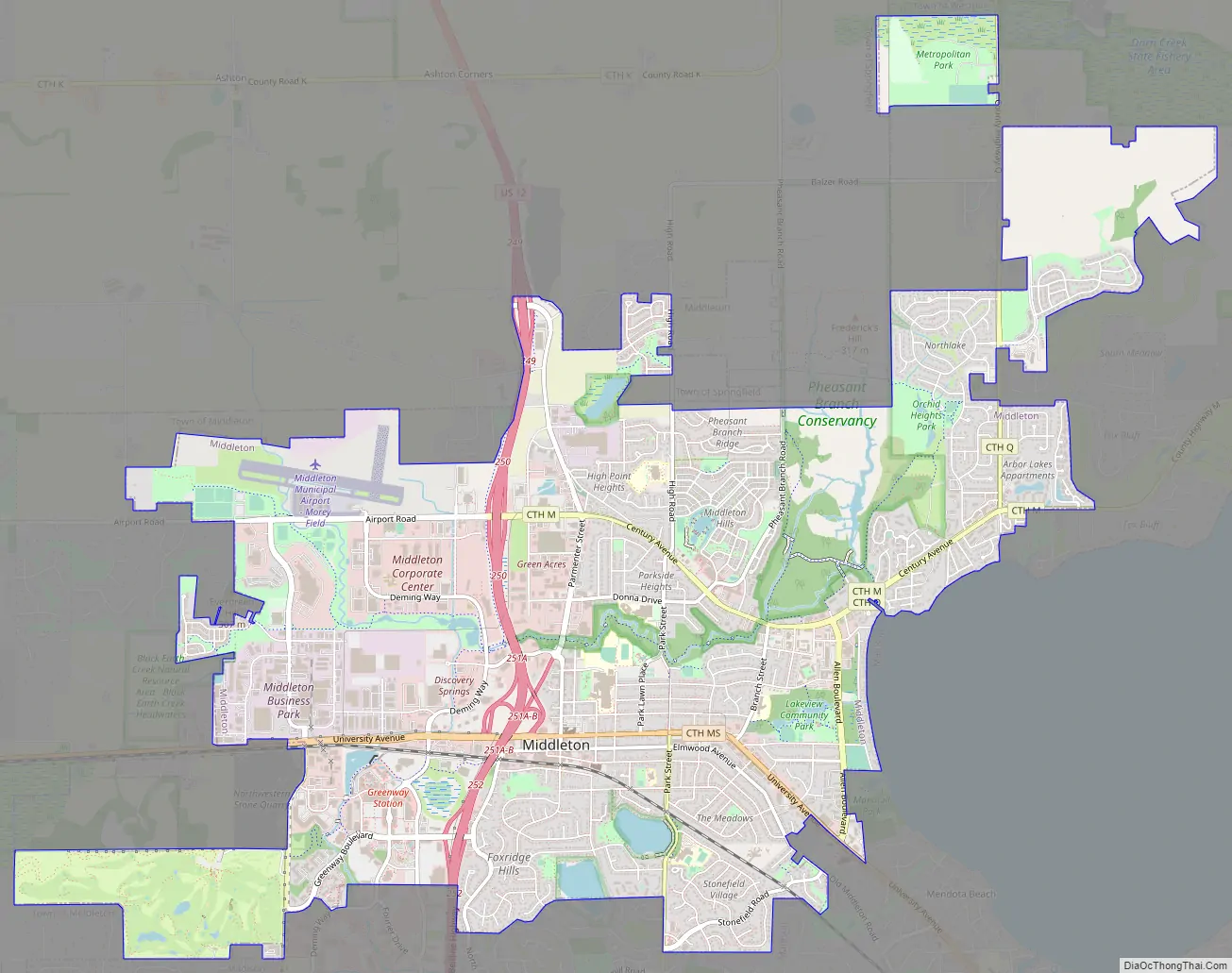
Middleton Road Map
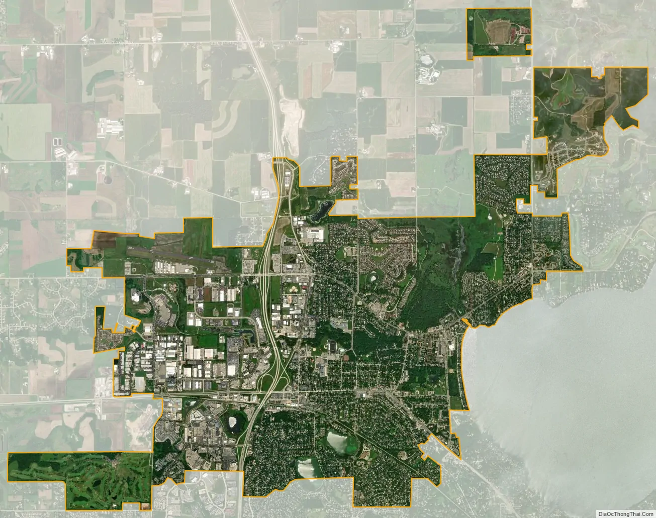
Middleton city Satellite Map
Geography
According to the United States Census Bureau, the city has a total area of 9.12 square miles (23.62 km), of which 8.98 square miles (23.26 km) is land and 0.14 square miles (0.36 km) is water. Middleton is located about 6 miles West/Northwest of Madison, the capital of the U.S. state of Wisconsin.
Climate
Severe flooding occurred in August 2018, including along Pheasant Branch Creek.
See also
Map of Wisconsin State and its subdivision:- Adams
- Ashland
- Barron
- Bayfield
- Brown
- Buffalo
- Burnett
- Calumet
- Chippewa
- Clark
- Columbia
- Crawford
- Dane
- Dodge
- Door
- Douglas
- Dunn
- Eau Claire
- Florence
- Fond du Lac
- Forest
- Grant
- Green
- Green Lake
- Iowa
- Iron
- Jackson
- Jefferson
- Juneau
- Kenosha
- Kewaunee
- La Crosse
- Lafayette
- Lake Michigan
- Lake Superior
- Langlade
- Lincoln
- Manitowoc
- Marathon
- Marinette
- Marquette
- Menominee
- Milwaukee
- Monroe
- Oconto
- Oneida
- Outagamie
- Ozaukee
- Pepin
- Pierce
- Polk
- Portage
- Price
- Racine
- Richland
- Rock
- Rusk
- Saint Croix
- Sauk
- Sawyer
- Shawano
- Sheboygan
- Taylor
- Trempealeau
- Vernon
- Vilas
- Walworth
- Washburn
- Washington
- Waukesha
- Waupaca
- Waushara
- Winnebago
- Wood
- Alabama
- Alaska
- Arizona
- Arkansas
- California
- Colorado
- Connecticut
- Delaware
- District of Columbia
- Florida
- Georgia
- Hawaii
- Idaho
- Illinois
- Indiana
- Iowa
- Kansas
- Kentucky
- Louisiana
- Maine
- Maryland
- Massachusetts
- Michigan
- Minnesota
- Mississippi
- Missouri
- Montana
- Nebraska
- Nevada
- New Hampshire
- New Jersey
- New Mexico
- New York
- North Carolina
- North Dakota
- Ohio
- Oklahoma
- Oregon
- Pennsylvania
- Rhode Island
- South Carolina
- South Dakota
- Tennessee
- Texas
- Utah
- Vermont
- Virginia
- Washington
- West Virginia
- Wisconsin
- Wyoming