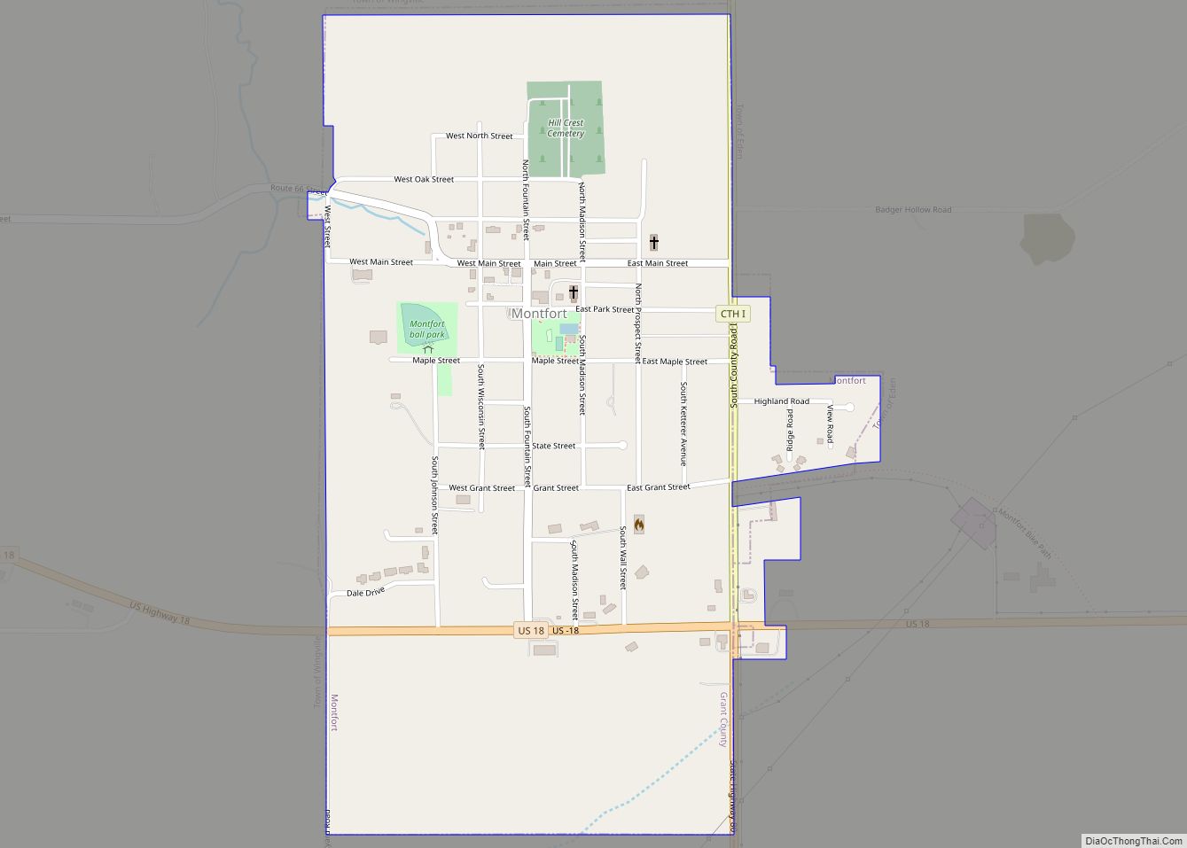
Map of Franks Field CDP

Map of Franks Field CDP

Franks Field is a census-designated place in the town of Sanborn, Ashland County, Wisconsin, United States. Its population was 154 as of the 2010 census. Franks Field is located on the Bad River Indian Reservation. Franks Field CDP overview: Name: Franks Field CDP LSAD Code: 57 LSAD Description: CDP (suffix) State: Wisconsin County: Ashland County … Read more

Map of Franklin city, Wisconsin

Map of Franklin city, Wisconsin

Franklin is a city in Milwaukee County, Wisconsin, United States. It is a suburb of Milwaukee with a population of 36,816 as of the 2020 census. Franklin city overview: Name: Franklin city LSAD Code: 25 LSAD Description: city (suffix) State: Wisconsin County: Milwaukee County Founded: 1841 Incorporated: 1956 Elevation: 790 ft (241 m) Total Area: 34.68 sq mi (89.82 km²) … Read more

Map of Gilman village, Wisconsin

Map of Gilman village, Wisconsin

Gilman is a village in Taylor County, Wisconsin, United States. The population was 410 at the 2010 census. The village is located between the towns of Aurora and Ford. Gilman village overview: Name: Gilman village LSAD Code: 47 LSAD Description: village (suffix) State: Wisconsin County: Taylor County Elevation: 1,224 ft (373 m) Total Area: 2.34 sq mi (6.06 km²) Land … Read more

Map of Francis Creek village

Map of Francis Creek village

Francis Creek is a village in Manitowoc County, Wisconsin, United States. The population was 659 at the 2020 census. The village is located within the town of Kossuth. Francis Creek village overview: Name: Francis Creek village LSAD Code: 47 LSAD Description: village (suffix) State: Wisconsin County: Manitowoc County Elevation: 732 ft (223 m) Total Area: 1.14 sq mi (2.94 km²) … Read more

Map of Gillett city, Wisconsin

Map of Gillett city, Wisconsin

Gillett is a city in Oconto County, Wisconsin, United States. The population was 1,386 at the 2010 census. It is part of the Green Bay Metropolitan Statistical Area. The city is adjacent to the Town of Gillett. Gillett city overview: Name: Gillett city LSAD Code: 25 LSAD Description: city (suffix) State: Wisconsin County: Oconto County … Read more

Map of Fox Point village

Map of Fox Point village

Fox Point is a village in Milwaukee County, Wisconsin, United States. The population was 6,934 at the 2020 census. Located on the western shore of Lake Michigan, Fox Point is one of the North Shore suburbs of the Milwaukee metropolitan area. The village is primarily residential. Shopping centers include Fox Point Shops, and RiverPoint Shopping … Read more

Map of Gibbsville CDP

Map of Gibbsville CDP

Gibbsville is a census-designated place in the town of Lima, Sheboygan County, Wisconsin, United States. Gibbsville is located on Wisconsin Highway 32 2.5 miles (4.0 km) northwest of Oostburg. Its population was 512 as of the 2010 census. Gibbsville CDP overview: Name: Gibbsville CDP LSAD Code: 57 LSAD Description: CDP (suffix) State: Wisconsin County: Sheboygan County … Read more

Map of Fox Lake city, Wisconsin

Map of Fox Lake city, Wisconsin

Fox Lake is a city in Dodge County, Wisconsin, United States. The population was 1,519 at the 2010 census. The city is located within the Town of Fox Lake. Fox Lake city overview: Name: Fox Lake city LSAD Code: 25 LSAD Description: city (suffix) State: Wisconsin County: Dodge County Elevation: 919 ft (280 m) Total Area: 1.62 sq mi … Read more

Map of Germantown village, Wisconsin

Map of Germantown village, Wisconsin

Germantown is a village in Washington County, Wisconsin, United States. The population was 19,749 at the 2010 census. The village surrounds the Town of Germantown. In July 2007, Germantown was ranked the 30th most appealing place to live in the United States by Money Magazine. Germantown village overview: Name: Germantown village LSAD Code: 47 LSAD … Read more

Map of Fox Crossing village

Map of Fox Crossing village

Fox Crossing is a village in Winnebago County, Wisconsin, United States. It was incorporated from the former Town of Menasha in 2016. The population as of the 2020 census was 18,974. Fox Crossing is located in the Fox Cities region and the Appleton-Oshkosh-Neenah, WI CSA, the third largest metropolitan area in Wisconsin. Fox Crossing village … Read more

Map of Genoa village, Wisconsin

Map of Genoa village, Wisconsin

Genoa is a town in Vernon County, Wisconsin, United States. The population was 705 at the 2000 census. The Village of Genoa is located within the town. The unincorporated community of Romance is located in the town of Genoa. Genoa village overview: Name: Genoa village LSAD Code: 47 LSAD Description: village (suffix) State: Wisconsin County: … Read more

Map of Genoa City village

Map of Genoa City village

Genoa City is a village located in Kenosha and Walworth counties in the U.S. state of Wisconsin, 43 mi (69 km) south-southwest of Milwaukee, located on the Illinois–Wisconsin border. The population was 2,982 at the 2020 census. It was named after Genoa, New York, which was named after Genoa in Italy. Genoa City village overview: Name: Genoa … Read more