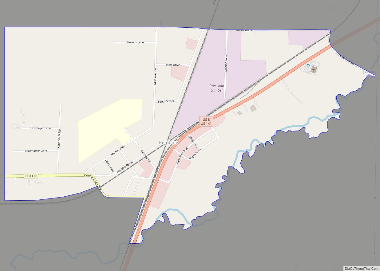
Map of Park Falls city
Park Falls is a city in Price County, Wisconsin, United States. The population was 2,462 at the 2010 census. Located in the woods of north central Wisconsin, primarily the Chequamegon National Forest, Park Falls is a small community divided by the North Fork of the Flambeau River, a popular destination for fishing, canoeing and whitewater ... Read more
Map of Park Falls city
Map of Pardeeville village
Pardeeville is a village in Columbia County, Wisconsin, United States. The population was 2,115 at the 2010 census. It is part of the Madison Metropolitan Statistical Area. Pardeeville village overview: Name: Pardeeville village LSAD Code: 47 LSAD Description: village (suffix) State: Wisconsin County: Columbia County Elevation: −1,738 ft (247 m) Total Area: 2.27 sq mi (5.87 km²) Land Area: 1.92 sq mi ... Read more
Map of Pardeeville village
Map of Palmyra village, Wisconsin
Palmyra is a town in Jefferson County, Wisconsin, United States. The population was 1,707 at the 2020 census. The village of Palmyra is located within the town. Palmyra village overview: Name: Palmyra village LSAD Code: 47 LSAD Description: village (suffix) State: Wisconsin County: Jefferson County FIPS code: 5561025 Online Interactive Map Palmyra online map. Source: ... Read more
Map of Palmyra village, Wisconsin
Map of Plain village
Plain is a village in Sauk County, Wisconsin, United States. The population was 773 at the 2010 census. Plain village overview: Name: Plain village LSAD Code: 47 LSAD Description: village (suffix) State: Wisconsin County: Sauk County Elevation: 810 ft (247 m) Total Area: 0.83 sq mi (2.16 km²) Land Area: 0.83 sq mi (2.16 km²) Water Area: 0.00 sq mi (0.00 km²) Total Population: 773 Population ... Read more
Map of Plain village
Map of Paddock Lake village
Paddock Lake is a village in Kenosha County, Wisconsin, United States. The population was 2,919 at the 2020 census. Paddock Lake village overview: Name: Paddock Lake village LSAD Code: 47 LSAD Description: village (suffix) State: Wisconsin County: Kenosha County Elevation: 817 ft (249 m) Total Area: 3.11 sq mi (8.05 km²) Land Area: 2.90 sq mi (7.51 km²) Water Area: 0.21 sq mi (0.54 km²) Total ... Read more
Map of Paddock Lake village
Map of Pittsville city, Wisconsin
Pittsville is a city in Wood County, Wisconsin, United States. The population was 874 at the 2010 census. Pittsville city overview: Name: Pittsville city LSAD Code: 25 LSAD Description: city (suffix) State: Wisconsin County: Wood County Elevation: 1,033 ft (315 m) Total Area: 2.00 sq mi (5.18 km²) Land Area: 1.99 sq mi (5.15 km²) Water Area: 0.01 sq mi (0.03 km²) Total Population: 874 Population ... Read more
Map of Pittsville city, Wisconsin
Map of Packwaukee CDP
Packwaukee is an unincorporated census-designated place located in the town of Packwaukee, Marquette County, Wisconsin, United States. Packwaukee is located on the north bank of Buffalo Lake, a lake on the Fox River; it is 7 miles (11 km) west-southwest of Montello. Packwaukee has a post office with ZIP code 53953. As of the 2010 census, ... Read more
Map of Packwaukee CDP
Map of Owen city
Owen is a city in Clark County in the U.S. state of Wisconsin. The population was 940 at the 2010 census. Owen is located directly east of the village of Withee, which is about half the size of Owen. Owen city overview: Name: Owen city LSAD Code: 25 LSAD Description: city (suffix) State: Wisconsin County: ... Read more
Map of Owen city
Map of Pewaukee village
Pewaukee is a village in Waukesha County, Wisconsin, United States. The population was 8,238 at the 2020 census. The village is nearly surrounded by the City of Pewaukee. The village was incorporated from what was formerly the Town of Pewaukee, and the remainder of the town later incorporated as a city. Pewaukee village overview: Name: ... Read more
Map of Pewaukee village
Map of Port Edwards village
Port Edwards is a town in Wood County, Wisconsin, United States. The population was 1,446 at the 2000 census. The village of Port Edwards is located to the northeast of and adjacent to the town. The town contains the Ho-Chunk community of Ceex Haci. Port Edwards village overview: Name: Port Edwards village LSAD Code: 47 ... Read more
Map of Port Edwards village
Map of Poplar village, Wisconsin
Poplar is a village in Douglas County, Wisconsin, United States. The population was 603 at the 2010 census. U.S. Highway 2, County Road D, and County Road P are the main routes in the community. Poplar village overview: Name: Poplar village LSAD Code: 47 LSAD Description: village (suffix) State: Wisconsin County: Douglas County Elevation: 981 ft ... Read more
Map of Poplar village, Wisconsin
Map of Polonia CDP
Polonia is an unincorporated census-designated place in the town of Sharon, Portage County, Wisconsin, United States. It is located on Wisconsin Highway 66 two miles east of Ellis and about 8 miles southwest of Rosholt. Polonia has an area of 3.371 square miles (8.73 km); 3.341 square miles (8.65 km) of this is land, and 0.030 square ... Read more
Map of Polonia CDP