Park Falls is a city in Price County, Wisconsin, United States. The population was 2,462 at the 2010 census. Located in the woods of north central Wisconsin, primarily the Chequamegon National Forest, Park Falls is a small community divided by the North Fork of the Flambeau River, a popular destination for fishing, canoeing and whitewater rafting.
| Name: | Park Falls city |
|---|---|
| LSAD Code: | 25 |
| LSAD Description: | city (suffix) |
| State: | Wisconsin |
| County: | Price County |
| Elevation: | 1,516 ft (462 m) |
| Total Area: | 3.88 sq mi (10.04 km²) |
| Land Area: | 3.65 sq mi (9.45 km²) |
| Water Area: | 0.23 sq mi (0.59 km²) |
| Total Population: | 2,462 |
| Population Density: | 610.96/sq mi (235.90/km²) |
| Area code: | 715 & 534 |
| FIPS code: | 5561200 |
| GNISfeature ID: | 1571039 |
| Website: | www.cityofparkfalls.com |
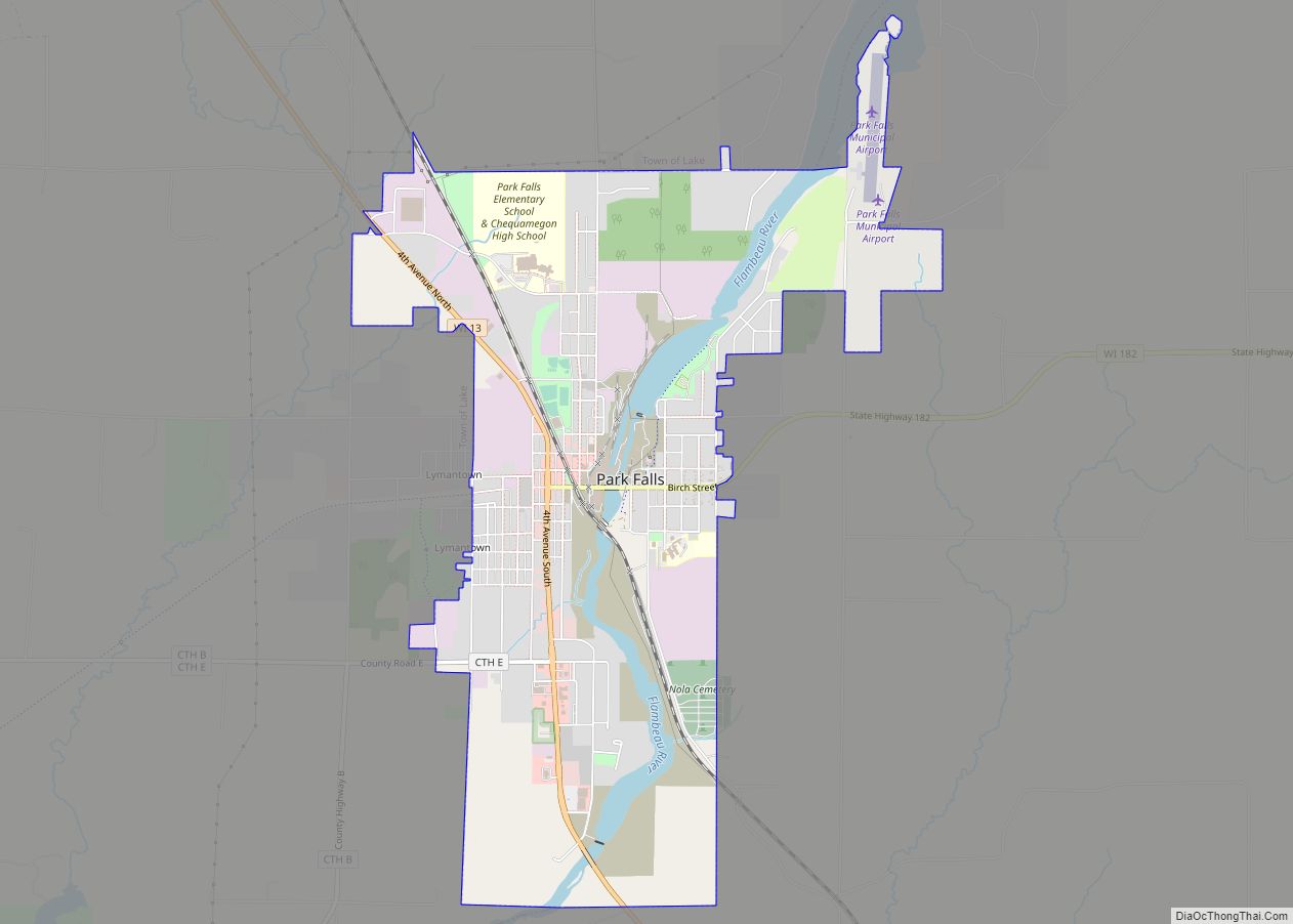
Online Interactive Map
Click on ![]() to view map in "full screen" mode.
to view map in "full screen" mode.
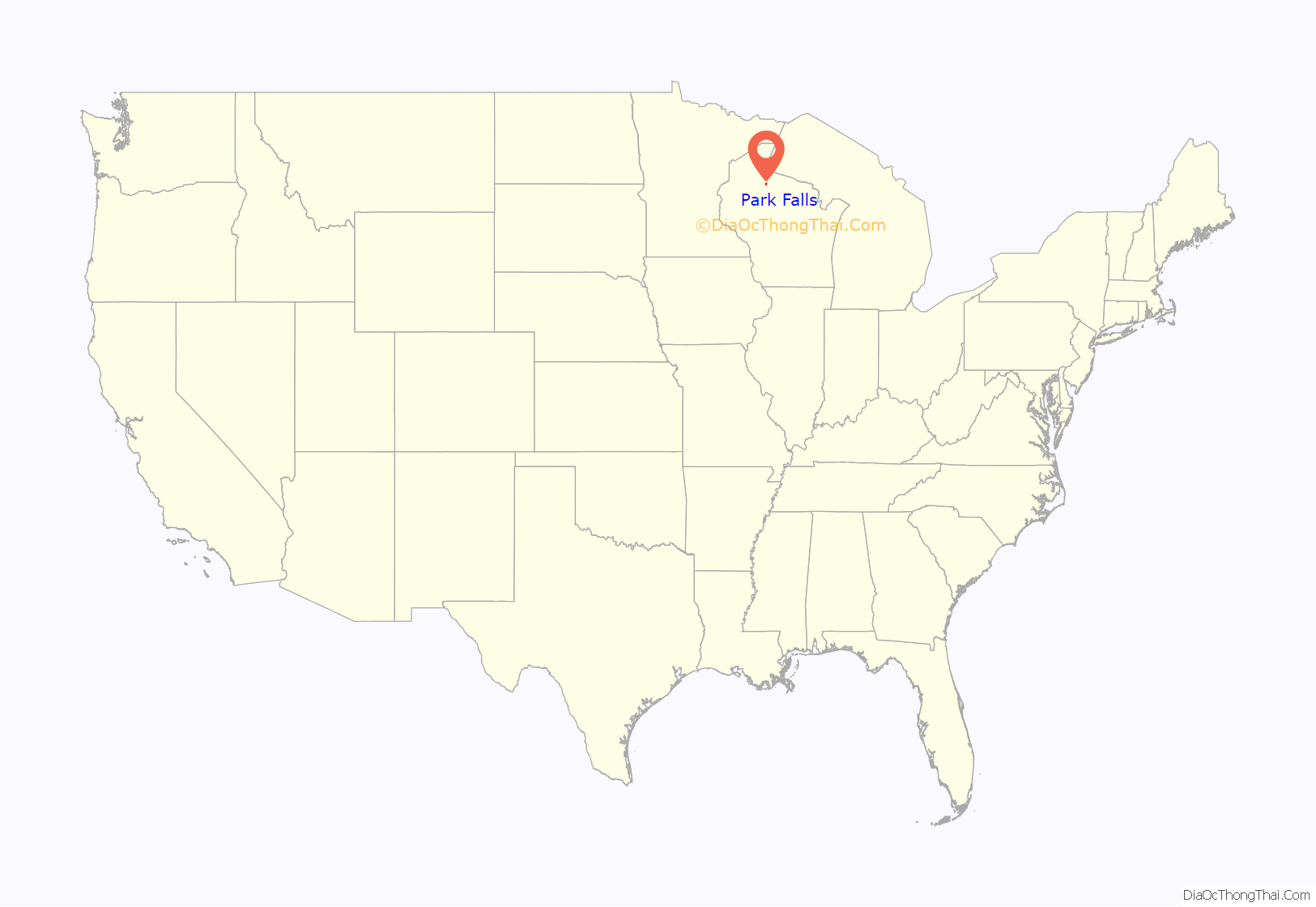
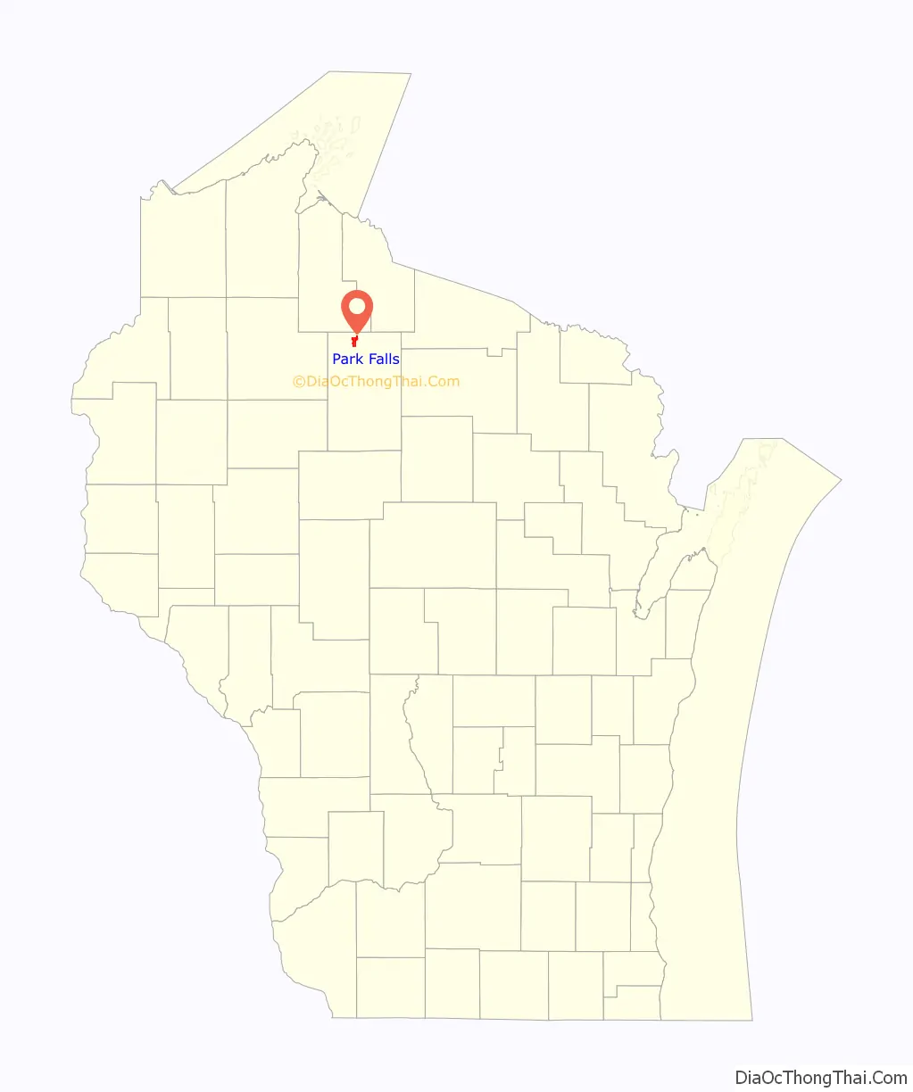
Park Falls location map. Where is Park Falls city?
History
The city began in the late 19th century as a small river village called Muskellunge Falls. It was later renamed Park Falls for the scenic beauty surrounding the former falls on the south side of town. With a pulp and paper mill, the town grew rapidly and was incorporated as a city in 1912.
At the height of the city’s industrial success the city’s population swelled to more than 4,000 residents. At the same time, commercial development fueled a sizeable downtown, which largely remains today.
Several residential neighborhoods, particularly along 1st Avenue North, were constructed of nearly identical homes, and this affordable housing stock is one of the community’s lasting assets.
Recent development, which mostly began in the early 1990s, has been primarily concentrated along Wis. Highway 13, a north–south highway that is the city’s main thoroughfare.
Several governmental offices are located in Park Falls, including a school district, a National Forest Service office, an outpost of the Wisconsin Department of National Resources, and the northern office of the state governor.
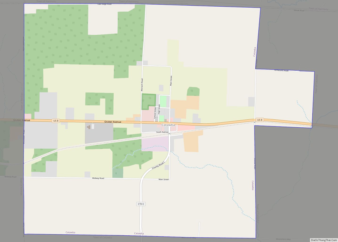
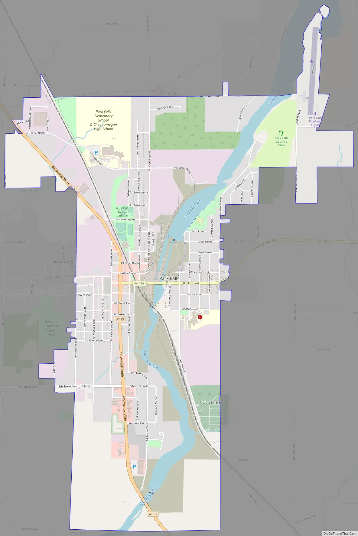
Park Falls Road Map
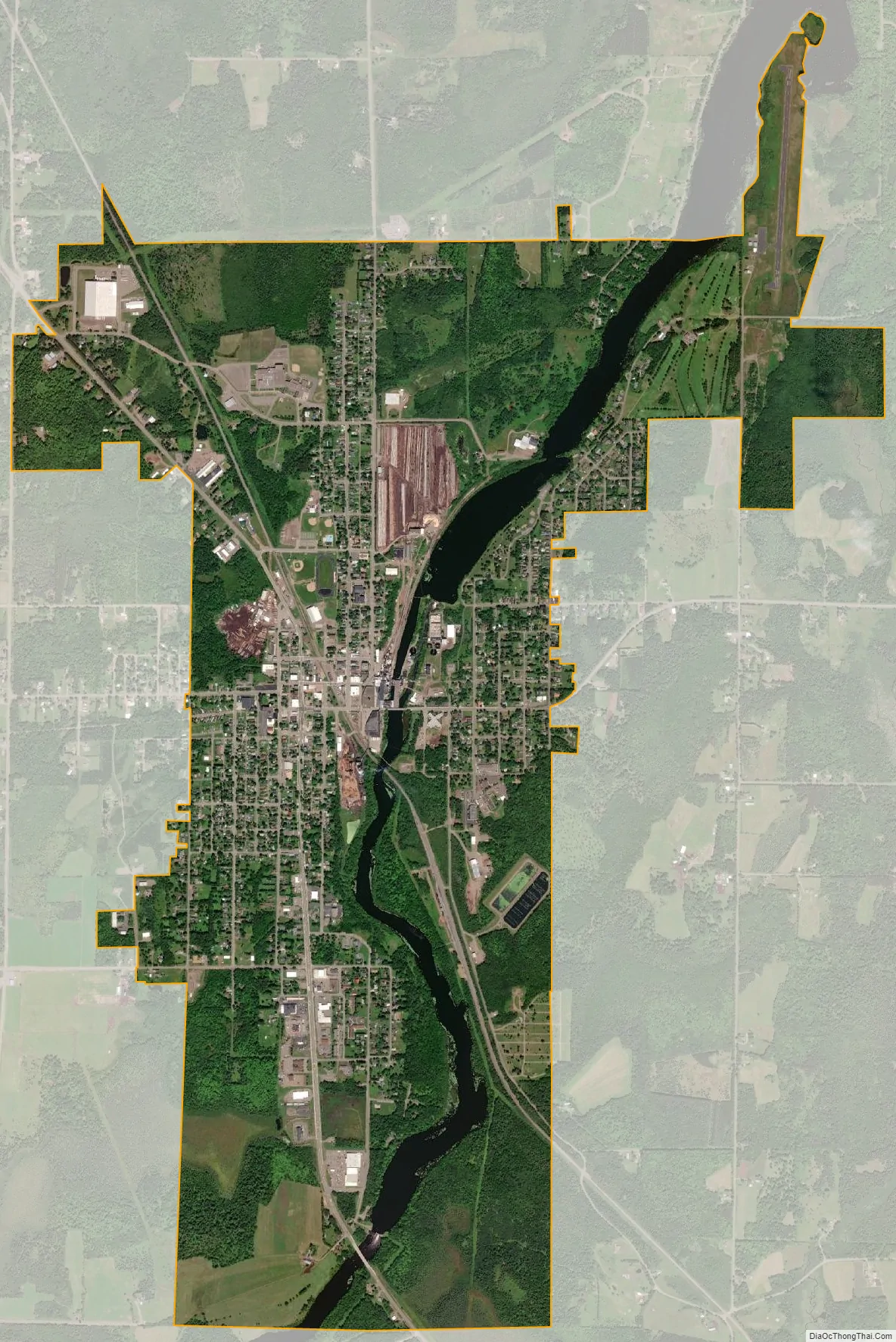
Park Falls city Satellite Map
Geography
Park Falls is located at 45°56′5″N 90°26′55″W / 45.93472°N 90.44861°W / 45.93472; -90.44861 (45.934590, -90.448538).
According to the United States Census Bureau, the city has a total area of 3.83 square miles (9.92 km), of which, 3.60 square miles (9.32 km) is land and 0.23 square miles (0.60 km) is water.
See also
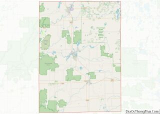
Map of Wisconsin State and its subdivision:- Adams
- Ashland
- Barron
- Bayfield
- Brown
- Buffalo
- Burnett
- Calumet
- Chippewa
- Clark
- Columbia
- Crawford
- Dane
- Dodge
- Door
- Douglas
- Dunn
- Eau Claire
- Florence
- Fond du Lac
- Forest
- Grant
- Green
- Green Lake
- Iowa
- Iron
- Jackson
- Jefferson
- Juneau
- Kenosha
- Kewaunee
- La Crosse
- Lafayette
- Lake Michigan
- Lake Superior
- Langlade
- Lincoln
- Manitowoc
- Marathon
- Marinette
- Marquette
- Menominee
- Milwaukee
- Monroe
- Oconto
- Oneida
- Outagamie
- Ozaukee
- Pepin
- Pierce
- Polk
- Portage
- Price
- Racine
- Richland
- Rock
- Rusk
- Saint Croix
- Sauk
- Sawyer
- Shawano
- Sheboygan
- Taylor
- Trempealeau
- Vernon
- Vilas
- Walworth
- Washburn
- Washington
- Waukesha
- Waupaca
- Waushara
- Winnebago
- Wood
- Alabama
- Alaska
- Arizona
- Arkansas
- California
- Colorado
- Connecticut
- Delaware
- District of Columbia
- Florida
- Georgia
- Hawaii
- Idaho
- Illinois
- Indiana
- Iowa
- Kansas
- Kentucky
- Louisiana
- Maine
- Maryland
- Massachusetts
- Michigan
- Minnesota
- Mississippi
- Missouri
- Montana
- Nebraska
- Nevada
- New Hampshire
- New Jersey
- New Mexico
- New York
- North Carolina
- North Dakota
- Ohio
- Oklahoma
- Oregon
- Pennsylvania
- Rhode Island
- South Carolina
- South Dakota
- Tennessee
- Texas
- Utah
- Vermont
- Virginia
- Washington
- West Virginia
- Wisconsin
- Wyoming