Platteville is the largest city in Grant County, Wisconsin. The population was 11,836 at the 2020 census, up from 11,224 at the 2010 census. Much of this growth is likely due to the enrollment increase of the University of Wisconsin–Platteville. It is the principal city of the Platteville Micropolitan Statistical area, which has an estimated population of 51,938. Platteville is located atop the greater Platte River valley in the southern Driftless Region of Wisconsin, an area known for its karst topography and rolling hills.
| Name: | Platteville city |
|---|---|
| LSAD Code: | 25 |
| LSAD Description: | city (suffix) |
| State: | Wisconsin |
| County: | Grant County |
| Elevation: | 991 ft (302 m) |
| Land Area: | 6.18 sq mi (16.00 km²) |
| Water Area: | 0.00 sq mi (0.00 km²) |
| Population Density: | 1,900/sq mi (740/km²) |
| ZIP code: | 53818 |
| Area code: | 608 |
| FIPS code: | 5563250 |
| Website: | http://www.platteville.org/ |
Online Interactive Map
Click on ![]() to view map in "full screen" mode.
to view map in "full screen" mode.
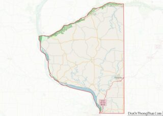
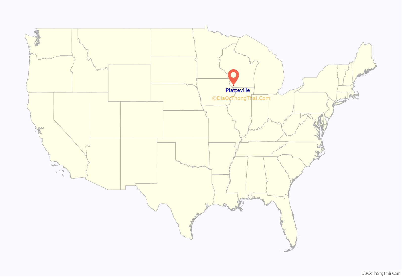
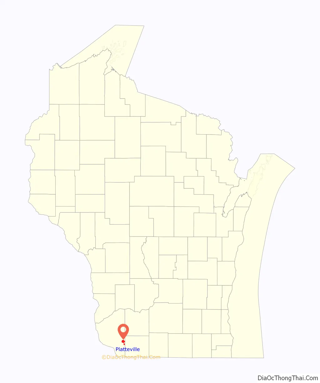
Platteville location map. Where is Platteville city?
History
Platteville was settled by pioneers and early lead miners. Along inlets and flat groves of The Rountree Branch and Little Platte River. Part of the Platte River shed; these rivers flow into the greater Upper Mississippi River system. More specifically located in the Driftless Region of Southwestern Wisconsin.
Due to its geographic location; areas of town are carved by ridges, narrow valleys, and steep hills. The influence of geography can also be seen in the irregularity of the streets in the community. As the town grew, roads were given odd routes, to avoid the steep ravines and mining shafts strewn about the locality.
Platteville was officially founded in 1829 by John H. Rountree, a southern businessman who had arrived in hopes of finding wealth during the areas lead rush. The town became a flourishing mining community in part due to its close proximity to Dubuque, Iowa & Galena, Illinois. Both were thriving cities along the Mississippi River trade route that benefited from the rising demand for lead throughout the United States from the 1820’s–1850’s.
John H. Rountree and other wealthy southerners in the area, such as Wisconsin’s First Governor Henry Dodge; brought slaves with them during the lead rush. They also brought freed black laborers, with intentions for them to work the mines at a more affordable cost, often nothing. Although unpaid labor was illegal, it was practiced in the region until after the Civil War.
In 1850, a freed African-American man from Virginia, named Charles Shepard, settled a community known as Pleasant Ridge, Grant County, Wisconsin just west of Platteville. This served as a safe haven for many black folks coming up the Mississippi River from Arkansas, Tennessee, Louisiana, etc. Some stayed and raised families but most continued on their way in hopes of finding success elsewhere. By 1950 all but one resident, had moved on from the community.
By the 1849s lead ore production was decreasing. However, the mining of zinc ore quickly filled the void for prospective work. Platteville had become an established town, complete with schools, a private preparatory academy, newspaper, several churches, and a telegraph service as of November 1849.
During this time, both a teachers’ college and a mining college were founded. The normal school was established on October 9, 1866 to train teachers for elementary school grades. The Wisconsin Mining Trade School opened in January 1908.
In 1959, these two colleges were merged to become Wisconsin State College and Institute of Technology. Its curriculum was developed to add graduate programs and departments, particularly in engineering. In 1971 it was renamed as University of Wisconsin–Platteville, to reflect its expanded programs in graduate study. Other additions included criminal justice and, in the early 21st century, UW Platteville is also considered to have the best criminal justice college in the Midwest.
From 1984 until 2001 the Chicago Bears football team held summer training camp on the campus of University of Wisconsin–Platteville. Their program resulted in a substantial infusion of money into the local economy each summer. The town felt the decline after the Bears moved their training camp to Olivet Nazarene University in Illinois.
In 2004, the University of Wisconsin System gave its approval to the University of Wisconsin–Platteville’s plan to expand the student enrollment from 5,000 to 7,500.
In 2004, U.S. Highway 151 was upgraded to a limited-access highway; it bypassed the city south of Platteville. Prior to the upgrade, the highway exits were closer to Platteville. The city made changes to adjust to the new southern US 151 bypass, and it has influenced subsequent development. A new hospital was built just north of US 151 and next to its off ramps. A Walmart Supercenter and a Menards have opened near the northern end of the US 151 bypass.
Historic buildings
Former Carnegie library building
Ullrich Hall, part of the University of Wisconsin-Platteville
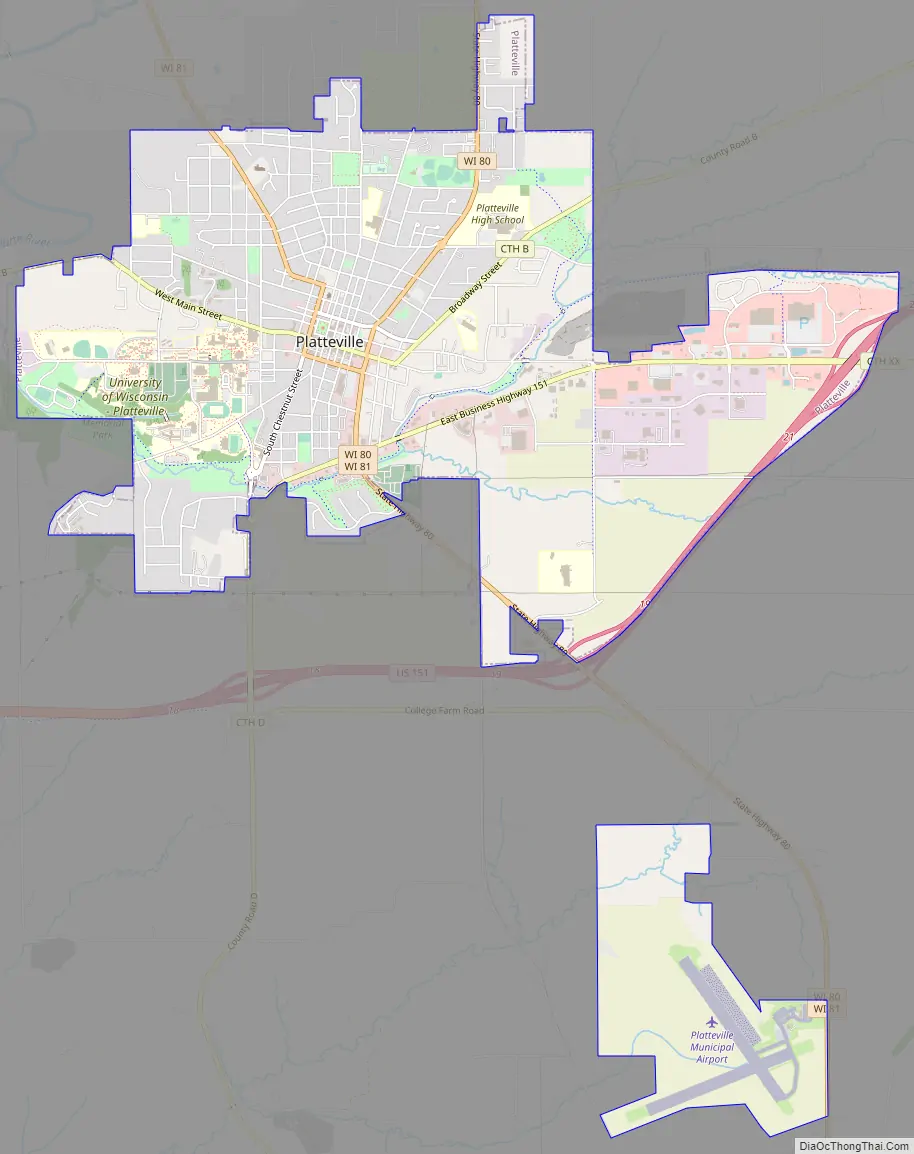
Platteville Road Map
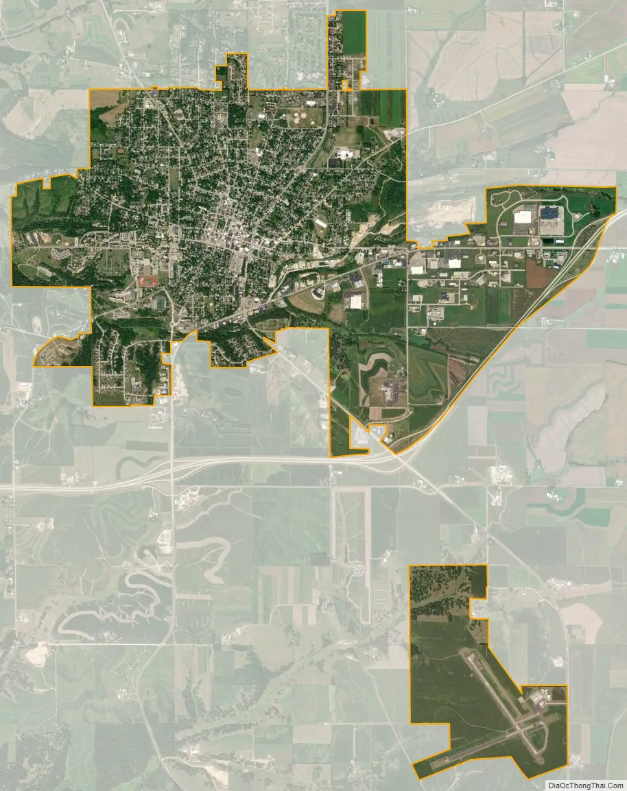
Platteville city Satellite Map
Geography
Platteville is located at 42°44′13″N 90°28′39″W / 42.73707°N 90.477501°W / 42.73707; -90.477501 (42.73707, −90.477501). It is in the Hollow Region, as named by early southern miners, in the rolling hills of southwestern Wisconsin.
According to the United States Census Bureau, the city has a total area of 6.18 square miles (16.01 km), all of it land.
Platteville is serviced by Wisconsin State Highways 80 and 81, as well as U.S. Highway 151. Originally, U.S. 151 went through the valley that made up the southern border of the city limits, but with the completion of the four-lane limited-access superhighway, traffic has been rerouted and now loops south of the city.
The minerals in the area consist of galena, a sulfide of lead (lead 86.6, sulfur 13.4). Sphalerite or zinc sulfide is also, common in the region. Zinc and lead mining were in heavy production through the 1820s–1920s. Consequently, there are few straight streets in Platteville. As a result of the mining in the 1800s leaving a honeycomb of abandoned old mines, streets were located to avoid the mines.
Climate
See also
Map of Wisconsin State and its subdivision:- Adams
- Ashland
- Barron
- Bayfield
- Brown
- Buffalo
- Burnett
- Calumet
- Chippewa
- Clark
- Columbia
- Crawford
- Dane
- Dodge
- Door
- Douglas
- Dunn
- Eau Claire
- Florence
- Fond du Lac
- Forest
- Grant
- Green
- Green Lake
- Iowa
- Iron
- Jackson
- Jefferson
- Juneau
- Kenosha
- Kewaunee
- La Crosse
- Lafayette
- Lake Michigan
- Lake Superior
- Langlade
- Lincoln
- Manitowoc
- Marathon
- Marinette
- Marquette
- Menominee
- Milwaukee
- Monroe
- Oconto
- Oneida
- Outagamie
- Ozaukee
- Pepin
- Pierce
- Polk
- Portage
- Price
- Racine
- Richland
- Rock
- Rusk
- Saint Croix
- Sauk
- Sawyer
- Shawano
- Sheboygan
- Taylor
- Trempealeau
- Vernon
- Vilas
- Walworth
- Washburn
- Washington
- Waukesha
- Waupaca
- Waushara
- Winnebago
- Wood
- Alabama
- Alaska
- Arizona
- Arkansas
- California
- Colorado
- Connecticut
- Delaware
- District of Columbia
- Florida
- Georgia
- Hawaii
- Idaho
- Illinois
- Indiana
- Iowa
- Kansas
- Kentucky
- Louisiana
- Maine
- Maryland
- Massachusetts
- Michigan
- Minnesota
- Mississippi
- Missouri
- Montana
- Nebraska
- Nevada
- New Hampshire
- New Jersey
- New Mexico
- New York
- North Carolina
- North Dakota
- Ohio
- Oklahoma
- Oregon
- Pennsylvania
- Rhode Island
- South Carolina
- South Dakota
- Tennessee
- Texas
- Utah
- Vermont
- Virginia
- Washington
- West Virginia
- Wisconsin
- Wyoming