Pepin is a village in Pepin County, Wisconsin, United States. The population was 837 at the 2010 census. The village is located within the Town of Pepin.
| Name: | Pepin village |
|---|---|
| LSAD Code: | 47 |
| LSAD Description: | village (suffix) |
| State: | Wisconsin |
| County: | Pepin County |
| Elevation: | 722 ft (220 m) |
| Total Area: | 0.72 sq mi (1.87 km²) |
| Land Area: | 0.72 sq mi (1.87 km²) |
| Water Area: | 0.00 sq mi (0.00 km²) |
| Total Population: | 837 |
| Population Density: | 1,080.22/sq mi (417.25/km²) |
| Area code: | 715 & 534 |
| FIPS code: | 5561925 |
| Website: | http://pepinwisconsin.org/ |
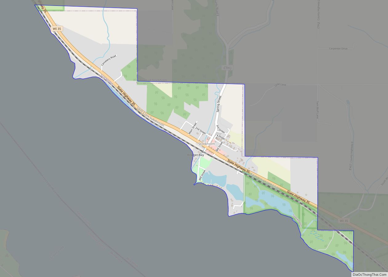
Online Interactive Map
Click on ![]() to view map in "full screen" mode.
to view map in "full screen" mode.
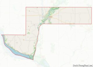
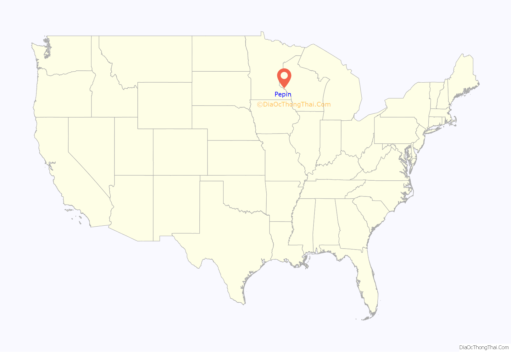
Pepin location map. Where is Pepin village?
History
By the mid-17th century, the French had begun to send expeditions into Wisconsin via the Great Lakes and Saint Lawrence River. King Louis XIII of France is believed to have granted a huge piece of land in the Upper Mississippi River Valley to two brothers, Etiene Pepin de la Fond and Guillaume dit Tranchemontagne. Two of Guillaume’s sons, Pierre Pepin and Jean Pepin du Cardonnets, later explored and traded in this area, and their surname became attached to the lake, and ultimately to the village and the county.
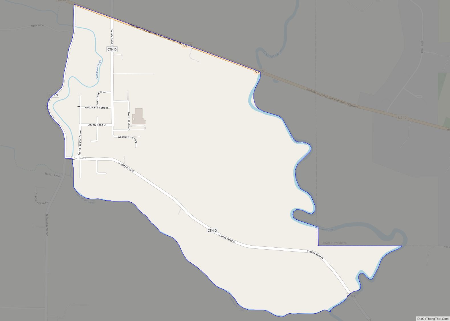
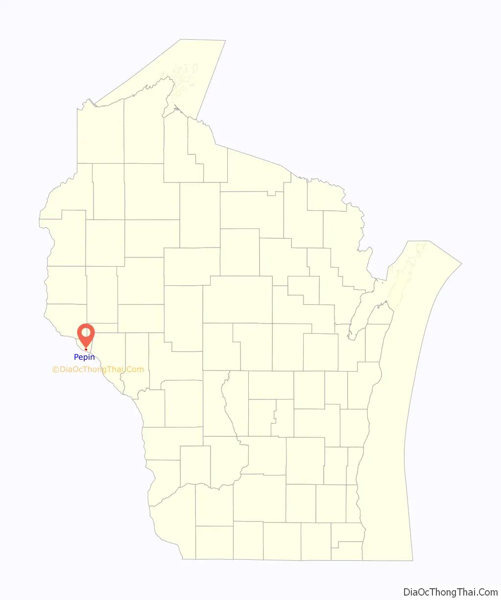
Pepin Road Map
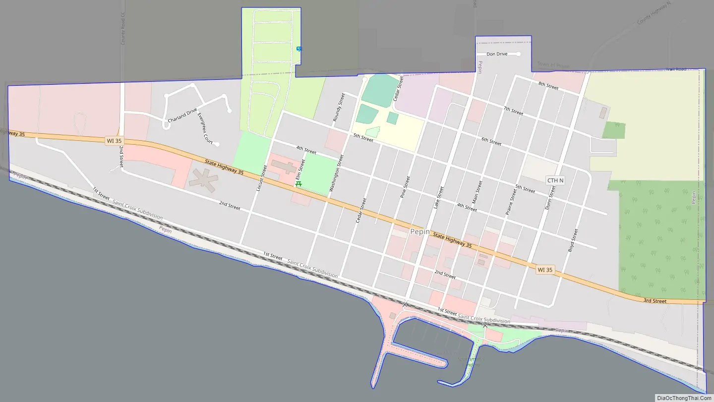
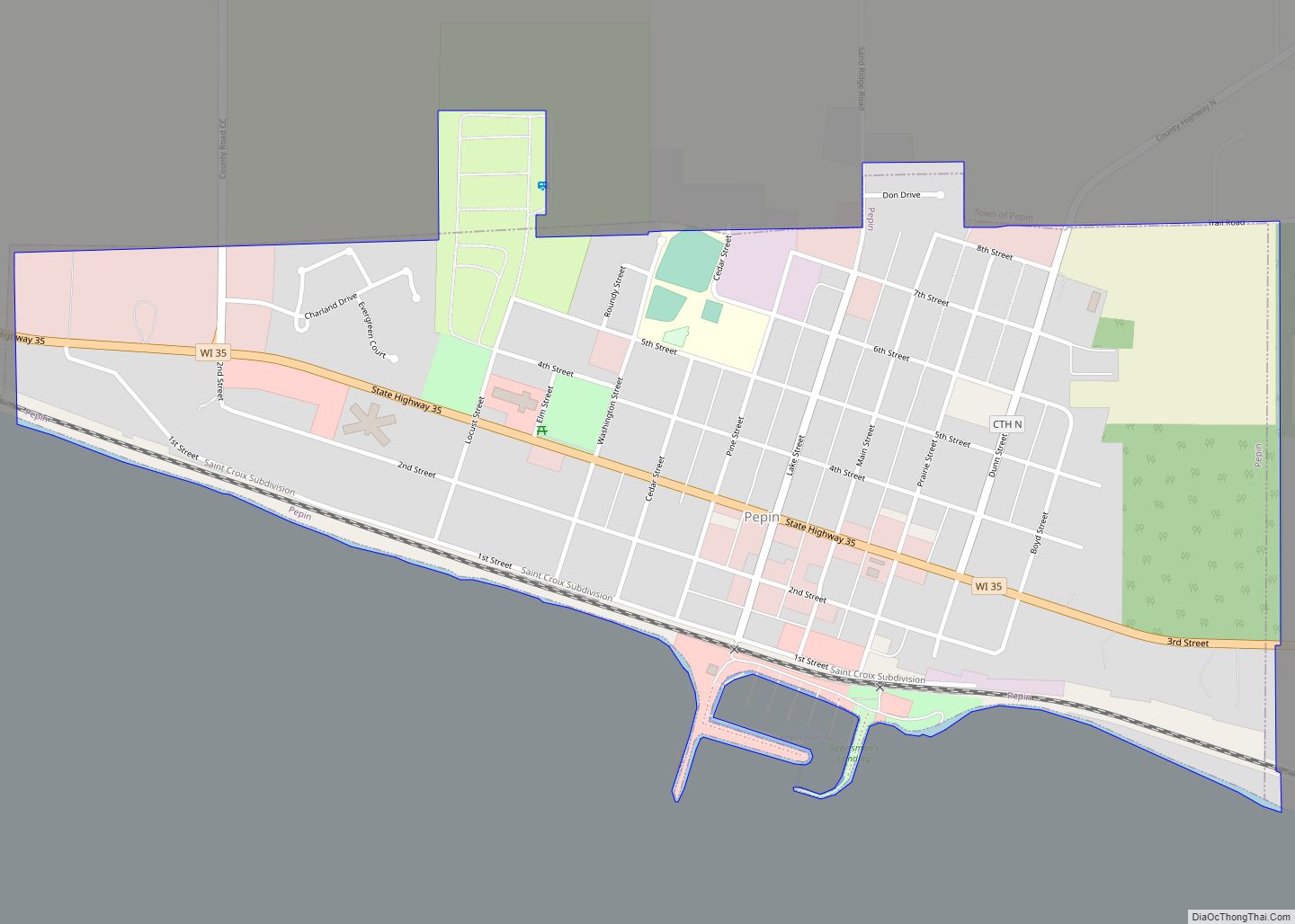
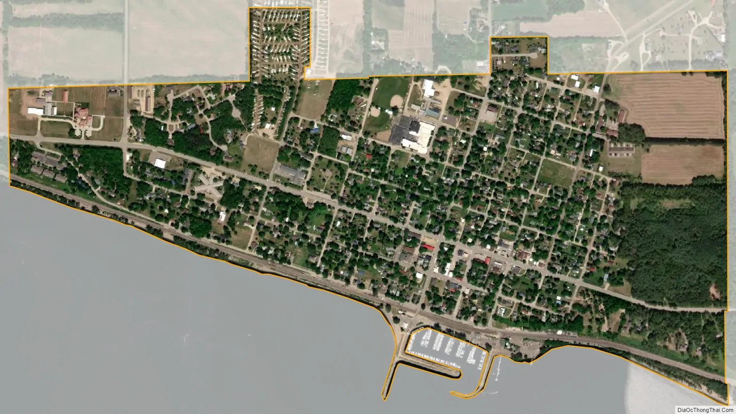
Pepin city Satellite Map
Geography
Pepin is located at 44°26′33″N 92°8′52″W / 44.44250°N 92.14778°W / 44.44250; -92.14778 (44.442724, -92.147884).
According to the United States Census Bureau, the village has a total area of 0.70 square miles (1.81 km), all of it land.
See also
Map of Wisconsin State and its subdivision:- Adams
- Ashland
- Barron
- Bayfield
- Brown
- Buffalo
- Burnett
- Calumet
- Chippewa
- Clark
- Columbia
- Crawford
- Dane
- Dodge
- Door
- Douglas
- Dunn
- Eau Claire
- Florence
- Fond du Lac
- Forest
- Grant
- Green
- Green Lake
- Iowa
- Iron
- Jackson
- Jefferson
- Juneau
- Kenosha
- Kewaunee
- La Crosse
- Lafayette
- Lake Michigan
- Lake Superior
- Langlade
- Lincoln
- Manitowoc
- Marathon
- Marinette
- Marquette
- Menominee
- Milwaukee
- Monroe
- Oconto
- Oneida
- Outagamie
- Ozaukee
- Pepin
- Pierce
- Polk
- Portage
- Price
- Racine
- Richland
- Rock
- Rusk
- Saint Croix
- Sauk
- Sawyer
- Shawano
- Sheboygan
- Taylor
- Trempealeau
- Vernon
- Vilas
- Walworth
- Washburn
- Washington
- Waukesha
- Waupaca
- Waushara
- Winnebago
- Wood
- Alabama
- Alaska
- Arizona
- Arkansas
- California
- Colorado
- Connecticut
- Delaware
- District of Columbia
- Florida
- Georgia
- Hawaii
- Idaho
- Illinois
- Indiana
- Iowa
- Kansas
- Kentucky
- Louisiana
- Maine
- Maryland
- Massachusetts
- Michigan
- Minnesota
- Mississippi
- Missouri
- Montana
- Nebraska
- Nevada
- New Hampshire
- New Jersey
- New Mexico
- New York
- North Carolina
- North Dakota
- Ohio
- Oklahoma
- Oregon
- Pennsylvania
- Rhode Island
- South Carolina
- South Dakota
- Tennessee
- Texas
- Utah
- Vermont
- Virginia
- Washington
- West Virginia
- Wisconsin
- Wyoming