Map of Arkdale CDP
Arkdale is an unincorporated census-designated place in the town of Strongs Prairie in Adams County, Wisconsin, United States. As of the 2020 Census, its population was 201. Arkdale has an area of 2.221 square miles (5.75 km); 2.144 square miles (5.55 km) of this is land, and 0.077 square miles (0.20 km) is water. Arkdale CDP overview: Name: ... Read more
Map of Arkdale CDP
Map of Balsam Lake village
Balsam Lake is a village in, and the county seat of Polk County, Wisconsin, United States. The population was 1,009 at the 2010 census. The village is located within the Town of Balsam Lake. Balsam Lake village overview: Name: Balsam Lake village LSAD Code: 47 LSAD Description: village (suffix) State: Wisconsin County: Polk County Elevation: ... Read more
Map of Balsam Lake village
Map of Argyle village, Wisconsin
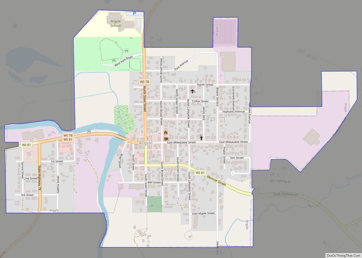
Argyle is a town in Lafayette County, Wisconsin, United States. The population was 436 at the 2010 census, down from 479 at the 2000 census. The village of Argyle is located within the town. Argyle village overview: Name: Argyle village LSAD Code: 47 LSAD Description: village (suffix) State: Wisconsin County: Lafayette County Elevation: 802 ft (244 m) ... Read more
Map of Argyle village, Wisconsin
Map of Argonne CDP
Argonne is an unincorporated census-designated place in the town of Argonne, Forest County, Wisconsin, United States. Argonne is located at the junction of Wisconsin Highway 32 and Wisconsin Highway 55 6 miles (9.7 km) north of Crandon. Argonne has a post office with ZIP code 54511. The community was established in 1888. As of the 2010 ... Read more
Map of Argonne CDP
Map of Belgium village, Wisconsin
Belgium is a town in Ozaukee County, Wisconsin, United States. The population was 1,513 at the 2000 census. The Village of Belgium is surrounded on all sides by the town, and the unincorporated communities of Decker, Holy Cross, Lake Church, and Sauk Trail Beach are located in the town, as is the ghost town of ... Read more
Map of Belgium village, Wisconsin
Map of Beaver Dam city, Wisconsin
Beaver Dam is a city in Dodge County, Wisconsin, United States, along Beaver Dam Lake and the Beaver Dam River. The population was 16,708 at the 2020 census, making it the largest city primarily located in Dodge County. It is the principal city of the Beaver Dam Micropolitan Statistical area. The city is adjacent to ... Read more
Map of Beaver Dam city, Wisconsin
Map of Berlin city, Wisconsin
Berlin is a city in Green Lake and Waushara counties in the U.S. state of Wisconsin. The population was 5,571 at the 2020 census. Of this, 5,435 were in Green Lake County, and only 89 were in Waushara County. The city is located mostly within the Town of Berlin in Green Lake County, with a ... Read more
Map of Berlin city, Wisconsin
Map of Benton village, Wisconsin
Benton is a town in Lafayette County, Wisconsin, United States. The population was 504 at the 2010 census, up from 469 at the 2000 census. The village of Benton is located within the town. The unincorporated communities of Jenkinsville and Strawbridge are also located in the town. Benton village overview: Name: Benton village LSAD Code: ... Read more
Map of Benton village, Wisconsin
Map of Black River Falls city
Black River Falls is a city in and the county seat of Jackson County, Wisconsin, United States. The population was 3,523 at the 2020 census. It is home to the administrative center of the Ho-Chunk Nation. Black River Falls city overview: Name: Black River Falls city LSAD Code: 25 LSAD Description: city (suffix) State: Wisconsin ... Read more
Map of Black River Falls city
Map of Boulder Junction CDP
Boulder Junction is an unincorporated census-designated place located in the town of Boulder Junction, Vilas County, Wisconsin, United States. Boulder Junction is 23 miles (37 km) northwest of Eagle River. Boulder Junction has a post office with ZIP code 54512. As of the 2010 census, its population was 183. Boulder Junction CDP overview: Name: Boulder Junction ... Read more
Map of Boulder Junction CDP
Map of Birchwood village
Birchwood is a town in Washburn County, Wisconsin, United States. The population was 453 at the 2000 census. The Village of Birchwood is located within the town. Birchwood village overview: Name: Birchwood village LSAD Code: 47 LSAD Description: village (suffix) State: Wisconsin County: Washburn County FIPS code: 5507550 Online Interactive Map Birchwood online map. Source: ... Read more
Map of Birchwood village
Map of Birch Hill CDP
Birch Hill is a census-designated place in the town of Sanborn, Ashland County, Wisconsin, United States. Its population was 293 as of the 2010 census. Birch Hill CDP overview: Name: Birch Hill CDP LSAD Code: 57 LSAD Description: CDP (suffix) State: Wisconsin County: Ashland County Elevation: 1,079 ft (329 m) Total Area: 0.619 sq mi (1.60 km²) Land Area: 0.619 sq mi ... Read more
Map of Birch Hill CDP