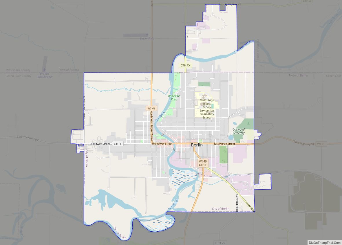
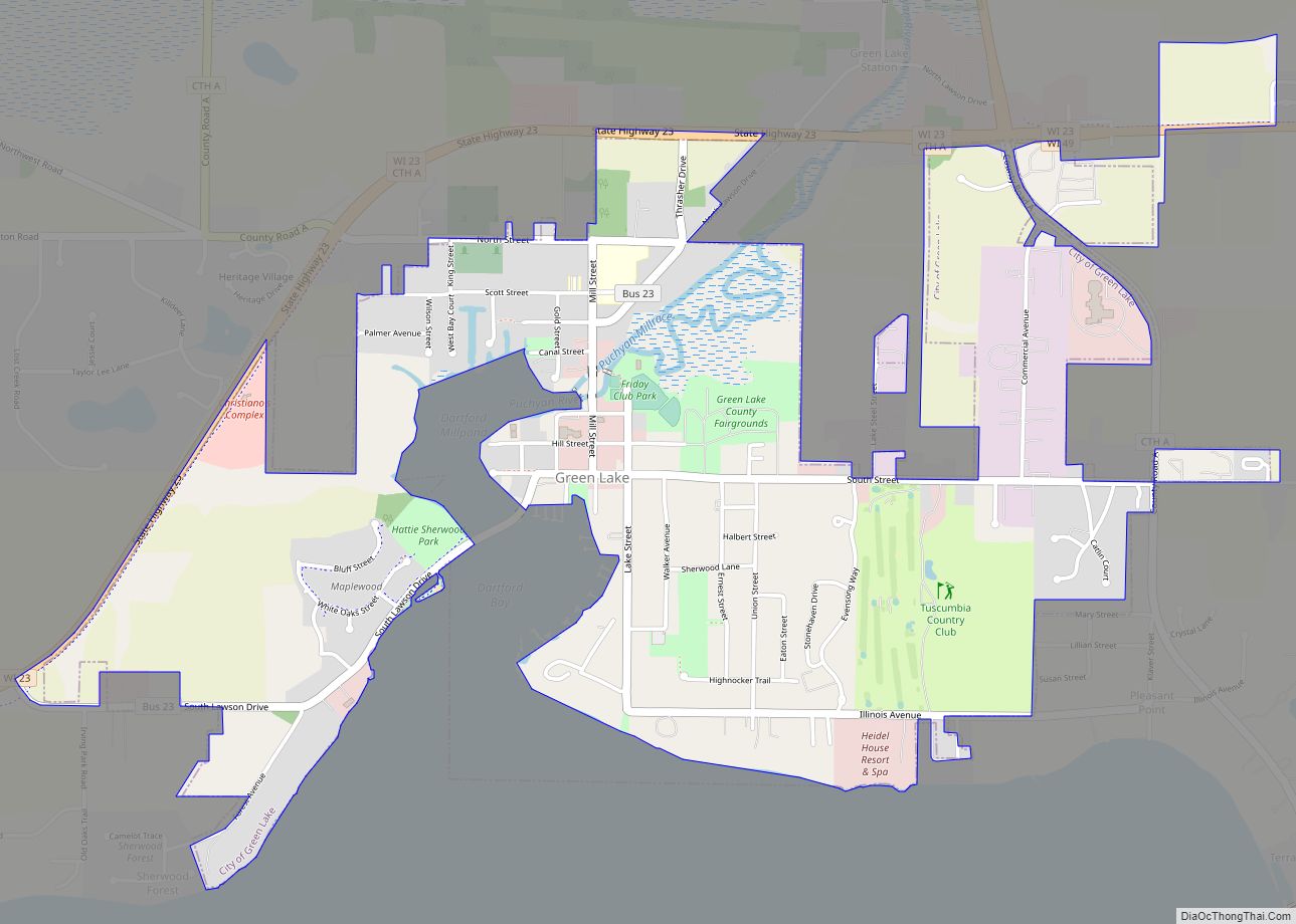
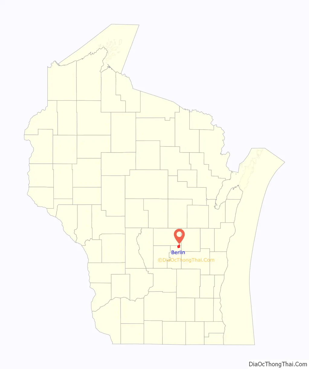
Berlin is a city in Green Lake and Waushara counties in the U.S. state of Wisconsin. The population was 5,571 at the 2020 census. Of this, 5,435 were in Green Lake County, and only 89 were in Waushara County. The city is located mostly within the Town of Berlin in Green Lake County, with a small portion extending into the Town of Aurora in Waushara County.
| Name: | Berlin city |
|---|---|
| LSAD Code: | 25 |
| LSAD Description: | city (suffix) |
| State: | Wisconsin |
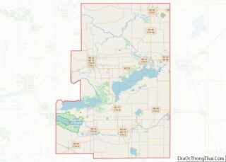
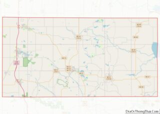
| County: | Green Lake County, Waushara County |
| Elevation: | 807 ft (246 m) |
| Total Area: | 6.39 sq mi (16.55 km²) |
| Land Area: | 5.78 sq mi (14.97 km²) |
| Water Area: | 0.61 sq mi (1.58 km²) |
| Total Population: | 5,571 |
| Population Density: | 931.34/sq mi (359.61/km²) |
| Area code: | 920 |
| FIPS code: | 5506925 |
| GNISfeature ID: | 1561600 |
| Website: | cityofberlin.net |
Online Interactive Map
Click on ![]() to view map in "full screen" mode.
to view map in "full screen" mode.
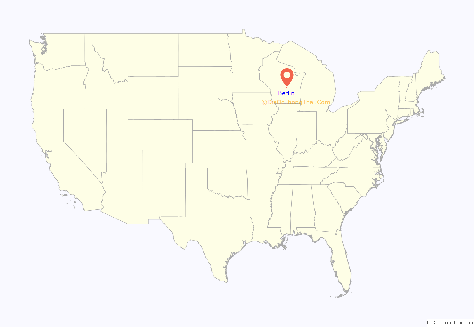
Berlin location map. Where is Berlin city?
History
In 1845, Nathan H. Strong (1813–1852) became the first resident of what is today Berlin. He was joined by Hugh G. Martin, Hiram Barnes, and William Dickey. Their settlement was known as Strong’s Landing. In 1848 a post office was established. It was named Berlin after the capital of Prussia, now the capital of Germany. The first school house was built in 1850 and the first church in 1851. Berlin was incorporated as a city in 1857.
Pronunciation
Area residents put the accent on the first syllable of Berlin /ˈbɜːrlɪn/ rather than on the second. It has been said that this was in reaction to the anti-German sentiment that swept across the United States during World War I, and that the accent was previously on the second syllable.
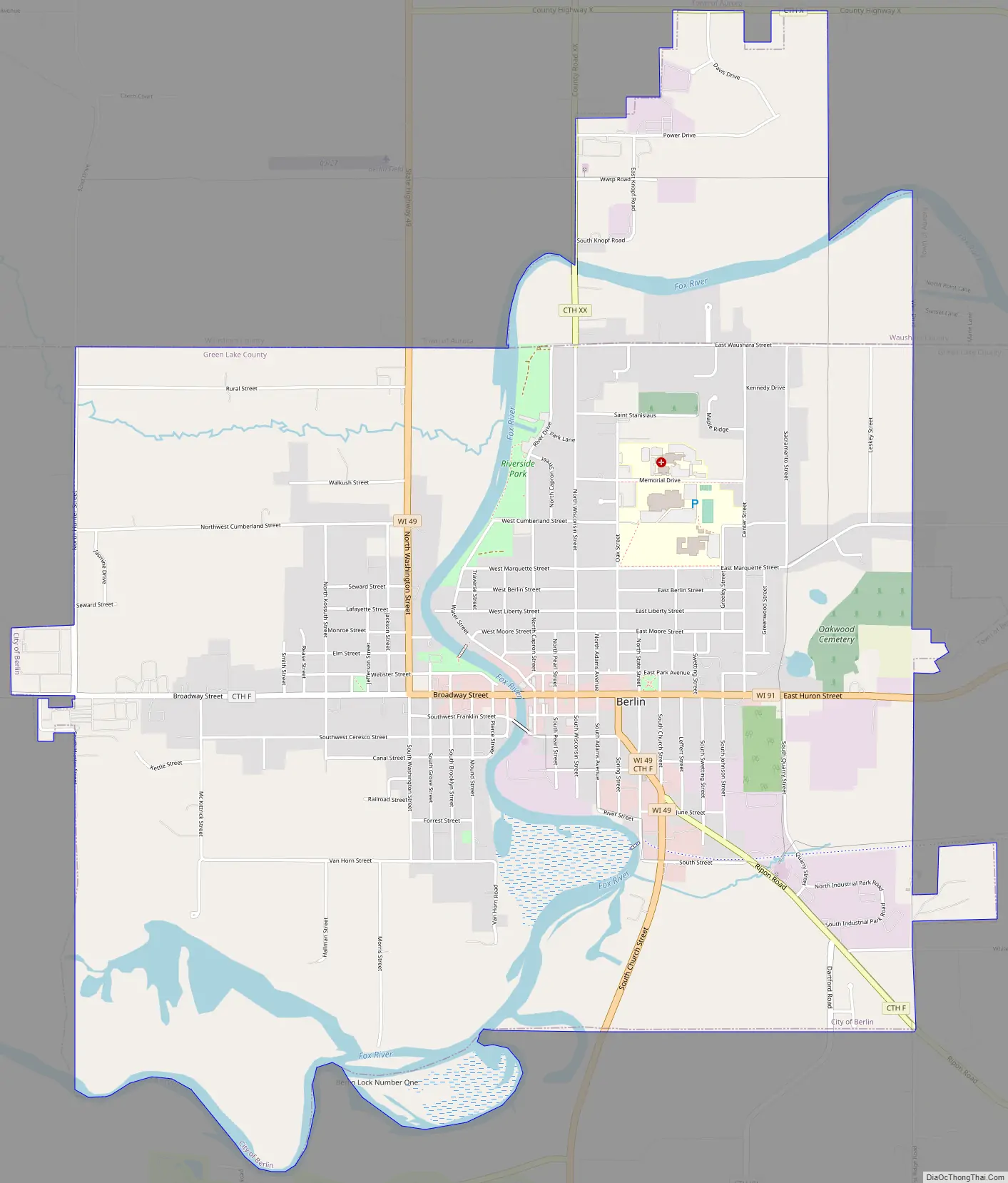
Berlin Road Map
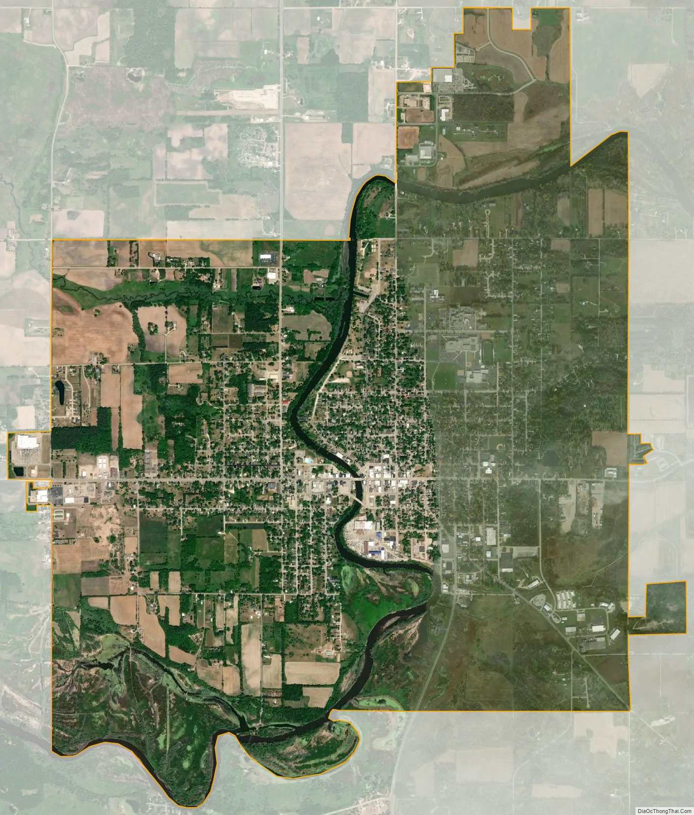
Berlin city Satellite Map
Geography
Berlin is located at 43°58′11″N 88°56′55″W / 43.96972°N 88.94861°W / 43.96972; -88.94861 (43.969732, −88.948717). The Fox River runs north-south through the middle of the city splitting it.
According to the United States Census Bureau, the city has a total area of 6.36 square miles (16.47 km), of which, 5.78 square miles (14.97 km) is land and 0.58 square miles (1.50 km) is water.
See also
Map of Wisconsin State and its subdivision:- Adams
- Ashland
- Barron
- Bayfield
- Brown
- Buffalo
- Burnett
- Calumet
- Chippewa
- Clark
- Columbia
- Crawford
- Dane
- Dodge
- Door
- Douglas
- Dunn
- Eau Claire
- Florence
- Fond du Lac
- Forest
- Grant
- Green
- Green Lake
- Iowa
- Iron
- Jackson
- Jefferson
- Juneau
- Kenosha
- Kewaunee
- La Crosse
- Lafayette
- Lake Michigan
- Lake Superior
- Langlade
- Lincoln
- Manitowoc
- Marathon
- Marinette
- Marquette
- Menominee
- Milwaukee
- Monroe
- Oconto
- Oneida
- Outagamie
- Ozaukee
- Pepin
- Pierce
- Polk
- Portage
- Price
- Racine
- Richland
- Rock
- Rusk
- Saint Croix
- Sauk
- Sawyer
- Shawano
- Sheboygan
- Taylor
- Trempealeau
- Vernon
- Vilas
- Walworth
- Washburn
- Washington
- Waukesha
- Waupaca
- Waushara
- Winnebago
- Wood
- Alabama
- Alaska
- Arizona
- Arkansas
- California
- Colorado
- Connecticut
- Delaware
- District of Columbia
- Florida
- Georgia
- Hawaii
- Idaho
- Illinois
- Indiana
- Iowa
- Kansas
- Kentucky
- Louisiana
- Maine
- Maryland
- Massachusetts
- Michigan
- Minnesota
- Mississippi
- Missouri
- Montana
- Nebraska
- Nevada
- New Hampshire
- New Jersey
- New Mexico
- New York
- North Carolina
- North Dakota
- Ohio
- Oklahoma
- Oregon
- Pennsylvania
- Rhode Island
- South Carolina
- South Dakota
- Tennessee
- Texas
- Utah
- Vermont
- Virginia
- Washington
- West Virginia
- Wisconsin
- Wyoming