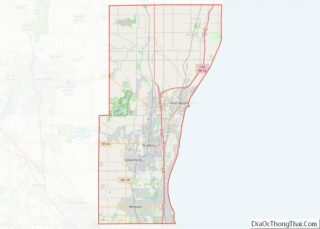
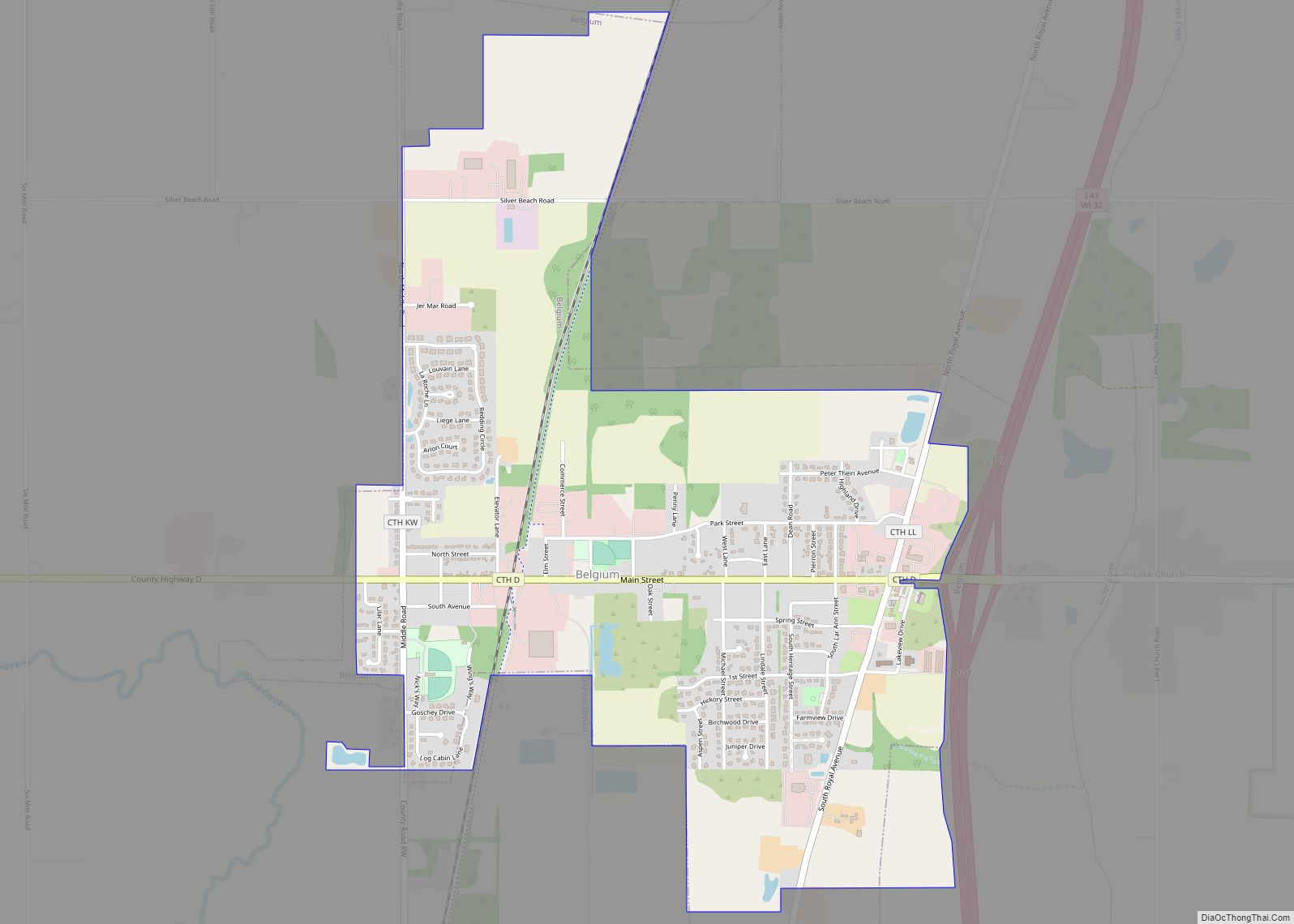
Belgium is a town in Ozaukee County, Wisconsin, United States. The population was 1,513 at the 2000 census. The Village of Belgium is surrounded on all sides by the town, and the unincorporated communities of Decker, Holy Cross, Lake Church, and Sauk Trail Beach are located in the town, as is the ghost town of Stonehaven. The unincorporated community of Dacada is also partially located in the town. The ghost town of Stonehaven is also located in the town.
Beginning in the 1840s, immigrant farmers from Luxembourg settled in the towns of Northern Ozaukee County, including Belgium. Their centers of settlement in the Town of Belgium included the hamlets of Dacada, Holy Cross, and Lake Church, as well as the settlement that would eventually become the Village of Belgium, which incorporated from some of the town’s land in 1922. The Town of Belgium is a primarily agricultural community with over 18,000 acres of farmland—the largest amount in any Ozaukee County community.
| Name: | Belgium village |
|---|---|
| LSAD Code: | 47 |
| LSAD Description: | village (suffix) |
| State: | Wisconsin |
| County: | Ozaukee County |
| Incorporated: | 1848; 175 years ago (1848) |
| Elevation: | 774 ft (236 m) |
| Total Area: | 36.8 sq mi (95.3 km²) |
| Land Area: | 35.7 sq mi (92.6 km²) |
| Water Area: | 1.1 sq mi (2.7 km²) |
| Total Population: | 1,513 |
| Population Density: | 42.3/sq mi (16.3/km²) |
| Area code: | 262 |
| FIPS code: | 5506150 |
| Website: | www.town.belgium.wi.us |
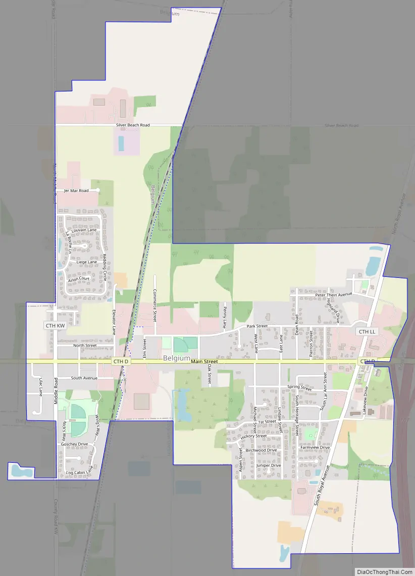
Online Interactive Map
Click on ![]() to view map in "full screen" mode.
to view map in "full screen" mode.
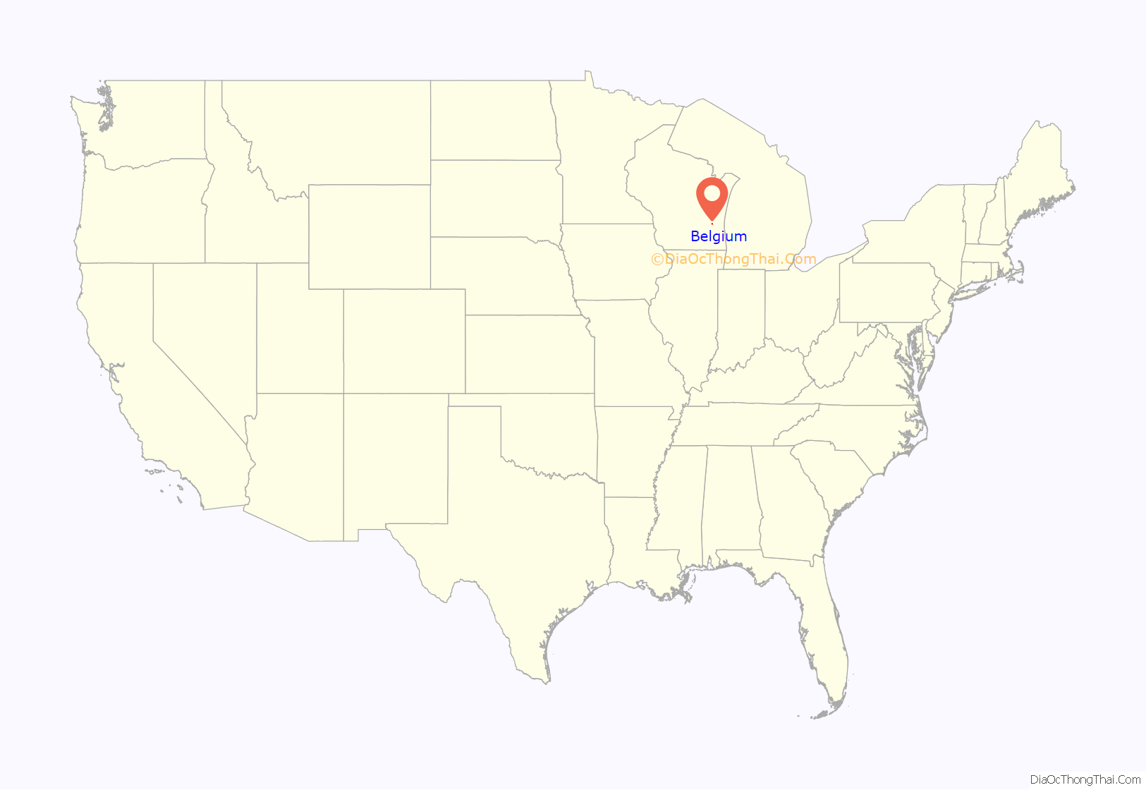
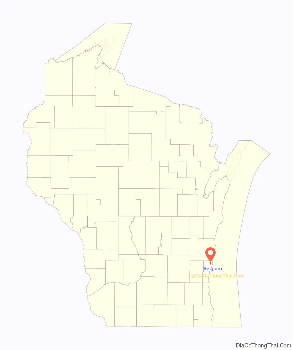
Belgium location map. Where is Belgium village?
History
Northeastern Ozaukee County, including the town and village Belgium, was inhabited by several Native American tribes, including the Menominee. The Menominee surrendered the land that would become Belgium to the United States Federal Government through the 1832 Treaty of Washington.
In the late 1840s, immigrants from Luxembourg began to settle in what would become northeastern Ozaukee County. In 1848, the Town of Belgium was created out of the Town of Port Washington.
The Chicago, Milwaukee & St. Paul Railway began running through the community in 1872, spurring population growth. In the early 20th Century, Belgium was a stop on the Milwaukee Interurban Line, which ran between Milwaukee and Sheboygan from 1908 until 1948. The population began to concentrate around the railroad station, and the Village of Belgium was incorporated out of some of the town’s land in 1922.
From 1901 to 1925, the Lake Shore Stone Company operated a dolomite quarry at the present location of Harrington Beach State Park in the Town of Belgium. There was a company town called Stonehaven at the site. Most of the workers were immigrants from Luxembourg, the Austro-Hungarian Empire, and Italy. When the quarry closed, some of the residential buildings were moved to the Village of Belgium. The foundations of some of the building remain in the state park.
Belgium Road Map
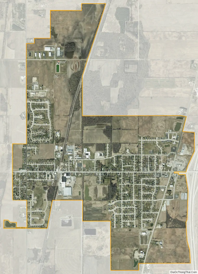
Belgium city Satellite Map
Geography
According to the United States Census Bureau, the town has a total area of 36.8 square miles (95.3 km), of which, 35.7 square miles (92.6 km) of it is land and 1.1 square miles (2.7 km) of it (2.88%) is water. The Village of Belgium is located in what was formerly the central part of the Town of Belgium. The town borders the Town of Holland to the north, Lake Michigan to the east, the Town of Port Washington to the south, and the Town of Fredonia to the west. The unincorporated communities of Dacada, Decker, Holy Cross, Lake Church, and Sauk Trail Beach are located in the town as is the former company town of Stonehaven.
The town is located in the Southeastern Wisconsin glacial till plains that were created by the Wisconsin glaciation during the most recent ice age. The Wisconsin Department of Natural Resources considers the town to be in the Central Lake Michigan Coastal ecological landscape. The Lake Michigan coastline in the town is lined with sand and gravel beaches.
Before white settlers arrived in the area, much of the Belgium area was an upland forest dominated by American beech and sugar maple trees. There were also lowland conifer forests and swamps dominated by white cedar and tamarack along the Onion River, Sauk Creek, and Sucker Creek, all of which flow through the town. Much of the original forest was cleared to prepare the land for agriculture. Much of the town remains agricultural; as of 2000 there were over 18,000 acres of agricultural land in the town—the largest amount of farmland in any Ozaukee County community. However, as of 2002, the Town of Belgium also had the largest share of restored wetlands in the county with over 126 acres spread across 105 restoration sites.
Large mammals, including white-tailed deer, coyotes, and red foxes can be seen in the town. The community is also home to several bird habitats, including the United States Fish and Wildlife Service’s Belgium Waterfowl Production Area and the Cedar Grove Waterfowl Production Area as well as Harrington Beach State Park which is located on the shore of Lake Michigan and is one of two Wisconsin Important Bird Areas in Ozaukee County. The open fields in the western part of Harrington Beach are a breeding ground for upland sandpipers.
The region struggles with many invasive species, including the emerald ash borer, common carp, reed canary grass, the common reed, purple loosestrife, garlic mustard, Eurasian buckthorns, and honeysuckles. Some of the wetlands in the Town of Belgium are especially affected by reed canary grass, with the invasive species accounting for more than 50% of plant coverage along some stretches of Sucker Creek and the Onion River.
See also
Map of Wisconsin State and its subdivision:- Adams
- Ashland
- Barron
- Bayfield
- Brown
- Buffalo
- Burnett
- Calumet
- Chippewa
- Clark
- Columbia
- Crawford
- Dane
- Dodge
- Door
- Douglas
- Dunn
- Eau Claire
- Florence
- Fond du Lac
- Forest
- Grant
- Green
- Green Lake
- Iowa
- Iron
- Jackson
- Jefferson
- Juneau
- Kenosha
- Kewaunee
- La Crosse
- Lafayette
- Lake Michigan
- Lake Superior
- Langlade
- Lincoln
- Manitowoc
- Marathon
- Marinette
- Marquette
- Menominee
- Milwaukee
- Monroe
- Oconto
- Oneida
- Outagamie
- Ozaukee
- Pepin
- Pierce
- Polk
- Portage
- Price
- Racine
- Richland
- Rock
- Rusk
- Saint Croix
- Sauk
- Sawyer
- Shawano
- Sheboygan
- Taylor
- Trempealeau
- Vernon
- Vilas
- Walworth
- Washburn
- Washington
- Waukesha
- Waupaca
- Waushara
- Winnebago
- Wood
- Alabama
- Alaska
- Arizona
- Arkansas
- California
- Colorado
- Connecticut
- Delaware
- District of Columbia
- Florida
- Georgia
- Hawaii
- Idaho
- Illinois
- Indiana
- Iowa
- Kansas
- Kentucky
- Louisiana
- Maine
- Maryland
- Massachusetts
- Michigan
- Minnesota
- Mississippi
- Missouri
- Montana
- Nebraska
- Nevada
- New Hampshire
- New Jersey
- New Mexico
- New York
- North Carolina
- North Dakota
- Ohio
- Oklahoma
- Oregon
- Pennsylvania
- Rhode Island
- South Carolina
- South Dakota
- Tennessee
- Texas
- Utah
- Vermont
- Virginia
- Washington
- West Virginia
- Wisconsin
- Wyoming