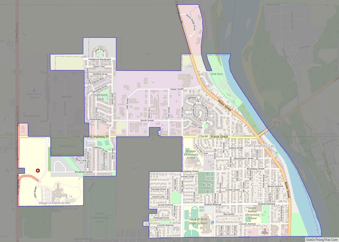
Map of Ironton village, Wisconsin

Map of Ironton village, Wisconsin

Ironton is a town in Sauk County, Wisconsin, United States. The population was 650 at the 2000 census. The town was named from deposits of iron ore in the area. The Village of Ironton is located within the town. Ironton village overview: Name: Ironton village LSAD Code: 47 LSAD Description: village (suffix) State: Wisconsin County: … Read more

Map of Lac du Flambeau CDP

Map of Lac du Flambeau CDP

Lac du Flambeau is a census-designated place (CDP) in the town of Lac du Flambeau in Vilas County, Wisconsin, United States. The population was 1,845 at the 2020 census. Lac du Flambeau is the major community for the Lac du Flambeau Band of Lake Superior Chippewa tribe. Lac du Flambeau CDP overview: Name: Lac du … Read more

Map of Kennan village

Map of Kennan village

Kennan is a town in Price County, Wisconsin, United States. The population was 378 at the 2000 census. The Village of Kennan is located within the town. Kennan village overview: Name: Kennan village LSAD Code: 47 LSAD Description: village (suffix) State: Wisconsin County: Price County FIPS code: 5539175 Online Interactive Map Kennan online map. Source: … Read more

Map of La Valle village

Map of La Valle village

The Town of La Valle is located in Sauk County, Wisconsin, United States. La Valle is a name derived from French meaning “the valley”. The population was 1,203 at the 2000 census. The Village of La Valle is located within the town. La Valle village overview: Name: La Valle village LSAD Code: 47 LSAD Description: … Read more

Map of Kendall village, Wisconsin

Map of Kendall village, Wisconsin

Kendall is a village in Monroe County, Wisconsin, United States, along the Baraboo River. The population was 472 at the 2010 census. Kendall village overview: Name: Kendall village LSAD Code: 47 LSAD Description: village (suffix) State: Wisconsin County: Monroe County Elevation: 1,030 ft (314 m) Total Area: 0.76 sq mi (1.98 km²) Land Area: 0.76 sq mi (1.98 km²) Water Area: 0.00 sq mi (0.00 km²) … Read more

Map of La Farge village

Map of La Farge village

La Farge is a village along the Kickapoo River in Vernon County, Wisconsin, United States. Its population was 746 at the 2010 census. La Farge village overview: Name: La Farge village LSAD Code: 47 LSAD Description: village (suffix) State: Wisconsin County: Vernon County Elevation: 797 ft (243 m) Total Area: 1.03 sq mi (2.68 km²) Land Area: 1.01 sq mi (2.61 km²) Water … Read more

Map of Kellnersville village

Map of Kellnersville village

Kellnersville is a village in Manitowoc County, Wisconsin, United States. The population was 307 at the 2020 census. Kellnersville village overview: Name: Kellnersville village LSAD Code: 47 LSAD Description: village (suffix) State: Wisconsin County: Manitowoc County Elevation: 830 ft (253 m) Total Area: 0.54 sq mi (1.40 km²) Land Area: 0.54 sq mi (1.40 km²) Water Area: 0.00 sq mi (0.00 km²) Total Population: 307 Population … Read more

Map of Kronenwetter village

Map of Kronenwetter village

Kronenwetter is a village in Marathon County, Wisconsin, United States. It is the largest village by land area (although Suamico is larger when its water area is added) in the state of Wisconsin, as well as in the entire United States, and the third-largest community by population in Marathon County. It is part of the … Read more

Map of Krakow CDP

Map of Krakow CDP

Krakow is an unincorporated community and census-designated place located primarily in Shawano County, Wisconsin, United States, with a small portion in Oconto County. Krakow is located on Wisconsin Highway 32 north of Pulaski, in the towns of Chase, and Angelica. Krakow has a post office with ZIP code 54137. As of the 2010 census, its … Read more

Map of Kohler village

Map of Kohler village

Kohler is a village in Sheboygan County, Wisconsin, United States, along the Sheboygan River. The population was 2,120 at the 2010 census. It is included in the Sheboygan, Wisconsin Metropolitan Statistical Area. Kohler village overview: Name: Kohler village LSAD Code: 47 LSAD Description: village (suffix) State: Wisconsin County: Sheboygan County Elevation: 686 ft (209 m) Total Area: … Read more

Map of Knowlton CDP

Map of Knowlton CDP

Knowlton is a census-designated place in the town of Knowlton, Marathon County, Wisconsin, United States. Its population was 120 as of the 2010 census. The northern terminus for Wisconsin Highway 34 is located just north of Knowlton and the highway passes through the community. Knowlton CDP overview: Name: Knowlton CDP LSAD Code: 57 LSAD Description: … Read more

Map of Knapp village

Map of Knapp village

Knapp is a village in Dunn County, Wisconsin, United States. The population was 463 at the 2010 census. Knapp village overview: Name: Knapp village LSAD Code: 47 LSAD Description: village (suffix) State: Wisconsin County: Dunn County Total Area: 1.57 sq mi (4.08 km²) Land Area: 1.57 sq mi (4.07 km²) Water Area: 0.01 sq mi (0.01 km²) Total Population: 463 Population Density: 295.54/sq mi (114.13/km²) … Read more