Rhinelander is a city in and the county seat of Oneida County, Wisconsin, United States. The population was 8,285 at the 2020 census.
| Name: | Rhinelander city |
|---|---|
| LSAD Code: | 25 |
| LSAD Description: | city (suffix) |
| State: | Wisconsin |
| County: | Oneida County |
| Elevation: | 1,549 ft (472 m) |
| Total Area: | 8.68 sq mi (22.47 km²) |
| Land Area: | 8.42 sq mi (21.82 km²) |
| Water Area: | 0.25 sq mi (0.65 km²) |
| Total Population: | 8,285 |
| Population Density: | 983.6/sq mi (379.8/km²) |
| Area code: | 715 & 534 |
| FIPS code: | 5567200 |
| GNISfeature ID: | 1572231 |
| Website: | www.rhinelandercityhall.org |
Online Interactive Map
Click on ![]() to view map in "full screen" mode.
to view map in "full screen" mode.
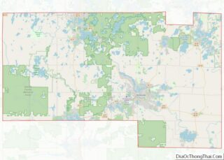
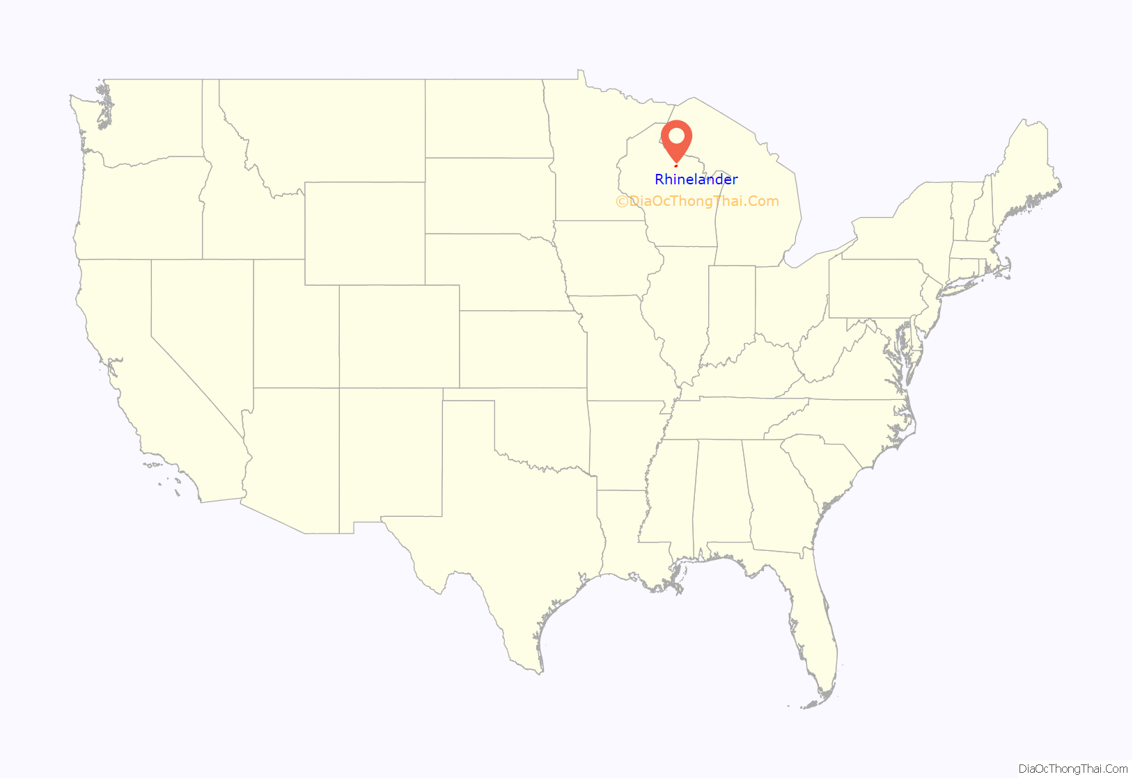
Rhinelander location map. Where is Rhinelander city?

History
The area that eventually became the city of Rhinelander was originally called Pelican Rapids by early settlers, named for the stretch of rapids just above the convergence of the Wisconsin and Pelican Rivers. Around 1870, Anderson W. Brown of Stevens Point and Anson P. Vaughn traveled up the Wisconsin River to cruise timber for Brown’s father, E. D. Brown. Upon arriving at the meeting point of the Wisconsin and Pelican Rivers at the site of John Curran’s trading post, and seeing the high banks along the rapids and the excellent pine stands, Anderson Brown envisioned a mill town with a lumber mill powered by the waters of the Wisconsin River. Brown’s vision did not come to fruition for some years, but after subsequent expeditions with others, including his brother and Rhinelander’s first mayor, Webster Brown, the brothers managed to convince their father and uncle to purchase the land from the federal government and build a town. In its charter, the city was named Rhinelander after Frederic W. Rhinelander of New York, who was president of the Milwaukee, Lake Shore and Western Railroad at the time. This was part of a bid by the Brown brothers to induce the railroad to extend a spur to the location to further their lumbering business. Ultimately, after over 10 years of negotiations, the Brown family agreed to convey half their land holdings in the area to the railroad in exchange for a rail line to their future city. In 1882, the railroad line from present-day Monico to Rhinelander was completed, jump starting the development of Rhinelander as the commercial hub of the region.
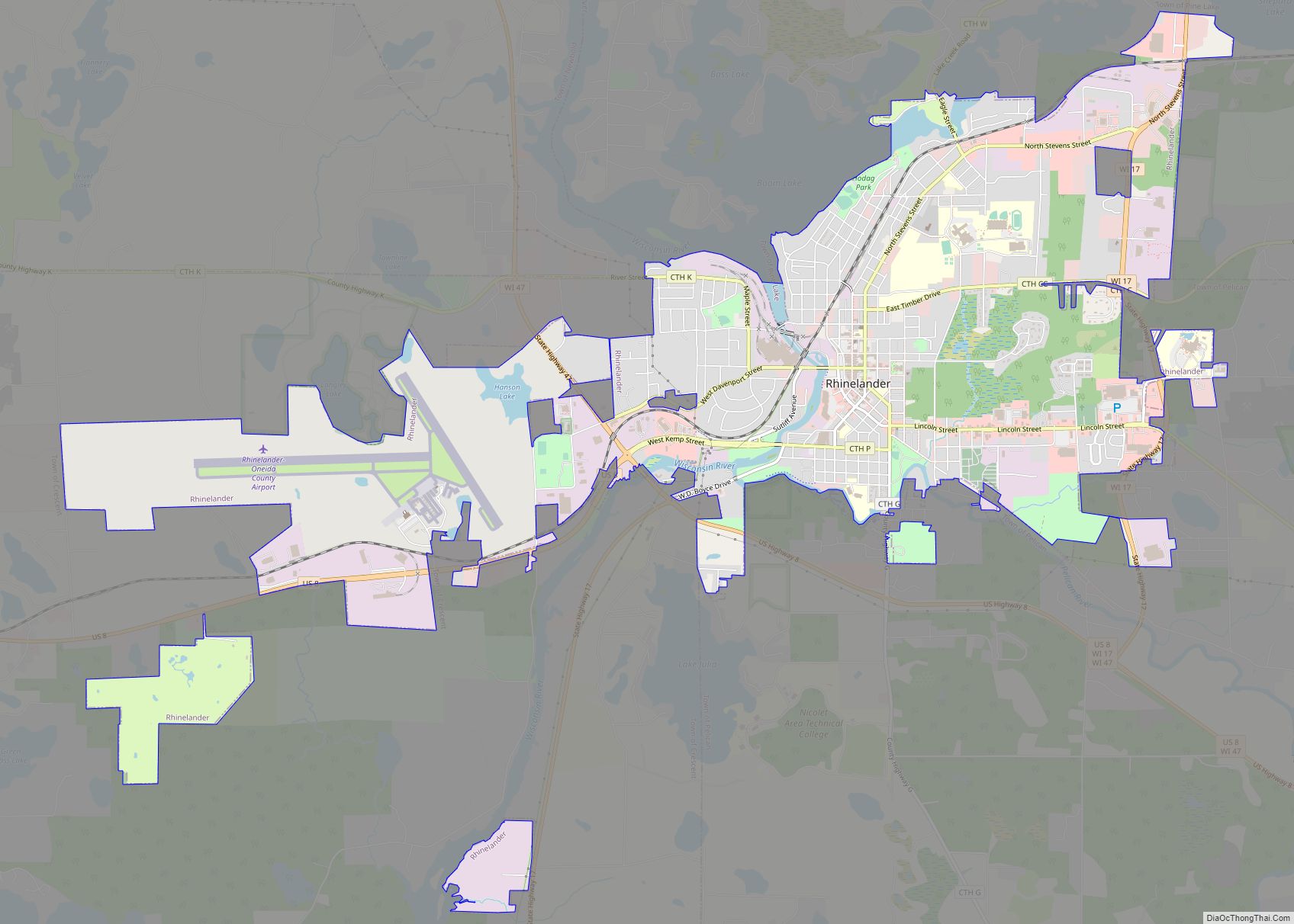
Rhinelander Road Map
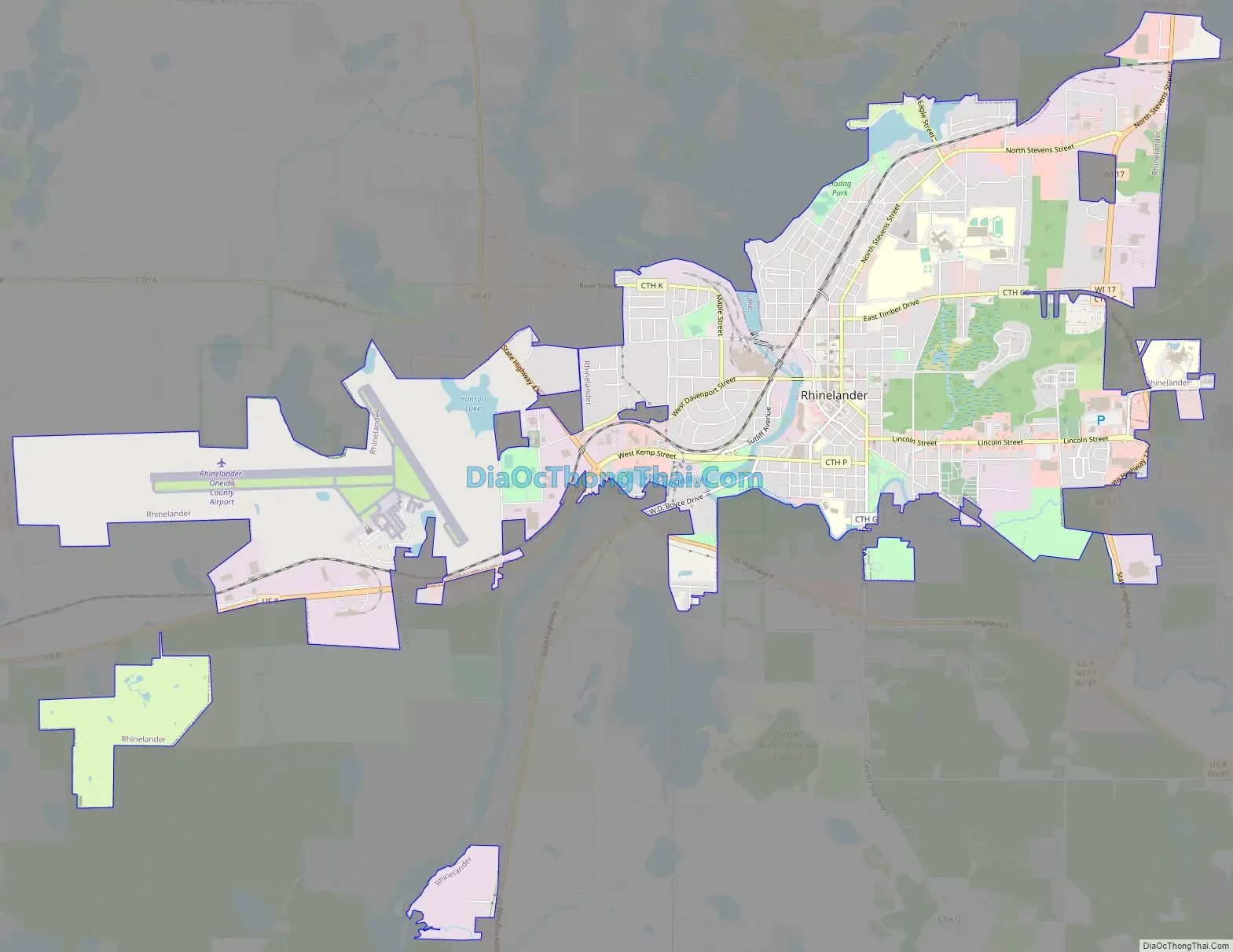
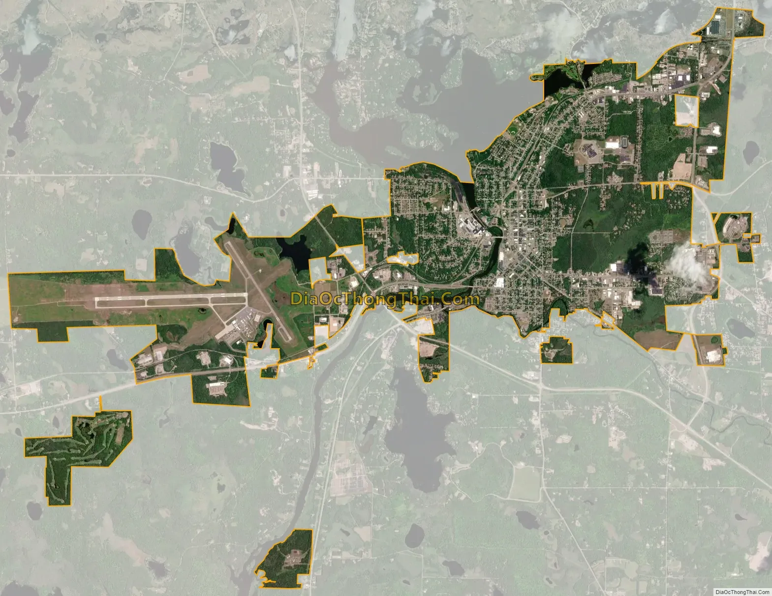
Rhinelander city Satellite Map
Geography
Rhinelander is located at 45°38′22″N 89°24′44″W / 45.63944°N 89.41222°W / 45.63944; -89.41222 (45.639515, −89.412086).
According to the United States Census Bureau, the city has a total area of 8.61 square miles (22.30 km), of which, 8.34 square miles (21.60 km) are land and 0.27 sq mi (0.70 km) is covered by water.
Climate
Rhinelander has a warm-summer humid continental climate (Köppen: Dfb). Because of its location, it is prone to Arctic cold snaps, and without the western Föhn winds its winter average is lower than other places in the US at 45 °N even at high elevations. Summers tend to be cooler with some degree of Lake Superior and Lake Michigan influence. Precipitation is still relatively distributed but not as much as other humid climates in the country.
See also
Map of Wisconsin State and its subdivision:- Adams
- Ashland
- Barron
- Bayfield
- Brown
- Buffalo
- Burnett
- Calumet
- Chippewa
- Clark
- Columbia
- Crawford
- Dane
- Dodge
- Door
- Douglas
- Dunn
- Eau Claire
- Florence
- Fond du Lac
- Forest
- Grant
- Green
- Green Lake
- Iowa
- Iron
- Jackson
- Jefferson
- Juneau
- Kenosha
- Kewaunee
- La Crosse
- Lafayette
- Lake Michigan
- Lake Superior
- Langlade
- Lincoln
- Manitowoc
- Marathon
- Marinette
- Marquette
- Menominee
- Milwaukee
- Monroe
- Oconto
- Oneida
- Outagamie
- Ozaukee
- Pepin
- Pierce
- Polk
- Portage
- Price
- Racine
- Richland
- Rock
- Rusk
- Saint Croix
- Sauk
- Sawyer
- Shawano
- Sheboygan
- Taylor
- Trempealeau
- Vernon
- Vilas
- Walworth
- Washburn
- Washington
- Waukesha
- Waupaca
- Waushara
- Winnebago
- Wood
- Alabama
- Alaska
- Arizona
- Arkansas
- California
- Colorado
- Connecticut
- Delaware
- District of Columbia
- Florida
- Georgia
- Hawaii
- Idaho
- Illinois
- Indiana
- Iowa
- Kansas
- Kentucky
- Louisiana
- Maine
- Maryland
- Massachusetts
- Michigan
- Minnesota
- Mississippi
- Missouri
- Montana
- Nebraska
- Nevada
- New Hampshire
- New Jersey
- New Mexico
- New York
- North Carolina
- North Dakota
- Ohio
- Oklahoma
- Oregon
- Pennsylvania
- Rhode Island
- South Carolina
- South Dakota
- Tennessee
- Texas
- Utah
- Vermont
- Virginia
- Washington
- West Virginia
- Wisconsin
- Wyoming