Whiting is a village in Portage County, Wisconsin, United States and is a suburb of Stevens Point. It is included in the Stevens Point Micropolitan Statistical Area. The population was 1,601 at the 2020 census. Whiting village overview: Name: Whiting village LSAD Code: 47 LSAD Description: village (suffix) State: Wisconsin County: Portage County Elevation: 1,086 ft ... Read more
Wisconsin Cities and Places
West Baraboo is a village along the Baraboo River in Sauk County, Wisconsin, United States. The population was 1,627 at the 2020 census. It is part of the Baraboo micropolitan statistical area. West Baraboo was previously known as Lyons. West Baraboo village overview: Name: West Baraboo village LSAD Code: 47 LSAD Description: village (suffix) State: ... Read more
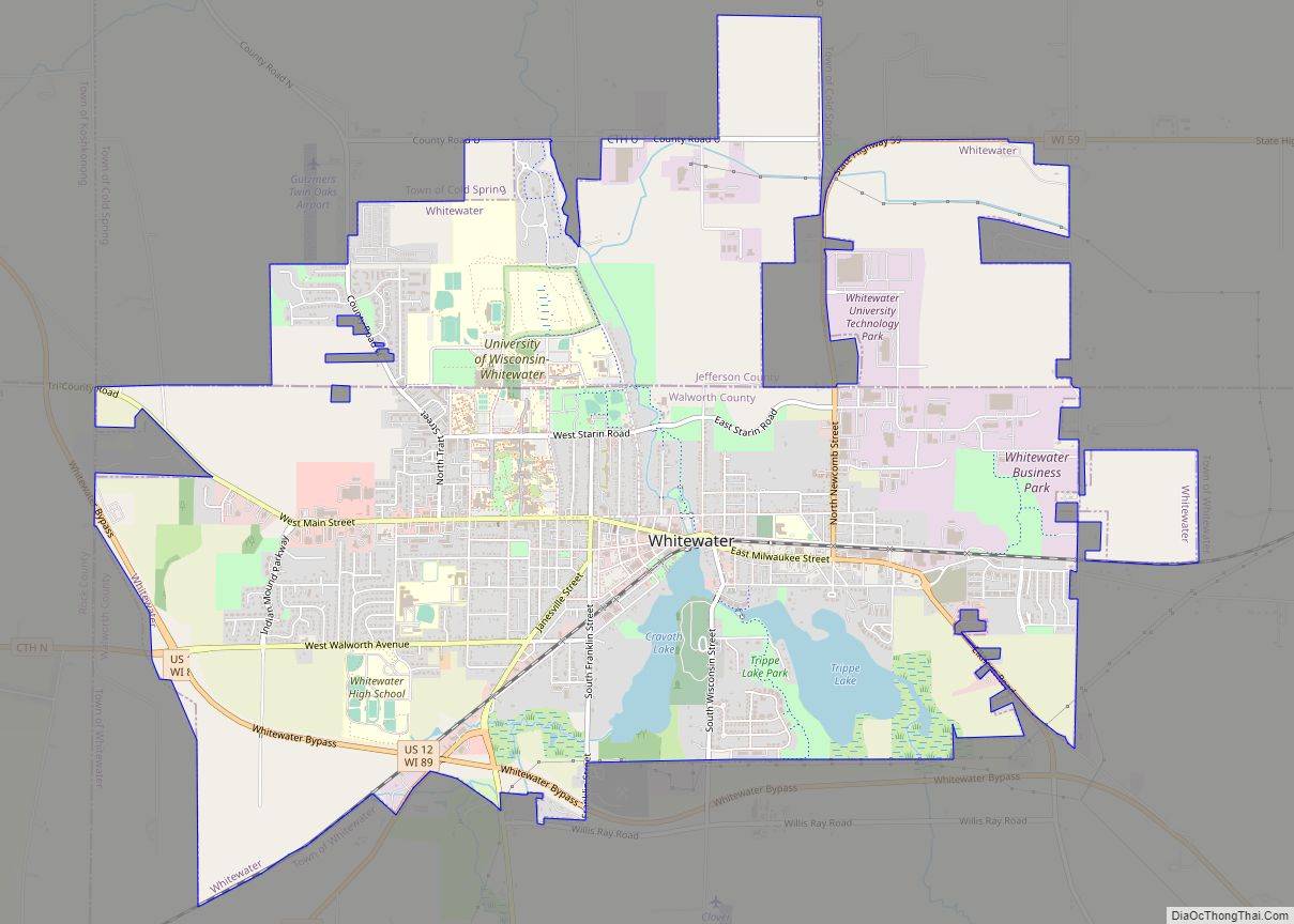
Whitewater is a city located in Walworth and Jefferson counties in the U.S. state of Wisconsin. Located near the southern portion of the Kettle Moraine State Forest, Whitewater is the home of the University of Wisconsin–Whitewater. As of the 2020 census, the city’s population was 14,889. Whitewater city overview: Name: Whitewater city LSAD Code: 25 ... Read more
West Allis is a city in Milwaukee County, Wisconsin, United States. A suburb of Milwaukee, it is part of the Milwaukee metropolitan area. The population was 60,325 at the 2020 census. West Allis city overview: Name: West Allis city LSAD Code: 25 LSAD Description: city (suffix) State: Wisconsin County: Milwaukee County Elevation: 728 ft (222 m) Total ... Read more
Whitehall is a city in Trempealeau County, Wisconsin, United States, along the Trempealeau River. The population was 1,645 at the 2020 census. It is the county seat of Trempealeau County. Whitehall is situated on the former Green Bay and Western Railroad midway between La Crosse and Eau Claire. Whitehall city overview: Name: Whitehall city LSAD ... Read more
Whitefish Bay is a village in Milwaukee County, Wisconsin, United States. The population was 14,954 at the 2020 census. Whitefish Bay village overview: Name: Whitefish Bay village LSAD Code: 47 LSAD Description: village (suffix) State: Wisconsin County: Milwaukee County Elevation: 650 ft (198 m) Total Area: 2.12 sq mi (5.48 km²) Land Area: 2.12 sq mi (5.48 km²) Water Area: 0.00 sq mi (0.00 km²) Total ... Read more
White Lake is a village in Langlade County, Wisconsin, United States. The population was 363 at the 2010 census. The White Lake Volunteer Fire Department is located within the village. White Lake village overview: Name: White Lake village LSAD Code: 47 LSAD Description: village (suffix) State: Wisconsin County: Langlade County Elevation: 1,286 ft (391.9728 m) Total Area: ... Read more
Wheeler is a village in Dunn County, Wisconsin, United States, along the Hay River. The population was 348 at the 2010 census. Wheeler village overview: Name: Wheeler village LSAD Code: 47 LSAD Description: village (suffix) State: Wisconsin County: Dunn County Elevation: 942 ft (287 m) Total Area: 0.87 sq mi (2.25 km²) Land Area: 0.82 sq mi (2.13 km²) Water Area: 0.05 sq mi (0.12 km²) ... Read more
Weyerhaeuser is a village in Rusk County, Wisconsin, United States. The population was 238 at the 2010 census. Weyerhaeuser village overview: Name: Weyerhaeuser village LSAD Code: 47 LSAD Description: village (suffix) State: Wisconsin County: Rusk County Elevation: 1,188 ft (362 m) Total Area: 0.95 sq mi (2.45 km²) Land Area: 0.94 sq mi (2.42 km²) Water Area: 0.01 sq mi (0.03 km²) Total Population: 238 Population ... Read more
Wind Point is a village in Racine County, Wisconsin, United States. The population was 1,651 at the 2020 census. Wind Point village overview: Name: Wind Point village LSAD Code: 47 LSAD Description: village (suffix) State: Wisconsin County: Racine County Elevation: 614 ft (187 m) Total Area: 1.29 sq mi (3.34 km²) Land Area: 1.27 sq mi (3.28 km²) Water Area: 0.03 sq mi (0.07 km²) Total ... Read more
Wind Lake is a census-designated place (CDP) in Racine County, Wisconsin, United States. The population was 5,355 at the 2020 census. Wind Lake is in the town of Norway. Wind Lake CDP overview: Name: Wind Lake CDP LSAD Code: 57 LSAD Description: CDP (suffix) State: Wisconsin County: Racine County Elevation: 794 ft (242 m) Total Area: 7.259 sq mi ... Read more
Wrightstown is a village in Brown and Outagamie counties in the U.S. state of Wisconsin. The population was 2,827 at the 2010 census. Of this, 2,676 were in Brown County, and 151 were in Outagamie County. The village is surrounded mostly by the westernmost part of the Town of Wrightstown in Brown County. On February ... Read more