Wisconsin Rapids is a city in and the county seat of Wood County, Wisconsin, United States. The population was 18,877 at the 2020 census. The city also forms one of the core areas of the United States Census Bureau’s Marshfield-Wisconsin Rapids Micropolitan Statistical Area, which includes all of Wood County and had a 2020 population of 74,207.
| Name: | Wisconsin Rapids city |
|---|---|
| LSAD Code: | 25 |
| LSAD Description: | city (suffix) |
| State: | Wisconsin |
| County: | Wood County |
| Elevation: | 1,027 ft (313 m) |
| Total Area: | 14.77 sq mi (38.25 km²) |
| Land Area: | 13.86 sq mi (35.88 km²) |
| Water Area: | 0.91 sq mi (2.37 km²) |
| Total Population: | 18,877 |
| Population Density: | 1,360.2/sq mi (525.2/km²) |
| Area code: | 715 & 534 |
| FIPS code: | 5588200 |
| GNISfeature ID: | 1576906 |
| Website: | http://www.wirapids.org |
Online Interactive Map
Click on ![]() to view map in "full screen" mode.
to view map in "full screen" mode.
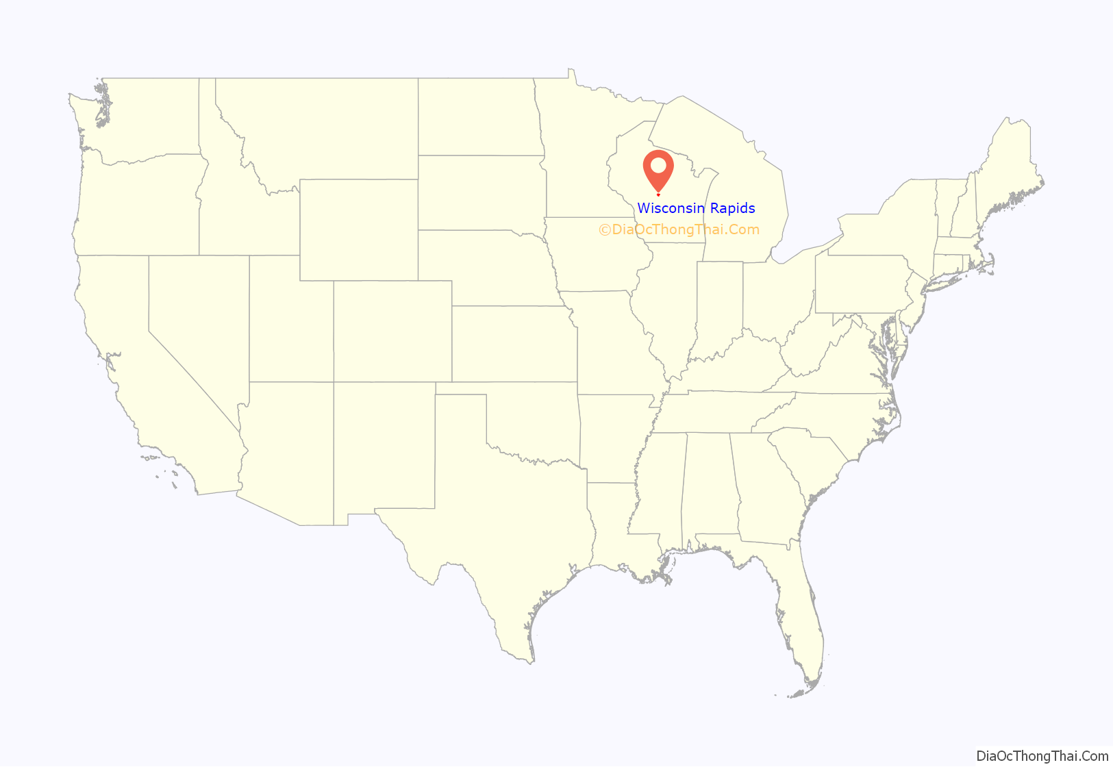
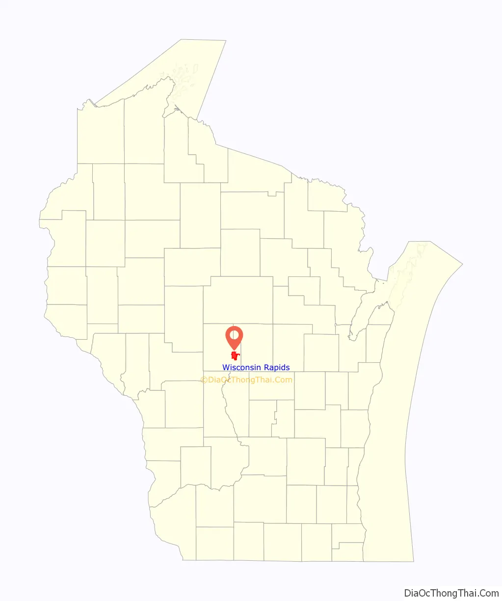
Wisconsin Rapids location map. Where is Wisconsin Rapids city?
History
The American Indians called the area “Ahdawagam”, meaning “Two-sided Rapids”. Although Europeans began to settle this area in the 1830s, Wisconsin Rapids has been known by this name only since 1920. Prior to that, the community was divided by the Wisconsin River, with the west side incorporated as Centralia and the east side as Grand Rapids. The two cities merged in 1900, with the entire community taking the name Grand Rapids. The name was changed in 1920 to avoid mail and other goods from being misdirected to the other city already named Grand Rapids, Wisconsin in the same county, or to the much better known Grand Rapids, Michigan.
Wisconsin Rapids Road Map
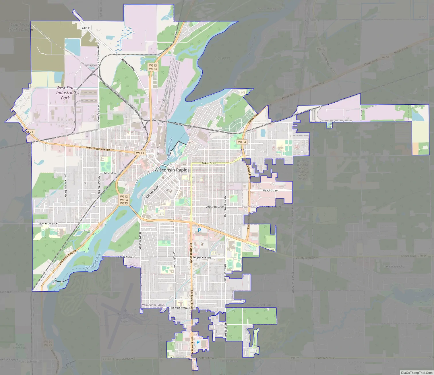
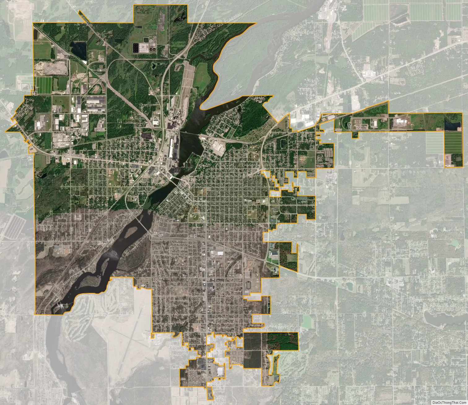
Wisconsin Rapids city Satellite Map
Geography
Wisconsin Rapids is located at 44°23′12″N 89°49′23″W / 44.38667°N 89.82306°W / 44.38667; -89.82306 (44.386805, −89.823078).
According to the United States Census Bureau, the city has a total area of 14.77 square miles (38.3 km), of which 13.88 square miles (35.9 km) is land and 0.89 square miles (2.3 km) is water.
See also
Map of Wisconsin State and its subdivision:- Adams
- Ashland
- Barron
- Bayfield
- Brown
- Buffalo
- Burnett
- Calumet
- Chippewa
- Clark
- Columbia
- Crawford
- Dane
- Dodge
- Door
- Douglas
- Dunn
- Eau Claire
- Florence
- Fond du Lac
- Forest
- Grant
- Green
- Green Lake
- Iowa
- Iron
- Jackson
- Jefferson
- Juneau
- Kenosha
- Kewaunee
- La Crosse
- Lafayette
- Lake Michigan
- Lake Superior
- Langlade
- Lincoln
- Manitowoc
- Marathon
- Marinette
- Marquette
- Menominee
- Milwaukee
- Monroe
- Oconto
- Oneida
- Outagamie
- Ozaukee
- Pepin
- Pierce
- Polk
- Portage
- Price
- Racine
- Richland
- Rock
- Rusk
- Saint Croix
- Sauk
- Sawyer
- Shawano
- Sheboygan
- Taylor
- Trempealeau
- Vernon
- Vilas
- Walworth
- Washburn
- Washington
- Waukesha
- Waupaca
- Waushara
- Winnebago
- Wood
- Alabama
- Alaska
- Arizona
- Arkansas
- California
- Colorado
- Connecticut
- Delaware
- District of Columbia
- Florida
- Georgia
- Hawaii
- Idaho
- Illinois
- Indiana
- Iowa
- Kansas
- Kentucky
- Louisiana
- Maine
- Maryland
- Massachusetts
- Michigan
- Minnesota
- Mississippi
- Missouri
- Montana
- Nebraska
- Nevada
- New Hampshire
- New Jersey
- New Mexico
- New York
- North Carolina
- North Dakota
- Ohio
- Oklahoma
- Oregon
- Pennsylvania
- Rhode Island
- South Carolina
- South Dakota
- Tennessee
- Texas
- Utah
- Vermont
- Virginia
- Washington
- West Virginia
- Wisconsin
- Wyoming