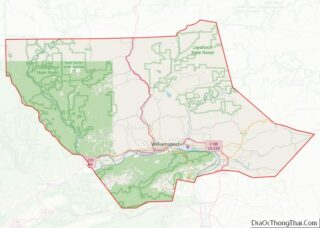
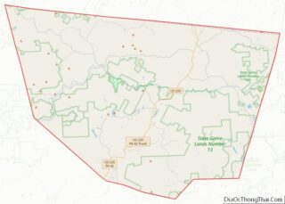
Map of Saint Mary's County

Map of St. Mary’s County, Maryland

St. Mary’s County, established in 1637, is a county located in the U.S. state of Maryland. As of the 2020 census, the population was 113,777. Its county seat is Leonardtown. The name is in honor of Mary, the mother of Jesus. St. Mary’s County comprises the California–Lexington Park, Maryland Metropolitan Statistical Area, which also is … Read more

Map of Norfolk County

Map of Norfolk County, Massachusetts

Norfolk County is located in the U.S. state of Massachusetts. At the 2020 census, the population was 725,981. Its county seat is Dedham. It is the fourth most populous county in the United States whose county seat is neither a city nor a borough, and it is the second most populous county that has a … Read more

Map of Calhoun County

Map of Calhoun County, Michigan

Calhoun County is a county in the U.S. state of Michigan. As of the 2020 Census, the population was 134,310. The county seat is Marshall. The county was established on October 19, 1829, and named after John C. Calhoun, who was at the time Vice President under Andrew Jackson, making it one of Michigan’s Cabinet … Read more

Map of Gratiot County

Map of Gratiot County, Michigan

Gratiot County (/ˈɡræʃɪt/ GRASH-it) is a county in the U.S. state of Michigan. As of the 2020 Census, the population was 41,761. The county seat is Ithaca, although its most populous city is Alma. Gratiot County comprises the Alma, MI Micropolitan Statistical Area, which is also part of the Mount Pleasant-Alma, MI Combined Statistical Area. … Read more

Map of Lake Michigan Water body

Map of Lake Michigan Water body, Michigan

Lake Michigan Water body overview: Name: Lake Michigan Water body State: Michigan Lake Michigan Water body location map. Where is Lake Michigan Water body? Lake Michigan Water body Road Map Lake Michigan Water body Topographic Map Lake Michigan Water body Satellite Map Lake Michigan Water body Outline Map

Map of Missaukee County

Map of Missaukee County, Michigan

Missaukee County overview: Name: Missaukee County FIPS code: 26-113 State: Michigan Founded: 1871 Seat: Lake City Largest city: Lake City Total Area: 574 sq mi (1,490 km²) Land Area: 565 sq mi (1,460 km²) Total Population: 15,052 Population Density: 26/sq mi (10/km²) Time zone: UTC−5 (Eastern) Summer Time Zone (DST): UTC−4 (EDT) Website: www.missaukee.org Missaukee County location map. Where is Missaukee County? … Read more

Map of Saginaw County

Map of Saginaw County, Michigan

Saginaw County, officially the County of Saginaw, is a county located in the U.S. state of Michigan. As of the 2020 Census, the population was 190,124. The county seat is Saginaw. The county was created by September 10, 1822, and was fully organized on February 9, 1835. The etymology of the county’s name is uncertain. … Read more

Map of Big Stone County

Map of Big Stone County, Minnesota

Big Stone County is a county in the U.S. state of Minnesota. As of the 2020 census, the population was 5,166. Its county seat is Ortonville. Big Stone County overview: Name: Big Stone County FIPS code: 27-011 State: Minnesota Founded: 1862 Named for: Big Stone Lake Seat: Ortonville Largest city: Ortonville Total Area: 528 sq mi (1,370 km²) … Read more

Map of Faribault County

Map of Faribault County, Minnesota

Faribault County (/ˈfeɪrɪboʊ/) is a county in the U.S. state of Minnesota. As of the 2020 census, the population was 13,921. Its county seat is Blue Earth. Faribault County overview: Name: Faribault County FIPS code: 27-043 State: Minnesota Founded: February 20, 1855 Named for: Jean Baptiste Faribault Seat: Blue Earth Largest city: Blue Earth Total … Read more

Map of Lake County

Map of Lake County, Minnesota

Lake County is a county in the U.S. state of Minnesota. As of the 2020 census, the population was 10,905. Its county seat is Two Harbors. Lake County overview: Name: Lake County FIPS code: 27-075 State: Minnesota Founded: March 1, 1856 Named for: Lake Superior Seat: Two Harbors Largest city: Two Harbors Total Area: 2,991 sq mi … Read more

Map of Nobles County

Map of Nobles County, Minnesota

Nobles County is a county in the U.S. state of Minnesota. As of the 2020 census, the population was 22,290. Its county seat is Worthington. Nobles County comprises the Worthington, MN Micropolitan Statistical Area. Nobles County overview: Name: Nobles County FIPS code: 27-105 State: Minnesota Founded: 1857 Named for: William H. Nobles Seat: Worthington Largest … Read more

Map of Saint Louis County

Map of St. Louis County, Minnesota

St. Louis County is a county located in the Arrowhead Region of the U.S. state of Minnesota. As of the 2020 census, the population was 200,231. Its county seat is Duluth. It is the largest county in Minnesota by land area, and the largest in the United States by total area east of the Mississippi … Read more