Upshur County is a county located in the eastern part of the U.S. state of Texas. As of the 2020 census, the population was 40,892. The county seat is Gilmer. The county is named for Abel P. Upshur, who was U.S. Secretary of State during President John Tyler’s administration.
Upshur County is part of the Longview, Texas Metropolitan Statistical Area, as well as the Longview–Marshall, TX Combined Statistical Area.
| Name: | Upshur County |
|---|---|
| FIPS code: | 48-459 |
| State: | Texas |
| Founded: | 1846 |
| Named for: | Abel P. Upshur |
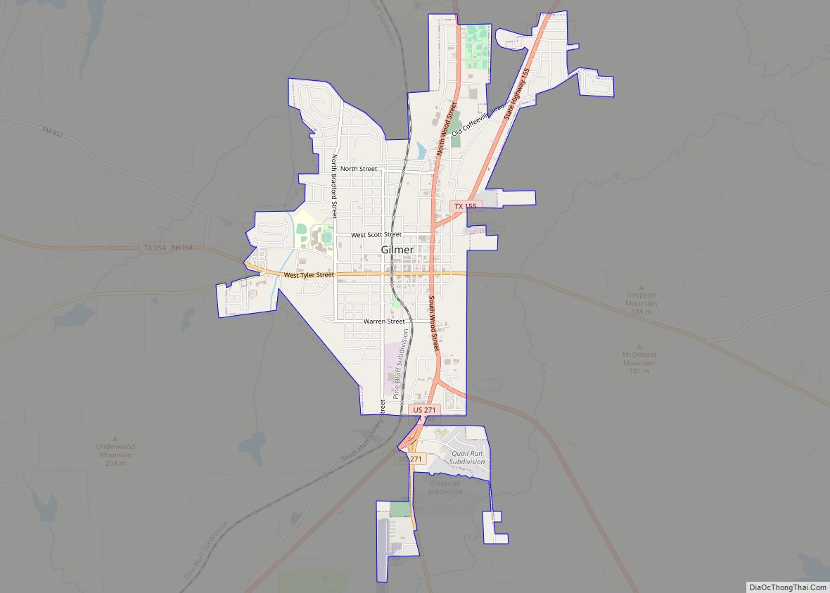
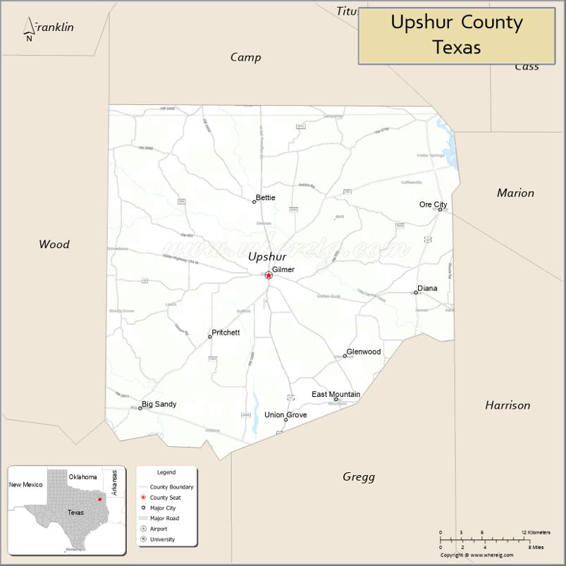
| Seat: | Gilmer |
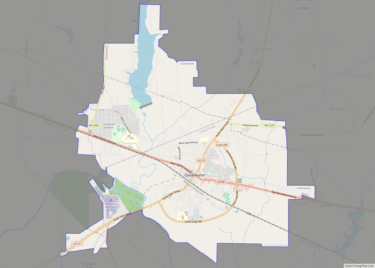
| Largest city: | Gladewater |
| Total Area: | 593 sq mi (1,540 km²) |
| Land Area: | 583 sq mi (1,510 km²) |
| Total Population: | 40,892 |
| Population Density: | 69/sq mi (27/km²) |
| Time zone: | UTC−6 (Central) |
| Summer Time Zone (DST): | UTC−5 (CDT) |
| Website: | www.countyofupshur.com |
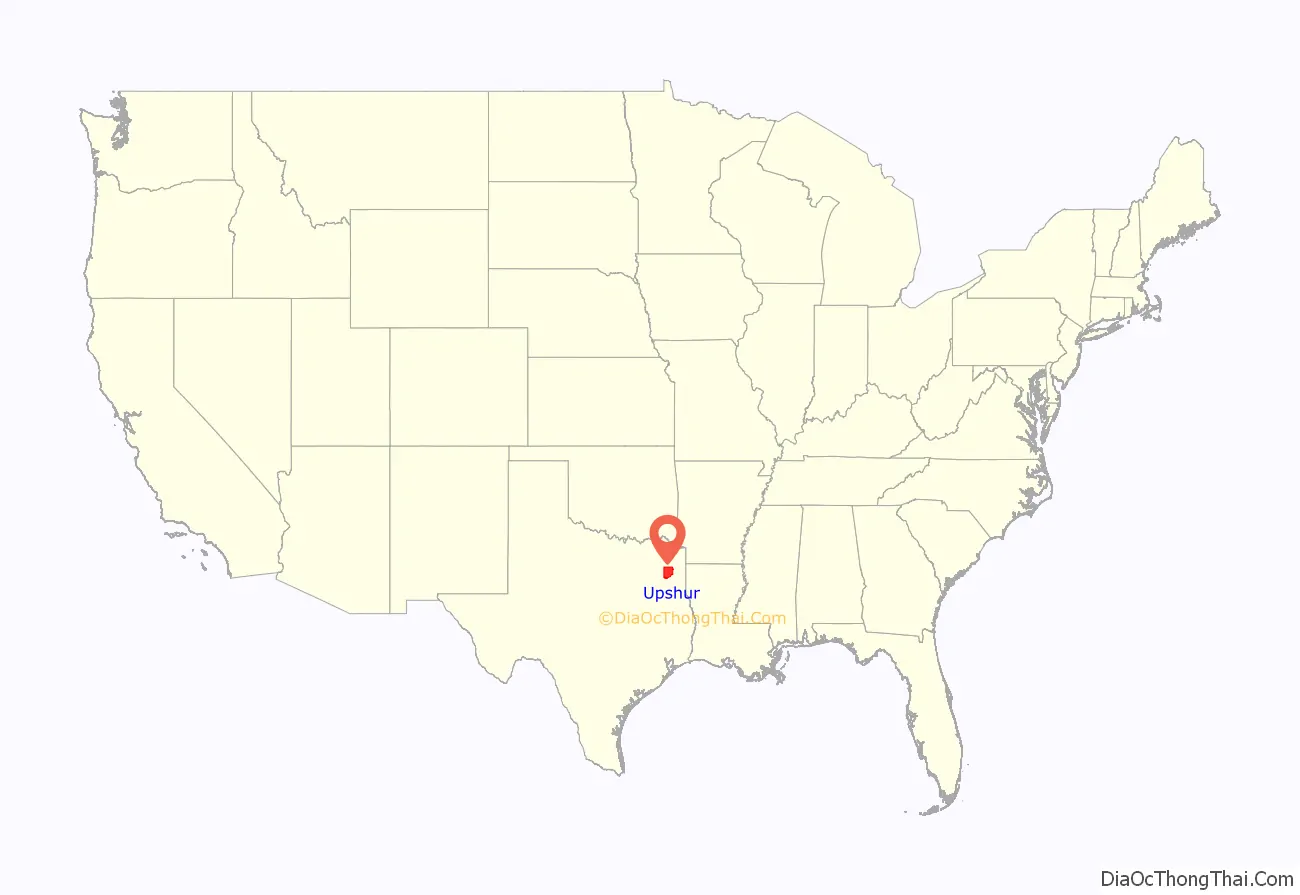
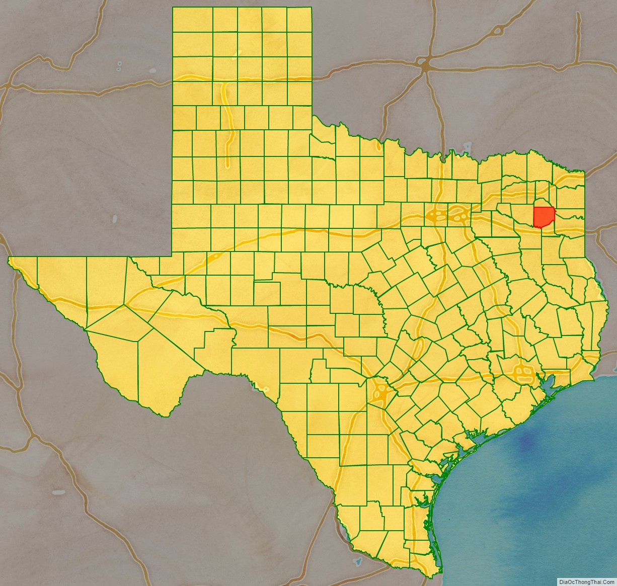
Upshur County location map. Where is Upshur County?
History
Humans have inhabited what is now Upshur County since at least 10,000 years ago. The Caddoan people lived in this area, but were driven out about 1750, probably due to losses from new infectious diseases carried chronically by Europeans.
Later, some Cherokee migrated to the area from their territories in the Southeast – Georgia and Alabama. The Cherokee were driven out of here by European-American settlers in 1839, after having been removed from the Southeast.
The first European-American settler in Upshur County was probably Isaac Moody, who settled there in 1836. Upshur County was named for Abel Parker Upshur, Secretary of State under John Tyler.
Upshur County has the distinction of being the county that has the largest settlement in Texas organized by the Church of Jesus Christ of Latter-day Saints. In 1904, the Latter-day Saint Southwestern States Mission organized a colony at Kelsey, Texas.
On March 21, 2022 Upshur County was hit by an EF-2 tornado with winds reported as high as 135 mph. Extensive damage was reported but no fatalities. This tornado was a part of the tornado outbreak of March 21-23, 2022.
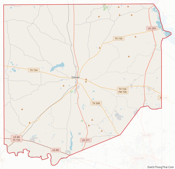
Upshur County Road Map
Geography
According to the U.S. Census Bureau, the county has a total area of 593 square miles (1,540 km), of which 583 square miles (1,510 km) are land and 9.7 square miles (25 km) (1.6%) are covered by water.
Major highways
- U.S. Highway 80
- U.S. Highway 259
- U.S. Highway 271
- State Highway 154
- State Highway 155
- State Highway 300
Adjacent counties
- Camp County (north)
- Morris County (northeast)
- Marion County (east)
- Harrison County (southeast)
- Gregg County (south)
- Smith County (southwest)
- Wood County (west)
Upshur County Topographic Map
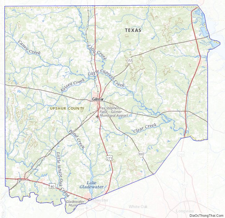
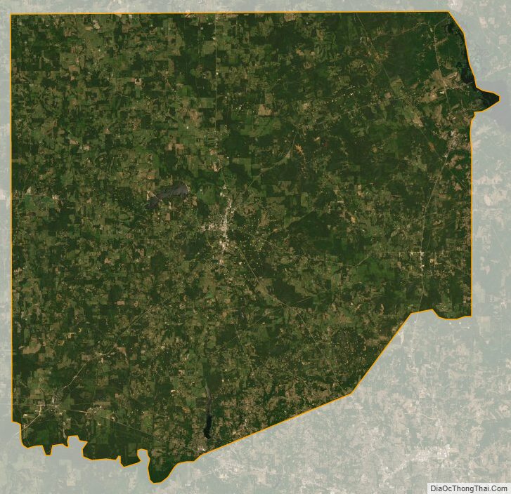
Upshur County Satellite Map
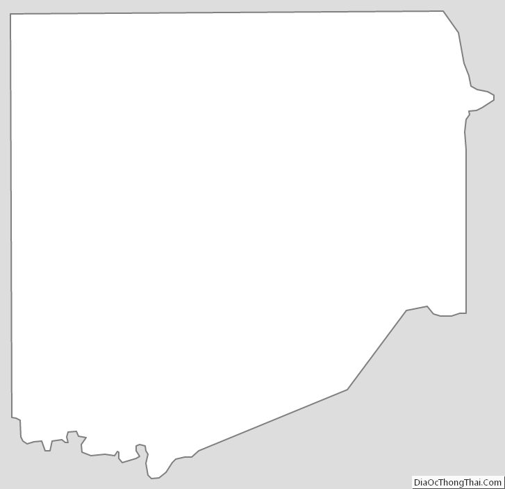
Upshur County Outline Map