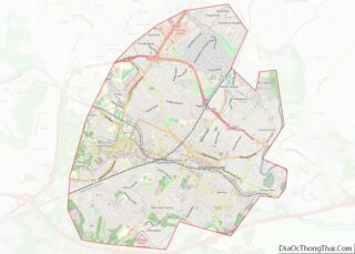
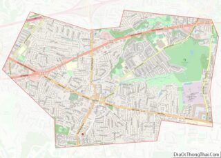
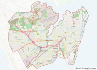
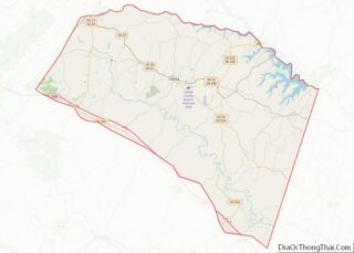
Map of Shelby County, Indiana
Shelby County is a county in the U.S. state of Indiana. As of the 2010 United States Census, the population was 44,436. The county seat (and only incorporated city) is Shelbyville. Shelby County overview: Name: Shelby County FIPS code: 18-145 State: Indiana Founded: 31 December 1821 (authorized)1822 (organized) Named for: Isaac Shelby Seat: Shelbyville Largest ... Read more
Map of Shelby County, Indiana
Map of Wayne County, Indiana
Wayne County is a county located in east central Indiana, United States, on the border with Ohio. As of the 2020 United States Census, the population was 66,553. The county seat is Richmond. Wayne County comprises the Richmond, IN Micropolitan Statistical Area. Richmond hosts Earlham College, a small private liberal arts college. Wayne County overview: ... Read more
Map of Wayne County, Indiana
Map of Calhoun County, Iowa
Calhoun County is a county located in the U.S. state of Iowa. As of the 2020 census, the population was 9,927. Its county seat is Rockwell City. Calhoun County overview: Name: Calhoun County FIPS code: 19-025 State: Iowa Founded: 1855 Named for: John C. Calhoun Seat: Rockwell City Largest city: Rockwell City Total Area: 572 sq mi ... Read more
Map of Calhoun County, Iowa
Map of Des Moines County, Iowa
Des Moines County is located in the U.S. state of Iowa. As of the 2020 census, the population was 38,910. The county seat and largest city is Burlington. It is one of Iowa’s two original counties along with Dubuque County; both were organized by the Michigan Territorial legislature in 1834. Des Moines County is part ... Read more
Map of Des Moines County, Iowa
Map of Howard County, Iowa
Howard County is a county located in the US state of Iowa. As of the 2020 census, the population was 9,469. The county seat is Cresco. The county was founded in 1851; it was named for General Tilghman Ashurst Howard, a Representative of Indiana. Howard County overview: Name: Howard County FIPS code: 19-089 State: Iowa ... Read more
Map of Howard County, Iowa
Map of Madison County, Iowa
Madison County is a county located in the U.S. state of Iowa. As of the 2020 census, the population was 16,548. The county seat is Winterset. Madison County is included in the Des Moines–West Des Moines, IA Metropolitan Statistical Area. Madison County is famous for being the county where John Wayne was born, and for ... Read more
Map of Madison County, Iowa
Map of Polk County, Iowa
Polk County is located in the U.S. state of Iowa. As of the 2020 census, the population was 492,401. It is Iowa’s most populous county, and home to over 15% of the state’s residents. The county seat is Des Moines, which is also the capital city of Iowa. Polk County is included in the Des ... Read more
Map of Polk County, Iowa
Map of Wayne County, Iowa
Wayne County is a county located in the U.S. state of Iowa. As of the 2020 census, the population was 6,497, making it the sixth-least populous county in Iowa. The county seat is Corydon. Wayne County overview: Name: Wayne County FIPS code: 19-185 State: Iowa Founded: 1846 Named for: Anthony Wayne Seat: Corydon Largest city: ... Read more
Map of Wayne County, Iowa
Map of Chautauqua County, Kansas
Chautauqua County (county code CQ) is a county located in Southeast Kansas, United States. As of the 2020 census, the county population was 3,379. Its county seat and most populous city is Sedan. Chautauqua County is named for Chautauqua County, New York, the birthplace of Edward Jaquins, a Kansas politician who was instrumental in getting ... Read more
Map of Chautauqua County, Kansas
Map of Ellis County, Kansas
Ellis County (county code EL) is a county located in the U.S. state of Kansas. As of the 2020 census, the county population was 28,934. Its county seat and most populous city is Hays. Ellis County is the official German Capital of Kansas. German immigrants settled in Hays, Ellis, Victoria, and nearby villages in the ... Read more
Map of Ellis County, Kansas
Map of Hodgeman County, Kansas
Hodgeman County (county code HG) is a county located in the U.S. state of Kansas. As of the 2020 census, the county population was 1,723. Its county seat and most populous city is Jetmore. Hodgeman County overview: Name: Hodgeman County FIPS code: 20-083 State: Kansas Founded: February 26, 1867 Named for: Amos Hodgman Seat: Jetmore ... Read more
Map of Hodgeman County, Kansas
Map of Marshall County, Kansas
Marshall County (standard abbreviation: MS) is a county located in the U.S. state of Kansas. As of the 2020 census, the county population was 10,038. The largest city and county seat is Marysville. Marshall County overview: Name: Marshall County FIPS code: 20-117 State: Kansas Founded: August 25, 1855 Named for: Frank J. Marshall Seat: Marysville ... Read more
Map of Marshall County, Kansas