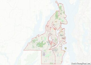
Map of Sumter County, Georgia
Sumter County is a county located in the west-central portion of the U.S. state of Georgia. As of the 2020 census, its population was 29,616. The county seat is Americus. The county was created on December 26, 1831. Sumter County is part of the Americus micropolitan statistical area. Sumter County overview: Name: Sumter County FIPS ... Read more
Map of Sumter County, Georgia
Map of Upson County, Georgia
Upson County is a county located in the west central Piedmont portion of the U.S. state of Georgia. As of the 2020 census, the population was 27,700. The county seat is Thomaston. The county was created on December 15, 1824. Upson County comprises the Thomaston, GA Micropolitan Statistical Area, which is also included in the ... Read more
Map of Upson County, Georgia
Map of Honolulu County, Hawaii
Honolulu County (officially known as the City and County of Honolulu, formerly Oahu County) is a consolidated city-county in the U.S. state of Hawaii. The city-county includes both the city of Honolulu (the state’s capital and largest city) and the rest of the island of Oʻahu, as well as several minor outlying islands, including all ... Read more
Map of Honolulu County, Hawaii
Map of Camas County, Idaho
Camas County is a county in the southern portion of the U.S. state of Idaho. The county seat and largest city is Fairfield. The county was established 106 years ago in 1917 by the Idaho Legislature with a partition of Blaine County on February 6. It is named for the camas root, or Camassia, a ... Read more
Map of Camas County, Idaho
Map of Latah County, Idaho
Latah County overview: Name: Latah County FIPS code: 16-057 State: Idaho Founded: May 14, 1888 Named for: Latah Creek Seat: Moscow Largest city: Moscow Total Area: 1,077 sq mi (2,790 km²) Land Area: 1,077 sq mi (2,790 km²) Total Population: 39,517 Population Density: 37/sq mi (14/km²) Time zone: UTC−8 (Pacific) Summer Time Zone (DST): UTC−7 (PDT) Website: latah.id.us Latah County location map. ... Read more
Map of Latah County, Idaho
Map of Alexander County, Illinois
Alexander County is the southernmost and southwesternmost county in the U.S. state of Illinois. As of the 2020 census, the population was 5,240. Its county seat is Cairo and its western boundary is formed by the Mississippi River. Alexander County is part of the Cape Girardeau, MO-IL Metropolitan Statistical Area which is made up of ... Read more
Map of Alexander County, Illinois
Map of Cumberland County, Illinois
Cumberland County is a county located in the U.S. state of Illinois. As of the 2010 census, the population was 11,048. Its county seat is Toledo. Cumberland County is part of the Charleston–Mattoon, IL Micropolitan Statistical Area. Cumberland County overview: Name: Cumberland County FIPS code: 17-035 State: Illinois Founded: 1823 Named for: Cumberland Road Seat: ... Read more
Map of Cumberland County, Illinois
Map of Hancock County, Illinois
Hancock County is a county in the U.S. state of Illinois. According to the 2020 census, it has a population of 17,620. Its county seat is Carthage, and its largest city is Hamilton. The county is made up of rural towns with many farmers. Hancock County is part of the Fort Madison–Keokuk, IA-IL-MO Micropolitan Statistical ... Read more
Map of Hancock County, Illinois
Map of Lake County, Illinois
Lake County is situated in the northeastern corner of the U.S. state of Illinois, along the shores of Lake Michigan. As of the 2020 census, it has a population of 714,342, making it the third-most populous county in Illinois. Its county seat is Waukegan, the tenth-largest city in Illinois. The county is primarily suburban, with ... Read more
Map of Lake County, Illinois
Map of Menard County, Illinois
Menard County is a county in the U.S. state of Illinois. According to the 2010 United States Census, it had a population of 12,705. Its county seat is Petersburg. Menard County is part of the Springfield, Illinois, IL Metropolitan Statistical Area. Menard County overview: Name: Menard County FIPS code: 17-129 State: Illinois Founded: 1839 Named ... Read more
Map of Menard County, Illinois
Map of Rock Island County, Illinois
Rock Island County is a county located in the U.S. state of Illinois, bounded on the west by the Mississippi River. According to the 2010 census, it had a population of 147,546. Its county seat is Rock Island; its largest city is neighboring Moline. Rock Island County is one of the four counties that make ... Read more
Map of Rock Island County, Illinois
Map of White County, Illinois
White County is a county located in the U.S. state of Illinois. According to the 2020 census, it had a population of 13,877. Its county seat is Carmi. It is located in the southern portion of Illinois known locally as “Little Egypt”.as of February 18 2023 information provided by http://world population review.com has listed the ... Read more
Map of White County, Illinois