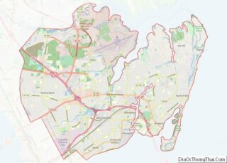
Map of Sawyer County

Map of Sawyer County, Wisconsin

Sawyer County is a county in the U.S. state of Wisconsin. As of the 2020 census, the population was 18,074. Its county seat is Hayward. The county partly overlaps with the reservation of the Lac Courte Oreilles Band of Lake Superior Chippewa Indians. Sawyer County overview: Name: Sawyer County FIPS code: 55-113 State: Wisconsin Founded: … Read more

Map of Big Horn County

Map of Big Horn County, Wyoming

Big Horn County is a county in the U.S. state of Wyoming. As of the 2020 United States Census, the population was 11,521. The county seat is Basin. Its north boundary abuts the south boundary of Montana. Big Horn County overview: Name: Big Horn County FIPS code: 56-003 State: Wyoming Founded: March 12, 1890 (authorized)1897 … Read more

Map of Sublette County

Map of Sublette County, Wyoming

Sublette County is a county in the U.S. state of Wyoming. As of the 2020 United States Census, the population was 8,728. The county seat is Pinedale. It is a sparsely populated rural county in western Wyoming, along the Green River. Sublette County overview: Name: Sublette County FIPS code: 56-035 State: Wyoming Founded: February 15, … Read more

Map of Butler County

Map of Butler County, Alabama

Butler County is a county located in the south central portion of the U.S. state of Alabama. As of the 2020 census, the population was 19,051. Its county seat is Greenville. Its name is in honor of Captain William Butler, who was born in Virginia and fought in the Creek War, and who was killed … Read more

Map of Dale County

Map of Dale County, Alabama

Dale County is a county located in the southeastern part of the U.S. state of Alabama. As of the 2020 census the population was 49,326. Its county seat and largest city is Ozark. Its name is in honor of General Samuel Dale. Dale County comprises the Ozark, AL Micropolitan Statistical Area, which is also included … Read more

Map of Lauderdale County

Map of Lauderdale County, Alabama

Lauderdale County is a county located in the northwestern corner of the U.S. state of Alabama. At the 2020 census the population was 93,564. Its county seat is Florence. Its name is in honor of Colonel James Lauderdale, of Tennessee. Lauderdale is part of the Florence-Muscle Shoals, AL Metropolitan Statistical Area, also known as “The … Read more

Map of Pike County

Map of Pike County, Alabama

Pike County is located in the U.S. state of Alabama. As of the 2020 census the population was 33,009. Its county seat is Troy. Its name is in honor of General Zebulon Pike, of New Jersey, an explorer who led an expedition to southern Colorado and discovered Pikes Peak in 1806. Pike County comprises the … Read more

Map of Bethel Census Area

Map of Bethel Census Area, Alaska

Bethel Census Area is a census area in the U.S. state of Alaska. As of the 2020 census, the population is 18,666, up from 17,013 in 2010. It is part of the unorganized borough and therefore has no borough seat. Its largest community is the city of Bethel, which is also the largest city in … Read more

Map of Sitka City And Borough

Map of Sitka City and Borough, Alaska

Sitka (Tlingit: Sheetʼká; Russian: Ситка) is a unified city-borough in the southeast portion of the U.S. state of Alaska. It was formerly known as New Archangel (Russian: Ново-Архангельск / Новоaрхангельск, romanized: Novo-Arkhangelsk / Novoarkhangelsk) while under Russian rule from 1799 to 1867. The city is situated on the west side of Baranof Island and the south … Read more

Map of Navajo County

Map of Navajo County, Arizona

Navajo County (Navajo: Tʼiisyaakin Áłtsʼíísí Bił Hahoodzo) is in the northern part of the U.S. state of Arizona. As of the 2020 census, its population was 106,717. The county seat is Holbrook. Navajo County comprises the Show Low, Arizona Micropolitan Statistical Area. Navajo County contains parts of the Hopi Indian reservation, the Navajo Nation, and … Read more

Map of Clay County

Map of Clay County, Arkansas

Clay County is a county located in the U.S. state of Arkansas. Originally incorporated as Clayton County, as of the 2020 census, its population was 14,552. The county has two county seats, Corning and Piggott. It is a dry county, in which the sale of alcoholic beverages is restricted or prohibited. Clay County overview: Name: … Read more

Map of Grant County

Map of Grant County, Arkansas

Grant County is a county in the U.S. state of Arkansas. Its population was 17,958 at the 2020 United States Census. The county seat is Sheridan. Grant County is included in the Little Rock–North Little Rock–Conway, AR Metropolitan Statistical Area. Grant County overview: Name: Grant County FIPS code: 05-053 State: Arkansas Founded: February 4, 1869 … Read more