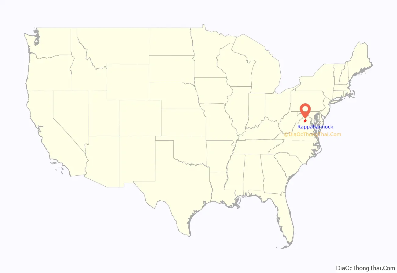
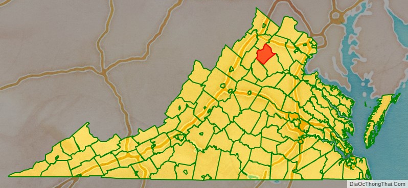
Rappahannock County is a county located in the northern Piedmont region of the Commonwealth of Virginia, US, adjacent to Shenandoah National Park. As of the 2020 Census, the population was 7,348. Its county seat is Washington. The name “Rappahannock” comes from the Algonquian word lappihanne (also noted as toppehannock), meaning “river of quick, rising water” or “where the tide ebbs and flows.” The county is included in the Washington-Arlington-Alexandria, DC-VA-MD-WV Metropolitan Statistical Area.
| Name: | Rappahannock County |
|---|---|
| FIPS code: | 51-157 |
| State: | Virginia |
| Founded: | 1833 |
| Named for: | Rappahannock River |
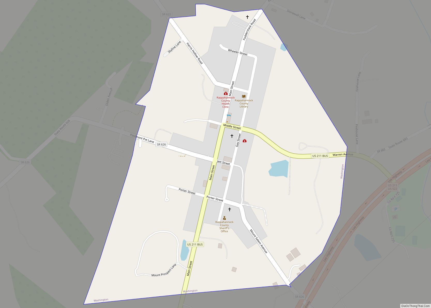
| Seat: | Washington |
| Largest town: | Washington |
| Total Area: | 267 sq mi (690 km²) |
| Land Area: | 266 sq mi (690 km²) |
| Total Population: | 7,348 |
| Population Density: | 28/sq mi (11/km²) |
Rappahannock County location map. Where is Rappahannock County?
History
Rappahannock County was founded by an act of the Virginia General Assembly in 1833, based on the growing population’s need to have better access to a county seat. The county’s land was carved from Culpeper County. Rappahannock County was named for the river that separates it from Fauquier County.
The land on which Rappahannock County is sited was owned in the early 1700s by Thomas Fairfax 6th Lord Fairfax. It was part of the Northern Neck Proprietary, which consisted of 5.3 million acres of land located between the Rappahannock River and the Potomac River, from their headwaters in the Blue Ridge mountains to the Chesapeake Bay. In 1649 King Charles II of England, then in exile in France after the execution of his father, Charles I, had given this unmapped and unsettled region to seven loyal supporters. By 1688 the proprietary was owned solely by Thomas Lord Culpeper whose only child married Thomas 5th Lord Fairfax in 1690. They acquired the proprietary on the death of Lord Culpeper, and the region became synonymous with the Fairfax name. In 1719, Thomas Fairfax 6th Lord Fairfax inherited the land.
In 1728, the land that became Rappahannock County began to be granted to individuals by agents of King George II of Great Britain. At that time, it was believed that the headwaters of the Rappahannock River were in the Chester Gap area and that the Rappahannock County land was located south of the Northern Neck Proprietary. Much of the land granted by the King consisted of large tracts along the rivers and streams and was prime agricultural land. In 1735, Thomas Fairfax brought suit against the English crown because of these land grants. Surveying parties were dispatched which determined that the headwaters of the Rappahannock River was the Conway River, which leads into the Rapidan River and then into the Rappahannock River. After 10 years, Fairfax won his suit against the Crown, and land grants in this area subsequent to 1745 were made by Fairfax. After the American Revolution the remaining land, located primarily in the mountains, was granted by the Commonwealth of Virginia.
After its founding in 1833, Rappahannock County was governed by 25 gentlemen justices, supplemented by a Clerk of the Court, Commonwealth attorney, county surveyor, commissioner of revenue, and sheriff. The courthouse, court clerk’s office, and jail were constructed in the town of Washington in 1834–1836. The county was primarily agricultural and self-sufficient, with a few merchants and craftsmen providing goods that could not be made on the farms. Although tobacco was widely grown in tidewater Virginia, the land in Rappahannock County was inadequate for this crop. Instead, farmers in the county grew wheat, oats, corn, and hay and maintained herds of cattle, sheep, and swine. The county was well-watered by streams and rivers originating in the Blue Ridge mountains, and mills along these waterways were built to grind corn and grain, saw lumber, and card and weave wool. The 1850s was an era of turnpike building, providing access from Culpeper, New Market, and Fredericksburg to the county. At this time, transportation was by foot, by horseback, or by horse-drawn wagon or carriage.
In 1861, Virginia seceded from the Union. No battles were fought in Rappahannock County during the Civil War although there were skirmishes, encampments, and significant troop movements through the county. Men from the county served in the 6th Regiment Virginia Cavalry and the 7th and 49th Regiment Virginia Infantry. The war devastated the agricultural economy of the county and destroyed the turnpikes. After the war, the county was governed under the auspices of Military District No. 1 commanded by Union General John M. Schofield. In 1870 a new Virginia constitution was adopted that mandated the county be divided into five townships with one elected supervisor from each to form a Board to perform the executive functions of the county. This government by a five-member Board of Supervisors still exists.
Recovery from the war was slow, but times were becoming more prosperous by the 1890s. The county remained primarily rural and agricultural. Apples became an important cash crop. Rappahannock County moved into the 20th century with the introduction of telephones, electricity, automobiles, improved roads, high school education, and a local newspaper. A jitney company was created in 1916 to provide public transportation, followed by other bus lines in the 1920s and 1930s. In the mid-1920s the Commonwealth of Virginia began actions to acquire land to establish Shenandoah National Park, either by purchase from willing owners or by condemnation and purchase. About 32,000 acres of Rappahannock County land was conveyed to the federal government for the Park, displacing multiple families. A memorial with the surnames of those who lived in the Rappahannock County portion of the Park was constructed along Route 211 in 2019. Two resettlement areas were established in the county, one near the town of Washington and the other near the village of Flint Hill. During the Depression years of the 1930s, the county benefitted from President Franklin Roosevelt’s New Deal programs. Construction of Skyline Drive in Shenandoah National Park began in 1931 through the Civilian Conservation Corps (CCC), and several of their camps were established at Beech Spring on Route 211 west of Sperryville and north and south of Thornton’s Gap at the top of the Blue Ridge. These provided work for local men and a market for farmers for produce, meat, milk, and eggs to feed the corpsmen.
The opening of Shenandoah National Park brought substantial tourism business to the county in the 1930s, aided by inexpensive automobile transportation and by the Commonwealth of Virginia taking over maintenance of all primary and secondary roads in the county. The area became replete with gasoline stations, roadside businesses, lunch rooms, restaurants, and motels. Many private homes took in overnight lodgers. In the 1970s there was an influx of young adults into the county who were seeking a rural lifestyle and who brought with them their skills and talents as artists, artisans, musicians, carpenters, and other craftsmen. They blended with the rural residents who already lived in the county, often for many generations, which fostered the community of diverse individuals who live in the county today. Rappahannock County continues to cater to tourists and locals alike, with chic restaurants, bars, artisan shops, artist studios, bed and breakfast accommodations, and antique stores. However, the county remains primarily rural, agricultural, and undeveloped, in large part due to tight governmental control of land zoning and restrictions on subdivision.
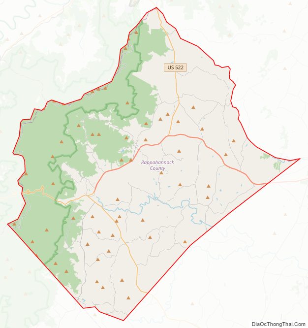
Rappahannock County Road Map
Geography
According to the U.S. Census Bureau, the county has a total area of 267.2 square miles (692.0 km), of which 266.4 sq mi (690.0 km) is land and 0.8 sq mi (2.1 km) (0.3%) is water.
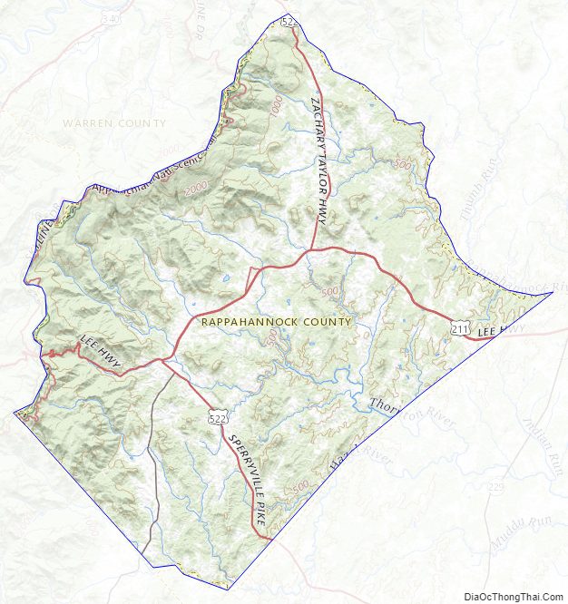
The Rappahannock River forms the northeastern boundary and separates Rappahannock County from Fauquier County. Rappahannock County is bounded on the southeast by Culpeper County and on the southwest by Madison County. The Blue Ridge Mountains occupy much of the western portion of the county.
Adjacent counties
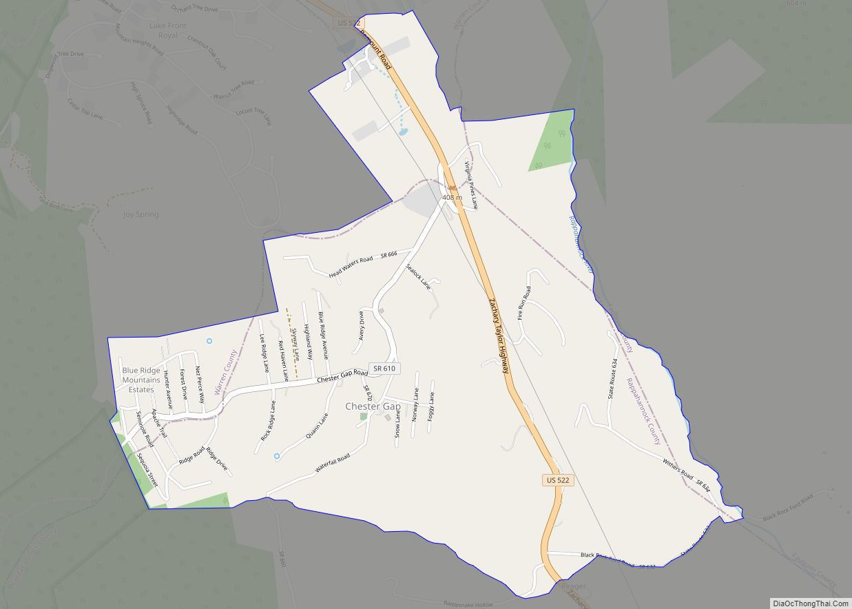
- Warren County, Virginia – northwest
- Fauquier County, Virginia – northeast
- Culpeper County, Virginia – southeast
- Madison County, Virginia – southwest
- Page County, Virginia – west
National protected area
- Shenandoah National Park (part)
Mountains
Rappahannock County is located in the northern Piedmont area of Virginia. Much of its land consists of monadnocks, many of which were named for the families that originally owned the land. These small mountains culminate in the west at the Blue Ridge mountains of Shenandoah National Park. When the Park’s land was privately owned, much of the land had been cleared for farms, pasturage, and orchards. Today these mountainsides are completely wooded again, laced with hiking trails including the Appalachian Trail and with Skyline Drive located along the summits of the Blue Ridge mountains. The summits of the following mountains are located within Rappahannock County:
- Battle and Little Battle Mountains
- Big and Little Bastard Mountains
- Bessie Bell Mountain
- Browns Mountain
- Buck Ridge
- Butler Mountain
- Castle (Castleton) Mountain
- Catlett Mountain
- Chancellor Mountain
- Compton Peak
- Fielding Mountain
- Fodderstack Mountain
- Fogg Mountain
- Fork Mountain
- Ginger Hill
- Googe Mountain
- Grindstone Mountain
- Hazel Mountain
- Hickerson Mountain
- Hogback Mountain
- Hot Mountain
- Jefferson Mountain
- Jenkins and Little Jenkins Mountains
- Jobbers Mountain
- Keyser Mountain
- Long Mountain
- Mary’s Rock
- Mason and Little Mason Mountains
- Massies Mountain
- Meetinghouse Mountain
- Menefee Mountain
- Mulky and Little Mulky Mountains
- North Marshall Mountain
- Long Mountain
- Oventop Mountain
- Pass Mountain
- The Peak
- Pickerel Ridge
- Pignut Mountain
- Pine Hill
- Piney Ridge
- The Pinnacle
- Poes Mountain
- Poortown Mountain
- Redmans Mountain
- Red Oak Mountain
- Rosser Mountain
- Round Mountain
- Schoolhouse Mountain
- Skinner Ridge
- Slaughter Mountain
- Turkey Ridge
- Turkey Mountain
- Walden Mountain
- Wolf Mountain
Transportation
Three primary highways traverse the county: U.S. Route 211, U.S. Route 522, and State Route 231. These account for 57 miles and 21% of the total public road mileage. The remaining 219 miles are secondary roads which provide a link to the rural residential and farm areas of the county. Five roads in the county have been designated as Virginia Scenic Byways, and Skyline Drive in Shenandoah National Park has been designated as a National Scenic Byway. The county has no public transportation by air, bus, or rail.
- US 211
- US 522
- SR 231
- Skyline Drive
Rappahannock County Topographic Map
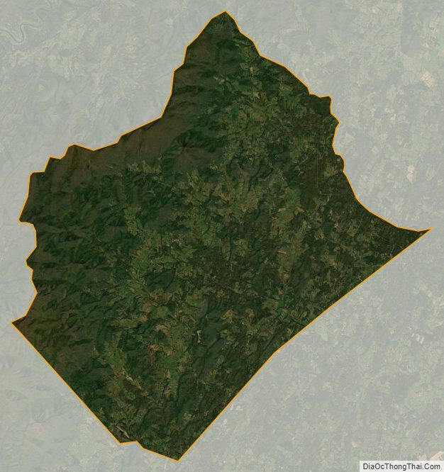
Rappahannock County Satellite Map
Rappahannock County Outline Map