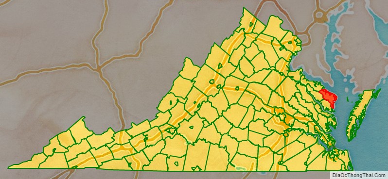
Northumberland County is a county located in the Commonwealth of Virginia. At the 2020 census, the population was 11,839. Its county seat is Heathsville. The county is located on the Northern Neck and is part of the Northern Neck George Washington Birthplace AVA winemaking appellation.
| Name: | Northumberland County |
|---|---|
| FIPS code: | 51-133 |
| State: | Virginia |
| Founded: | 1648 |
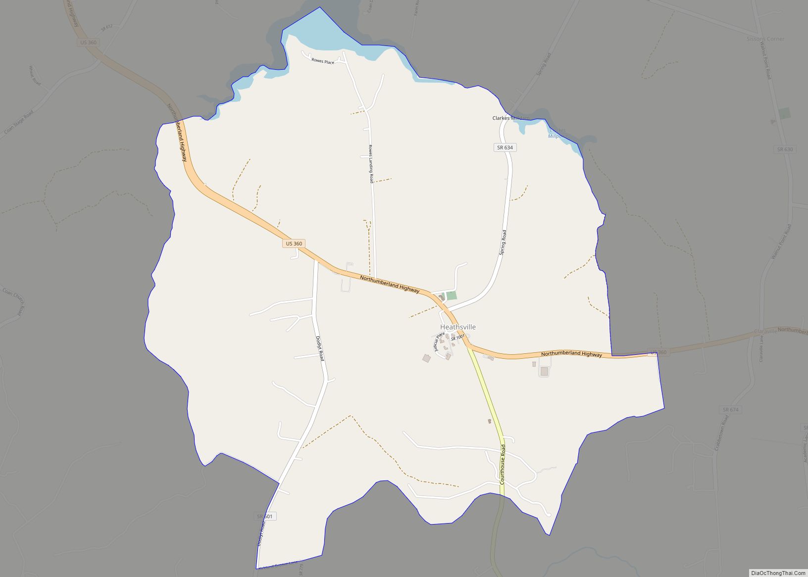
| Seat: | Heathsville |
| Total Area: | 286 sq mi (740 km²) |
| Land Area: | 191 sq mi (490 km²) |
| Total Population: | 11,839 |
| Population Density: | 41/sq mi (16/km²) |
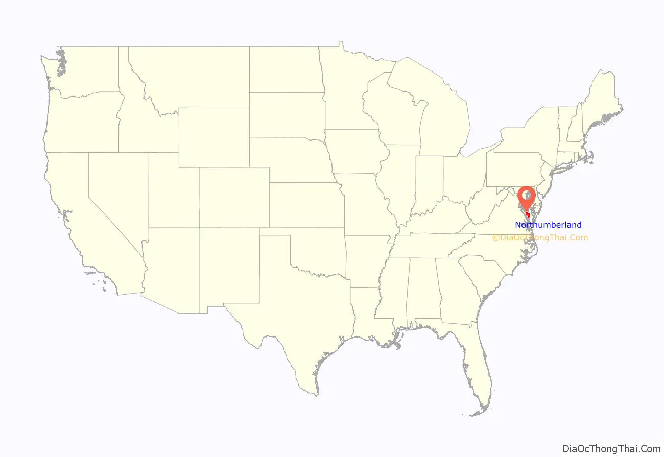
Northumberland County location map. Where is Northumberland County?
History
The area was occupied at the time of English settlement by the Algonquian-speaking historic tribes of the Wicocomico, Chickacoan, and Patawomeck. The county was created by the Virginia General Assembly in 1648 during a period of rapid population growth and geographic expansion. Settlement began in this area of the Northern Neck around 1635. Originally known as the Indian district Chickacoan, the area was first referred to as Northumberland (a namesake of Northumberland County, England) in the colonial records in 1644. The following year, John Mottrom served as the first burgess for the territory in the House of Burgesses, which met at the capital of the Virginia Colony at Jamestown. The county was formed from a part of York County.
The colonial court ordered the Wicocomico and Chickacoan tribes to merge and by 1655, assigned them a reservation of 4,400 acres (18 km) near Dividing Creek, south of the Great Wicomico River. The Patawomeck Tribe was hunted nearly to extinction in 1666, and survived only by intermarriage. By the early 1700s, the Wicocomico tribe was greatly reduced, and English colonists took control of their lands. They were believed to be extinct as a tribe as, landless, they disappeared from the historical record. Descendants of the last weroance are working to regain recognition as a tribe, the Wicocomico Indian Nation. Descendants of the Patawomeck achieved tribal recognition from the state of Virginia in February 2010. The size of the county was drastically reduced in 1651 and 1653 when the colonial government organized Lancaster and Westmoreland counties from it.
Of the 172 counties, that have ever existed in Virginia’s history, Northumberland ended up being an “ancestor” to 116 of these—more than the current 95 counties (several were lost to other states, such as West Virginia).
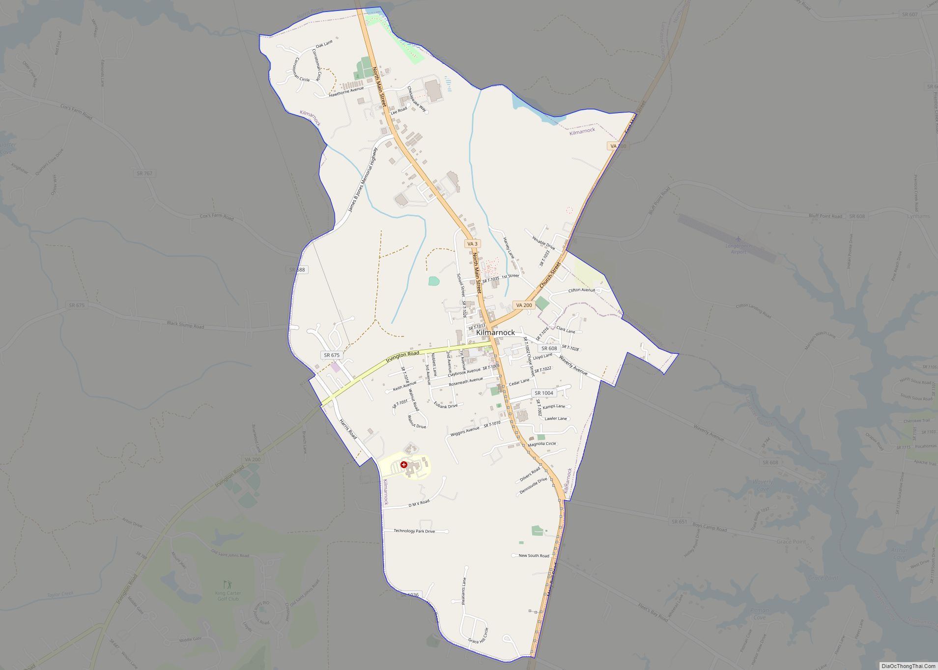
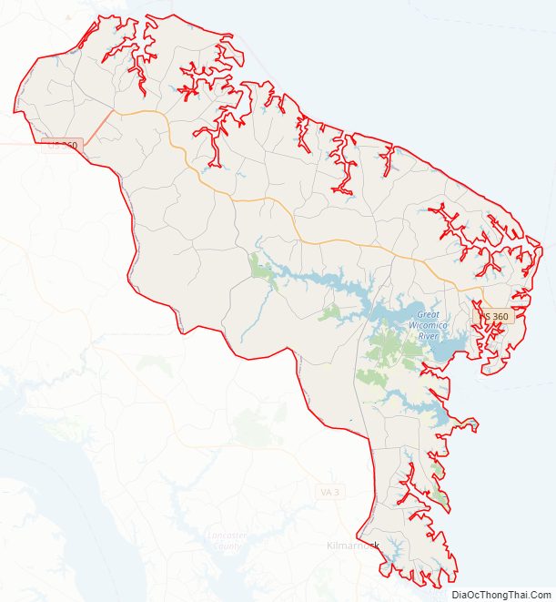
Northumberland County Road Map
Geography
According to the U.S. Census Bureau, the county has a total area of 286 square miles (740 km), of which 191 square miles (490 km) is land and 94 square miles (240 km) (33.0%) is water. The county is located between the Rappahannock River to the south and Potomac River to the north. Chesapeake Bay is immediately east of the county.
Adjacent counties
- Lancaster County – south
- Richmond County – west
- Westmoreland County – northwest
- St. Mary’s County, Maryland – north
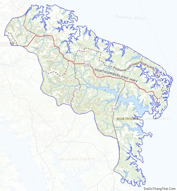
Northumberland County Topographic Map
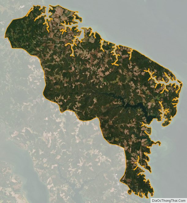
Northumberland County Satellite Map
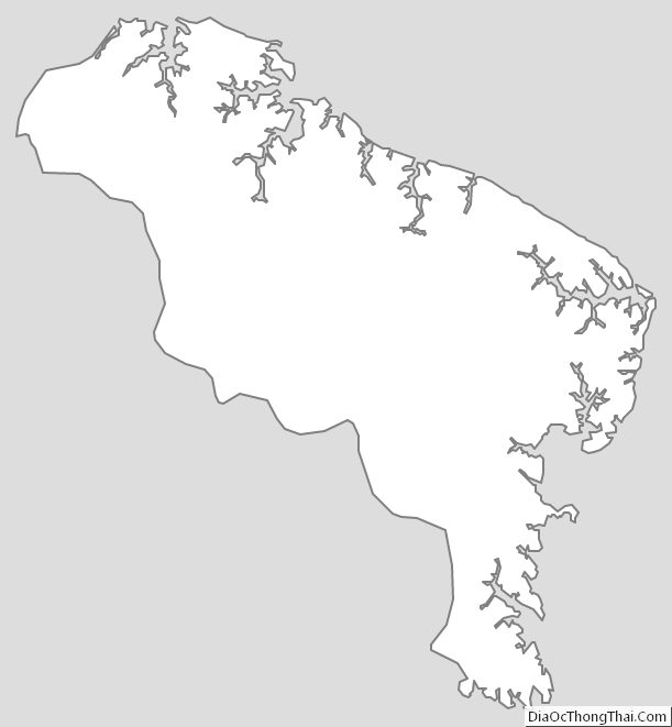
Northumberland County Outline Map