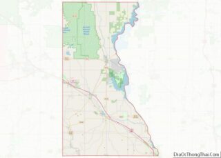
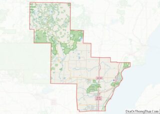
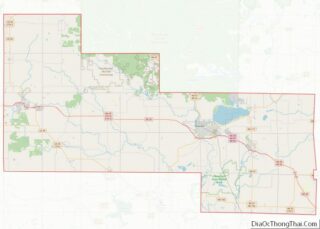
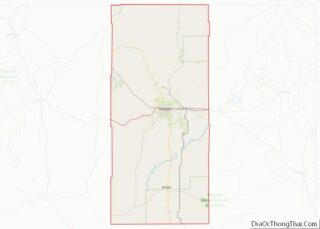
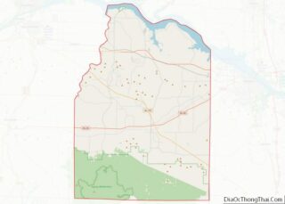
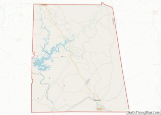
Map of Obion County

Map of Obion County, Tennessee

Obion County overview: Name: Obion County FIPS code: 47-131 State: Tennessee Founded: 1824 Named for: Obion River Seat: Union City Largest city: Union City Total Area: 556 sq mi (1,440 km²) Land Area: 545 sq mi (1,410 km²) Total Population: 30,787 Population Density: 58/sq mi (22/km²) Time zone: UTC−6 (Central) Summer Time Zone (DST): UTC−5 (CDT) Website: www.obioncountytn.gov Obion County location map. … Read more

Map of Sullivan County

Map of Sullivan County, Tennessee

Sullivan County is a county located in the U.S. state of Tennessee on its northeast border. As of the 2020 census, the population was 158,163. Its county seat is Blountville. Sullivan County is part of the Kingsport–Johnson City–Bristol, TN-VA Metropolitan Statistical Area, which is a component of the Kingsport–Johnson City–Bristol, TN-VA Combined Statistical Area, commonly … Read more

Map of Angelina County

Map of Angelina County, Texas

Angelina County (/ˌændʒəˈliːnə/ AN-jə-LEE-nə) is a county located in the U.S. state of Texas. It is in East Texas and its county seat is Lufkin. As of the 2020 census, the population was 86,395. The Lufkin, TX Micropolitan Statistical Area includes all of Angelina County. It was formed in 1846 from Nacogdoches County. It is … Read more

Map of Bowie County

Map of Bowie County, Texas

Bowie County (/ˈbuːi/ BOO-ee) is a county in the U.S. state of Texas. Its legal county seat is Boston, though its courthouse is located in New Boston. As of the 2020 census, the population was 92,893. Bowie County is part of the Texarkana metropolitan statistical area. The county is named for James Bowie, the legendary … Read more

Map of Castro County

Map of Castro County, Texas

Castro County is a county located in the U.S. state of Texas. As of the 2020 census, its population was 7,371. Its county seat is Dimmitt. The county was named for Henri Castro, who was consul general to France for the Republic of Texas and the founder of a colony in Texas. The county was … Read more

Map of Cottle County

Map of Cottle County, Texas

Cottle County is a county in the U.S. state of Texas. As of the 2020 census, its population was 1,380. Its county seat is Paducah. The county was founded in 1876 and later organized in 1892. It is named for George Washington Cottle, who died defending the Alamo. Cottle County was formerly one of 46 … Read more

Map of Eastland County

Map of Eastland County, Texas

Eastland County overview: Name: Eastland County FIPS code: 48-133 State: Texas Founded: 1873 Seat: Eastland Largest city: Eastland Total Area: 932 sq mi (2,410 km²) Land Area: 926 sq mi (2,400 km²) Total Population: 17,725 Population Density: 19/sq mi (7.3/km²) Time zone: UTC−6 (Central) Summer Time Zone (DST): UTC−5 (CDT) Website: www.eastlandcountytexas.com Eastland County location map. Where is Eastland County? Eastland County … Read more

Map of Gaines County

Map of Gaines County, Texas

Gaines County is a county in the U.S. state of Texas. As of the 2020 census, its population was 21,598. The county seat is Seminole. Gaines County overview: Name: Gaines County FIPS code: 48-165 State: Texas Founded: 1905 Seat: Seminole Largest city: Seminole Total Area: 1,503 sq mi (3,890 km²) Land Area: 1,502 sq mi (3,890 km²) Total Population: 21,598 Population … Read more

Map of Hardeman County

Map of Hardeman County, Texas

Hardeman County (/ˈhɑːrdɪmən/ HAR-di-mən) is a county located in the U.S. state of Texas. As of the 2020 census, its population was 3,549. The county seat and largest city is Quanah. The county was created in 1858 and later organized in 1884. It is named for two brothers, Bailey Hardeman and Thomas Jones Hardeman, early … Read more

Map of Hudspeth County

Map of Hudspeth County, Texas

Hudspeth County is a county located in the U.S. state of Texas. As of the 2020 census, the population was 3,202. Its county seat is Sierra Blanca, and the largest community is Fort Hancock. The county is named for Claude Benton Hudspeth, a state senator and United States Representative from El Paso. It is northeast … Read more

Map of Kenedy County

Map of Kenedy County, Texas

Kenedy County is a county located in the U.S. state of Texas. As of the 2020 census, its population was 350. It is the third-least populous county in Texas and fourth-least populous in the United States. Its county seat is Sarita. The county was created in 1921 from parts of Hidalgo and Willacy counties and … Read more

Map of Limestone County

Map of Limestone County, Texas

Limestone County is a county in the U.S. state of Texas. As of the 2020 census, its population was 22,146. Its county seat is Groesbeck. The county was created in 1846. Limestone County overview: Name: Limestone County FIPS code: 48-293 State: Texas Founded: 1846 Seat: Groesbeck Largest city: Mexia Total Area: 933 sq mi (2,420 km²) Land Area: … Read more