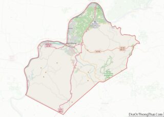
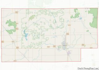
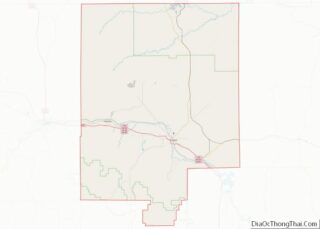
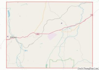
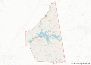
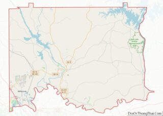
Map of Cottonwood County

Map of Cottonwood County, Minnesota

Cottonwood County is a county in the U.S. state of Minnesota. As of the 2020 census, the population was 11,517. Its county seat is Windom. Cottonwood County overview: Name: Cottonwood County FIPS code: 27-033 State: Minnesota Founded: 1857 Named for: Cottonwood River Seat: Windom Largest city: Windom Total Area: 649 sq mi (1,680 km²) Land Area: 639 sq mi (1,660 km²) … Read more

Map of Kanabec County

Map of Kanabec County, Minnesota

Kanabec County (/kəˈneɪbɪk/ kə-NAY-bik) is a county in the East Central part of U.S. state of Minnesota. As of the 2020 census, the population was 16,032. Its county seat is Mora. Kanabec County overview: Name: Kanabec County FIPS code: 27-065 State: Minnesota Founded: 1858 Named for: Snake River Seat: Mora Largest city: Mora Total Area: … Read more

Map of Mille Lacs County

Map of Mille Lacs County, Minnesota

Mille Lacs County (/ˌmɪl ˈlæks/ mil LAKS) is a county in the East Central part of the U.S. state of Minnesota. As of the 2020 census, the population was 26,459. Its county seat is Milaca. The county was founded in 1857, and its boundary was expanded in 1860. Mille Lacs County is included in the … Read more

Map of Redwood County

Map of Redwood County, Minnesota

Redwood County is a county in the U.S. state of Minnesota. As of the 2020 census the population was 15,425. Its county seat is Redwood Falls, along the Redwood River near its confluence with the Minnesota River. The Lower Sioux Indian Reservation (also known as the Mdewakankton Tribal Reservation) is entirely within the county, along … Read more

Map of Wadena County

Map of Wadena County, Minnesota

Wadena County (/wəˈdiːnə/ wə-DEEN-ə) is a county in the U.S. state of Minnesota. As of the 2020 census, the population was 14,065. Its county seat is Wadena. Wadena County overview: Name: Wadena County FIPS code: 27-159 State: Minnesota Founded: 1858 Named for: A trading post Seat: Wadena Largest city: Wadena Total Area: 543 sq mi (1,410 km²) Land … Read more

Map of Chickasaw County

Map of Chickasaw County, Mississippi

Chickasaw County is a county located in the U.S. state of Mississippi. As of the 2020 census, the population was 17,106. Its county seats are Houston and Okolona. The county is named for the Chickasaw people, who lived in this area for hundreds of years. Most were forcibly removed to Indian Territory in the 1830s, … Read more

Map of Hinds County

Map of Hinds County, Mississippi

Hinds County is a county located in the U.S. state of Mississippi. With its county seats (Raymond and the state’s capital, Jackson), Hinds is the most populous county in Mississippi with a 2020 census population of 227,742 residents. Hinds County is a central part of the Jackson metropolitan statistical area. It is a professional, educational, … Read more

Map of Lee County

Map of Lee County, Mississippi

Lee County is a county in U.S. state of Mississippi. At the 2020 census, the population was 83,353. Lee County is included in the Tupelo Micropolitan Statistical Area. Lee County overview: Name: Lee County FIPS code: 28-081 State: Mississippi Founded: 1866 Named for: Gen. Robert E. Lee Seat: Tupelo Largest city: Tupelo Total Area: 453 sq mi … Read more

Map of Pike County

Map of Pike County, Mississippi

Pike County is a county located on the southwestern border of the U.S. state of Mississippi. As of the 2020 census, the population was 40,324. The county seat is Magnolia. Pike County is named for explorer Zebulon Pike. Pike County is part of the McComb, MS Micropolitan Statistical Area. Pike County overview: Name: Pike County … Read more

Map of Union County

Map of Union County, Mississippi

Union County is a county located in the U.S. state of Mississippi. As of the 2020 census, the population was 27,777. Its county seat is New Albany. According to most sources, the county received its name by being a union of pieces of several large counties, like other Union counties in other states. However, other … Read more

Map of Bates County

Map of Bates County, Missouri

Bates County is a county located in the west central part of the U.S. state of Missouri, two counties south of the Missouri River and is part of the Kansas City metropolitan area. As of the 2020 census, the population was 16,042. Its county seat is Butler. The county was organized in 1841 and named … Read more

Map of Clark County

Map of Clark County, Missouri

Clark County overview: Name: Clark County FIPS code: 29-045 State: Missouri Founded: December 16, 1836 Named for: William Clark Seat: Kahoka Largest city: Kahoka Total Area: 512 sq mi (1,330 km²) Land Area: 505 sq mi (1,310 km²) Total Population: 6,634 Population Density: 13/sq mi (5.0/km²) Time zone: UTC−6 (Central) Summer Time Zone (DST): UTC−5 (CDT) Clark County location map. Where is … Read more