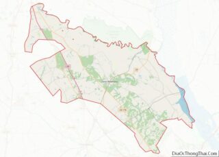
Cherokee County is a county located in the U.S. state of Iowa. As of the 2020 census, the population was 11,658. The county seat is Cherokee. The county was formed on January 15, 1851, from open territory. It was named after the Cherokee people. Cherokee County overview: Name: Cherokee County FIPS code: 19-035 State: Iowa ... Read more
Map of US Counties
Floyd County is a county located in the U.S. state of Iowa. As of the 2020 census, the population was 15,627. The county seat is Charles City. Floyd County overview: Name: Floyd County FIPS code: 19-067 State: Iowa Founded: 1851 Named for: Charles Floyd Seat: Charles City Largest city: Charles City Total Area: 501 sq mi (1,300 km²) ... Read more
Jasper County is a county in the U.S. state of Iowa. As of the 2020 census, the population was 37,813. The county seat is Newton. The county was organized in 1846 and is named after Sergeant William Jasper, a Revolutionary War hero. Jasper County is part of the Des Moines–West Des Moines, IA Metropolitan Statistical ... Read more
Mitchell County is a county located in the U.S. state of Iowa. As of the 2020 census, the population was 10,565. The county seat is Osage. It is not clear whom the county is named after: the county website mentions John Mitchell, an early surveyor, and an Irish patriot John Mitchel. Mitchell County overview: Name: ... Read more
Scott County is a county located in the U.S. state of Iowa. As of the 2020 census, the population was 174,669, making it the third-most populous county in Iowa. The county seat is Davenport. Scott County is included in the Davenport–Moline–Rock Island, IA–IL Metropolitan Statistical Area. Scott County overview: Name: Scott County FIPS code: 19-163 ... Read more
Worth County is a county located in the U.S. state of Iowa. As of the 2020 census, the population was 7,443. The county seat is Northwood. The county was founded in 1851 and named for Major General William Jenkins Worth (1794–1849), an officer in both the Seminole War and the Mexican–American War. Worth County is ... Read more
Cloud County (county code CD) is a county located in the U.S. state of Kansas. As of the 2020 census, the county population was 9,032. Its county seat and most populous city is Concordia. Cloud County overview: Name: Cloud County FIPS code: 20-029 State: Kansas Founded: March 27, 1867 Named for: William F. Cloud Seat: ... Read more
Geary County (county code GE) is a county located in the U.S. state of Kansas. As of the 2020 census, the county population was 36,739. Its county seat and most populous city is Junction City. The county is named in honor of Governor John W. Geary. Geary County overview: Name: Geary County FIPS code: 20-061 ... Read more
Kearny County overview: Name: Kearny County FIPS code: 20-093 State: Kansas Founded: March 20, 1873 Named for: Philip Kearny Seat: Lakin Largest city: Lakin Total Area: 871 sq mi (2,260 km²) Land Area: 871 sq mi (2,260 km²) Total Population: 3,983 Population Density: 4.6/sq mi (1.8/km²) Time zone: UTC−6 (Central) Summer Time Zone (DST): UTC−5 (CDT) Website: KearnyCountyKansas.com Kearny County location map. ... Read more
Montgomery County (county code MG) is a county located in Southeast Kansas. As of the 2020 census, the county population was 31,486. Its county seat is Independence, and its most populous city is Coffeyville. Montgomery County overview: Name: Montgomery County FIPS code: 20-125 State: Kansas Founded: February 26, 1867 Named for: Richard Montgomery Seat: Independence ... Read more
Republic County overview: Name: Republic County FIPS code: 20-157 State: Kansas Founded: February 27, 1860 Named for: Republican River Seat: Belleville Largest city: Belleville Total Area: 720.31 sq mi (1,865.6 km²) Land Area: 716.38 sq mi (1,855.4 km²) Total Population: 4,674 Population Density: 6.5/sq mi (2.5/km²) Time zone: UTC−6 (Central) Summer Time Zone (DST): UTC−5 (CDT) Website: republiccounty.org Republic County location map. ... Read more
Stevens County (standard abbreviation: SV) is a county located in the U.S. state of Kansas. As of the 2020 census, the county population was 5,250. Its county seat is Hugoton. The county is named for the Reconstruction era Pennsylvania politician Thaddeus Stevens. Stevens County overview: Name: Stevens County FIPS code: 20-189 State: Kansas Founded: August ... Read more