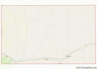
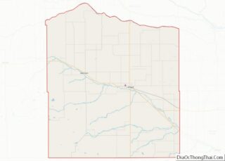
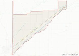
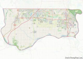
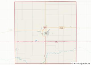
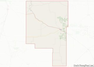
Map of Bandera County

Map of Bandera County, Texas

Bandera County (Spanish: “flag”, /bænˈdɛrə/ ban-DERR-ə) is a county in the U.S. state of Texas. It is located in the Hill Country and its county seat is Bandera. As of the 2020 census, the population is 20,851. Bandera County is part of the San Antonio-New Braunfels metropolitan statistical area. The county is officially recognized as … Read more

Map of Burleson County

Map of Burleson County, Texas

Burleson County overview: Name: Burleson County FIPS code: 48-051 State: Texas Founded: 1846 Named for: Edward Burleson Seat: Caldwell Largest city: Caldwell Total Area: 677 sq mi (1,750 km²) Land Area: 659 sq mi (1,710 km²) Total Population: 17,642 Population Density: 26/sq mi (10/km²) Time zone: UTC−6 (Central) Summer Time Zone (DST): UTC−5 (CDT) Website: www.co.burleson.tx.us Burleson County location map. Where is … Read more

Map of Coleman County

Map of Coleman County, Texas

Coleman County is a county located in the U.S. state of Texas. As of the 2020 census, its population was 7,684. The county seat is Coleman. The county was founded in 1858 and organized in 1864. It is named for Robert M. Coleman, a signer of the Texas Declaration of Independence and soldier at the … Read more

Map of Dawson County

Map of Dawson County, Texas

Dawson County is a county in the U.S. state of Texas. As of the 2020 census, its population was 12,456. The county seat is Lamesa. The county was created in 1876 and later organized in 1905. It is named for Nicholas Mosby Dawson, a soldier of the Texas Revolution. Dawson County comprises the Lamesa, TX … Read more

Map of Fannin County

Map of Fannin County, Texas

Fannin County is a county in the far northeast of the U.S. state of Texas, on the border with Oklahoma. As of the 2020 census, its population was 35,662. The county seat is Bonham. The county was named for James Fannin, who commanded the group of Texans killed in the Goliad Massacre during the Texas … Read more

Map of Gray County

Map of Gray County, Texas

Gray County is a county located in the U.S. state of Texas. As of the 2020 census, its population was 21,227. The county seat is Pampa. The county was created in 1876 and later organized in 1902. is named for Peter W. Gray, a Confederate lawyer and soldier in the American Civil War. Gray County … Read more

Map of Hemphill County

Map of Hemphill County, Texas

Hemphill County overview: Name: Hemphill County FIPS code: 48-211 State: Texas Founded: 1887 Named for: John Hemphill Seat: Canadian Largest city: Canadian Total Area: 912 sq mi (2,360 km²) Land Area: 906 sq mi (2,350 km²) Total Population: 3,382 Population Density: 3.7/sq mi (1.4/km²) Time zone: UTC−6 (Central) Summer Time Zone (DST): UTC−5 (CDT) Website: www.co.hemphill.tx.us Hemphill County location map. Where is … Read more

Map of Jeff Davis County

Map of Jeff Davis County, Texas

Jeff Davis County is a county in the U.S. state of Texas. As of the 2020 census, its population was 1,996. Its county seat is Fort Davis. The county is named for Jefferson Davis, who served as the 23rd United States Secretary of War in the 1850s, and as President of the Confederate States of … Read more

Map of Knox County

Map of Knox County, Texas

Knox County is a county located in the U.S. state of Texas. As of the 2020 census, its population was 3,353. Its county seat is Benjamin. The county was created in 1858 and later organized in 1886. It is named for Henry Knox, an American Revolutionary War general. Knox County overview: Name: Knox County FIPS … Read more

Map of Madison County

Map of Madison County, Texas

Madison County overview: Name: Madison County FIPS code: 48-313 State: Texas Founded: 1854 Named for: James Madison Seat: Madisonville Largest city: Madisonville Total Area: 472 sq mi (1,220 km²) Land Area: 466 sq mi (1,210 km²) Total Population: 13,455 Population Density: 29/sq mi (11/km²) Time zone: UTC−6 (Central) Summer Time Zone (DST): UTC−5 (CDT) Website: www.co.madison.tx.us Madison County location map. Where is … Read more

Map of Montgomery County

Map of Montgomery County, Texas

Montgomery County is a county in the U.S. state of Texas. As of the 2020 U.S. census, the county had a population of 620,443. The county seat is Conroe. The county was created by an act of the Congress of the Republic of Texas on December 14, 1837, and is named for the town of … Read more

Map of Pecos County

Map of Pecos County, Texas

Pecos County is a county located in the U.S. state of Texas. As of the 2020 census, its population was 15,193. The county seat is Fort Stockton. The county was created in 1871 and organized in 1875. It is named for the Pecos River. It is one of the nine counties that comprise the Trans-Pecos … Read more