| Name: | Cape May County |
|---|---|
| FIPS code: | 34-009 |
| State: | New Jersey |
| Founded: | 1685 |
| Named for: | Cornelius Jacobsen Mey |
| Seat: | Cape May Court House |
| Total Area: | 620.42 sq mi (1,606.9 km²) |
| Land Area: | 251.42 sq mi (651.2 km²) |
| Total Population: | 95,263 |
| Population Density: | 378.9/sq mi (146.3/km²) |
| Website: | capemaycountynj.gov |
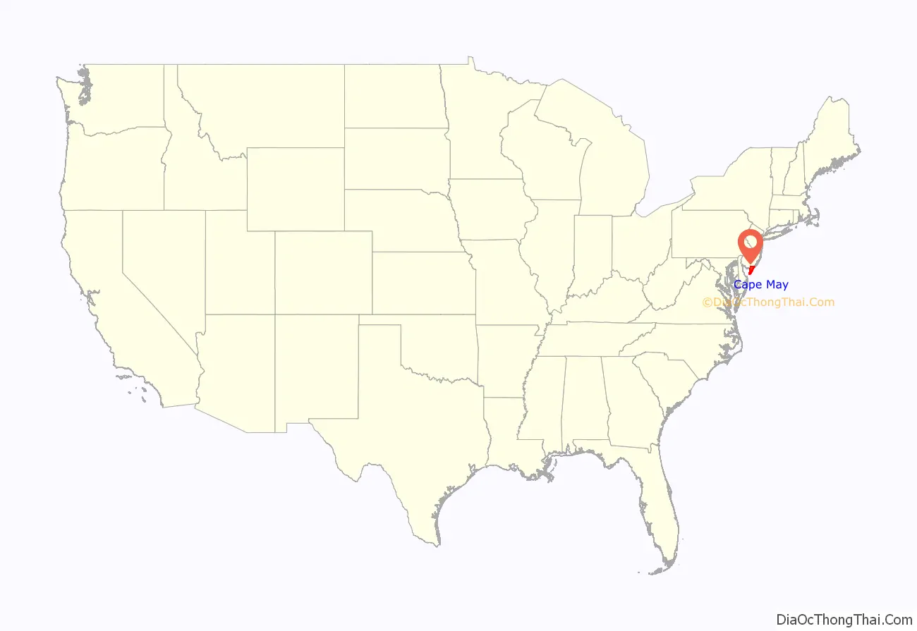
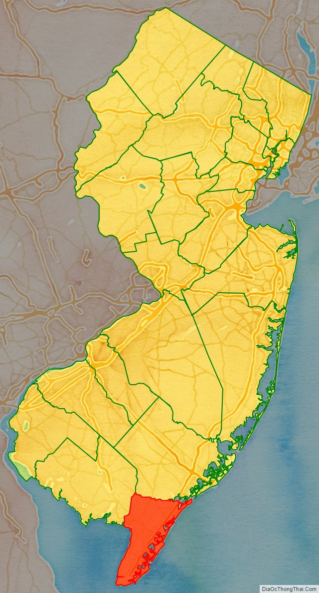
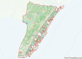
Cape May County location map. Where is Cape May County?
History
Etymology
Before Cape May County was settled by Europeans, the indigenous Kechemeche tribe of the Lenape people inhabited South Jersey, and traveled to the barrier islands during the summer to hunt and fish. During the 17th century, the area that is now Cape May County was claimed as part of New Netherlands, New Sweden, the Province of New Jersey under the British crown, and later West Jersey. On August 28, 1609, English explorer Henry Hudson entered the Delaware Bay and stayed one day on land, north of what is now Cape May Point. As early as 1666, the southern tip of New Jersey was known as Cape Maey, named after Dutch explorer Cornelius Jacobsen May, who sailed the coastline of New Jersey from 1620 to 1621. In 1630, representatives of the Dutch West India Company purchased a 16 sq mi (41 km) tract of land along the Delaware from indigenous people, and bought additional land 11 years later. Due to the large number of whales in the region of Cape May, Dutch explorers founded Town Bank around 1640 along the Delaware Bay as a whaling village. It was the first European settlement in what is now Cape May County, and was populated by descendants of Plymouth County.
History
In 1685, the court of Cape May was split from Burlington County, which at that time encompassed all or nearly all of South Jersey. In 1690, a settlement began at Cape Island (now Cape May). As whaling declined due to overpopulation, Town Bank diminished in importance in favor of Cape May, and was largely washed away by 1750. In 1692, Cape May County was designated as one of the original four counties of West Jersey, defined as the land from the most northerly portion of Great Egg Harbor Bay to a point 20 mi (32 km) east of the mouth of the Maurice River (called West Creek), south to the tip of Cape May. The limits of the county were adjusted over the next two centuries, mostly the portion near Maurice River Township. The first water mill in the county was constructed in 1699 in Cold Spring. Nearby, the First Baptist Church was built in 1712, and the first Cold Spring Presbyterian Church was built in 1718. Both churches, as well as nearby private homes, functioned as the center of early county government.
In 1744, the county chose Romney Marsh – later Cape May Court House – near the county’s center to become the county seat. The first jail and courthouse were built in 1764. The county’s population was around 1,000 in 1750, isolated from the rest of New Jersey by forests. Cape May grew independently as America’s oldest bathing resort by 1765, leading to the city’s current motto “The Nation’s Oldest Seashore Resort”. Amid the British blockade of the Delaware Bay in the American Revolutionary War, two British ships pursued and attacked the American brig Nancy, which fled to the coast at Turtle Gut Inlet (located in Wildwood Crest today). The Nancy was abandoned and sabotaged, killing at least 30 British sailors when the brig exploded after they boarded. The Battle of Turtle Gut Inlet on June 29, 1776, was the only Revolutionary War battle fought in the county.
Cape May County was split into three townships on February 21, 1798 – Lower, Middle, and Upper. The three townships were previously established as precincts on April 2, 1723. During the War of 1812, British forces raided farms in the county for food and fresh water. In retaliation, residents dug canals to the ocean, making the water no longer drinkable. In 1827, Dennis Township was created from portions of Upper Township, 101 years after its namesake Dennisville was founded in 1726. The oldest independent borough in the county was Cape Island Borough in 1848, which became the city of Cape May in 1869. Over the next 60 years as transport to the region improved, most of the current municipalities in the county were created. Sea Grove, later renamed Cape May Point, was founded in 1875. In 1879, Ocean City was founded as a religious retreat. Sea Isle City was founded in 1882, followed by West Cape May in 1884. In 1885, Anglesea (renamed North Wildwood in 1906) and Holly Beach (later a part of Wildwood) were founded. A land development company established Avalon in 1887. In 1891, Woodbine was founded on the mainland as an agriculture settlement for Russian Jews who fled religious persecution. From 1894 until 1945, South Cape May existed as an independent borough until it was largely destroyed by the 1944 Great Atlantic hurricane. In 1906, the eastern coastal boundary of Cape May County was established at a point 3 nautical miles (3.5 mi, 5.5 km) east of the coast. The last municipalities to be established were Wildwood Crest (in 1910), Stone Harbor (in 1914), and West Wildwood (in 1920). In 1928, North Cape May was founded, but was dissolved in 1945 after it failed to attract development following the Great Depression.
During World War II, Cape May Canal was built to connect the Delaware Bay and Cape May Harbor, completed in March 1943. The completion of the Garden State Parkway in 1955 brought hundreds of thousands of tourists, as well as a larger year-round population. Since the 1970s, the mainland has become more developed, due to the high cost of building on the barrier islands. Commercial development concentrated along U.S. Route 9 in Rio Grande, Cape May Court House, and Marmora. Concurrent with the 1980 Presidential election, Cape May County residents voted in favor to create a new state of South Jersey along with five other counties in a nonbinding referendum.
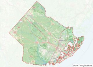
Cape May County Road Map
Geography
Cape May County is 29 mi (47 km) long and 15 mi (24 km) at its widest. According to the 2010 Census, the county had a total area of 620.42 square miles (1,606.9 km), including 251.42 square miles (651.2 km) of land (40.5%) and 368.99 square miles (955.7 km) of water (59.5%). The county is located about 150 mi (240 km) south of New York City, 80 mi (130 km) southeast of Philadelphia, and 150 mi (240 km) east of Washington, D.C. To the south and east of the county is the Atlantic Ocean. The location near water provides milder temperatures than surrounding areas, as well as a continuous breeze, which contribute to the area’s tourism-driven economy. Sea level along the coast is the lowest point. The highest elevation is found at three areas in Belleplain State Forest in the county’s northern corner, which are approximately 60 ft (18 m) above sea level.
Overall, the county is flat and coastal. Much of Cape May County lies on the Cape May Peninsula, which is part of the Atlantic coastal plain. The peninsula is bounded to the west by the Delaware Bay, and to the east is 1.5 to 3 mi (2.4 to 4.8 km) of marshes and water channels making up the Intracoastal Waterway. There are over 1,574 mi (2,533 km) of streams and rivers in the county, with the Great Egg Harbor River and its tributaries covering the northern portion of the county. There are also 24,150 acres (9,770 ha) of ponds, lakes, bays, and reservoirs. There are five barrier islands, measuring 32 mi (51 km) in total, that are adjacent to the mainland. The islands have gently-sloped beaches and are largely built up. There were only barrier four islands from 1922, when Turtle Gut Inlet was filled in to create Wildwood Crest, until 1945, when Cape May Canal was constructed through the southern portion of the county.
Climate
Given its maritime influence and southernmost location within New Jersey, Cape May County has a more moderate climate than surrounding areas. During the summer, the county is often 3–5 degrees cooler, and 5–10 degrees warmer in the winter. Much of the county is in USDA plant hardiness zone 7a/7b, with a small portion in the county’s southeastern extreme in zone 8a. This equates to an average annual minimum temperature of 0 to 10 °F (−18 to −12 °C). The average temperatures in the county seat of Cape May Court House range from a low of 22 °F (−6 °C) in January to a high of 85 °F (29 °C) in July, although a record low of −22 °F (−30 °C) was recorded in January 1942 and a record high of 103 °F (39 °C) was recorded in July 1993. Average monthly precipitation ranged from 2.91 inches (74 mm) in June to 4.68 inches (119 mm) in August, and annual precipitation is around 40 in (1,000 mm). The region typically gets 10 to 15 in (250 to 380 mm) of snowfall each year, much less than the mountains of New Jersey. According to the Köppen climate classification system, Cape May County has a humid subtropical climate (Cfa). According to the Trewartha climate classification this climate is Do (oceanic.) The county has windy conditions throughout the year.
Owing to its location along the coast, Cape May County has experienced the effects of tropical cyclones for centuries. In Whale Beach on Ludlam Island, core samples suggested the passage of an intense hurricane sometime between 1278 and 1438. The next significant hurricane in the area was September 3, 1821. Around 1800 UTC (2:00 PM local time), the eye of the hurricane crossed over Cape May, estimated as a Category 4 on the Saffir–Simpson scale. It is estimated that an identical hurricane to the 1821 storm would cause over $1 billion in damage in Cape May County, and $107 billion in damage nationwide. The Gale of 1878 flooded Cape May County and produced 84 mph (135 km/h) winds. During the passage of Hurricane Gloria in 1985, Ocean City recorded a wind gust of 101 mph (162 km/h). Hurricane Sandy struck the state on October 31, causing at least $150 million in damage in the county from its high winds and high tides. At the terminal for the Cape May–Lewes Ferry in North Cape May, Sandy produced the highest tide on record at 8.9 ft (2.7 m), surpassing the previous record of 8.8 ft (2.7 m) set by Hurricane Gloria.
Cape May County has experienced a variety of other weather effects. In March 1962, a stalled coastal storm produced several days of extremely high tides along the barrier islands, which damaged the boardwalks of Cape May, Avalon, and Sea Isle City. The 1991 Perfect Storm produced high tides and beach erosion. In January 2016, a blizzard nicknamed “Winter Storm Jonas” produced record high tides in the county, reaching 9.0 ft (2.7 m) at the terminal for Cape May–Lewes Ferry, surpassing that of Hurricane Sandy. Nearly every municipality in the county reported damage, and in coastal towns, the beaches were severely eroded. Since 1997, three tornadoes have touched down in the county, all of them weak.
Flora and fauna
The uplands, wetlands, and open waters of the county support one of the largest concentration of migratory birds in North America. Nearly 900,000 migratory birds were observed in 1995 in Avalon. Along the Delaware Bay, 800,000 to 1.5 million birds pass through the area each spring. In 1947, the Stone Harbor Bird Sanctuary was established, which was designated as a National Natural Landmark in 1965. In addition to the 151 species of birds that frequent the county, there are two species of whales, the loggerhead sea turtle, the northern pine snake, two species of treefrog, and the tiger salamander that inhabit the waters of Cape May County. Eight species of fish and four species of shellfish populate the coastal waters.
About 30% of the county is covered by forests that runs the length of the Cape May peninsula and connects with the Pinelands. The largely unfragmented forest provides breeding grounds for the barred owl, red-shouldered hawk, and wood thrush, and also provides habitat for insects and migratory birds. In the county’s swampy interior, there are over 20 species of trees and 40 species of shrubs. About 42% of the county consists of wetlands. The marshes between the mainland and the barrier island are dominated by the common reed, narrow-leaved cattail, bulrushes, and smooth cordgrass. Along the beach, the American beachgrass predominantly make up dune systems, along with other plant species.
The county utilizes five underground aquifers, including two that derive from the Kirkwood-Cohansey aquifer. Severe storms resulted in saltwater intrusion of the county’s freshwater supply. The suitable growing conditions led to West Cape May considering itself the “lima bean capital of the world”, until Guatemala surpassed it in the 1990s. The city still hosts an annual lima bean festival.
Geology
The oldest rocks in the county are at a depth of 5,000 ft (1,500 m), formed during the Precambrian era. These metamorphic rocks include gneiss, quartzite, and schist. During the Paleozoic era, the region was part of a mountainous landmass that extended from the Arctic to Mexico. Erosion during the Triassic and Jurassic periods formed valleys that gathered sediment, which deposited and layered as the coastline receded and rose. In the Paleocene and Eocene epochs, as well as the later Miocene epoch, the area that is now Cape May County was under water. The coastline receded again during the Quaternary period.
During the Sangamonian interglacial period, melting glaciers formed rivers that carried sediment to the coast. The Bridgeton Formation deposited silt and clay through a fluvial process, while the later Cape May Formation deposited sand, silt, clay, and gravel. The Great Egg Harbor River in its formative stage produced a delta that covered much of what is now Cape May County with sediment. During the most recent ice age (Wisconsin glaciation), the sea level dropped to 430 ft (130 m) below its current depth. Around 14,000 years ago, glaciers began melting, and the barrier islands of Cape May County formed, likely from spits and lines of dunes.
