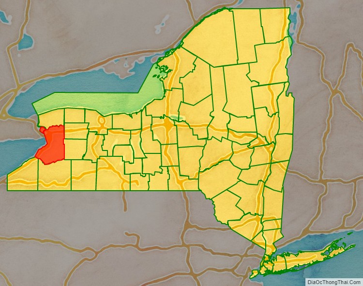
Erie County is a county along the shore of Lake Erie in western New York State. As of the 2020 census, the population was 954,236. The county seat is Buffalo, which makes up about 28% of the county’s population. Both the county and Lake Erie were named for the regional Iroquoian language-speaking Erie tribe of Native Americans, who lived in the area before 1654. They were later pushed out by the more powerful Iroquoian nations tribes.
Erie County, along with its northern neighbor Niagara County, makes up the Buffalo-Niagara Falls metropolitan area, the second largest in the State of New York behind New York City. The county’s southern part is known as the Southtowns. The county has seen one of the highest growth rates of any county in the State of New York from the 2010 to 2020 census.
| Name: | Erie County |
|---|---|
| FIPS code: | 36-029 |
| State: | New York |
| Founded: | 1821 |
| Named for: | Eriechronon |
| Seat: | Buffalo |
| Largest city: | Buffalo |
| Total Area: | 1,227 sq mi (3,180 km²) |
| Land Area: | 1,043 sq mi (2,700 km²) |
| Total Population: | 954,236 |
| Population Density: | 914.9/sq mi (353.2/km²) |
| Time zone: | UTC−5 (Eastern) |
| Summer Time Zone (DST): | UTC−4 (EDT) |
| Website: | www.erie.gov |
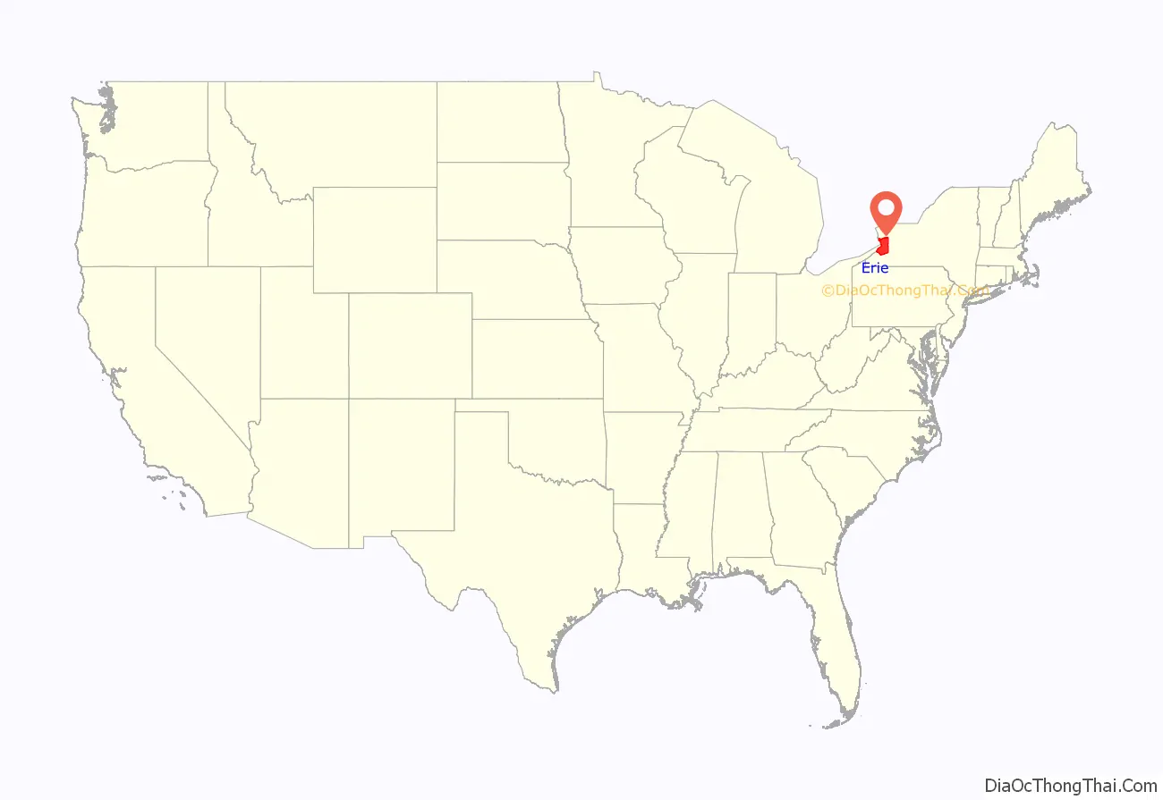
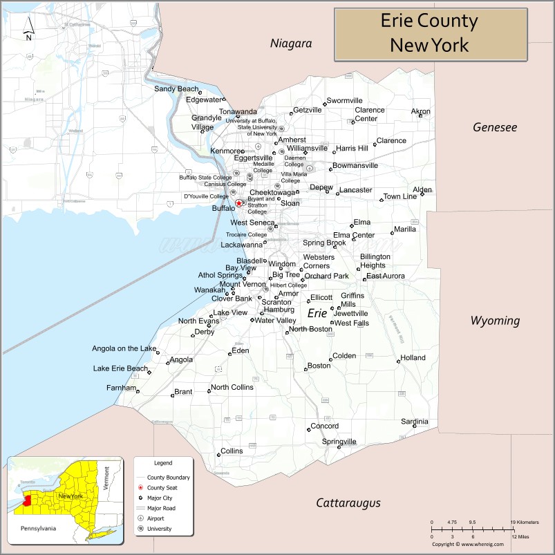
Erie County location map. Where is Erie County?
History
When counties were established by the English colonial authorities in the Province of New York in 1683, present-day Erie County was inhabited by the Iroquois. Significant colonization by White Americans did not begin until after the United States had gained independence with the end of the American Revolutionary War in 1783. The U.S. forced the Iroquois to cede most of their lands, as many had been allies of the British during the conflict.
About 1800, the Holland Land Company, formed by American businessmen and their Dutch associates, extinguished aboriginal claims by purchasing the land from New York, acquired the title to the territory of what are today the eight westernmost counties of New York, surveyed their holdings, established towns and began selling lots to individuals. The state was eager to attract settlers and have homesteads and businesses developed. At this time, all of western New York was included in Ontario County.
As the population increased, the state legislature created Genesee County in 1802 out of part of Ontario County. In 1808, Niagara County was created out of Genesee County. In 1821, Erie County was created out of Niagara County, encompassing all the land between Tonawanda Creek and Cattaraugus Creek. The first towns formed in present-day Erie County were the Town of Clarence and the Town of Willink. Clarence and Willink comprised the northern and southern portions of Erie county, respectively. Clarence is still a distinct town, but Willink was quickly subdivided into other towns. When Erie County was established in 1821, it consisted of the towns of Amherst, Aurora, Boston, Clarence, Collins, Concord, Eden, Evans, Hamburg, Holland, Sardinia and Wales.
The county has a number of houses and other properties listed on the National Register of Historic Places listings in Erie County, New York.
In 1861, the hamlet of Town Line in the Town of Lancaster voted 85–40 to secede from the Union. Town Line never sought admission into the Confederate States of America and there is no evidence that men from the community ever fought for the Confederacy. Some reporting from that time indicates the vote was a joke. On January 24, 1946, as part of a nationally reported event, Town Line voted to officially return to the Union after 85 years of Union secession.
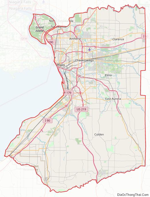
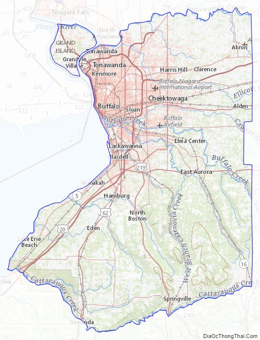
Erie County Road Map
Geography
According to the U.S. Census Bureau, the county has a total area of 1,227 square miles (3,180 km), of which 1,043 square miles (2,700 km) (85%) is land and 184 square miles (480 km) (15%) is water.
Erie County is in the western portion of upstate New York, bordering on the lake of the same name. Part of the industrial area that has included Buffalo, it is the most populous county in upstate New York outside of the New York City metropolitan area. The county also lies on the international border between the United States and Canada, bordering the Province of Ontario.
The northern border of the county is Tonawanda Creek. Part of the southern border is Cattaraugus Creek. Other major streams include Buffalo Creek (Buffalo River), Cayuga Creek, Cazenovia Creek, Scajaquada Creek, Eighteen Mile Creek and Ellicott Creek. The county’s northern half, including Buffalo and its suburbs, is known as the Northtowns and is relatively flat and rises gently up from the lake. The southern half, known as the Southtowns, is much hillier. It has the northwesternmost foothills of the Appalachian Mountains. The highest elevation in the county is a hill in the Town of Sardinia that tops out at around 1,940 feet (591 m) above sea level. The lowest ground is about 560 feet (171 m), on Grand Island at the Niagara River. The Onondaga Escarpment runs through the northern part of Erie County.
Rivers, streams and lakes
- Buffalo River
- Cattaraugus Creek
- Cayuga Creek
- Cazenovia Creek
- Eighteen Mile Creek
- Ellicott Creek
- Lake Erie
- Niagara River
- Scajaquada Creek
- Tonawanda Creek
Adjacent counties and municipality
- Niagara County – north
- Genesee County – northeast
- Wyoming County – southeast
- Cattaraugus County – south
- Chautauqua County – southwest
- Niagara Region, Ontario, Canada – northwest
Major highways
- Interstate 90 (New York State Thruway)
- Interstate 190 (Niagara Thruway)
- Interstate 290 (Youngmann Expressway)
- Interstate 990 (Lockport Expressway)
- U.S. Route 20 (Southwestern Boulevard/Transit Road/Broadway)
- U.S. Route 20A (Big Tree Road)
- U.S. Route 62 (South Park Avenue/Bailey Avenue/Niagara Falls Boulevard)
- U.S. Route 219 (Southern Expressway)
- New York State Route 5 (Hamburg Turnpike/Buffalo Skyway/Main Street)
- New York State Route 16 (Seneca Street)
- New York State Route 33 (Kensington Expressway/Genesee Street)
- New York State Route 39
- New York State Route 78 (Transit Road)
- New York State Route 179 (Milestrip Expressway/Road)
- New York State Route 198 (Scajaquada Expressway)
- New York State Route 263 (Grover Cleveland Highway/Millersport Highway)
- New York State Route 240 (Orchard Park Road/Harlem Road)
- New York State Route 277 (Union Road)
- New York State Route 324 (Grand Island Boulevard/Sheridan Drive)
- New York State Route 354 (Clinton Street)
- New York State Route 400 (Aurora Expressway)
National protected area
- Theodore Roosevelt Inaugural National Historic Site
State protected areas
- Amherst State Park, Town of Amherst.
- Beaver Island State Park, Town of Grand Island.
- Buckhorn Island State Park, Town of Grand Island.
- Buffalo Harbor State Park, City of Buffalo.
- Evangola State Park, Towns of Brant and Evans.
- Great Baehre Swamp Wildlife Management Area, Town of Amherst.
- Hampton Brook Woods Wildlife Management Area, Village of Hamburg.
- Knox Farm State Park, Town of East Aurora.
- Motor Island Wildlife Management Area, Town of Grand Island.
- Onondaga Escarpment Unique Area, Town of Akron.
- Reinstein Woods Nature Preserve, Town of Cheektowaga.
- Spicer Creek Wildlife Management Area, Town of Grand Island.
- Strawberry Island State Park, Town of Townawanda.
- Tillman Road Wildlife Management Area, Town of Clarence.
- Woodlawn Beach State Park, Town of Hamburg.
- Zoar Valley Multiple Use Area, Town of Collins.
Erie County Topographic Map
Erie County Satellite Map

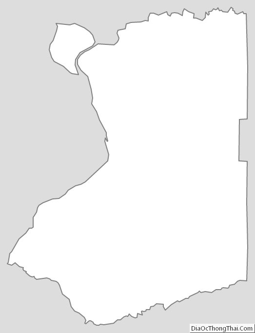
Erie County Outline Map