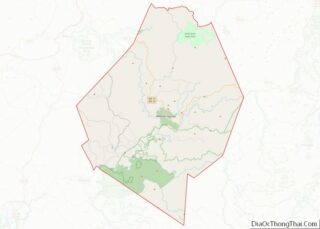
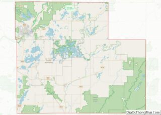
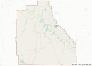
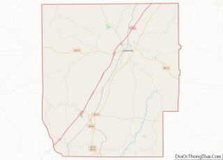
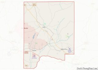
Map of Ionia County

Map of Ionia County, Michigan

Ionia County (/aɪˈoʊnjə/ eye-OH-nyə) is a county located in the U.S. state of Michigan. As of the 2020 census, the population was 66,804. The county seat is Ionia. The Ionia County Courthouse was designed by Claire Allen, a prominent southern Michigan architect. Ionia County is part of the Grand Rapids-Kentwood metropolitan statistical area. Ionia County … Read more

Map of Lenawee County

Map of Lenawee County, Michigan

Lenawee County (/ˈlɛnəweɪ/ LEN-ə-way) is a county located in the U.S. state of Michigan. As of the 2020 United States Census, the population was 99,423. The county seat is Adrian. The county was created in 1822, from territory partitioned from Monroe County. Its governing structure was organized in 1826. Lenawee County comprises the Adrian, MI … Read more

Map of Newaygo County

Map of Newaygo County, Michigan

Newaygo County (/nəweɪɡoʊ/ nə-WAY-goh) is a county in the U.S. state of Michigan. As of the 2020 United States Census, the population was 49,978. The county seat is White Cloud. The county was created in 1840, and was organized in 1851. It was either named for an Ojibwe leader who signed the Treaty of Saginaw … Read more

Map of Shiawassee County

Map of Shiawassee County, Michigan

Shiawassee County (/ˌʃaɪəˈwɒsi/ shy-ə-WAH-see) is a county located in the U.S. state of Michigan. As of the 2020 United States Census, the population was 68,094. The county seat is Corunna, and the largest city in the county is Owosso. In 2010, the center of population of Michigan was located in Shiawassee County, in Bennington Township. … Read more

Map of Cass County

Map of Cass County, Minnesota

Cass County is a county in the central part of the U.S. state of Minnesota. As of the 2020 census, the population was 30,066. Its county seat is Walker. The county was formed in 1851, and was organized in 1897. Cass County is included in the Brainerd, MN Micropolitan Statistical Area. A substantial part of … Read more

Map of Hennepin County

Map of Hennepin County, Minnesota

Hennepin County (/ˈhɛnəpɪn/ HEN-ə-pin) is a county in the U.S. state of Minnesota. Its county seat is Minneapolis, the state’s most populous city. The county is named in honor of the 17th-century explorer Father Louis Hennepin. The county extends from Minneapolis to the suburbs and outlying cities in the western part of the county. The … Read more

Map of Lyon County

Map of Lyon County, Minnesota

Lyon County is a county in the U.S. state of Minnesota. As of the 2020 census, the population was 25,269. Its county seat is Marshall. Lyon County comprises the Marshall, MN Micropolitan Statistical Area. Lyon County overview: Name: Lyon County FIPS code: 27-083 State: Minnesota Founded: March 6, 1868March 2, 1869 Named for: Nathaniel Lyon … Read more

Map of Pine County

Map of Pine County, Minnesota

Pine County is a county in the U.S. state of Minnesota. As of the 2020 census, the population was 28,876. Its county seat is Pine City. The county was formed in 1856 and organized in 1872. Part of the Mille Lacs Indian Reservation is in Pine County. Pine County overview: Name: Pine County FIPS code: … Read more

Map of Steele County

Map of Steele County, Minnesota

Steele County is a county in the U.S. state of Minnesota. As of the 2020 census, the population was 37,406. Its county seat is Owatonna. Steele County comprises the Owatonna Micropolitan Statistical Area. Steele County overview: Name: Steele County FIPS code: 27-147 State: Minnesota Founded: February 20, 1855 Named for: Franklin Steele Seat: Owatonna Largest … Read more

Map of Amite County

Map of Amite County, Mississippi

Amite County /ˈeɪ.mɛt/ is a county located in the state of Mississippi on its southern border with Louisiana. As of the 2020 census, the population was 12,720. Its county seat is Liberty. The county is named after the Amite River, which runs through the county. Amite County is part of the McComb, MS micropolitan statistical … Read more

Map of Franklin County

Map of Franklin County, Mississippi

Franklin County is a county located in the U.S. state of Mississippi. As of the 2020 census, the population was 7,675. Its county seat is Meadville. The county was formed on December 21, 1809, from portions of Adams County and named for Founding Father Benjamin Franklin. It is bisected by the Homochitto River, which runs … Read more

Map of Kemper County

Map of Kemper County, Mississippi

Kemper County is a county located on the central eastern border of the U.S. state of Mississippi. As of the 2020 census, the population was 8,988. Its county seat is De Kalb. The county is named in honor of Reuben Kemper. The county is part of the Meridian, MS Micropolitan Statistical Area. In 2010 the … Read more