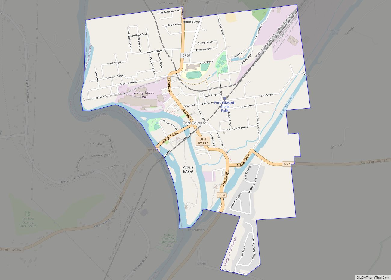
Washington County is a county in the U.S. state of New York. As of the 2020 census, the population was 61,302. The county seat is Fort Edward. The county was named for U.S. President George Washington.
Washington County is part of the Glens Falls, NY Metropolitan Statistical Area, which is also included in the Albany–Schenectady, NY Combined Statistical Area.
| Name: | Washington County |
|---|---|
| FIPS code: | 36-115 |
| State: | New York |
| Founded: | 1772 |
| Named for: | George Washington |
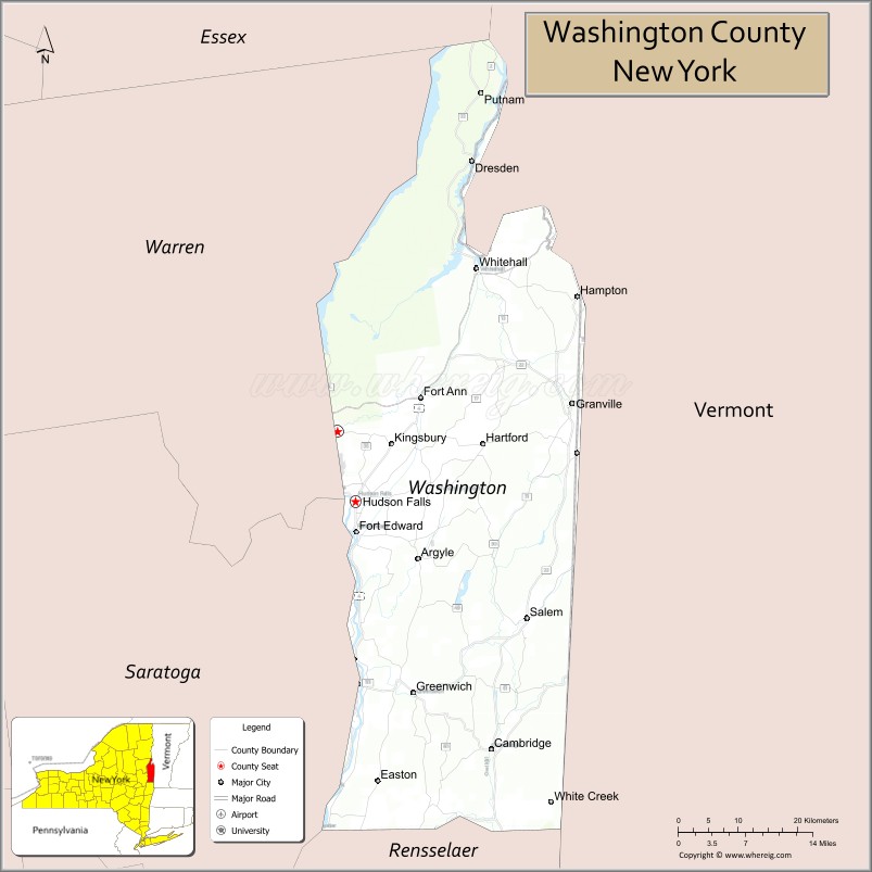
| Seat: | Fort Edward |
| Total Area: | 846 sq mi (2,190 km²) |
| Land Area: | 831 sq mi (2,150 km²) |
| Total Population: | 61,302 |
| Population Density: | 73.8/sq mi (28.5/km²) |
| Time zone: | UTC−5 (Eastern) |
| Summer Time Zone (DST): | UTC−4 (EDT) |
| Website: | www.washingtoncountyny.gov |
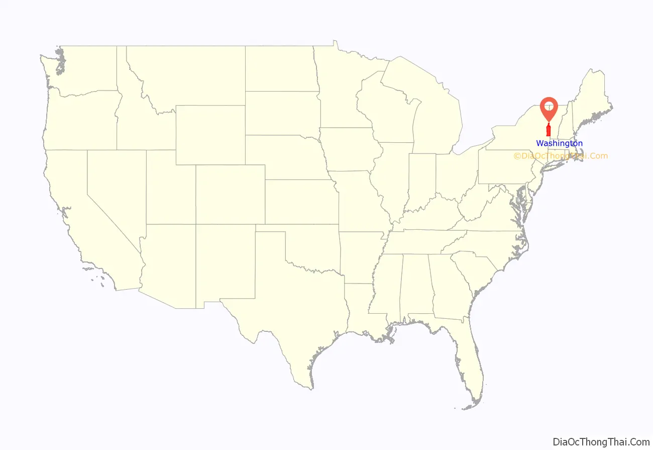
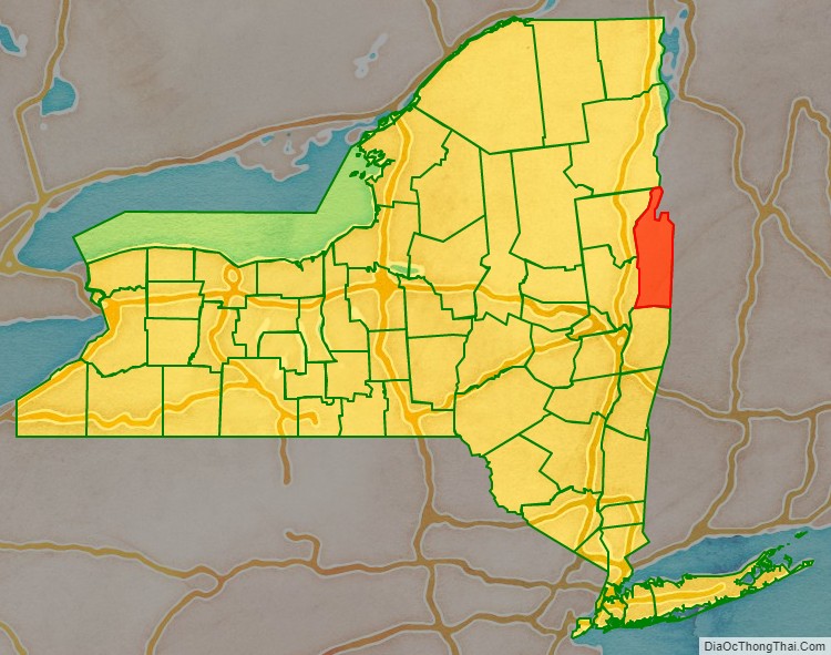
Washington County location map. Where is Washington County?
History
When counties were established in the colony of New York in 1683, the present Washington County was part of Albany County. This was an enormous county, including the northern part of New York State as well as all of the present state of Vermont and, in theory, extending westward to the Pacific Ocean. This county was reduced in size on July 3, 1766, by the creation of Cumberland County, and further on March 16, 1770, by the creation of Gloucester County, both containing territory now in Vermont.
On March 12, 1772, what was left of Albany County was split into three parts, one remaining under the name Albany County. The other two were called Tryon County (later renamed Montgomery County) and Charlotte County.
On April 2, 1784, Charlotte County was renamed Washington County in honor of George Washington, the American Revolutionary War general and later President of the United States of America.
In 1788, Clinton County was split off from Washington County. This was a much larger area than the present Clinton County, including several other counties or county parts of the present New York State.
In 1791, the Town of Cambridge was transferred from Albany County to Washington County.
In 1813, Warren County was split off from Washington County.
In 1994, with the completion of the new municipal center, the county seat was moved from Hudson Falls to Fort Edward.
In 2006, Cambridge Town Supervisor Jo Ann Trinkle made history by being elected as the first chairwoman of the Board of Supervisors.
Historic sites
Washington County has four historic covered bridges, each listed on the National Register of Historic Places:
- Buskirk Bridge
- Eagleville Bridge
- Rexleigh Bridge
- Shushan Bridge
Including those, it has a total of 35 sites listed on the National Register. The Lemuel Haynes House is designated as a National Historic Landmark, the highest level of significance.
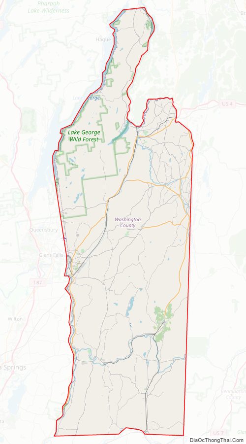
Washington County Road Map
Geography
According to the U.S. Census Bureau, the county has a total area of 846 square miles (2,190 km), of which 831 square miles (2,150 km) is land and 15 square miles (39 km) (1.7%) is water.
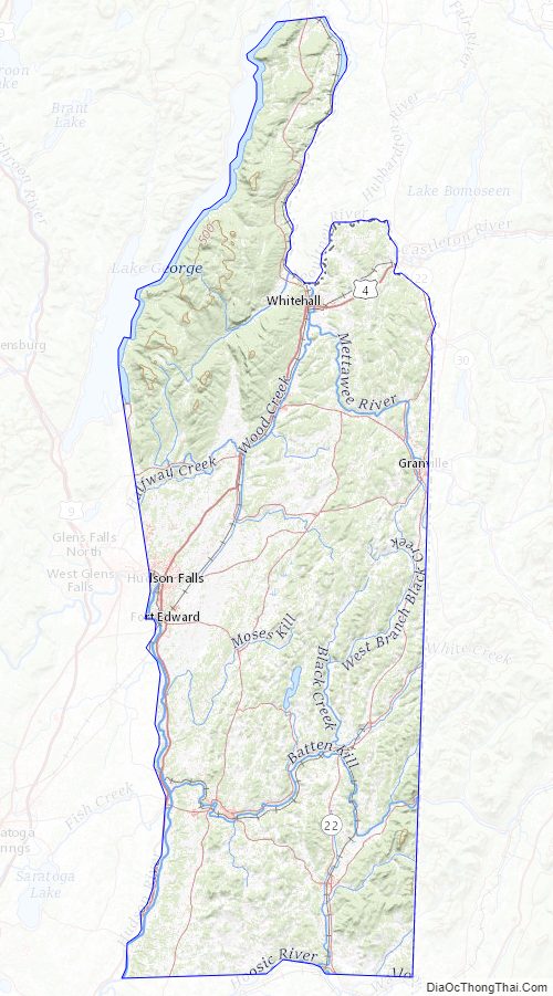
Washington County is a long narrow county located in the northeastern section of the State. It is known for its rich valley farm land and is part of the Great Appalachian Valley (also known simply as the ‘Great Valley’) which is a long narrow valley strip often between tall mountain ranges. The county transitions from the Taconic Mountains to the Adirondack Mountains, and from the Lake Champlain Valley to Hudson River Valley.
Much of the county is part of the slate valley of the Upper Taconic Mountains (Taghkanic, meaning ‘in the trees’). The eastern boundary of Washington County is the New York–Vermont border, part of which is Lake Champlain. This is also the border with New England proper. The northern end of the county is within the 6.1 million acre Adirondack Park. Western boundaries include primarily the Hudson River and Lake George.
Washington County belongs to the following valleys and watersheds: Champlain Valley / Lake George Watershed—02010001 Hudson River Valley / Hudson-Hoosic Watershed—02020003 Waters in the northern part drain into Lake Champlain via Lake George (Horican) or the Mettawee River, and then flow into the Saint Lawrence River (Kaniatarowanenneh). These waters mingle in the Saint Lawrence with waters of all the Great Lakes as they flow northeast into the Gulf of Saint Lawrence, and ultimately join the Atlantic Ocean. Meanwhile, the remainder of waters drain south via the Hudson River (Muh-he-kun-ne-tuk or Muhheakantuck), and ultimately flow south into the Atlantic Ocean below New York City. See the approximation of the watershed divide mapped in context of mountains and valleys.
Nearly half of its borders are by long bodies of water. Winding across the bottom of the county is the legendary Batten Kill (Dionondehowa), famous for its worldclass flyfishing, and its marvelous falls (near the Washington County fairgrounds).
Black Mountain, in the Adirondacks, is the tallest peak in Washington County at approximately 2,640 feet (800 meters), and has beautiful views of Lake George, Lake Champlain, the surrounding countryside, and the Adirondacks, Taconic Mountains and Green Mountains. Willard Mountain is a ski center in the southern part of the county.
Adjacent counties
- Essex County – north
- Addison County, Vermont – northeast
- Rutland County, Vermont – east
- Bennington County, Vermont – southeast
- Rensselaer County – south
- Saratoga County – southwest
- Warren County – west
Washington County Topographic Map
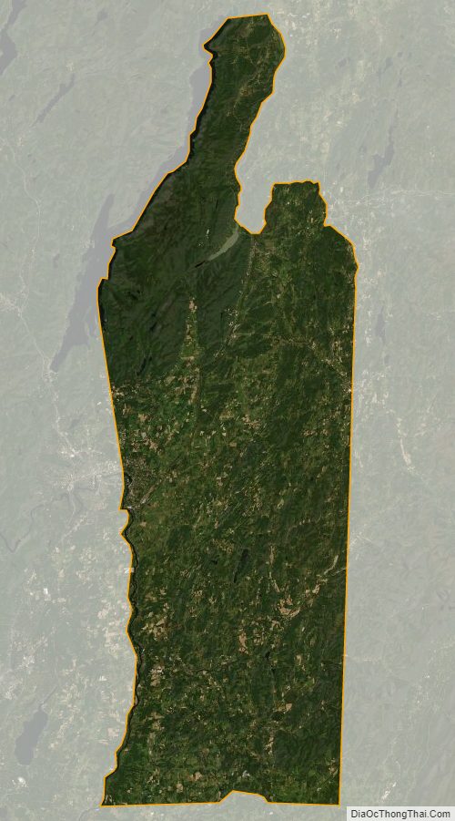
Washington County Satellite Map
Washington County Outline Map