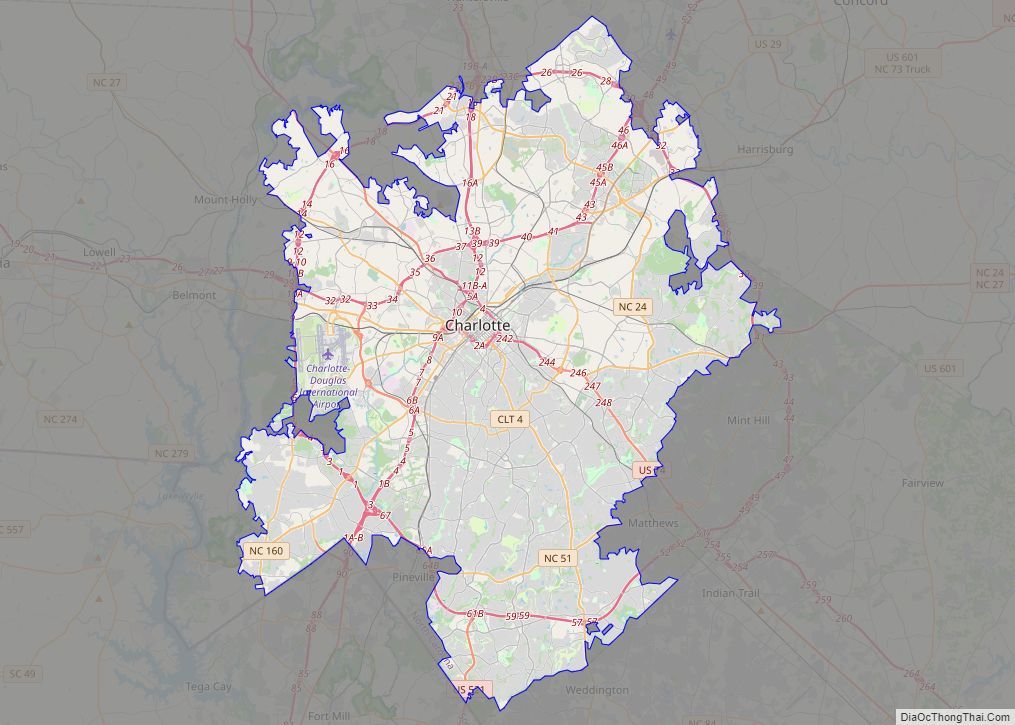
Mecklenburg County is a county located in the southwestern region of the state of North Carolina, in the United States. As of the 2020 census, the population was 1,115,482, making it the second-most populous county in North Carolina (after Wake County) and the first county in the Carolinas to surpass one million in population. Its county seat is Charlotte, the state’s largest city.
Mecklenburg County is the central county of the Charlotte-Concord-Gastonia, NC-SC Metropolitan Statistical Area. On September 12, 2013, the county welcomed its one millionth resident.
Like its seat, the county is named after Charlotte of Mecklenburg-Strelitz, Queen of the United Kingdom (1761–1818), whose name is derived from the region of Mecklenburg in Germany, itself deriving its name from Mecklenburg Castle (Mecklenburg meaning “large castle” in Low German) in the village of Dorf Mecklenburg.
| Name: | Mecklenburg County |
|---|---|
| FIPS code: | 37-119 |
| State: | North Carolina |
| Founded: | December 11, 1762 |
| Named for: | Charlotte of Mecklenburg-Strelitz |
| Seat: | Charlotte |
| Largest city: | Charlotte |
| Total Area: | 546 sq mi (1,410 km²) |
| Land Area: | 524 sq mi (1,360 km²) |
| Total Population: | 1,115,482 |
| Population Density: | 2,000/sq mi (790/km²) |
| Time zone: | UTC−5 (Eastern) |
| Summer Time Zone (DST): | UTC−4 (EDT) |
| Website: | www.mecknc.gov |
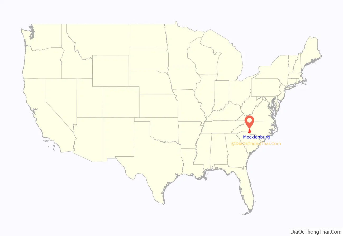
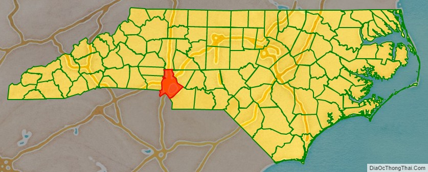
Mecklenburg County location map. Where is Mecklenburg County?
History
Mecklenburg County was formed in 1762 from the western part of Anson County, both in the Piedmont section of the state. It was named in commemoration of the marriage of King George III to Charlotte of Mecklenburg-Strelitz, for whom the county seat Charlotte is named. Due to unsure boundaries, a large part of south and western Mecklenburg County extended into areas that would later form part of the state of South Carolina. In 1768, most of this area (the part of Mecklenburg County west of the Catawba River) was designated Tryon County, North Carolina.
Determining the final boundaries of these “western” areas between North and South Carolina was a decades-long process. As population increased in the area following the American Revolutionary War, in 1792 the northeastern part of Mecklenburg County was taken by the North Carolina legislature for Cabarrus County. Finally, in 1842 the southeastern part of Mecklenburg County was combined with the western part of Anson County to form Union County.
The Mecklenburg Declaration of Independence was allegedly signed on May 20, 1775, and if the document is genuine, Mecklenburg County was the first part of the Thirteen Colonies to declare independence from Great Britain. The “Mecklenburg Resolves” were adopted on May 31, 1775. Mecklenburg continues to celebrate the Meck Dec each year in May. The date of the Mecklenburg Declaration is also listed on the flag of North Carolina, represented by the date of May 20, 1775 as one of two dates on the Flag of North Carolina.
in 1917, during World War I, Camp Greene was established west of Charlotte as a training camp for the army, it was later decommissioned. Around the 1930s and 40s, the population began to rapidly, during this time, Charlotte Memorial Hospital and Charlotte College (Now UNCC) were built. Lake Norman was also completed in 1964 after a 5 year construction period.
In the mid-20 century, the county continued to see rapid growth. Many new government building were constructed, Charlotte Douglas International Airport was also expanded in 1954. By 1960, a quarter million people were living in the county with that number hitting half a million by 1990. An unsuccessful attempt to form a Consolidated city-county government was tried in 1971, but was voted down residents. The Metropolitan Statistical Area now includes 6 counties in both North and South Carolina with a combined population of 2,595,027 in 2020.
In mid-2020, the county was the site of the 2020 Colonial Pipeline oil spill, wherein about 2,000,000 U.S. gal (7,600,000 L) of gasoline leaked from the Colonial Pipeline in the Oehler Nature Preserve near Huntersville. It is one of the largest gasoline spills in U.S. history and cleanup efforts are expected to last for several years.
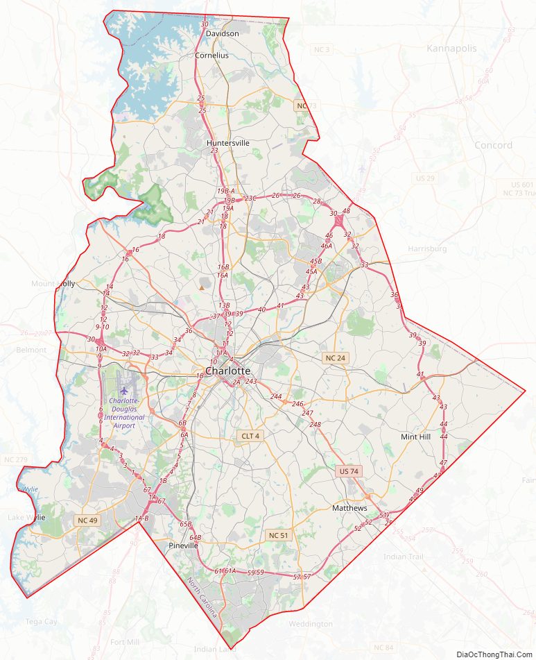
Mecklenburg County Road Map
Geography
According to the U.S. Census Bureau, the county has a total area of 546 square miles (1,410 km), of which 524 square miles (1,360 km) is land and 22 square miles (57 km) (4.0%) is water.
State and local protected areas/sites
- Carowinds (partially in South Carolina)
- Historic Latta Plantation
- Historic Rural Hill/Nature Preserve
- President James K. Polk Historic Site
Nature preserves in Charlotte:
- Auten Nature Preserve
- Cowans Ford Wildlife Refuge
- Ferrelltown Nature Preserve
- Latta Nature Preserve
- McDowell Nature Preserve
- Possum Walk Nature Preserve
- Reedy Creek Nature Preserve
- Sherman Branch Nature Preserve
- Stevens Creek Nature Preserve
Major water bodies
- Catawba River
- Lake Norman
- Mountain Island Lake
- Rocky River
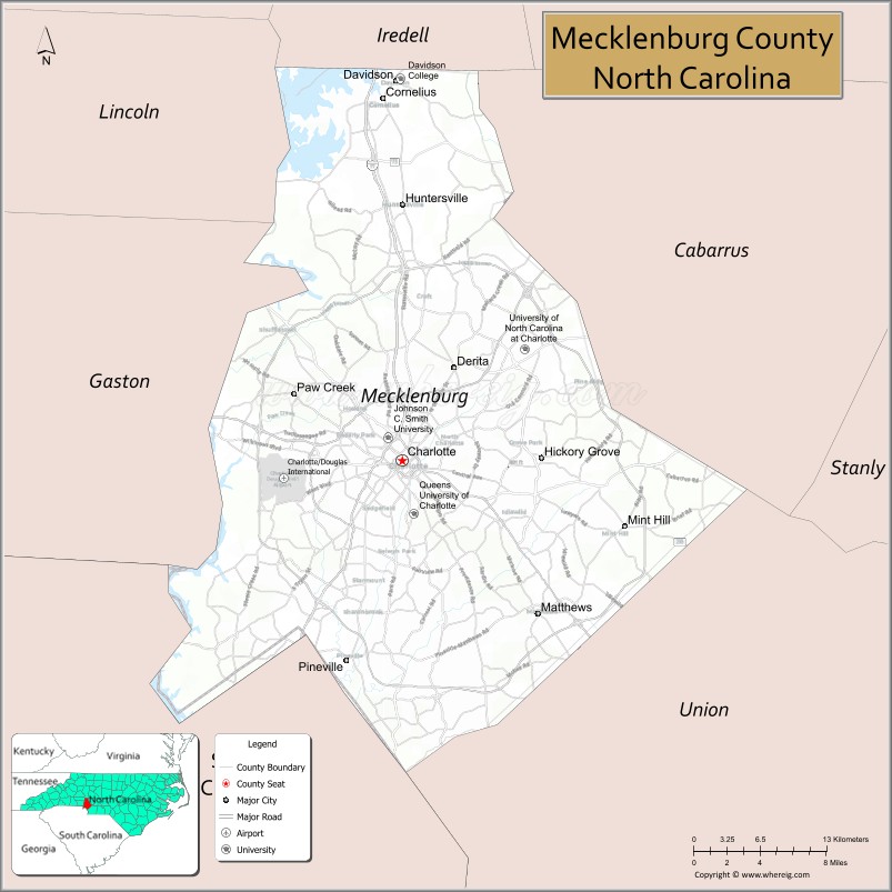
Adjacent counties
- Iredell County – north
- Cabarrus County – northeast
- Union County – southeast
- Lancaster County, South Carolina – south
- York County, South Carolina – southwest
- Gaston County – west
- Lincoln County – northwest
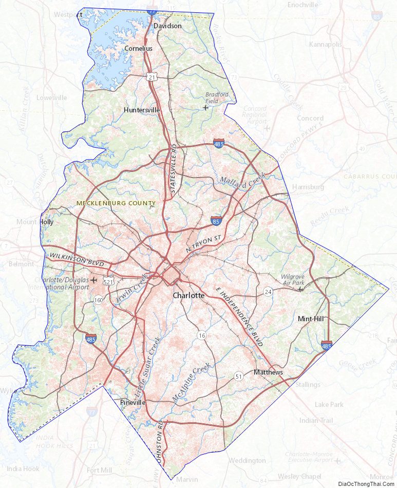
Mecklenburg County Topographic Map
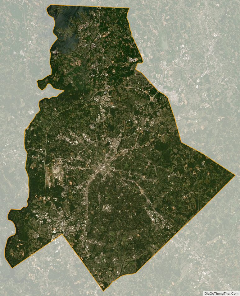
Mecklenburg County Satellite Map
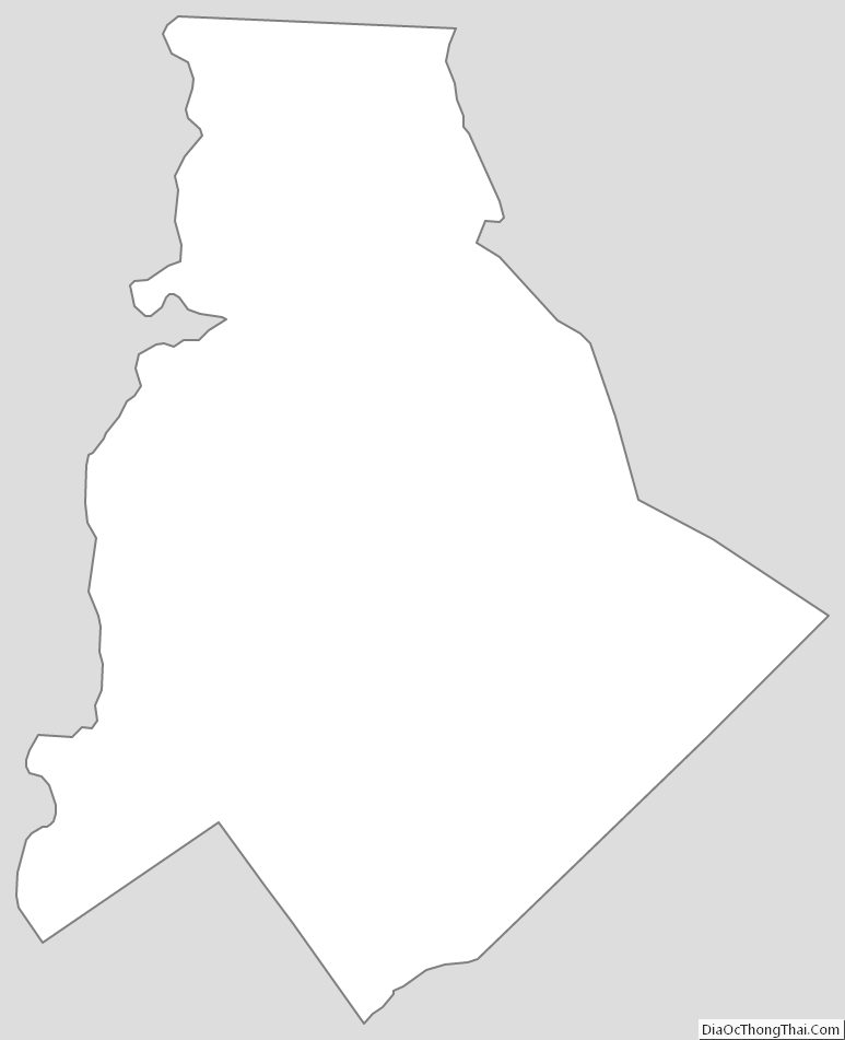
Mecklenburg County Outline Map