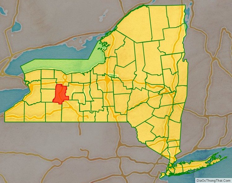
Livingston County is a county in the U.S. state of New York. As of the 2020 census, the population was 61,834. Its county seat is Geneseo. The county is named after Robert R. Livingston, who helped draft the Declaration of Independence and negotiated the Louisiana Purchase.
Livingston County is part of the Rochester Metropolitan Statistical Area.
| Name: | Livingston County |
|---|---|
| FIPS code: | 36-051 |
| State: | New York |
| Founded: | 1821 |
| Named for: | Robert R. Livingston |
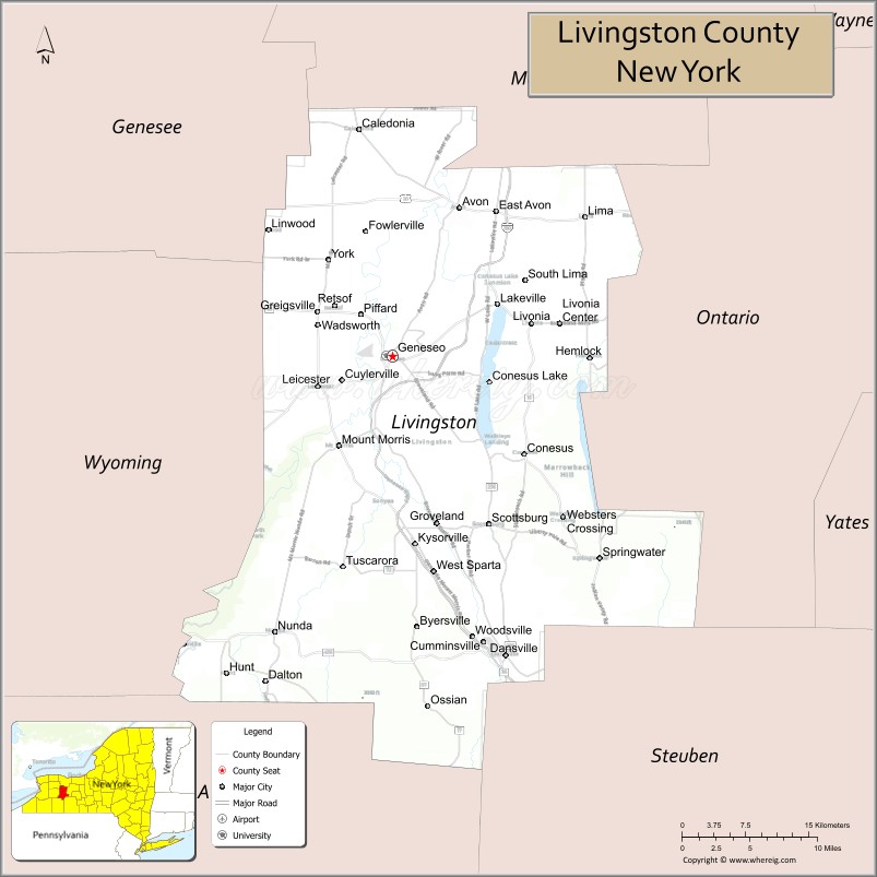
| Seat: | Geneseo |
| Total Area: | 640 sq mi (1,700 km²) |
| Land Area: | 632 sq mi (1,640 km²) |
| Total Population: | 61,834 |
| Population Density: | 97.9/sq mi (37.8/km²) |
| Time zone: | UTC−5 (Eastern) |
| Summer Time Zone (DST): | UTC−4 (EDT) |
| Website: | www.co.livingston.state.ny.us |
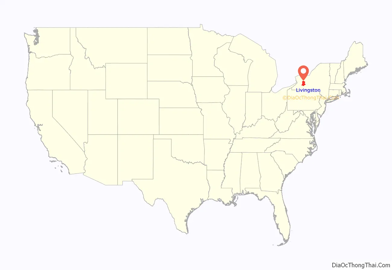
Livingston County location map. Where is Livingston County?
History
On February 23, 1821, Livingston County, New York was formed from Ontario and Genesee Counties. The twelve original towns were: Avon, Caledonia, Conesus, Geneseo (county seat), Groveland, Leicester, Lima, Livonia, Mount Morris, Sparta, Springwater, and York.
Part of North Dansville was annexed from Steuben County in 1822 and became a separate town when Sparta was divided in 1846. At the same time, the town of West Sparta was also formed from Sparta. The towns of Nunda and Portage were annexed in 1846 and the town of Ossian was annexed in 1857 from Allegany County.
Avon, Williamsburgh, and the hamlet of Lakeville competed for the honor of becoming the Livingston County seat, but the distinction was bestowed upon Geneseo, the principal village and center of commerce. The Wadsworths donated a suitable lot, beautifully situated at the north end of the village. The brick courthouse faced Main Street, the jail of wood construction was built directly west, and a one-story cobblestone building for the County Clerk’s office was built east of the courthouse. Until construction was completed in 1823, court was held in the upper story of the district school on Center Street (east of the present-day Livingston County Museum) and prisoners were housed in Canandaigua. In 1829 the county opened a poor house farm just outside the village.
Livingston County Flag
The County Flag was adopted in 1971 for the county’s 150th anniversary. The significance of the colors and design relates to features and history of the county:
Yellow – the golden grain of the northern towns;
Blue – the Genesee River;
Green – the forests in the southern towns;
White – salt and limestone, prominent minerals in the county;
Balance and crossed quills – in honor of New York’s first Chancellor Robert R. Livingston, for whom the county was named.
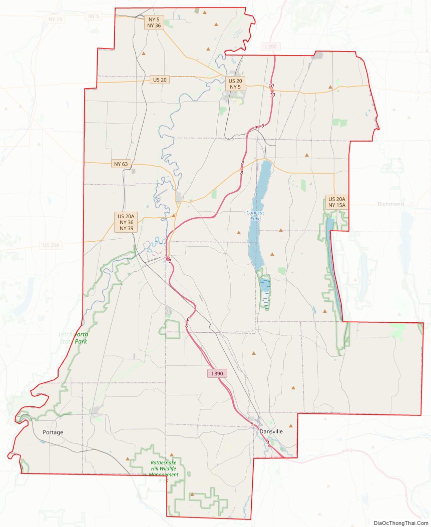
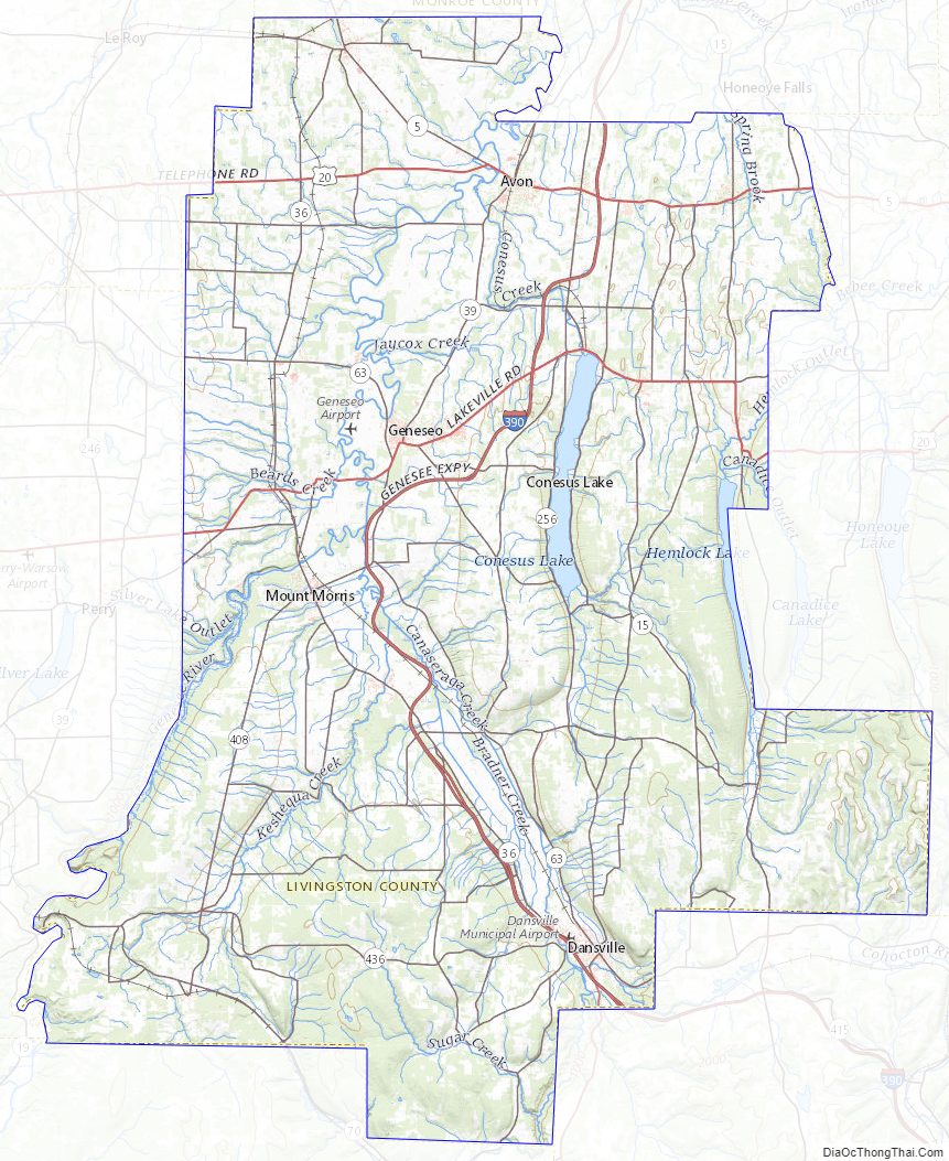
Livingston County Road Map
Geography
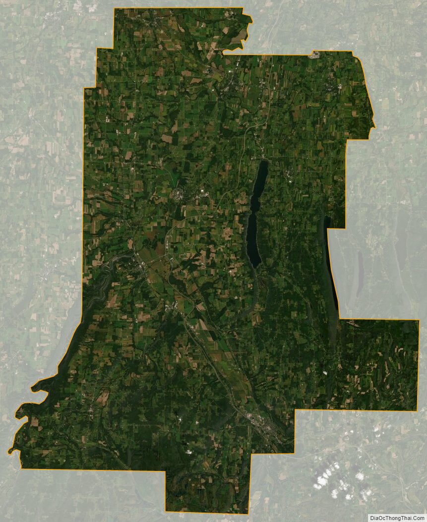
According to the U.S. Census Bureau, the county has a total area of 640 square miles (1,700 km), of which 632 square miles (1,640 km) is land and 8.5 square miles (22 km) (1.3%) is water.
Livingston County is located in the Finger Lakes region, south of Rochester and east of Buffalo.
Letchworth State Park is partly in the western part of the county. The Genesee River flows northward through the county.
The Rochester and Southern Railroad (RSR) traverses the county from Greigsville south through Mount Morris to Dansville.
Adjacent counties
- Monroe County – north
- Ontario County – east
- Steuben County – southeast
- Allegany County – south
- Wyoming County – west
- Genesee County – northwest
Major highways
- Interstate 390
- U.S. Route 20
- U.S. Route 20A
- New York State Route 5
- New York State Route 15
- New York State Route 15A
- New York State Route 36
- New York State Route 39
- New York State Route 63
- New York State Route 65
Livingston County Topographic Map
Livingston County Satellite Map
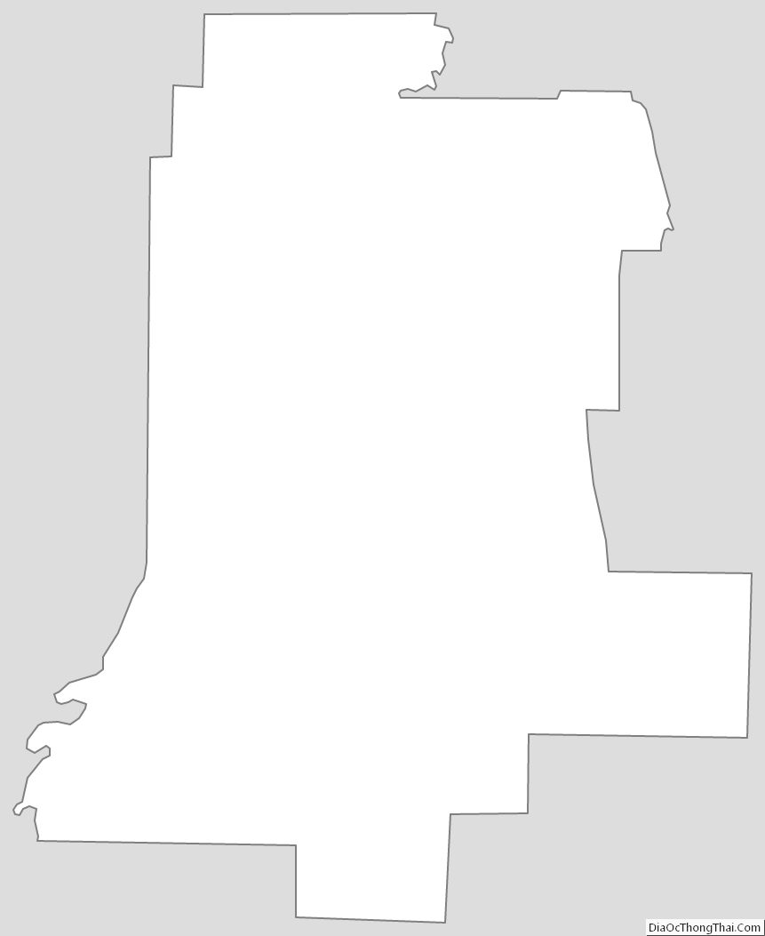
Livingston County Outline Map