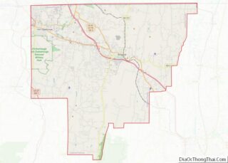
Map of Klickitat County, Washington
Klickitat County is a county located in the U.S. state of Washington. As of the 2020 census, the population was 22,735. The county seat and largest city is Goldendale. The county is named after the Klickitat tribe. Klickitat County overview: Name: Klickitat County FIPS code: 53-039 State: Washington Founded: December 20, 1859 Named for: Klickitat ... Read more
Map of Klickitat County, Washington
Map of Walla Walla County, Washington
Walla Walla County is a county located in the U.S. state of Washington. As of the 2020 census, its population was 62,584. The county seat and largest city is Walla Walla. The county was formed on April 25, 1854 and is named after the Walla Walla tribe of Native Americans. Walla Walla County is included ... Read more
Map of Walla Walla County, Washington
Map of Greenbrier County, West Virginia
Greenbrier County (/ˈɡriːnbraɪ.ər/) is a county in the U.S. state of West Virginia. As of the 2020 census, the population was 32,977. Its county seat is Lewisburg. The county was formed in 1778 from Botetourt and Montgomery counties in Virginia. Greenbrier County overview: Name: Greenbrier County FIPS code: 54-025 State: West Virginia Founded: October 20, ... Read more
Map of Greenbrier County, West Virginia
Map of Mineral County, West Virginia
Mineral County is a county in the U.S. state of West Virginia. It is part of the Cumberland, MD-WV Metropolitan Statistical Area. As of the 2020 census, the population was 26,938. Its county seat is Keyser. The county was founded in 1866. Mineral County overview: Name: Mineral County FIPS code: 54-057 State: West Virginia Founded: ... Read more
Map of Mineral County, West Virginia
Map of Summers County, West Virginia
Summers County is a county located in the U.S. state of West Virginia. As of the 2020 census, the population was 11,959. Its county seat is Hinton. The county was created by an act of the West Virginia Legislature on February 27, 1871, from parts of Fayette, Greenbrier, Mercer and Monroe counties and named in ... Read more
Map of Summers County, West Virginia
Map of Buffalo County, Wisconsin
Buffalo County is a county located in the U.S. state of Wisconsin. As of the 2020 census, the population was 13,317. Its county seat is Alma. The county was created in 1853 and organized the following year. Buffalo County overview: Name: Buffalo County FIPS code: 55-011 State: Wisconsin Founded: 1854 Named for: Buffalo River Seat: ... Read more
Map of Buffalo County, Wisconsin
Map of Grant County, Wisconsin
Grant County is a county located in the U.S. state of Wisconsin. As of the 2020 census, the population was 51,938. Its county seat is Lancaster. The county is named after the Grant River, in turn named after a fur trader who lived in the area when Wisconsin was a territory. Grant County comprises the ... Read more
Map of Grant County, Wisconsin
Map of Manitowoc County, Wisconsin
Manitowoc County /ˈmænɪtəwɔːk/ is a county in the U.S. state of Wisconsin. As of the 2020 census, the population was 81,359. Its county seat is Manitowoc. The county was created in 1836 prior to Wisconsin’s statehood and organized in 1848. Manitowoc County comprises the Manitowoc, WI Micropolitan Statistical Area. Manitowoc County overview: Name: Manitowoc County ... Read more
Map of Manitowoc County, Wisconsin
Map of Racine County, Wisconsin
Racine County (rus-EEN, sometimes also ray-SEEN) is a county in southeastern Wisconsin. As of the 2020 census, its population was 197,727, making it Wisconsin’s fifth-most populous county. Its county seat is Racine. The county was founded in 1836, then a part of the Wisconsin Territory. Racine County comprises the Racine metropolitan statistical area. This area ... Read more
Map of Racine County, Wisconsin
Map of Waukesha County, Wisconsin
Waukesha County overview: Name: Waukesha County FIPS code: 55-133 State: Wisconsin Largest city: Waukesha Total Area: 581 sq mi (1,500 km²) Land Area: 550 sq mi (1,400 km²) Total Population: 406,978 Population Density: 740.3/sq mi (285.8/km²) Waukesha County location map. Where is Waukesha County? History Known as forested and prairie land, the region was first home to Indigenous tribes like Menomonie, Ojibwe ... Read more
Map of Waukesha County, Wisconsin
Map of Lincoln County, Wyoming
Lincoln County is a county in the U.S. state of Wyoming. As of the 2020 United States Census, the population was 19,581. Its county seat is Kemmerer. Its western border abuts the eastern borders of the states of Idaho and Utah. Lincoln County overview: Name: Lincoln County FIPS code: 56-023 State: Wyoming Founded: February 21, ... Read more
Map of Lincoln County, Wyoming
Map of Baldwin County, Alabama
Baldwin County is a county located in the southwestern part of the U.S. state of Alabama, on the Gulf coast. It is one of only two counties in Alabama that border the Gulf of Mexico, along with Mobile County. As of the 2020 census, the population was 231,767. The county seat is Bay Minette. The ... Read more
Map of Baldwin County, Alabama