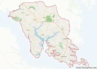
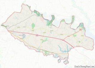
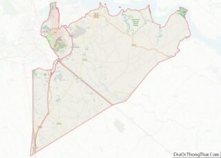
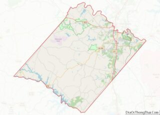
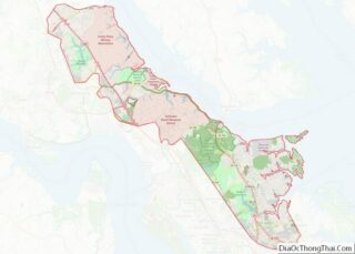
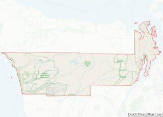
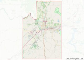
Map of Wasatch County, Utah
Wasatch County (/ˈwɑːsætʃ/ WAH-satch) is a county in the U.S. state of Utah. As of the 2010 United States Census, the population was 23,530. Its county seat and largest city is Heber City. The county was named for a Ute Native American word meaning mountain pass or low place in the high mountains. Wasatch County ... Read more
Map of Wasatch County, Utah
Map of Windham County, Vermont
Windham County is a county located in the U.S. state of Vermont. As of the 2020 census, the population was 45,905. The shire town (county seat) is Newfane, and the largest municipality is the town of Brattleboro. Windham County overview: Name: Windham County FIPS code: 50-025 State: Vermont Founded: 1781 Named for: Windham, Vermont, which ... Read more
Map of Windham County, Vermont
Map of Bristol City, Virginia
Bristol City overview: Name: Bristol City FIPS code: 51-520 State: Virginia Total Area: 13.00 sq mi (33.66 km²) Land Area: 12.87 sq mi (33.34 km²) Total Population: 17,219 Population Density: 1,300/sq mi (510/km²) Bristol City location map. Where is Bristol City? History Evan Shelby first appeared in what is now the Bristol area around 1765. In 1766, Shelby moved his family and ... Read more
Map of Bristol City, Virginia
Map of Covington City, Virginia
Covington is an independent city in the Commonwealth of Virginia. As of the 2020 census, the population was 5,737, making it the second-least populous city in Virginia. It is surrounded by Alleghany County, of which it is also the county seat. Located at the confluence of Jackson River and Dunlap Creek, Covington is one of ... Read more
Map of Covington City, Virginia
Map of Frederick County, Virginia
Frederick County is located in the Commonwealth of Virginia. As of the 2020 census, the population was 91,419. Its county seat is Winchester. The county was formed in 1743 by the splitting of Orange County. It is Virginia’s northernmost county. Frederick County is included in the Winchester, VA-WV Metropolitan Statistical Area, which is also included ... Read more
Map of Frederick County, Virginia
Map of Hopewell City, Virginia
Hopewell is an independent city surrounded by Prince George County and the Appomattox River in the Commonwealth of Virginia, United States. At the 2020 census, the population was 23,033. The Bureau of Economic Analysis combines the city of Hopewell with Prince George County for statistical purposes. Hopewell is in the Tri-Cities area of the Richmond ... Read more
Map of Hopewell City, Virginia
Map of Martinsville City, Virginia
Martinsville is an independent city in the Commonwealth of Virginia in the United States. As of the 2020 census, the population was 13,485. A community of both Southside and Southwest Virginia, it is the county seat of Henry County, although the two are separate jurisdictions. The Bureau of Economic Analysis combines the city of Martinsville ... Read more
Map of Martinsville City, Virginia
Map of Petersburg City, Virginia
Petersburg is an independent city in the Commonwealth of Virginia in the United States. As of the 2020 census, the population was 33,458. The Bureau of Economic Analysis combines Petersburg (along with the city of Colonial Heights) with Dinwiddie County for statistical purposes. The city is 21 miles (34 km) south of the commonwealth (state) capital ... Read more
Map of Petersburg City, Virginia
Map of Russell County, Virginia
Russell County (/rʌs.səl/) is a county located in the Commonwealth of Virginia. As of the 2020 census, the population was 25,781. Its county seat is Lebanon. Russell County overview: Name: Russell County FIPS code: 51-167 State: Virginia Founded: January 2, 1786 Named for: William Russell Seat: Lebanon Largest town: Lebanon Total Area: 477 sq mi (1,240 km²) Land ... Read more
Map of Russell County, Virginia
Map of Waynesboro City, Virginia
Waynesboro (formerly Flack) is an independent city in the Commonwealth of Virginia. It is a principal city of the Staunton-Waynesboro Metropolitan Statistical Area. Waynesboro is located in the Shenandoah Valley and is surrounded by Augusta County. As of the 2020 census, the population was 22,196. Waynesboro City overview: Name: Waynesboro City FIPS code: 51-820 State: ... Read more
Map of Waynesboro City, Virginia
Map of Ferry County, Washington
Ferry County is a county located on the northern border of the U.S. state of Washington. As of the 2020 census, the population was 7,178, making it the fourth-least populous county in Washington. The county seat and largest city is Republic. The county was created out of Stevens County in February 1899 and is named ... Read more
Map of Ferry County, Washington
Map of Pend Oreille County, Washington
Pend Oreille County (/ˌpɒndəˈreɪ/ POND-ə-RAY) is a county located in the northeast corner of the U.S. state of Washington, along the Canada–US border. As of the 2020 census, the population was 13,401. The county seat and largest city is Newport. The county was created out of Stevens County on March 1, 1911. It is the ... Read more
Map of Pend Oreille County, Washington