Loudoun County (/ˈlaʊdən/) is in the northern part of the Commonwealth of Virginia in the United States. In 2020, the census returned a population of 420,959, making it Virginia’s third-most populous county. Loudoun County’s seat is Leesburg. Loudoun County is part of the Washington–Arlington–Alexandria, DC–VA–MD–WV Metropolitan Statistical Area. As of 2020, Loudoun County had a median household income of $147,111. Since 2008, the county has been ranked first in the U.S. in median household income among jurisdictions with a population of 65,000 or more.
| Name: | Loudoun County |
|---|---|
| FIPS code: | 51-107 |
| State: | Virginia |
| Founded: | 1757 |
| Named for: | John Campbell, 4th Earl of Loudoun |
| Seat: | Leesburg |
| Largest town: | Leesburg |
| Total Area: | 521.33 sq mi (1,350.2 km²) |
| Land Area: | 515.74 sq mi (1,335.8 km²) |
| Total Population: | 420,959 |
| Population Density: | 816.22/sq mi (315.14/km²) |
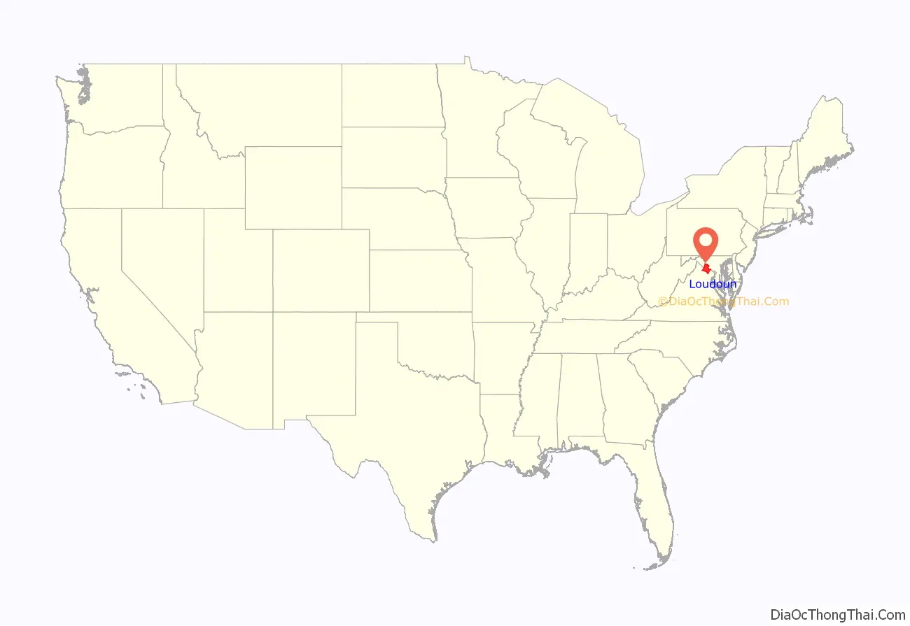
Loudoun County location map. Where is Loudoun County?
History
Loudoun County was established in 1757 from Fairfax County. The county is named for John Campbell, Fourth Earl of Loudoun and governor general of Virginia from 1756 to 1759. Western settlement began in the 1720s and 1730s with Quakers, Scots-Irish, Germans and others moving south from Pennsylvania and Maryland, and also by English and enslaved Africans moving upriver from Tidewater.
By the time of the American Revolution, it was Virginia’s most populous county. It was also rich in agriculture, and the county’s contributions of grain to George Washington’s Continental Army earned it the nickname “Breadbasket of the Revolution.”
During the War of 1812, important Federal documents and government archives were evacuated from Washington and stored at Leesburg. Local tradition holds that these documents were stored at Rokeby House.
U.S. president James Monroe treated Oak Hill Plantation as a primary residence from 1823 until his death on July 4, 1831. The Loudoun County coat of arms and flag, granted by the English College of Arms, memorialize the special relationship between Britain and the United States that developed through his Monroe Doctrine.
Early in the American Civil War, the Battle of Balls Bluff took place near Leesburg on October 21, 1861. Future jurist Oliver Wendell Holmes Jr. was critically wounded in that battle along the Potomac River. During the Gettysburg Campaign in June 1863, Confederate major general J.E.B. Stuart and Union cavalry clashed in the battles of Aldie, Middleburg, and Upperville. Confederate partisan John S. Mosby based his operations in Loudoun and adjoining Fauquier County (for a more in-depth account of the history of Loudoun County during the Civil War, see Loudoun County in the American Civil War).
During World War I, Loudoun County was a major Breadbasket for supplying provisions to soldiers in Europe. Loudoun farmers implemented new agricultural innovations such as vaccination of livestock, seed inoculations and ensilage. The county experienced a boom in agricultural output, outputting an annual wheat output of 1.04 million bushels in 1917, the largest of any county in Virginia that year. 1.2 million units of home produce were produced at home, much of which went to training sites across the state such as Camp Lee. The Smith–Lever Act of 1914 established increased agricultural education in Virginia counties, increasing agricultural yields. After the war, a plaque was dedicated to the “30 glorious dead” from the county who died in the Great War. Five of the thirty died on the front, while the other twenty five died while in training or in other locations inside the United States.
In 1962, Washington Dulles International Airport was built in southeastern Loudoun County in Sterling. Since then, Loudoun County has experienced a high-tech boom and rapid growth. Accordingly, many have moved to eastern Loudoun and become residents of planned communities such as Sterling Park, Sugarland Run, Cascades, Ashburn Village, and Ashburn Farm, making that section a veritable part of the Washington suburbs. Others have moved to the county seat or to the small towns and rural communities of the Loudoun Valley.
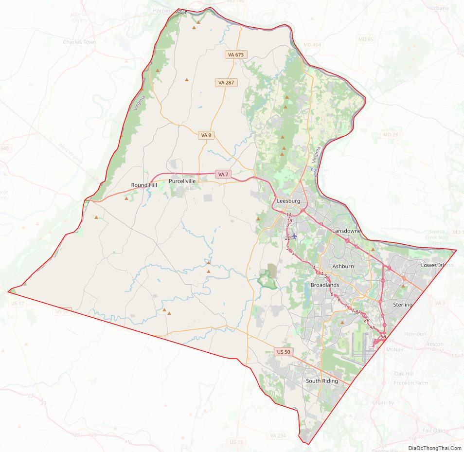
Loudoun County Road Map
Geography
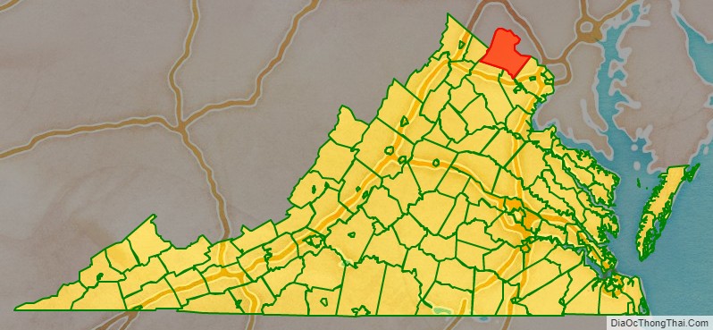
According to the U.S. Census Bureau, Loudoun County has a total area of 521 square miles (1,350 km), of which 516 square miles (1,340 km) is land and 6 square miles (16 km) (1.1%) is water. It is bounded on the north by the Potomac River; across the river are Frederick, Washington and Montgomery counties in Maryland; it is bounded on the south by Prince William and Fauquier counties, on the west by watershed of the Blue Ridge Mountain across which are Jefferson County, West Virginia and Clarke County, and on the east by Fairfax County. The Bull Run Mountains and Catoctin Mountain bisect the county. To the west of the range is the Loudoun Valley. Bisecting the Loudoun Valley from Hillsboro to the Potomac River is Short Hill Mountain.
Adjacent counties
National protected area
- Harpers Ferry National Historical Park
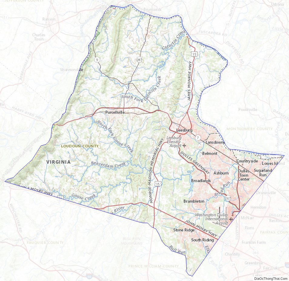
Loudoun County Topographic Map
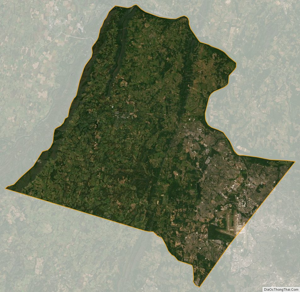
Loudoun County Satellite Map
Loudoun County Outline Map