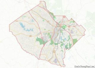
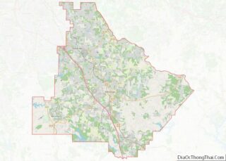
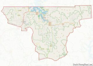
Map of St. Louis County, Minnesota
St. Louis County is a county located in the Arrowhead Region of the U.S. state of Minnesota. As of the 2020 census, the population was 200,231. Its county seat is Duluth. It is the largest county in Minnesota by land area, and the largest in the United States by total area east of the Mississippi ... Read more
Map of St. Louis County, Minnesota
Map of Winona County, Minnesota
Winona County is a county in the U.S. state of Minnesota. As of the 2020 census, its population was 49,671. Its county seat is Winona. Winona County comprises the Winona, MN Micropolitan Statistical Area. Winona County overview: Name: Winona County FIPS code: 27-169 State: Minnesota Founded: February 23, 1854 Named for: Winona (Native American) Seat: ... Read more
Map of Winona County, Minnesota
Map of Coahoma County, Mississippi
Coahoma County overview: Name: Coahoma County FIPS code: 28-027 State: Mississippi Founded: February 9, 1836 Seat: Clarksdale Largest city: Clarksdale Total Area: 583 sq mi (1,510 km²) Land Area: 552 sq mi (1,430 km²) Total Population: 21,390 Population Density: 37/sq mi (14/km²) Time zone: UTC−6 (Central) Summer Time Zone (DST): UTC−5 (CDT) Website: www.coahomacounty.net Coahoma County location map. Where is Coahoma County? ... Read more
Map of Coahoma County, Mississippi
Map of Jackson County, Mississippi
Jackson County is a county located in the U.S. state of Mississippi. As of the 2020 census, the population was 143,252, making it the fifth-most populous county in Mississippi. Its county seat is Pascagoula. The county was named for Andrew Jackson, general in the United States Army and afterward President of the United States. Jackson ... Read more
Map of Jackson County, Mississippi
Map of Marion County, Mississippi
Marion County is a county located in the U.S. state of Mississippi. As of the 2020 census, the population was 24,441. Its county seat is Columbia. Marion County is named for American Revolutionary War guerrilla leader Francis Marion also known as The Swamp Fox. Marion County overview: Name: Marion County FIPS code: 28-091 State: Mississippi ... Read more
Map of Marion County, Mississippi
Map of Scott County, Mississippi
Scott County is a county located in the U.S. state of Mississippi. As of the 2020 census, the population was 27,990. Its county seat is Forest. The county is named for Abram M. Scott, the Governor of Mississippi from 1832 to 1833. Scott County overview: Name: Scott County FIPS code: 28-123 State: Mississippi Founded: 1833 ... Read more
Map of Scott County, Mississippi
Map of Webster County, Mississippi
Webster County is a county located in center of the U.S. state of Mississippi, bordered on the south by the Big Black River. As of the 2020 census, the population was 9,926. The county was organized in 1874 during the Reconstruction era; the biracial legislature named it after Massachusetts statesman Daniel Webster. Its county seat ... Read more
Map of Webster County, Mississippi
Map of Butler County, Missouri
Butler County is a county located in the southeast Ozark Foothills Region in the U.S. state of Missouri. As of the 2020 Census, the county’s population was 42,130. The largest city and county seat is Poplar Bluff. The county was officially organized from Wayne County on February 27, 1849, and is named after former U.S. ... Read more
Map of Butler County, Missouri
Map of Crawford County, Missouri
Crawford County is a county located in the east-central portion of the U.S. state of Missouri. At the 2010 Census, the population was 24,696. Its county seat is Steelville. The county was organized in 1829 and is named after U.S. Senator William H. Crawford of Georgia. The section of Sullivan which is located in Crawford ... Read more
Map of Crawford County, Missouri
Map of Holt County, Missouri
Holt County is a county located in the northwestern portion of the U.S. state of Missouri. As of the 2020 census, the population was 4,223. It’s county seat is Oregon. The county was organized February 15, 1841. Originally named Nodaway County, it was soon renamed for David Rice Holt (1803–1840), a Missouri state legislator from ... Read more
Map of Holt County, Missouri
Map of Macon County, Missouri
Macon County is a county located in the northern portion of the U.S. state of Missouri. As of the 2020 census, the population was 15,209. Its county seat is Macon. The county was organized January 6, 1837, and named for Nathaniel Macon, a Revolutionary War hero and North Carolina politician. Macon County overview: Name: Macon ... Read more
Map of Macon County, Missouri
Map of Osage County, Missouri
Osage County is a county in the central part of the U.S. state of Missouri. As of the 2020 census, the population was 13,274. Its county seat is Linn. The county was organized January 29, 1841, and named from the Osage River. Osage County is part of the Jefferson City, MO Metropolitan Statistical Area. Its ... Read more
Map of Osage County, Missouri