Pontotoc County is a county located in the U.S. state of Mississippi. It has been identified as one of the most corrupt counties in Northern Mississippi. As of the 2020 census, the population was 31,184. Its county seat is Pontotoc. It was created on February 9, 1836, from lands ceded to the United States under the Chickasaw Cession. Pontotoc is a Chickasaw word meaning “land of hanging grapes”. The original Natchez Trace and the current-day Natchez Trace Parkway both pass through the southeast corner of Pontotoc County.
Pontotoc County is part of the Tupelo, MS Micropolitan Statistical Area.
| Name: | Pontotoc County |
|---|---|
| FIPS code: | 28-115 |
| State: | Mississippi |
| Founded: | 1836 |
| Named for: | Chickasaw word for the region meaning either “cattail prairie” “land of hanging grapes” |
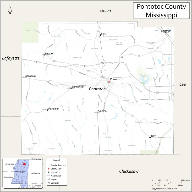
| Seat: | Pontotoc |
| Largest city: | Pontotoc |
| Total Area: | 501 sq mi (1,300 km²) |
| Land Area: | 498 sq mi (1,290 km²) |
| Total Population: | 31,184 |
| Population Density: | 62/sq mi (24/km²) |
| Time zone: | UTC−6 (Central) |
| Summer Time Zone (DST): | UTC−5 (CDT) |
| Website: | pontotoccoms.com |
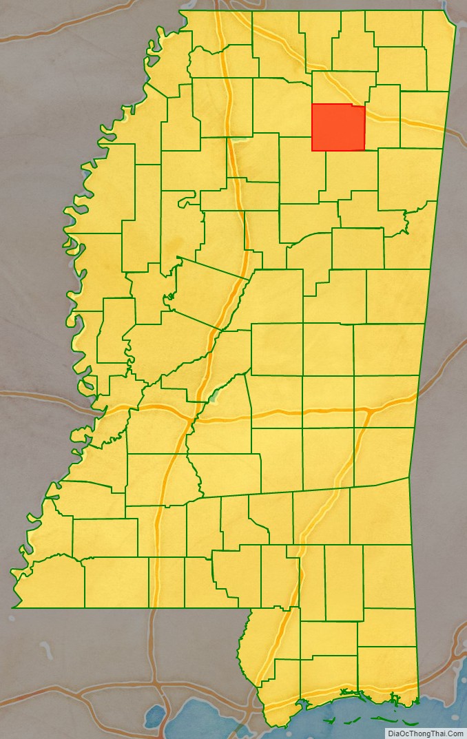
Pontotoc County location map. Where is Pontotoc County?

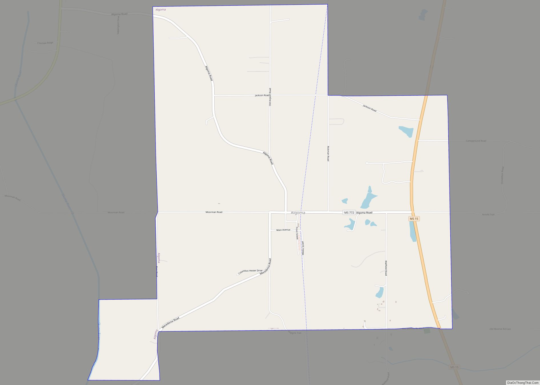
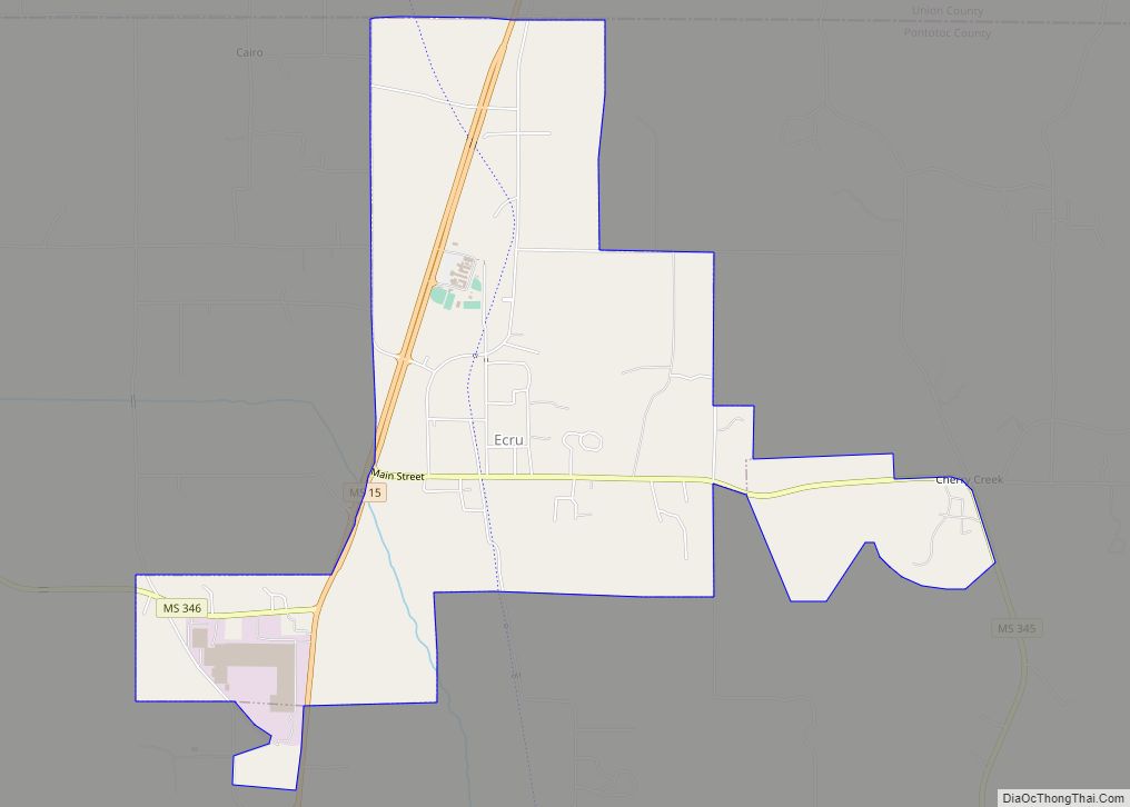
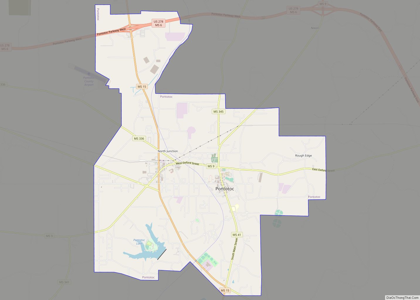
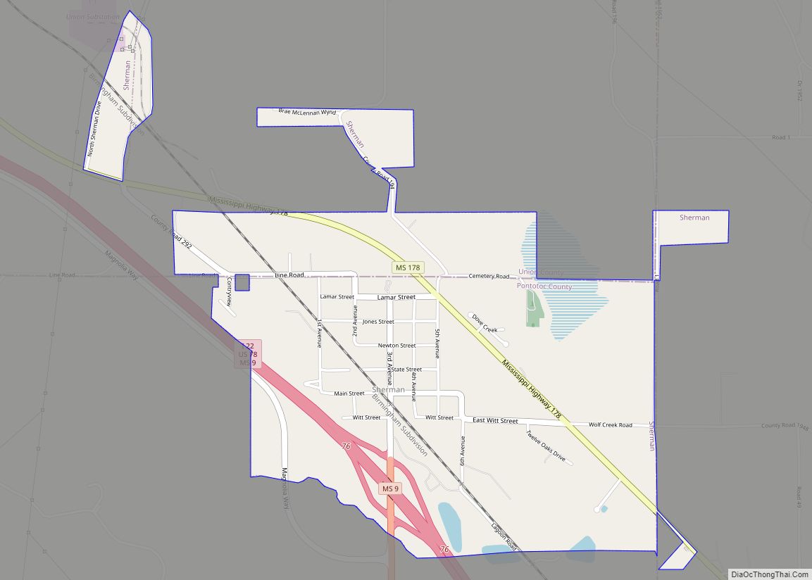
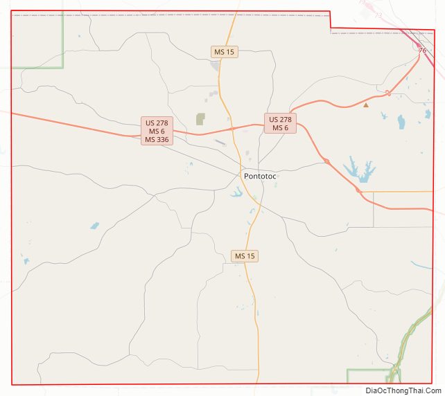
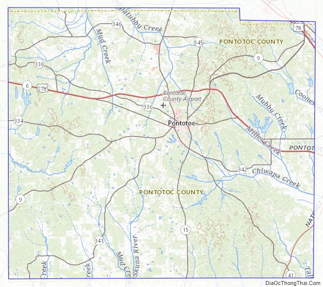
Pontotoc County Road Map
Geography
According to the U.S. Census Bureau, the county has a total area of 501 square miles (1,300 km), of which 498 square miles (1,290 km) is land and 3.3 square miles (8.5 km) (0.7%) is water.
Major highways
- Interstate 22
- U.S. Route 78
- U.S. Route 278
- Mississippi Highway 6
- Mississippi Highway 9
- Mississippi Highway 15
- Mississippi Highway 41
- Natchez Trace Parkway
Adjacent counties
- Union County (north)
- Lee County (east)
- Chickasaw County (south)
- Calhoun County (southwest)
- Lafayette County (west)
National protected area
- Natchez Trace Parkway (part)
- Tombigbee National Forest (part)
Pontotoc County Topographic Map
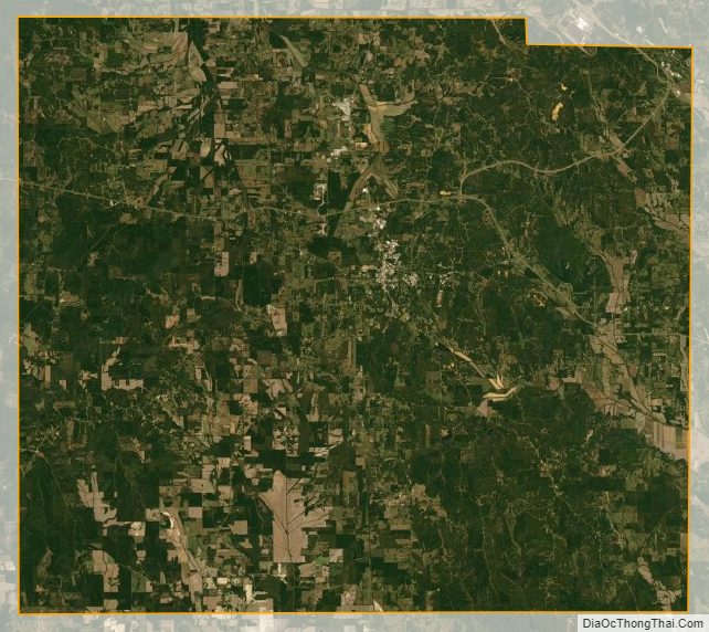
Pontotoc County Satellite Map
Pontotoc County Outline Map