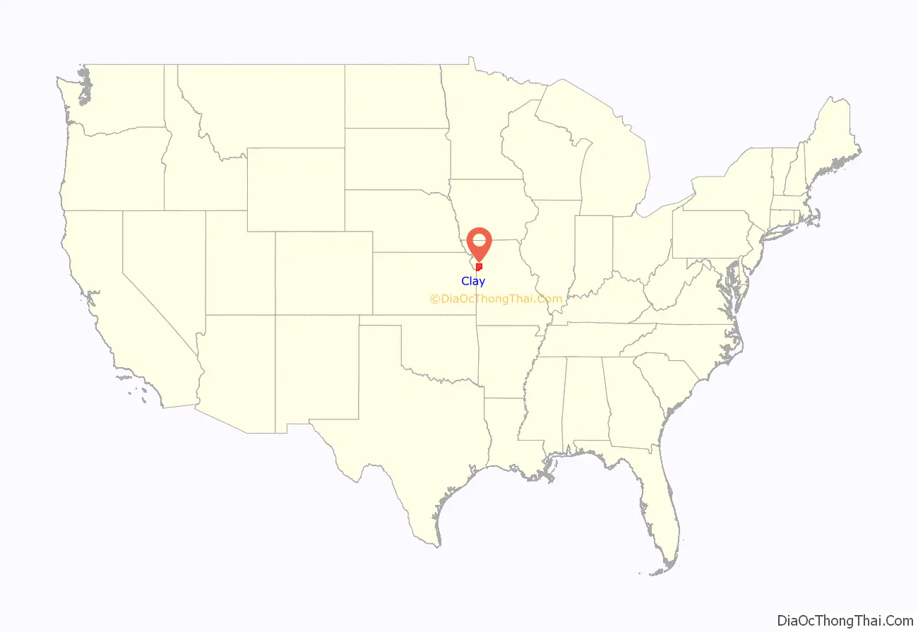
Clay County is located in the U.S. state of Missouri and is part of the Kansas City metropolitan area. As of the 2020 census, the county had a population of 253,335, making it the fifth-most populous county in Missouri. Its county seat is Liberty. The county was organized January 2, 1822, and named in honor of U.S. Representative Henry Clay from Kentucky, later a member of the United States Senate and United States Secretary of State.
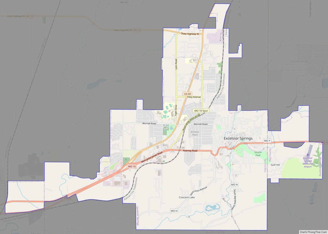
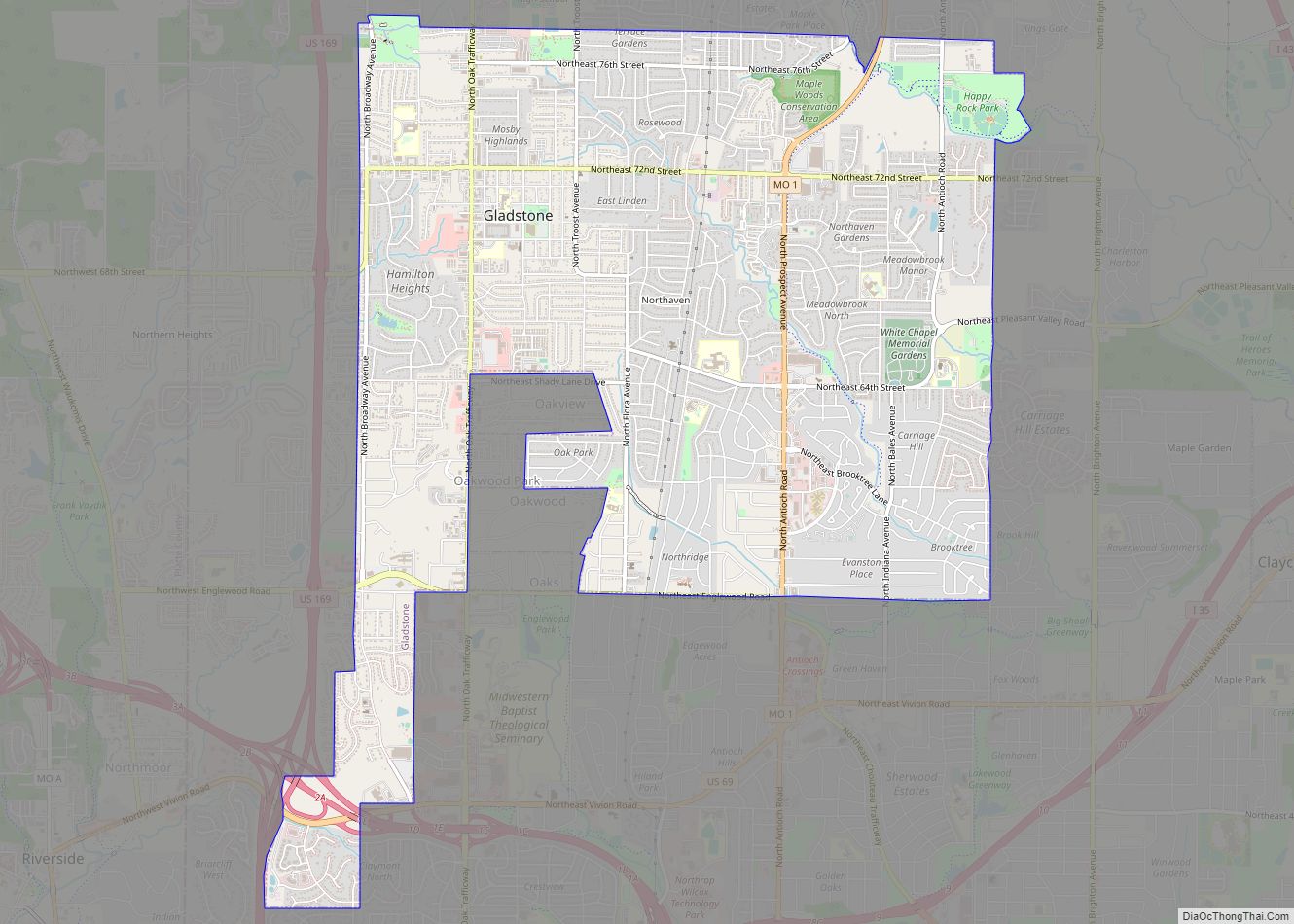
Clay County contains many of the area’s northern suburbs, along with a substantial portion of the city of Kansas City, Missouri. It also owns and operates the Midwest National Air Center in Excelsior Springs.
| Name: | Clay County |
|---|---|
| FIPS code: | 29-047 |
| State: | Missouri |
| Founded: | January 2, 1822 |
| Named for: | Henry Clay |
| Seat: | Liberty |
| Largest city: | Kansas City |
| Total Area: | 409 sq mi (1,060 km²) |
| Land Area: | 397 sq mi (1,030 km²) |
| Total Population: | 253,335 |
| Population Density: | 620/sq mi (240/km²) |
| Time zone: | UTC−6 (Central) |
| Summer Time Zone (DST): | UTC−5 (CDT) |
| Website: | www.claycountymo.gov |
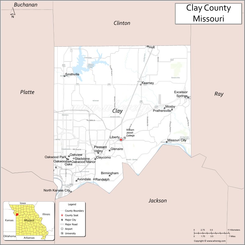
Clay County location map. Where is Clay County?
History
Clay County was settled primarily from migrants from the Upper Southern states of Kentucky, Tennessee, and Virginia. They brought enslaved persons and slaveholding traditions with them, and quickly started cultivating crops similar to those in Middle Tennessee and Kentucky: hemp and tobacco. Clay was one of several counties settled mostly by Southerners to the north and south of the Missouri River. Given their culture and traditions, this area became known as Little Dixie. In 1860, enslaved persons made up 25% or more of the county’s population.
The 1828 execution of Annice, a slave owned by Jeremiah Prior, was the first to occur in Clay County. She was also the first female slave executed in the state of Missouri.
Many members of the Latter Day Saint movement found refuge in Clay County in November 1833. In 1836, mobs and the Missouri State militia viciously drove the members of the church from the county. Leaders of this church, most notably Joseph Smith, were imprisoned for some months in Clay County in the jail at Liberty. In May 2012, the LDS Church opened a Kansas City Missouri Temple six miles southwest of the Liberty Jail site at 7001 Searcy Creek Parkway in Kansas City, Missouri.
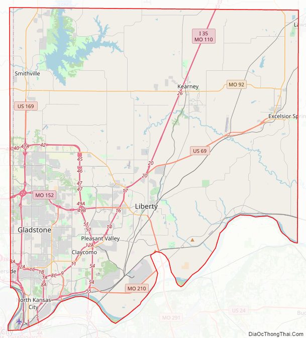
Clay County Road Map
Geography
According to the U.S. Census Bureau, the county has a total area of 409 square miles (1,060 km), of which 397 square miles (1,030 km) is land and 11 square miles (28 km) (2.8%) is covered by water. It is the fourth-smallest county in Missouri by area.
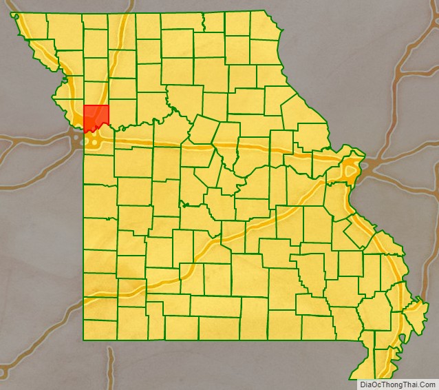
Adjacent counties
- Clinton County (north)
- Ray County (east)
- Jackson County (south)
- Wyandotte County, Kansas (southwest)
- Platte County (west)
Major highways
- Interstate 29
- Interstate 35
- Interstate 435
- U.S. Route 69
- U.S. Route 71
- U.S. Route 169
- Route 1
- Route 9
- Route 10
- Route 33
- Route 92
- Route 152
- Route 210
- Route 291
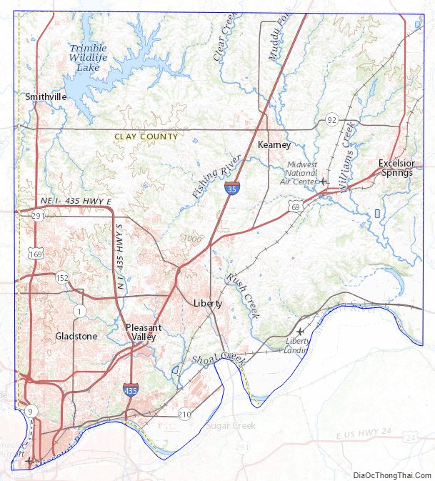
Clay County Topographic Map
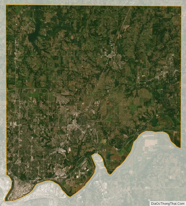
Clay County Satellite Map
Clay County Outline Map