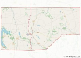
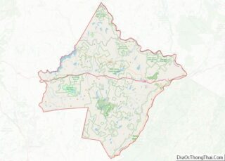
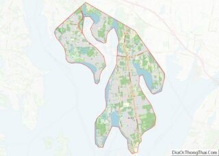
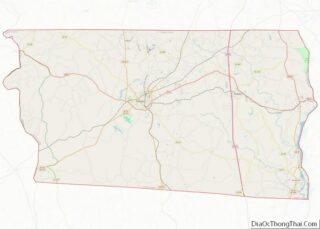
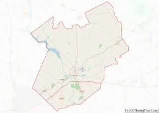
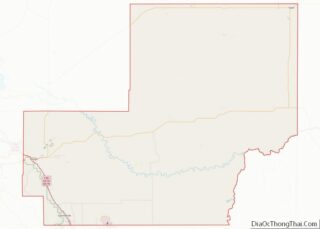
Map of Ottawa County

Map of Ottawa County, Ohio

Ottawa County is a county located in the northwestern part of the U.S. state of Ohio. As of the 2020 census, the population was 40,364. Its county seat is Port Clinton. The county is named either for the Ottawa (Odawa) Indigenous peoples who lived there, or for an Indigenous word meaning “trader”. Ottawa County comprises … Read more

Map of Trumbull County

Map of Trumbull County, Ohio

Trumbull County is a county in the far northeast portion of U.S. state of Ohio. As of the 2020 census, the population was 201,977. Its county seat and largest city is Warren, which developed industry along the Mahoning River. Trumbull County is part of the Youngstown-Warren-Boardman, OH-PA Metropolitan Statistical Area. Trumbull County overview: Name: Trumbull … Read more

Map of Blaine County

Map of Blaine County, Oklahoma

Blaine County is a county located in the U.S. state of Oklahoma. As of the 2020 census, the population was 8,735. Its county seat is Watonga. Part of the Cheyenne-Arapaho land opening in 1892, the county had gained rail lines by the early 1900s and highways by the 1930s. The county was named for James … Read more

Map of Dewey County

Map of Dewey County, Oklahoma

Dewey County is a county in the western part of the U.S. state of Oklahoma. As of the 2010 census, the population was 4,810. Its county seat is Taloga. The county was created in 1891 as “County D”. In an 1898 election, county voters chose the name Dewey, honoring Admiral George Dewey. Dewey County overview: … Read more

Map of Kiowa County

Map of Kiowa County, Oklahoma

Kiowa County is a county located in the southwestern part of the U.S. state of Oklahoma. As of the 2010 census, the population was 9,446. Its county seat is Hobart. The county was created in 1901 as part of Oklahoma Territory. It was named for the Kiowa people. Kiowa County overview: Name: Kiowa County FIPS … Read more

Map of Okfuskee County

Map of Okfuskee County, Oklahoma

Okfuskee County is a county located in the U.S. state of Oklahoma. As of the 2010 census, its population was 12,191. Its county seat is Okemah. The county is named for a former Muscogee town in present Cleburne County, Alabama, that in turn was named for the Okfuskee, a Muscogee tribe. Okfuskee County overview: Name: … Read more

Map of Texas County

Map of Texas County, Oklahoma

Texas County is a county located in the panhandle of the U.S. state of Oklahoma. Its county seat is Guymon. As of the 2010 census, the population was 20,640. It is the second largest county in Oklahoma, based on land area, and is named for Texas, the state that adjoins the county to its south. … Read more

Map of Deschutes County

Map of Deschutes County, Oregon

Deschutes County (/dəˈʃuːts/ də-SHOOTS) is one of the 36 counties in the U.S. state of Oregon. As of the 2020 census, the population was 198,253. The county seat is Bend. The county was created in 1916 out of part of Crook County and was named for the Deschutes River, which itself was named by French-Canadian … Read more

Map of Morrow County

Map of Morrow County, Oregon

Morrow County is one of the 36 counties in the U.S. state of Oregon. As of the 2020 census, the population was 12,186. The county seat is Heppner. The county is named for one of its first settlers, Jackson L. Morrow, who was a member of the state legislature when the county was created. Half … Read more

Map of Bedford County

Map of Bedford County, Pennsylvania

Bedford County is a county in the Commonwealth of Pennsylvania. As of the 2020 census, the population was 47,577. The county seat is Bedford. Bedford County overview: Name: Bedford County FIPS code: 42-009 State: Pennsylvania Founded: March 9, 1771 Named for: Fort Bedford Seat: Bedford Total Area: 1,017 sq mi (2,630 km²) Land Area: 1,012 sq mi (2,620 km²) Total Population: … Read more

Map of Cumberland County

Map of Cumberland County, Pennsylvania

Cumberland County is a county in the Commonwealth of Pennsylvania. As of the 2020 census, the population was 259,469. Its county seat is Carlisle. Cumberland County is included in the Harrisburg–Carlisle metropolitan statistical area. Cumberland County overview: Name: Cumberland County FIPS code: 42-041 State: Pennsylvania Founded: January 27, 1750 Named for: Cumberland Seat: Carlisle Total … Read more

Map of Lawrence County

Map of Lawrence County, Pennsylvania

Lawrence County is a county in the Commonwealth of Pennsylvania. As of the 2020 census, the population was 86,070. The county seat is New Castle. Lawrence County comprises the entire New Castle, PA Micropolitan Statistical Area, which is also included in the larger Pittsburgh-New Castle-Weirton, PA-WV-OH Combined Statistical Area. Lawrence County overview: Name: Lawrence County … Read more