Volyn Oblast (Ukrainian: Воли́нська о́бласть, romanized: Volýnsʹka óblastʹ; also referred to as Volyn or Lodomeria) is an oblast (province) in northwestern Ukraine. Its administrative centre is Lutsk. Kovel is the westernmost town and the last station in Ukraine on the rail line running from Kyiv to Warsaw. The population is 1,021,356 (2022 est.)
| Unit Name | Volyn Oblast |
|---|---|
| Total area | 20.144 km² (7.778 sq mi) |
| Area Rank | Rank 20th |
| Population (2021) | 1.027.397 |
| Time zone | UTC+2 (EET) |
| Summer (DST) | UTC+3 (EEST) |
| Postal code | 43xxx-45xxx |
| Area code | +380-33 |
| ISO 3166 code | UA-07 |
| Website | www.voladm.gov.ua |
| Flag |  |
| Coat of arms |  |
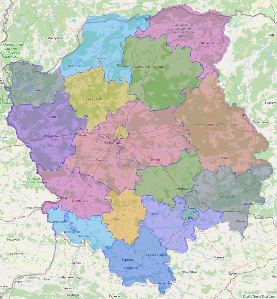
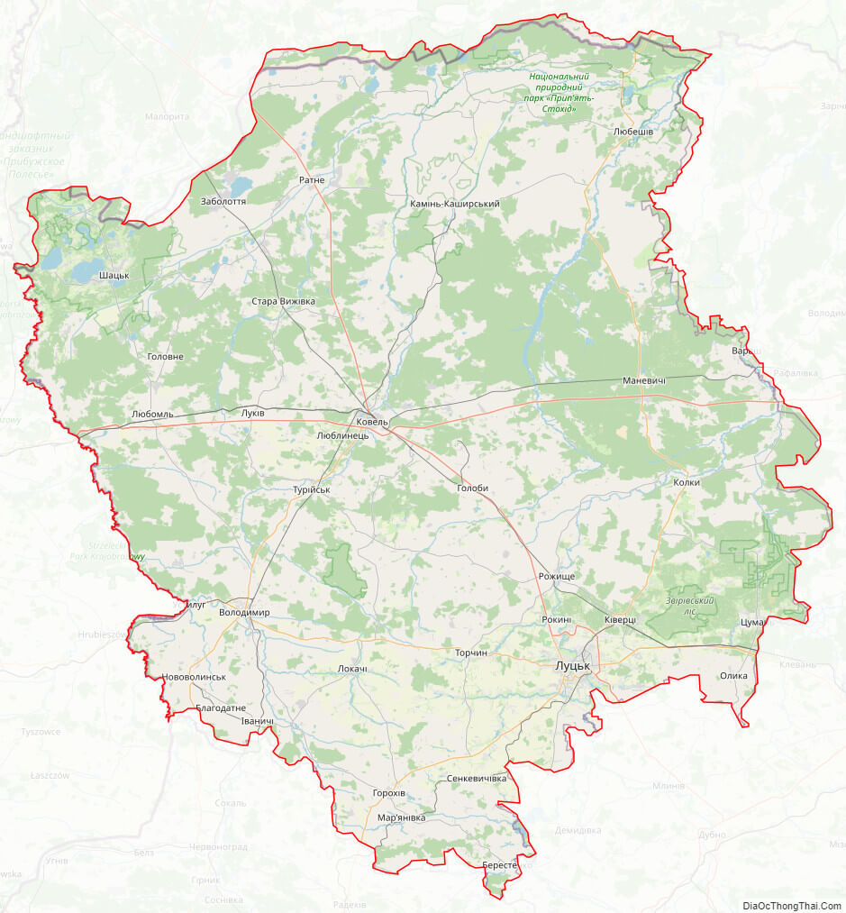
Online subdivision map of Volyn oblast
Volyn Oblast, situated in western Ukraine, is a region rich in history, culture, and natural beauty. For those seeking to explore this fascinating region, an online subdivision map can be an invaluable tool.
Using an online base map such as Google Maps or OpenStreetMap, one can navigate and explore the various sub-administrative units of Volyn Oblast. Each region has its own unique attractions, from the historic town of Lutsk with its iconic castle and churches, to the stunning natural landscapes of Shatsky National Park.
The online subdivision map provides a clear and detailed view of the region’s administrative divisions and boundaries, including districts, cities, towns, and villages. This enables users to easily identify and locate specific areas of interest, such as historic sites, museums, nature reserves, and cultural events.
Moreover, an online subdivision map of Volyn Oblast can also be a useful resource for researchers and scholars studying the region’s geography, demographics, and history. With the ability to overlay additional data such as population density, economic indicators, and transportation infrastructure, researchers can gain new insights into the region’s past and present.
Overall, an online subdivision map of Volyn Oblast is an essential tool for anyone interested in exploring this vibrant and diverse region. So why not start your journey today and discover all that Volyn Oblast has to offer?
Click on ![]() to view map in "full screen" mode.
to view map in "full screen" mode.
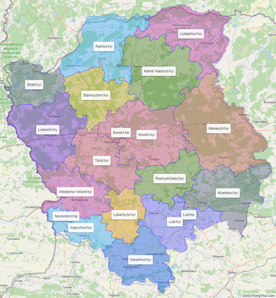
List administrative sub-division of Volyn oblast
| # | Name | Type |
|---|---|---|
| 1 | Novovolyns’ka | Mis’ka Rada |
| 2 | Kovel’s’ka | Misto |
| 3 | Luts’ka | Misto |
| 4 | Horokhivs’kyi | Raion |
| 5 | Ivanychivs’kyi | Raion |
| 6 | Kamin’-Kashyrs’kyi | Raion |
| 7 | Kivertsivs’kyi | Raion |
| 8 | Kovel’s’kyi | Raion |
| 9 | Liubeshivs’kyi | Raion |
| 10 | Liuboml’s’ky | Raion |
| 11 | Lokachyns’kyi | Raion |
| 12 | Luts’kyi | Raion |
| 13 | Manevyts’kyi | Raion |
| 14 | Ratnivs’kyi | Raion |
| 15 | Rozhyshchens’kyi | Raion |
| 16 | Shats’kyi | Raion |
| 17 | Starovyzhivs’kyi | Raion |
| 18 | Turiis’kyi | Raion |
| 19 | Volodymyr-Volyns’kyi | Raion |
Explaination:
- Mis’ka Rada: City municipalities (governed by a mayor and a city council)
- Misto: city at least 10,000 people (not a town).
- Raion: often translated as “district”.
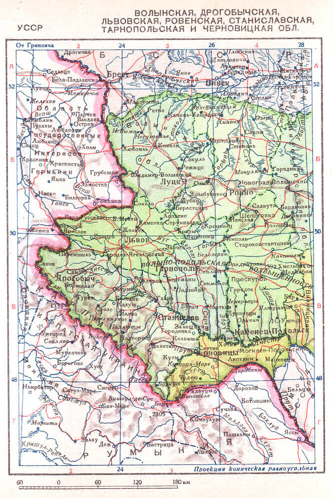
Location map of Volyn oblast, Ukraine


Political map of Volyn oblast
Detail map of Volyn oblast
Volyn oblast streeet map
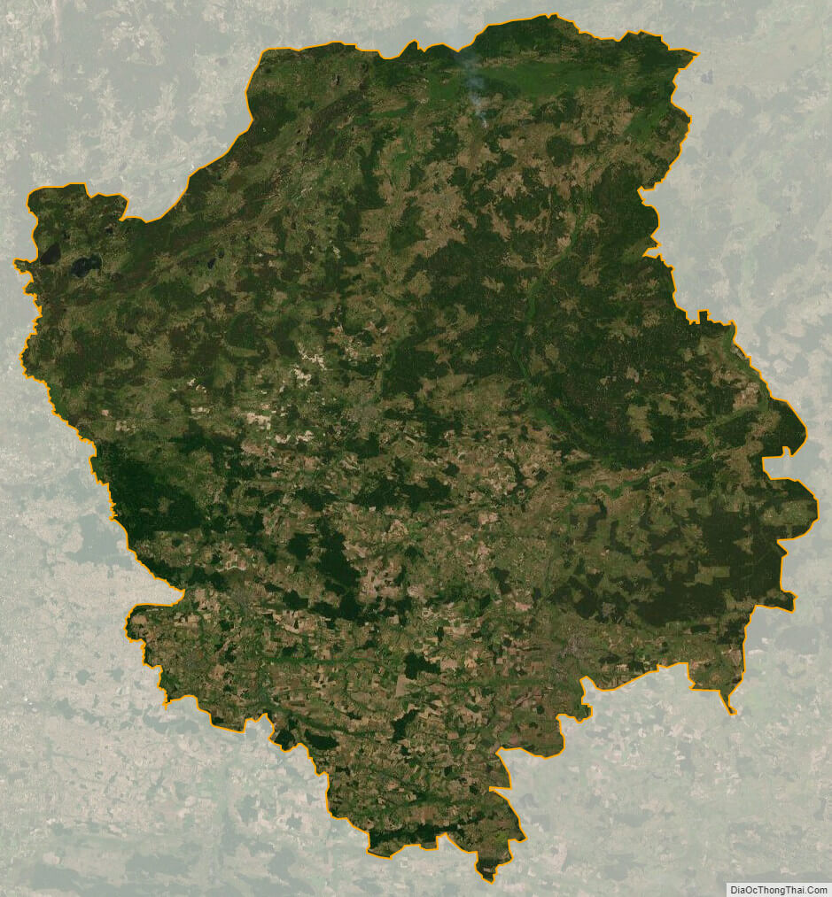
Volyn oblast satellite map