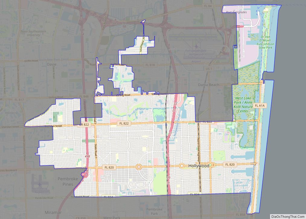
Map of Kansas City city

Map of Kansas City, Kansas

Kansas City (abbreviated as KCK) is the third-most populous city in the U.S. state of Kansas, and the county seat of Wyandotte County. It is an inner suburb of the older and more populous Kansas City, Missouri, after which it is named. As of the 2020 census, the population of the city was 156,607, making … Read more

Map of Escondido city

Map of Escondido city

Escondido is a city in San Diego County, California, United States. Located in the North County region, it was incorporated in 1888, and is one of the oldest cities in San Diego County. It has a population of 151,038 as of the 2020 census. Escondido city overview: Name: Escondido city LSAD Code: 25 LSAD Description: … Read more

Map of Roseville city

Map of Roseville city, California

Roseville is the most populous city in Placer County, California, located within the Sacramento metropolitan area. As of 2019, the US Census Bureau estimated the city’s population to be 141,500. Interstate 80 runs through Roseville and State Route 65 runs through part of the northern edge of the city. Roseville city overview: Name: Roseville city … Read more

Map of Bellevue city, Washington

Map of Bellevue city, Washington

Bellevue (/ˈbɛlvjuː/ BEL-vew) is a city in the Eastside region of King County, Washington, United States, located across Lake Washington from Seattle. It is the third-largest city in the Seattle metropolitan area and has variously been characterized as a satellite city, a suburb, a boomburb, or an edge city. Its population was 122,363 at the … Read more

Map of Joliet city

Map of Joliet city, Illinois

Joliet (/ˈdʒoʊliɛt, dʒoʊliˈɛt/ JOH-lee-et, joh-lee-ET) is a city in Will and Kendall counties in the U.S. state of Illinois, 35 miles (56 km) southwest of Chicago. It is the county seat of Will County. At the 2020 census, the city was the third-largest in Illinois, with a population of 150,362. Joliet city overview: Name: Joliet city … Read more

Map of Pasadena city, Texas

Map of Pasadena city, Texas

Pasadena (/ˌpæsəˈdiːnə/) is a city in the U.S. state of Texas, within the Houston–The Woodlands–Sugar Land metropolitan area. As of the 2020 U.S. census, the city’s population was 151,950, making it the twentieth most populous city in the state of Texas, as well as the second-largest city in Harris County. The area was founded in … Read more

Map of Naperville city

Map of Naperville city

Naperville (/ˈneɪpərˌvɪl/ NAY-pər-vil) is a city within the Chicago Metropolitan Area in DuPage and Will counties in the U.S. state of Illinois. It is a western suburb of Chicago located 28 miles (45 km) west of the city. Naperville was founded in 1831 by Joseph Naper. The city was established by the banks of the DuPage … Read more

Map of Surprise city

Map of Surprise city, Arizona

Surprise is a city in Maricopa County, in the U.S. state of Arizona. The population was 143,148 at the 2020 census, up from 117,517 in 2010 and just 30,848 in 2000. The city has a 10,562-square-foot (981.2 m) Aquatics Center and Maricopa County’s northwest regional library, a $5.5 million, 20,000-square-foot (1,900 m) library, along with a 100.3 … Read more

Map of Denton city, Texas

Map of Denton city, Texas

Denton is a city in and the county seat of Denton County, Texas, United States. With a population of 139,869 as of 2020, it is the 27th-most populous city in Texas, the 197th-most populous city in the United States, and the 12th-most populous city in the Dallas–Fort Worth metroplex. A Texas land grant led to … Read more