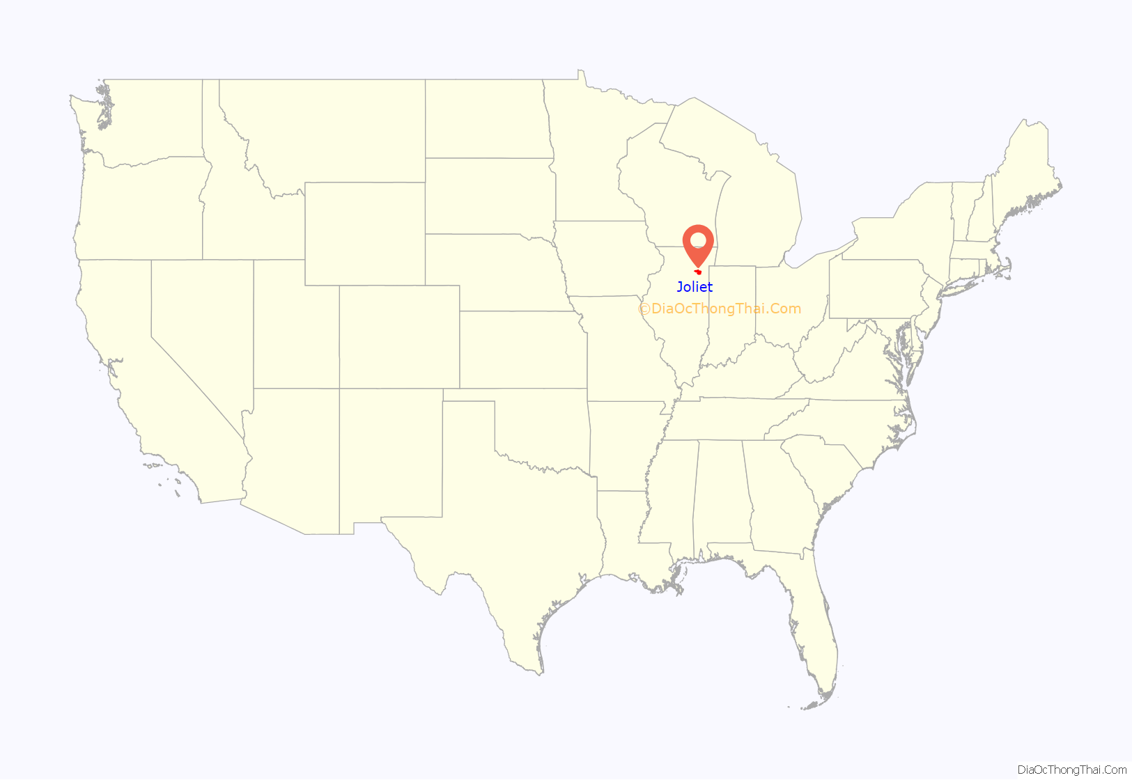
Joliet (/ˈdʒoʊliɛt, dʒoʊliˈɛt/ JOH-lee-et, joh-lee-ET) is a city in Will and Kendall counties in the U.S. state of Illinois, 35 miles (56 km) southwest of Chicago. It is the county seat of Will County. At the 2020 census, the city was the third-largest in Illinois, with a population of 150,362.
| Name: | Joliet city |
|---|---|
| LSAD Code: | 25 |
| LSAD Description: | city (suffix) |
| State: | Illinois |
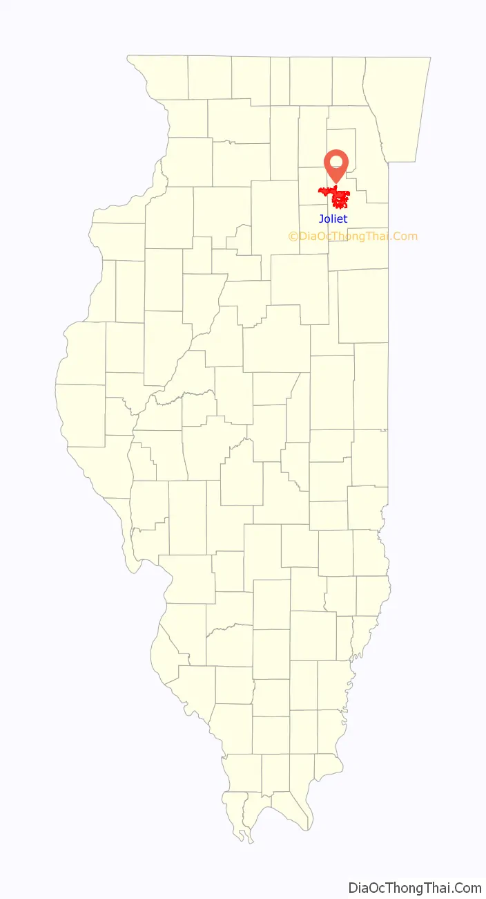
| County: | Kendall County, Will County |
| Incorporated: | 1852 |
| Elevation: | 610 ft (190 m) |
| Total Area: | 65.82 sq mi (170.48 km²) |
| Land Area: | 65.08 sq mi (168.56 km²) |
| Water Area: | 0.74 sq mi (1.92 km²) |
| Total Population: | 150,362 |
| Population Density: | 2,310.31/sq mi (892.02/km²) |
| ZIP code: | 60431–60436, 60586 |
| Area code: | 815, 779 |
| FIPS code: | 1738570 |
| GNISfeature ID: | 2395477 |
| Website: | www.joliet.gov |
Online Interactive Map
Click on ![]() to view map in "full screen" mode.
to view map in "full screen" mode.
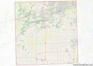
Joliet location map. Where is Joliet city?
History
In 1673, Louis Jolliet, along with Father Jacques Marquette, paddled up the Des Plaines River and camped on a huge earthwork mound, a few miles south of present-day Joliet. Maps from Jolliet’s exploration of the area showed a large hill or mound down river from Chicago, labeled Mont Joliet. The mound has since been flattened due to mining.
In 1833, following the Black Hawk War, Charles Reed built a cabin along the west side of the Des Plaines River. Across the river in 1834, James B. Campbell, treasurer of the canal commissioners, laid out the village of “Juliet”, a corruption of “Joliet” that was also in use at the time. Just before the economic depression of 1837, Juliet incorporated as a village, but to cut tax expenses, Juliet residents soon petitioned the state to rescind that incorporation.
In 1845, local residents changed the community’s name from “Juliet” to “Joliet”, reflecting the original name. Joliet was reincorporated as a city in 1852. Cornelius Covenhoven Van Horne was active in getting the city its first charter, and because of this, he was elected Joliet’s first mayor. When the city later built a new bridge, it was named the Van Horne Bridge.
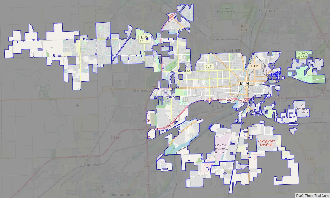
Joliet Road Map
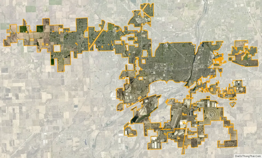
Joliet city Satellite Map
Geography
According to the 2010 census, Joliet has a total area of 62.768 square miles (162.57 km), of which 62.11 square miles (160.86 km) (or 98.95%) are land and 0.658 square miles (1.70 km) (or 1.05%) is covered by water. It has a sprawling, irregular shape that extends into nine different townships, more than any other Illinois city. They are: Joliet, Plainfield, Troy, New Lenox, Jackson, Channahon, and Lockport in Will County, and Na-Au-Say and Seward in Kendall County. Joliet developed along the Des Plaines River, and its downtown is located in the river valley.
Joliet has a “west side” and “east side”, referring to areas in relation to the river.
With the construction of highways and suburban development to the west, many businesses moved from the downtown area to the expanding areas west of the river. Many stores relocated to the west side in new strip malls and shopping centers with more parking and easier access. These changes resulted in the decline of the downtown shopping district, which is still felt today. Today, Joliet has a “west side” and a “far west side” (which includes all city limits in Kendall County). This has given rise to a newly referenced “Central Joliet” portion of the city, which essentially is all land west of the Des Plaines River and east of Interstate 55. This new reference may soon change the current meaning of “west side” to west of I-55.
Climate
Joliet has a hot summer humid continental climate (Köppen Dfa) with hot, humid summers, and cold winters with moderate to heavy snowfall.
See also
Map of Illinois State and its subdivision:- Adams
- Alexander
- Bond
- Boone
- Brown
- Bureau
- Calhoun
- Carroll
- Cass
- Champaign
- Christian
- Clark
- Clay
- Clinton
- Coles
- Cook
- Crawford
- Cumberland
- De Kalb
- De Witt
- Douglas
- Dupage
- Edgar
- Edwards
- Effingham
- Fayette
- Ford
- Franklin
- Fulton
- Gallatin
- Greene
- Grundy
- Hamilton
- Hancock
- Hardin
- Henderson
- Henry
- Iroquois
- Jackson
- Jasper
- Jefferson
- Jersey
- Jo Daviess
- Johnson
- Kane
- Kankakee
- Kendall
- Knox
- La Salle
- Lake
- Lake Michigan
- Lawrence
- Lee
- Livingston
- Logan
- Macon
- Macoupin
- Madison
- Marion
- Marshall
- Mason
- Massac
- McDonough
- McHenry
- McLean
- Menard
- Mercer
- Monroe
- Montgomery
- Morgan
- Moultrie
- Ogle
- Peoria
- Perry
- Piatt
- Pike
- Pope
- Pulaski
- Putnam
- Randolph
- Richland
- Rock Island
- Saint Clair
- Saline
- Sangamon
- Schuyler
- Scott
- Shelby
- Stark
- Stephenson
- Tazewell
- Union
- Vermilion
- Wabash
- Warren
- Washington
- Wayne
- White
- Whiteside
- Will
- Williamson
- Winnebago
- Woodford
- Alabama
- Alaska
- Arizona
- Arkansas
- California
- Colorado
- Connecticut
- Delaware
- District of Columbia
- Florida
- Georgia
- Hawaii
- Idaho
- Illinois
- Indiana
- Iowa
- Kansas
- Kentucky
- Louisiana
- Maine
- Maryland
- Massachusetts
- Michigan
- Minnesota
- Mississippi
- Missouri
- Montana
- Nebraska
- Nevada
- New Hampshire
- New Jersey
- New Mexico
- New York
- North Carolina
- North Dakota
- Ohio
- Oklahoma
- Oregon
- Pennsylvania
- Rhode Island
- South Carolina
- South Dakota
- Tennessee
- Texas
- Utah
- Vermont
- Virginia
- Washington
- West Virginia
- Wisconsin
- Wyoming