Naperville (/ˈneɪpərˌvɪl/ NAY-pər-vil) is a city within the Chicago Metropolitan Area in DuPage and Will counties in the U.S. state of Illinois. It is a western suburb of Chicago located 28 miles (45 km) west of the city.
Naperville was founded in 1831 by Joseph Naper. The city was established by the banks of the DuPage river, and was originally known as Naper’s Settlement. By 1832, over 100 residents lived in Naper’s Settlement. In 1839, after DuPage County was split from Cook County, Naperville became the county seat, which it remained until 1868. Beginning in the 1960s, Naperville experienced a significant population increase as a result of Chicago’s urban sprawl.
As of the 2020 census, its population was 149,540, making it the state’s fourth-most populous city. Naperville’s largest employer is Edward Hospital with 4,500 employees.
Naperville is home to Moser Tower and Millennium Carillon, one of the world’s four largest carillons. It is also home to an extensive parks and forest preserve network, including Centennial Beach. Naperville has two school districts, 203 and 204. It also has media outlets, like NCTV17. Naperville has a train station served by Amtrak and Metra.
| Name: | Naperville city |
|---|---|
| LSAD Code: | 25 |
| LSAD Description: | city (suffix) |
| State: | Illinois |
| County: | DuPage County, Will County |
| Incorporated: | February 7, 1857 (1857-02-07) (Village) March 17, 1890 (1890-03-17) (City) |
| Elevation: | 705 ft (215 m) |
| Total Area: | 39.70 sq mi (102.81 km²) |
| Land Area: | 39.11 sq mi (101.29 km²) |
| Water Area: | 0.59 sq mi (1.52 km²) |
| Total Population: | 149,540 |
| Population Density: | 3,823.57/sq mi (1,476.29/km²) |
| FIPS code: | 1751622 |
| GNISfeature ID: | 2395147 |
| Website: | naperville.il.us |
Online Interactive Map
Click on ![]() to view map in "full screen" mode.
to view map in "full screen" mode.
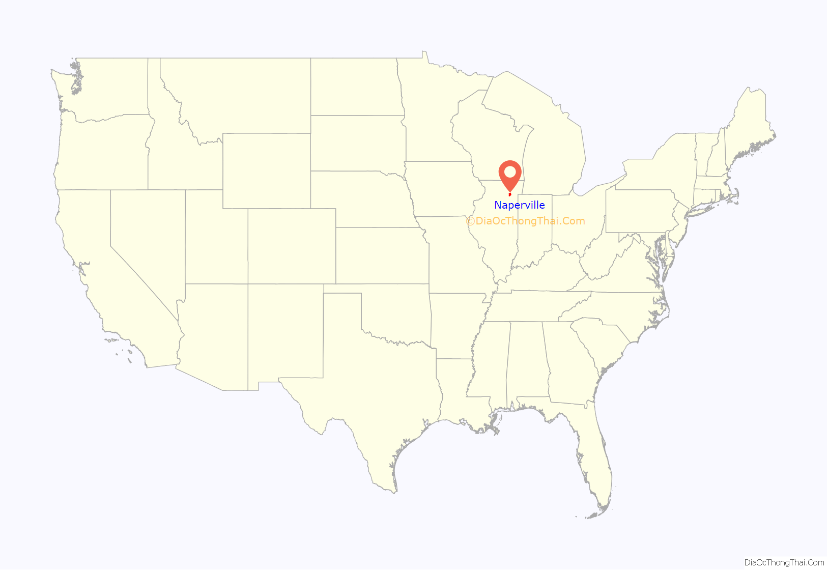
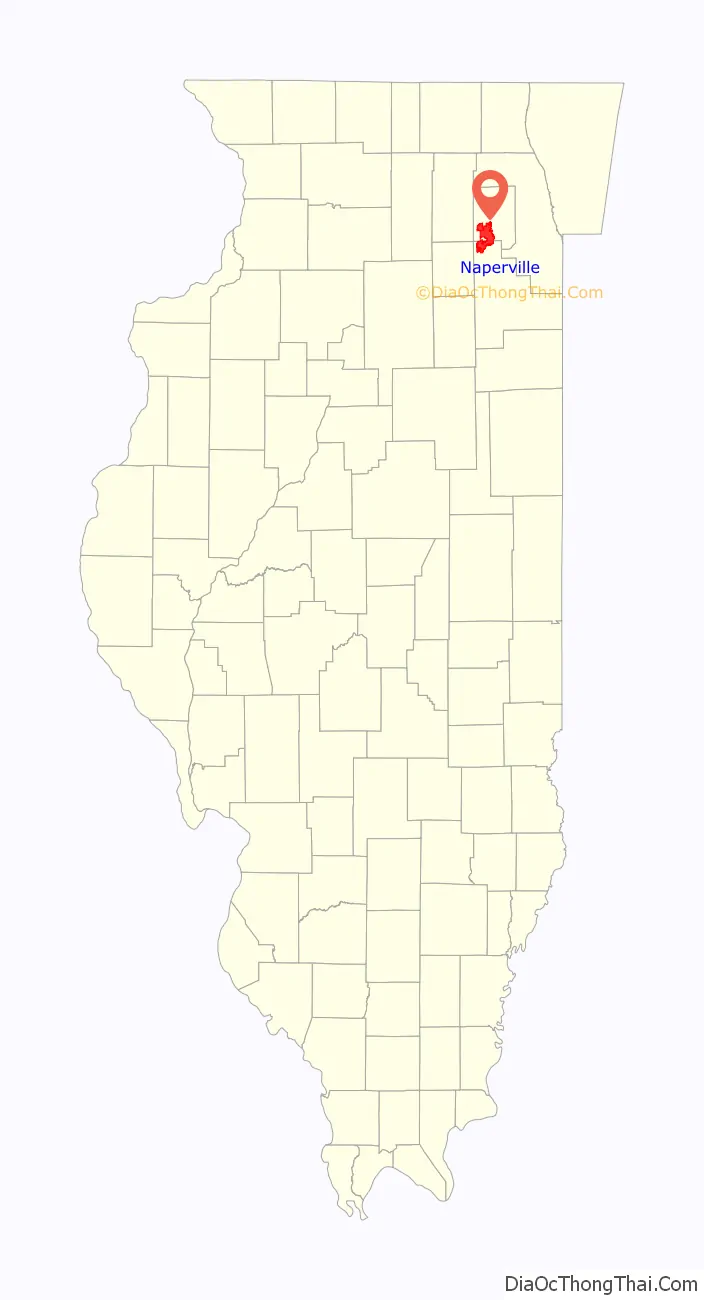
Naperville location map. Where is Naperville city?
History
Before any settlement, Naperville was home to Native American tribes. In 1641, the first Caucasian contact with Native Americans in Illinois was made with members of the Iliniwek tribe. The Iliniwek was the predominant tribe throughout Illinois at the time. They were later forced off the land by the Potawatomi tribe. The Potawatomi inhabited Naperville when the first settlers arrived. There was a major Potawatomi village at the present site of downtown Naperville, reached from Chicago by a trail that became Ogden Avenue. A minor village was near where Bailey Hobson later built his mill in 1834.
In 1831, Joseph Naper arrived at the west bank of the DuPage River with his family and friends to found what would be known as Naper’s Settlement. Among those original settlers were Naper’s wife, his brother and his wife, his sister and her husband John Murray, and his mother. Their arrival followed a nearly two-month voyage from Ashtabula County, Ohio, in the Naper brothers’ schooner, the Telegraph.
By 1832, over 100 settlers had arrived at Naper’s Settlement. After the news of the Indian Creek massacre during the Black Hawk War, these settlers were temporarily displaced to Fort Dearborn for protection from an anticipated attack by the Sauk tribe. Fort Payne was built at Naper’s Settlement, the settlers returned and the attack never materialized. The Pre-Emption House was constructed in 1834, as the Settlement became a stagecoach stop on the road from Chicago to Galena. The Pre-Emption House was the first hotel in DuPage county. After DuPage County was split from Cook County in 1839, Naper’s Settlement became the DuPage county seat. In 1843, the Illinois General assembly passed an act to incorporate the Naperville Cemetery Association. In 1855, Sybil Dunbar came to Naperville as its first recorded black female resident; she died in 1868 and was buried in Naperville Cemetery.
Naper’s Settlement was incorporated as the Village of Naperville in 1857, with a population of 2,000. The county seat distinction was lost in 1868 to Wheaton. On August 5, 1873, a train crashed on the CB&Q tracks about 1.5 miles (2.4 km) east of Naperville. Conductor Williams, who was operating a passenger train, was informed of a freight train occupying the line, but for some reason increased his speed, and upon rounding a curve, ran into a freight caboose. A conductor sitting in the caboose and a cattle drover were instantly killed. The passenger train fireman and engineer jumped out of the locomotive just in time to save their lives.
In 1887, Peter Edward Kroehler established the Kroehler Manufacturing Company’s factory in Naperville along the Chicago, Burlington & Quincy tracks. In 1890, reincorporation as a city occurred.
After Professor James Nichols donated $10,000, Nichols Library was built, and dedicated in 1898. In January 1907, Edward Sanatorium (now Edward Hospital) was opened by Eudora Hull Spalding. It used the “open air” treatment for tuberculosis patients. In 1908, the Chicago YMCA stated that Naperville was too small for its own YMCA building, but Peter Kroehler led a campaign to build one. In January 1910, Kroehler was the mayor of Naperville and its richest resident. But rumors in Naperville relating to a relationship between him and his stenographer caused him to resign as mayor. After his resignation he retreated to his Binghamton, New York factory. The YMCA was opened on March 26, 1911, and included the first swimming pool in DuPage County. In February 1920, Edward sanatorium burned to the ground, and cost $500,000 to rebuild.
On April 26, 1946, Naperville was the site of a train disaster. Two Chicago, Burlington and Quincy Railroad trains collided “head to tail” on a single track just west of the Loomis Street grade crossing. The accident killed 45 and injured approximately 127 passengers and/or crew members. In the 1950s, the city limits were about six square miles, but by 1960, the city had its single largest year in geographical expansion in Naperville’s history. That year saw over 1,500 acres annexed.
In 1955 Edward Sanatorium was converted into a general hospital.
A predominantly rural community for most of its existence, Naperville experienced a population explosion beginning in the 1960s and continuing into the 1980s and 1990s. Throughout the 1990s and ’80s the city’s population tripled.
In 1996, Naperville was the site of a flood that also affected the majority of northeastern Illinois. Naperville received 14 inches of rain in less than 24 hours, and DuPage County was declared a disaster zone. The estimated damages were over $30 million.
The YMCA in Downtown Naperville was announced to close in May 2020 after 109 years of operation, due to economic difficulties caused by the COVID-19 pandemic.
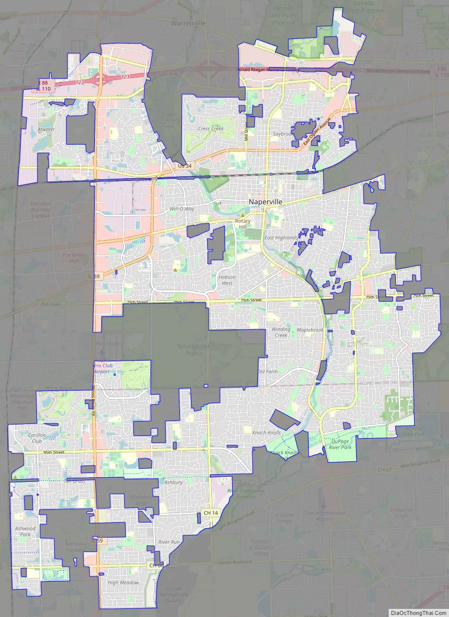
Naperville Road Map
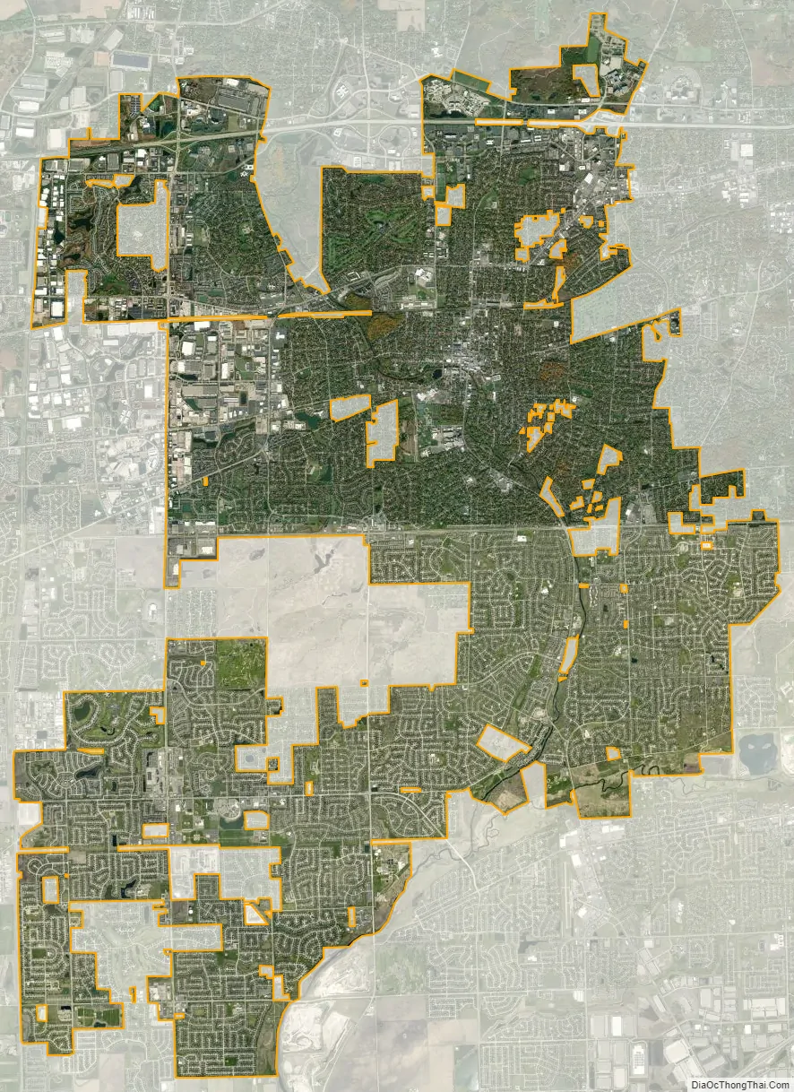
Naperville city Satellite Map
Geography
According to the 2021 census gazetteer files, Naperville has a total area of 39.68 square miles (102.77 km), of which 39.10 square miles (101.27 km) (or 98.52%) is land and 0.59 square miles (1.53 km) (or 1.48%) is water.
Parts of Naperville drain to the West Branch of the DuPage River in DuPage County. The Forest Preserve District ownership of a large amount of property along the West Branch has minimized development in floodplains and has helped reduce the damage from overbank flooding that has occurred in the county’s more developed watersheds. The DuPage River Trail also runs along the DuPage River, which serves bikes and pedestrians. Naperville was primarily flat prairie before its settlement. Its main geographic anomalies are manmade hills, such as the Greene Valley Hill, a former garbage dump.
Naperville has had two major floods, one in 1996 and one in 2013.
Naperville is in six townships and two counties. In DuPage County, the northwest portion is in Winfield Township, the northeast portion in Milton Township, the west-central portion in Naperville Township, and the east-central portion in Lisle Township.
In Will County, the southwest portion is in Wheatland Township and the southeast portion in DuPage Township. The largest number of Naperville residents live in Lisle Township, followed by Naperville Township.
Naperville’s municipal boundaries are cut in noticeably by many places. In the west, Springbrook Prairie, a forest preserve run by The Forest Preserve District of DuPage County, is a major enclave. In the southwest, the Tamarack neighborhood is a major unincorporated enclave. In the north, McDowell Grove Forest Preserve and various office complexes around Diehl Road form a major enclave into the boundary.
Climate
Naperville has a typical Midwestern humid continental climate (Köppen Dfa). There are four distinct seasons: winters are cold and snowy, springs are humid, summers are hot, and falls are cool. The highest recorded temperature was 105 °F. The coldest was -29 °F.
See also
Map of Illinois State and its subdivision:- Adams
- Alexander
- Bond
- Boone
- Brown
- Bureau
- Calhoun
- Carroll
- Cass
- Champaign
- Christian
- Clark
- Clay
- Clinton
- Coles
- Cook
- Crawford
- Cumberland
- De Kalb
- De Witt
- Douglas
- Dupage
- Edgar
- Edwards
- Effingham
- Fayette
- Ford
- Franklin
- Fulton
- Gallatin
- Greene
- Grundy
- Hamilton
- Hancock
- Hardin
- Henderson
- Henry
- Iroquois
- Jackson
- Jasper
- Jefferson
- Jersey
- Jo Daviess
- Johnson
- Kane
- Kankakee
- Kendall
- Knox
- La Salle
- Lake
- Lake Michigan
- Lawrence
- Lee
- Livingston
- Logan
- Macon
- Macoupin
- Madison
- Marion
- Marshall
- Mason
- Massac
- McDonough
- McHenry
- McLean
- Menard
- Mercer
- Monroe
- Montgomery
- Morgan
- Moultrie
- Ogle
- Peoria
- Perry
- Piatt
- Pike
- Pope
- Pulaski
- Putnam
- Randolph
- Richland
- Rock Island
- Saint Clair
- Saline
- Sangamon
- Schuyler
- Scott
- Shelby
- Stark
- Stephenson
- Tazewell
- Union
- Vermilion
- Wabash
- Warren
- Washington
- Wayne
- White
- Whiteside
- Will
- Williamson
- Winnebago
- Woodford
- Alabama
- Alaska
- Arizona
- Arkansas
- California
- Colorado
- Connecticut
- Delaware
- District of Columbia
- Florida
- Georgia
- Hawaii
- Idaho
- Illinois
- Indiana
- Iowa
- Kansas
- Kentucky
- Louisiana
- Maine
- Maryland
- Massachusetts
- Michigan
- Minnesota
- Mississippi
- Missouri
- Montana
- Nebraska
- Nevada
- New Hampshire
- New Jersey
- New Mexico
- New York
- North Carolina
- North Dakota
- Ohio
- Oklahoma
- Oregon
- Pennsylvania
- Rhode Island
- South Carolina
- South Dakota
- Tennessee
- Texas
- Utah
- Vermont
- Virginia
- Washington
- West Virginia
- Wisconsin
- Wyoming


