Bellevue (/ˈbɛlvjuː/ BEL-vew) is a city in the Eastside region of King County, Washington, United States, located across Lake Washington from Seattle. It is the third-largest city in the Seattle metropolitan area and has variously been characterized as a satellite city, a suburb, a boomburb, or an edge city. Its population was 122,363 at the 2010 census and 151,854 in the 2020 census. The city’s name is derived from the French term belle vue (“beautiful view”).
Bellevue is home to some of the world’s largest technology companies. Before and after the 2008 recession, its downtown area has been undergoing rapid change with many high-rise projects being constructed. Downtown Bellevue is currently the second-largest city center in Washington state, with 1,300 businesses, 45,000 employees, and 10,200 residents. In a 2018 estimate, the city’s median household income was among the top five cities in the state of Washington. In 2008, Bellevue was number one in CNNMoney’s list of the best places to live and launch a business, and in 2010 was again ranked as the fourth-best place to live in America. In 2014, Bellevue was ranked as the second-best place to live by USA Today.
More than 145 companies have been located in Bellevue; companies currently headquartered there include PACCAR Inc, T-Mobile, and Valve. The technology company Amazon was founded in Bellevue by Jeff Bezos.
| Name: | Bellevue city |
|---|---|
| LSAD Code: | 25 |
| LSAD Description: | city (suffix) |
| State: | Washington |
| County: | King County |
| Incorporated: | March 31, 1953 |
| Elevation: | 85 ft (26 m) |
| Land Area: | 33.46 sq mi (86.66 km²) |
| Water Area: | 4.04 sq mi (10.47 km²) |
| Population Density: | 4,000/sq mi (1,600/km²) |
| Area code: | 425 |
| FIPS code: | 5305210 |
| Website: | bellevuewa.gov |
Online Interactive Map
Click on ![]() to view map in "full screen" mode.
to view map in "full screen" mode.
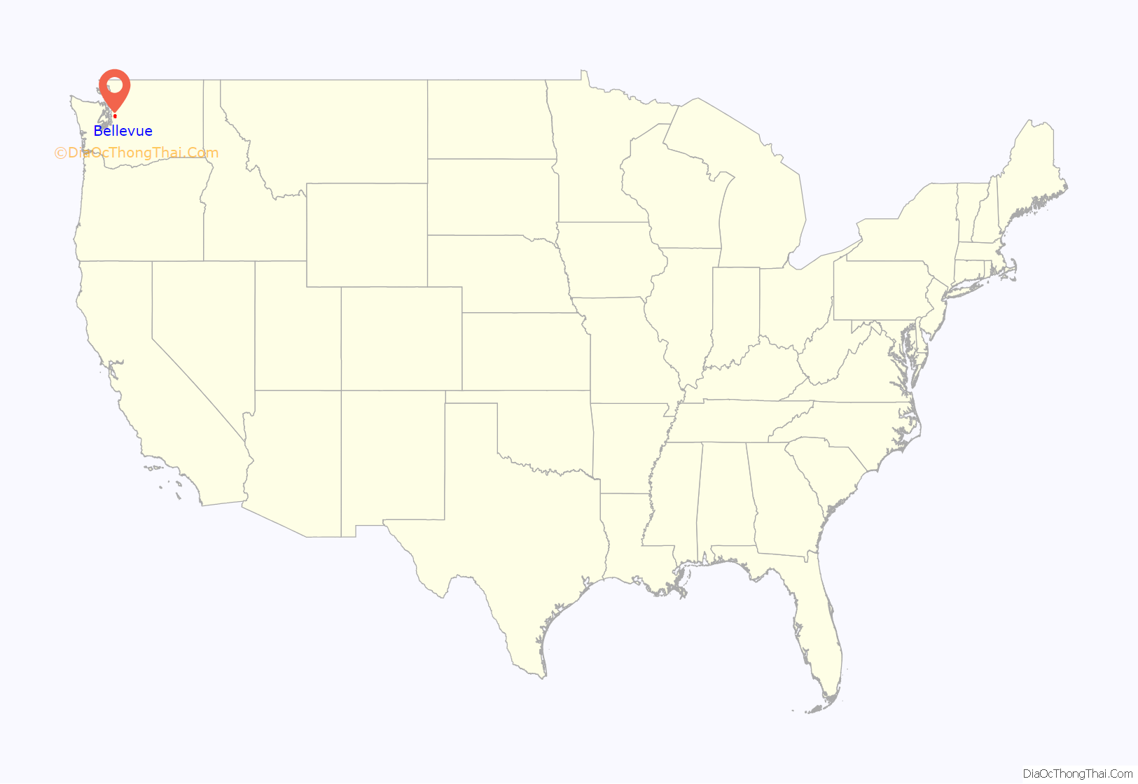
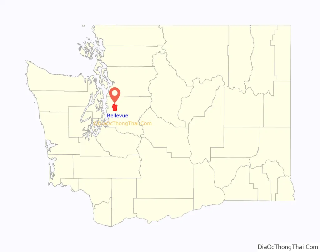
Bellevue location map. Where is Bellevue city?
History
The Duwamish, whose main settlements were located in present-day Renton and Seattle, maintained a small outpost settlement called Satskal (SAH-tsah-kahl) along the Mercer Slough, south of present-day downtown Bellevue. It was from this village that an attack on the settlers of Elliott Bay was staged. The Duwamish also had a village near Factoria called ‘pah-pah-DEEL’.
Bellevue was first settled by European Americans in 1869 by William Meydenbauer and Aaron Mercer, who claimed homestead tracts several miles apart. Both moved away within a few years, and permanent residents did not arrive until 1879. By 1882, a community, consisting mostly of logging homesteaders, had established itself. Once the land had been logged, it was gradually cleared, largely by Japanese immigrant labor in the early 20th century, to support small-scale farming on leased land plots.
By the early part of the 20th century, Bellevue had acquired a reputation as a weekend getaway destination for Seattle residents, who would arrive by ferry at Meydenbauer Bay and spend the day at nearby Wildwood Park. After the ferry landing was moved to Medina, however, tourism to Bellevue waned. To counter this decline, the Bellevue Strawberry Festival was conceived of in 1925, and by the 1930s it had grown to attract as many as 15,000 visitors. At the time, Bellevue was still a small town with around 2,000 residents.
Prior to the opening of the Lake Washington Floating Bridge in 1940, Bellevue was mostly rural farmland area with little development. Although it was small, developers were pushing to change that; in the 1920s, James S. Ditty predicted that it would become a city with a population of 200,000. He envisioned plans that included the bridging of Lake Washington and an area filled with golf courses and airports. His map with these visions was published in 1928. Once the Murrow Memorial Bridge opened, access from Seattle improved, and the area began to evolve into a bedroom community.
In 1942, the Bellevue Strawberry Festival was cancelled. The primary reason was that some 90 percent of the agricultural workforce in the area was of Japanese ancestry, and all of these farmers and their families had been forcibly interned in camps following the start of World War II. The fair would not be revived for another 45 years. Following the expulsion of the ethnic Japanese farming community, a large quantity of farmland became available for development. This made way for the initial development of the Bellevue downtown area.
Bellevue incorporated as a third-class city on the March 31, 1953. Following the 1963 opening of a second bridge across the lake, the Evergreen Point Floating Bridge, the city began to grow more rapidly. The Crossroads community was annexed in 1964. Lake Hills was annexed in 1969. By the 1970 census, Bellevue had become the fourth most populous city in the state of Washington, behind only Seattle, Spokane, and Tacoma.
Bellevue remains one of the largest cities in the state, with several high-rise structures in its core and a burgeoning business community. The city experienced a building boom during the mid-2000s, with the building of developments such as Lincoln Square and the Bravern.
Bellevue Square is located in downtown Bellevue and is now one of the largest shopping centers in the region. Opened in 1946, the mall has undergone several significant phases of expansion since the 1980s.
The city’s plans include the Bel-Red Corridor Project, a large-scale planning effort to encourage the redevelopment of the large Bel-Red section of the city bordering the adjacent town of Redmond which is a major employment area in the city. Patterned after the redevelopment of the downtown core, plans include superblock mixed-use projects similar to Lincoln Square, premised on private construction and the development of infrastructure such as the extension of Link light rail to the Eastside.
Bellevue Road Map
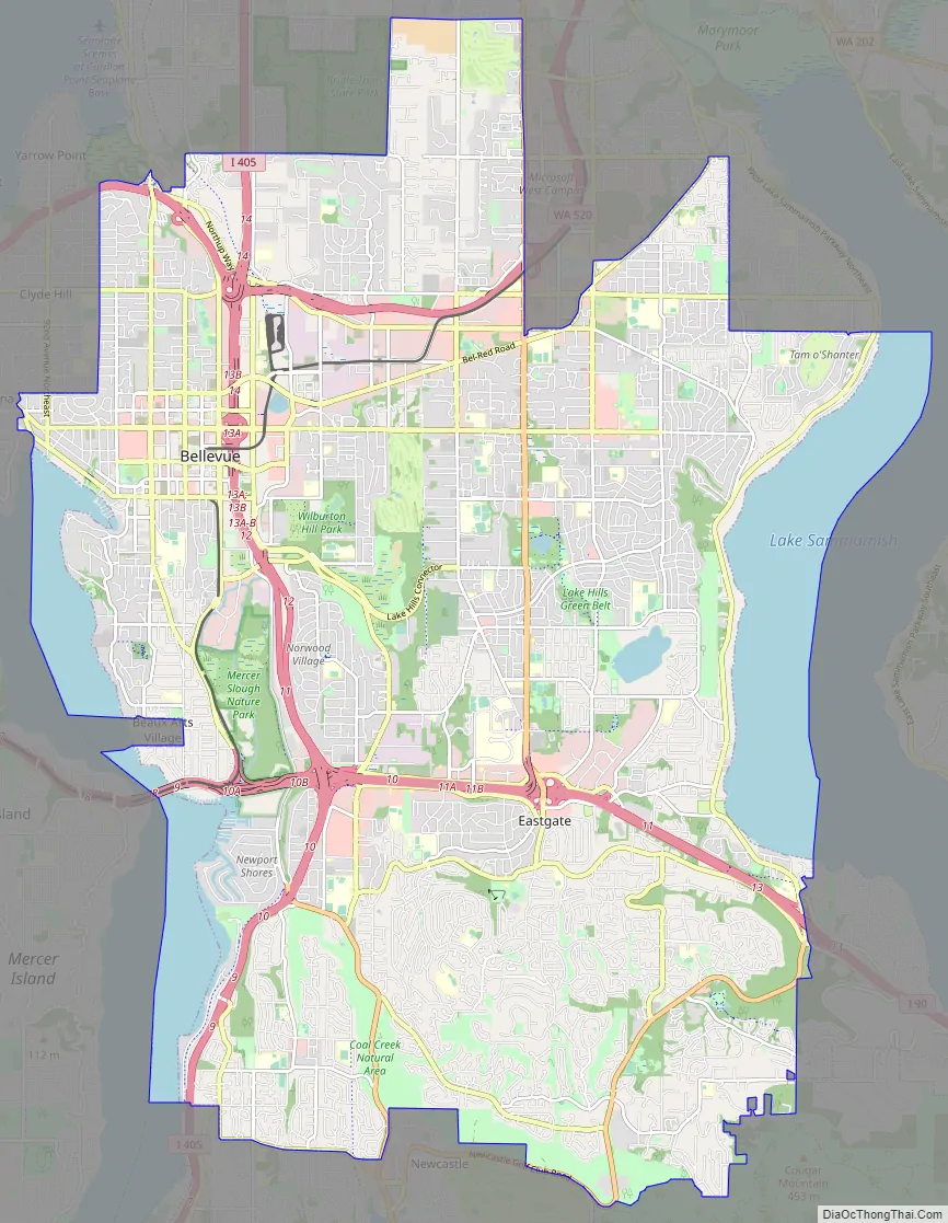
Bellevue city Satellite Map

Geography
Bellevue lies between Lake Washington to the west and the smaller Lake Sammamish to the east. Much of Bellevue is drained by the Kelsey Creek watershed, whose source is located in the Larsen Lake and Phantom Lake green belt and whose outlet is near where Interstate 90 meets Lake Washington’s eastern shore. The city is bisected by Interstate 405 running north–south, and the southern portion is crossed from west to east by Interstate 90. The State Route 520 freeway roughly delineates the upper reaches of Bellevue.
According to the United States Census Bureau, the city has a total area of 36.47 square miles (94.46 km), of which 31.97 square miles (82.80 km) is land and 4.50 square miles (11.65 km) is water.
The city’s name is derived from a French term for “beautiful view”. Under favorable weather conditions, scenic vistas of the Olympic Mountains and Cascade Mountains can be viewed from hilltops (and strategically positioned high-rise buildings) within the incorporated city.
South of I-90, the city continues up Cougar Mountain, at the top of which is an unincorporated King County location called Hilltop. To the west of Cougar Mountain, Bellevue includes the Coal Creek, Somerset, and Factoria neighborhoods.
Bellevue is bordered by the cities of Kirkland to the north and Redmond to the northeast along the Overlake and Crossroads neighborhoods. Across the short East Channel Bridge, I-90 connects Bellevue to Mercer Island to the southwest. Issaquah is to the east, down I-90 at the south end of Lake Sammamish. The city is bordered to the west by many affluent suburbs such as Medina, Clyde Hill, Hunts Point and Yarrow Point. The south end of Bellevue is bordered by the city of Renton, and to the southeast, the relatively recently incorporated city of Newcastle.
Cityscape
Neighborhoods within Bellevue include Bellecrest, Bel-Red, Bridle Trails, Crossroads, Eastgate/Cougar Mountain, Enatai, Factoria, Lake Hills, Newport, Newport Hills, Northeast Bellevue, Northwest Bellevue, Overlake, Sammamish/East Bellevue, Somerset, Sunset, Tam O’Shanter, West Bellevue, Wilburton, and Woodridge.
Climate
Like much of the Puget Sound lowland, Bellevue has a mild oceanic climate. It also has frequent rain showers from October to May, with precipitation levels typically being over 2 inches (51 mm). On average, the hottest month is July, while January is the coldest. Bellevue gets an average of 32.02 inches (813 mm) of rain per year, based on data from 1981 to 2013. However, the city published an analysis of rainfall stating that 2016 saw an usually high 47.14 inches (1,197 mm) of rainfall, and that rainfall in 2014–2016 was trending unusually high. The wet season of 2017, defined as the period from October through April, saw a similar rainfall of 47.26 inches (1,200 mm).
Surrounding cities
Transportation
Bellevue is the main Eastside hub for both the local transit authority, King County Metro, and Sound Transit, the regional transit system. The Bellevue Transit Center, which serves both Metro and Sound buses, is located in the heart of the downtown business district and is connected to Interstate 405 by NE 6th St. and a direct-access Texas T HOV ramp. Local buses run into Kirkland, Redmond, Issaquah, Renton, and the University District; regional buses go to Bothell, Lynnwood, Everett, Seattle, Renton, Kent and Auburn, among other cities.
The 2 Line of Sound Transit’s Link light rail system is planned to run from Seattle through Mercer Island and Bellevue before ending in Redmond. It was approved by voters on November 4, 2008, as part of the Sound Transit 2 ballot measure. It began construction in 2015 and is scheduled to begin service in 2023.
The Bellevue City Council lobbied hard for Sound Transit—the regional transit authority—to construct its light-rail line underground through Bellevue’s rapidly growing downtown. Bellevue promised to devote between $104 million and $150 million toward a potential tunnel in the form of cash, services, free access to rights-of-way and one-time tax revenues that result from the East Link project. In November 2011, the council signed an agreement with Sound Transit. Tunnel construction started in early 2016 while the remainder of downtown Bellevue construction began in mid-2017. Former Bellevue City Council member Claudia Balducci is a member of the Sound Transit board of directors.
The City of Bellevue has undertaken an extensive “Bel-Red Area Transformation” process which seeks to plan some 900 acres (3.6 km) in the Spring District in the city’s northern portion, all of which is premised on the extension of light rail to the Eastside under Sound Transit 2. The top-down and highly integrated land use and transportation planning is similar to earlier planning for the Downtown.
Bellevue was also served by a railroad, a Burlington Northern branch line known as the Woodinville Subdivision, which included the historic Wilburton Trestle. The line is now disused, though part of the track bed at Wilburton Station will be reused by Sound Transit’s light-rail construction. Construction of Eastrail, a rail trail on the abandoned Woodinville Subdivision right of way through Bellevue, is planned to be completed in 2023. Some sections of the railroad in Bellevue were demolished in 2008 to make way for the expansion of I-405 and will require the construction of additional structures to supplement the existing right of way.
The city once had an operating airfield named Bellevue Airfield; it shut down in 1983.
See also
Map of Washington State and its subdivision:- Adams
- Asotin
- Benton
- Chelan
- Clallam
- Clark
- Columbia
- Cowlitz
- Douglas
- Ferry
- Franklin
- Garfield
- Grant
- Grays Harbor
- Island
- Jefferson
- King
- Kitsap
- Kittitas
- Klickitat
- Lewis
- Lincoln
- Mason
- Okanogan
- Pacific
- Pend Oreille
- Pierce
- San Juan
- Skagit
- Skamania
- Snohomish
- Spokane
- Stevens
- Thurston
- Wahkiakum
- Walla Walla
- Whatcom
- Whitman
- Yakima
- Alabama
- Alaska
- Arizona
- Arkansas
- California
- Colorado
- Connecticut
- Delaware
- District of Columbia
- Florida
- Georgia
- Hawaii
- Idaho
- Illinois
- Indiana
- Iowa
- Kansas
- Kentucky
- Louisiana
- Maine
- Maryland
- Massachusetts
- Michigan
- Minnesota
- Mississippi
- Missouri
- Montana
- Nebraska
- Nevada
- New Hampshire
- New Jersey
- New Mexico
- New York
- North Carolina
- North Dakota
- Ohio
- Oklahoma
- Oregon
- Pennsylvania
- Rhode Island
- South Carolina
- South Dakota
- Tennessee
- Texas
- Utah
- Vermont
- Virginia
- Washington
- West Virginia
- Wisconsin
- Wyoming


