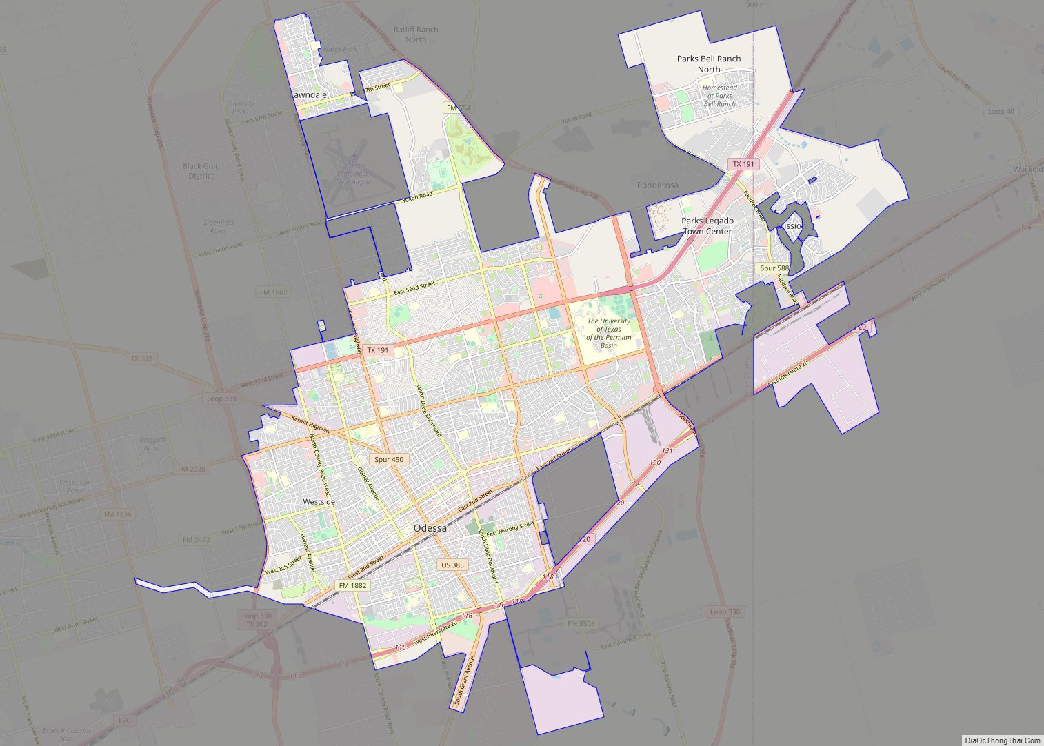
Map of Beaumont city, Texas

Map of Beaumont city, Texas

Beaumont is a coastal city in the U.S. state of Texas. It is the seat of government of Jefferson County, within the Beaumont–Port Arthur metropolitan statistical area, located in Southeast Texas on the Neches River about 85 miles (137 km) east of Houston (city center to city center). With a population of 115,282 at the 2020 … Read more

Map of Lansing city, Michigan

Map of Lansing city, Michigan

Lansing (/ˈlænsɪŋ/) is the capital of the U.S. state of Michigan. It is mostly in Ingham County, although portions of the city extend west into Eaton County and north into Clinton County. The 2020 census placed the city’s population at 112,644, making it the sixth largest city in Michigan. The population of its metropolitan statistical … Read more

Map of Downey city

Map of Downey city, California

Downey is a city located in Southeast Los Angeles County, California, United States, 13 mi (21 km) southeast of Downtown Los Angeles. It is considered part of the Gateway Cities. The city is the birthplace of the Apollo space program. It is also the home of the oldest operating McDonald’s restaurant in the world. As of the … Read more

Map of Peoria city, Illinois

Map of Peoria city, Illinois

Peoria (/piˈɔːriə/ pee-OR-ee-ə) is a city in and county seat of Peoria County, Illinois, United States. Located on the Illinois River, the city had a population of 113,150 as of the 2020 census. It is the principal city of the Peoria Metropolitan Area in Central Illinois, consisting of the counties of Fulton, Marshall, Peoria, Stark, … Read more

Map of Pueblo city

Map of Pueblo city, Colorado

Pueblo (/ˈpwɛbloʊ/) is a home rule municipality that is the county seat and the most populous municipality of Pueblo County, Colorado, United States. The city population was 111,876 at the 2020 United States Census, making Pueblo the ninth most populous city in Colorado. Pueblo is the principal city of the Pueblo, CO Metropolitan Statistical Area … Read more

Map of Temecula city

Map of Temecula city

Temecula (/təˈmɛkjʊlə/; Spanish: Temécula, [te’mekula]; Luiseño: Temeekunga) is a city in southwestern Riverside County, California, United States. The city had a population of 110,003 as of the 2020 census and was incorporated on December 1, 1989. The city is a tourist and resort destination, with the Temecula Valley Wine Country, Old Town Temecula, the Temecula … Read more

Map of Miami Gardens city

Map of Miami Gardens city

Miami Gardens is a city in north-central Miami-Dade County, Florida, United States. It is located 16 miles (26 km) north of Downtown Miami with city boundaries that stretch from I-95 and Northeast 2nd Avenue to its east to Northwest 47th and Northwest 57th Avenues to its west, and from the Broward County line to its north … Read more

Map of Pompano Beach city

Map of Pompano Beach city

Pompano Beach (/ˈpɒmpənoʊ/ POMP-ə-noh) is a city in Broward County, Florida, United States. It is located along the coast of the Atlantic Ocean, just north of Fort Lauderdale. The nearby Hillsboro Inlet forms part of the Atlantic Intracoastal Waterway. As of the 2020 census, the city’s population was 112,046. Located 36 miles (58 km) north of … Read more

Map of San Buenaventura (Ventura) city

Map of San Buenaventura (Ventura) city

Ventura, officially named San Buenaventura (Spanish for “Saint Bonaventure”), is a city in and the county seat of Ventura County, California, United States. The population was 110,763 at the 2020 census. Ventura is a popular tourist destination, owing to its historic landmarks, beaches, and resorts. Ventura has been inhabited by different peoples, including the Chumash … Read more

Map of Costa Mesa city

Map of Costa Mesa city

Costa Mesa (/ˌkoʊstə ˈmeɪsə/; Spanish for “Mesa Coast”) is a city in Orange County, California, United States. Since its incorporation in 1953, the city has grown from a semi-rural farming community of 16,840 to an urban area including part of the South Coast Plaza–John Wayne Airport edge city, one of the region’s largest commercial clusters, … Read more

Map of Sugar Land city

Map of Sugar Land city

Sugar Land is the largest city in Fort Bend County, Texas, United States, located in the southwestern part of the Houston–The Woodlands–Sugar Land metropolitan area. Located about 19 miles (31 km) southwest of downtown Houston, Sugar Land is a populous suburban municipality centered around the junction of Texas State Highway 6 and Interstate 69/U.S. Route 59. … Read more