Beaumont is a coastal city in the U.S. state of Texas. It is the seat of government of Jefferson County, within the Beaumont–Port Arthur metropolitan statistical area, located in Southeast Texas on the Neches River about 85 miles (137 km) east of Houston (city center to city center). With a population of 115,282 at the 2020 census, Beaumont is the largest incorporated municipality by population near the Louisiana border. Its metropolitan area was the 10th largest in Texas in 2019, and 132nd in the United States.
The city of Beaumont was founded in 1838. The pioneer settlement had an economy based on the development of lumber, farming, and port industries. In 1892, Joseph Eloi Broussard opened the first commercially successful rice mill in Texas, stimulating development of rice farming in the area; he also started an irrigation company (since 1933, established as the Lower Neches Valley Authority) to support rice culture. Rice became an important commodity crop in Texas and is now cultivated in 23 counties.
A big change occurred in 1901 with the Spindletop gusher, which demonstrated that a huge oil field lay underneath and adjacent to the city. With Spindletop, several energy companies developed in Beaumont, and some remain. The area rapidly developed as one of the country’s major petrochemical refining areas. Along with Port Arthur and Orange, Beaumont forms the Golden Triangle, a major industrial area on the Texas Gulf Coast.
Beaumont is home to Lamar University, a national Carnegie doctoral research university with over 14,000 students, including undergraduates and postgraduates. Over the years, several corporations have been based in this city, including Gulf States Utilities, which had its headquarters in Beaumont until its takeover by Entergy Corporation in 1994. GSU’s Edison Plaza headquarters remains the tallest building in Beaumont.
| Name: | Beaumont city |
|---|---|
| LSAD Code: | 25 |
| LSAD Description: | city (suffix) |
| State: | Texas |
| County: | Jefferson County |
| Elevation: | 16 ft (5 m) |
| Land Area: | 82.46 sq mi (213.56 km²) |
| Water Area: | 2.73 sq mi (7.08 km²) |
| Population Density: | 1,400/sq mi (520/km²) |
| ZIP code: | 77701–77710, 77713, 77720, 77725, 77726 |
| Area code: | 409 |
| FIPS code: | 4807000 |
| GNISfeature ID: | 1330268 |
| Website: | beaumonttexas.gov |
Online Interactive Map
Click on ![]() to view map in "full screen" mode.
to view map in "full screen" mode.
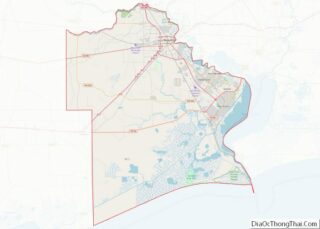
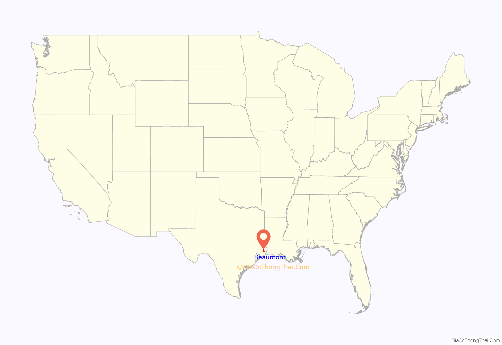
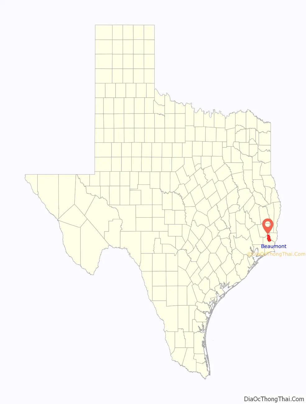
Beaumont location map. Where is Beaumont city?
History
In 1824 Noah and Nancy Tevis settled on the west bank of the Neches River and developed a farm. Soon after that, a small community grew up around the farm, which was named Tevis Bluff or Neches River Settlement. In 1835 the land of Tevis, together with the nearby community of Santa Anna (in total, 50 acres (20 ha)), was purchased by Henry Millard (c. 1796–1844), Joseph Pulsifer (1805–1861), and Thomas Byers Huling (1804–1865). They began planning a town to be laid out on this land. Their partnership, J.P. Pulsifer and Company, controlled the first 50 acres (200,000 m) upon which the town was founded. This town was named Beaumont, after Mary Dewburleigh Barlace Warren Beaumont, the wife of Henry Millard. They added more property for a total of 200 acres.
Beaumont became a town on December 16, 1838. Beaumont’s first mayor was Alexander Calder. From the town’s founding in 1835, business activities included real estate, transportation, and retail sales. Later, other businesses were formed, especially in railroad construction and operation, new building construction, lumber sales, and communications. The Port of Beaumont became a successful regional shipping center. Beaumont was a small center for cattle raisers and farmers in its early years. With an active riverport by the 1880s, it became an important lumber and rice-milling town. The city exported rice as a commodity crop. Beaumont’s lumber boom, which reached its peak in the late 19th century, was stimulated by the rebuilding and expansion of the railroads in the state and region after the Civil War.
The Beaumont Rice Mill, founded in 1892 by Joseph Eloi Broussard, was the first commercially successful rice mill in Texas. In addition, Broussard cofounded the Beaumont Irrigation Company in 1898 to operate an irrigation system to support rice culture. The company along with four others established around the same time helped stimulate the expansion of rice cultivation from 1500 acres in 1892 to 400,000 acres in 23 counties by his death in 1956. The other companies were The Port Arthur Rice and Irrigation Company, The McFaddin-Wiess-Kyle Canal Company, the Treadaway or Neches Canal Company, and the Taylors-Hillebrand complex. The holdings of those companies formed the basis for the Lower Neches Valley Authority established by the state legislature in 1933.
The rise of Beaumont’s mill economy drew many new residents to the city, many of them immigrants. By the early 20th century, the city was served by the Southern Pacific; Kansas City Southern, Atchison, Topeka, and Santa Fe; and Missouri Pacific railroad systems.
Oil was discovered at nearby Spindletop on January 10, 1901. Spindletop became the first major oil field and one of the largest in American history. With the discovery of oil at Spindletop, Beaumont’s population more than tripled in two months from 9,000 in January 1901 to 30,000 in March 1901. Oil is, and has always been, a major export of the city, and a major contributor to the national GDP.
William Casper Tyrrell, nicknamed “Captain W.C.”, was a leading businessman and oil tycoon in the city in the early 20th century, developing businesses during the Texas Oil Boom. An entrepreneur from Pennsylvania and Iowa, he arrived after the gusher at Spindletop, and invested in development of a commercial port in the city, and an irrigation system to support the local rice industry, as well as residential and retail development of suburban property. He was also a philanthropist. He purchased and donated First Baptist Church, whose congregation had moved to a new facility, to use as the city’s first public library, now known as the Tyrrell Historical Library.
When the city became a major center for defense shipbuilding during World War II, tens of thousands of rural Texans migrated there for the new high-paying jobs. The Roosevelt administration ordered the defense industry to be integrated, and many Southern whites were working closely with blacks for the first time. Housing was scarce in the crowded city, and racial tensions increased. In June 1943 after workers at the Pennsylvania shipyards in Beaumont learned that a white woman had accused a black man of raping her, nearly 2,000 went to the jail where a suspect was being held, attracting more men along the way and reaching a total of 4,000. Ultimately the white mob rioted for three days, destroying major black neighborhoods and killing five persons. No one was prosecuted for the deaths. The riot in Beaumont was one of several in 1943 which centered in the defense industry, including Los Angeles, Detroit, and Mobile, Alabama as well as other cities across the country. The wartime social disruption was similar to war time riots which had occurred in other parts of the country during and following World War I.
During the war years, airmen cadets from the Royal Air Force, flying from their training base at Terrell, Texas, routinely flew to Beaumont on training flights. The community served as a stand-in for the British for Paris, France, which was the same distance from London, England as Beaumont is from Terrell.
In the postwar years, Beaumont’s port continued in importance. As was typical with other cities, post-war highway construction led to the development of new suburbs and dispersal of the population in search of new housing. Recently, there has been some renewal in Downtown Beaumont and in other areas of the city.
In 1996, the Jefferson County courts, located in Beaumont, became the first court in the nation to implement electronic filing and service of court documents. This eliminated the need for law firms to print and mail reams of documents.
In 2005 and 2008, Beaumont and surrounding areas suffered extensive damage from Hurricane Rita and Hurricane Ike, respectively. Mandatory evacuations were issued in advance of both storms.
In August 2017, Beaumont and surrounding areas experienced severe flooding as a result of Hurricane Harvey. Due to the flooding, Memorial Hermann Baptist Hospital evacuated all of its highest level of acuity patients with the help of National Guard helicopters. In addition, many Beaumont residents had to be rescued by both boats and helicopters as a result of the floodwaters. As of March 2019, many residents in the area are still attempting to recover from the hurricane as the city received emergency assistance.
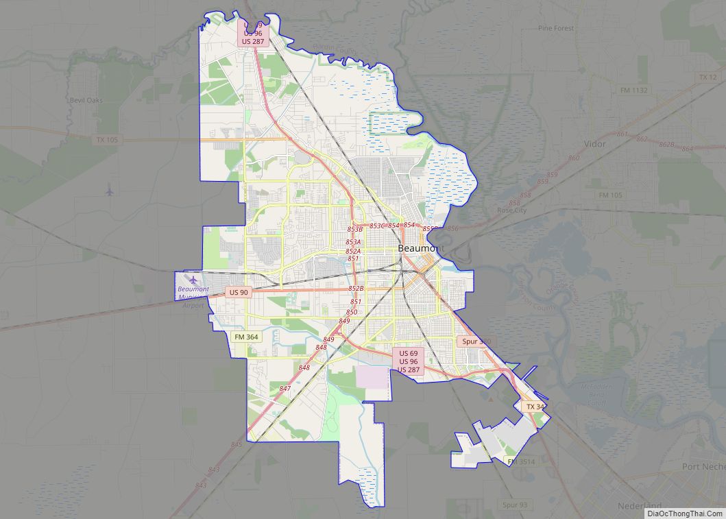
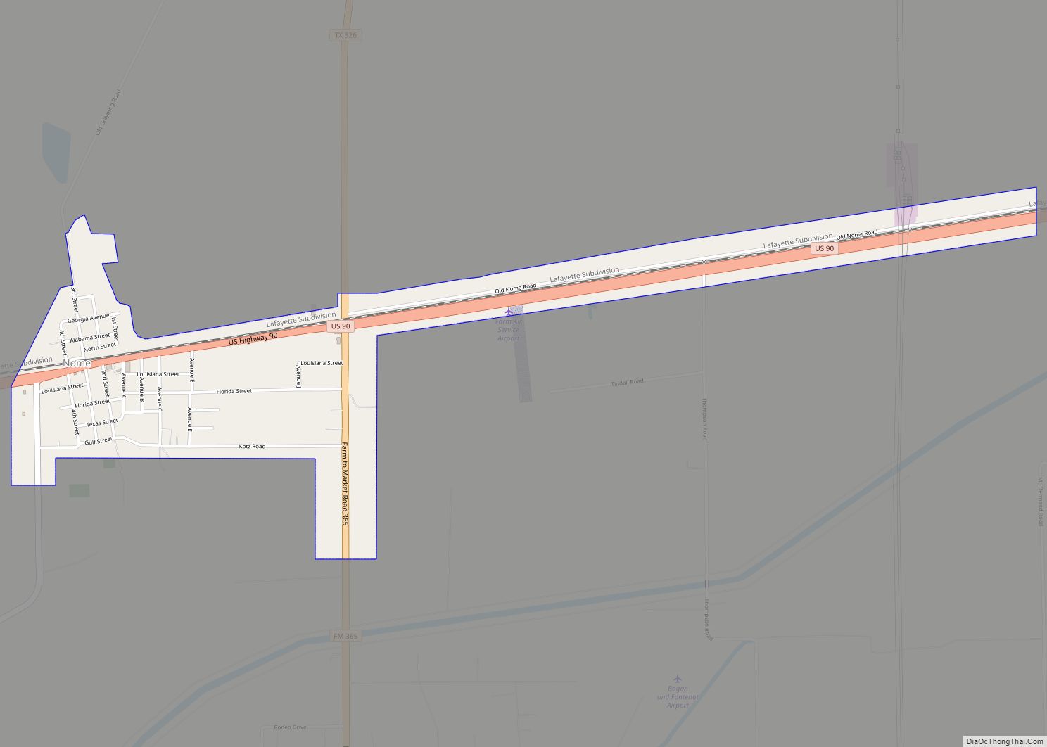
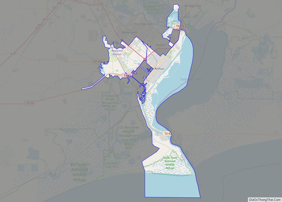
Beaumont Road Map


Beaumont city Satellite Map
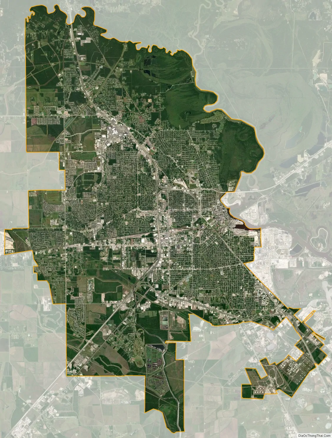
Geography
According to the United States Census Bureau, the city has a total area of 85.8 square miles (222.3 km), of which 82.8 square miles (214.5 km) are land and 3.1 square miles (7.9 km), or 3.53%, are water.
Beaumont lies on Texas’ coastal plain, about 30 miles (48 km) inland from the Gulf of Mexico, 85 miles (137 km) east of Houston, and just south of the dense pine forests of East Texas. The city is bordered on the east by the Neches River and to the north by Pine Island Bayou. Before being settled, the area was crisscrossed by numerous small streams. Most of these streams have since been filled in or converted for drainage purposes. The island directly across from Riverfront Park is called Trinity Island. There are also three other islands in the Neches River around the downtown area/port: Harbor, Smith and Clark. Beaumont is relatively flat compared to other Texas cites at being 16 ft. above sea level. South of Beaumont, Port Arthur is only 7 ft. above sea level.
Annexations
Several towns and communities have been absorbed into the city of Beaumont. These include: Amelia, established in 1885 and incorporated into Beaumont in 1956; Elizabeth, the depot of Amelia that was established around 1903 or after and annexed into Beaumont in 1957; Elwood, established sometimes in the late 1800s, changed to Voth in 1902, and annexed into Beaumont in 1957; Guffey, post office was established in 1901 and closed in 1925 but is part of Beaumont now; Santa Anna, became part of Beaumont when it was founded; Tevis Bluff, became part of Beaumont when it was founded in 1835.
Architecture
Beaumont has 8 buildings over 100 feet (30 m) tall, the tallest being the Edison Plaza, which is 254 feet (77 m) tall. The old Edson Hotel, built in 1928 is nearly the same height at 240 feet (73 m). One of the most prominent downtown buildings is the 15-story San Jacinto Building. Built in 1921, it sports one of the largest four faced clock towers in the nation, each dial being 17 feet (5.2 m) in diameter. In 1922 the 11-story Hotel Beaumont was built across the street from the San Jacinto. The Hotel Beaumont bears a resemblance to the old Winecoff Hotel in Atlanta.
The second oil boom of 1925 brought more people and wealth to Beaumont, the same year the 12-story American National Bank Building (now Orleans Building), was erected, and in 1926 Forrest Goodhue built the 12-story Goodhue Building which included a penthouse. In 1928, the Edson Hotel was built. No other buildings were built until Century Tower in 1962 and in 1982 Edison Plaza was built. In 1994 the 12-story LaSalle Hotel, built in 1927, was demolished.
The Jefferson Theatre was built in 1927 by the Jefferson Amusement Company for $1 million and was Beaumont’s showpiece for many years. In 1928 the City Hall and Auditorium was built. It is now the Julie Rogers Theater.
Beaumont’s Jefferson County Courthouse is one of the tallest county courthouses in the state and is an excellent example of Art Deco architecture. Across the street from the Jack Brooks Federal Building is the Kyle Building, built in 1933. The storefront was recently restored and is considered to be one of the best examples of Zig-Zag architecture in Texas. The Oaks Historic District has many restored historic homes.
Kyle Building, Edson Hotel, Goodhue Building
Orleans Building
Left-San Jacinto Building, Right-Hotel Beaumont
Century Tower
Goodhue Building
Jefferson Theatre.
Julie Rogers Theater
Edison Plaza
Pollution
The Beaumont–Port Arthur region has historically been cited as one of the most polluted urban areas in the United States due to various energy industries and chemical plants in the area. Even so, as of July 2014, the Beaumont-Port Arthur region was not under any Environmental Protection Agency non-attainment restrictions; however, counties in the Greater Houston area, the Dallas–Fort Worth metroplex, and El Paso were. As of October 2014, the Beaumont-Port Arthur area was not under any Texas Commission on Environmental Quality attainment compliance deadlines. Regardless, according to an article published in 2007 focusing on Port Arthur, a neighboring city to the southeast of Beaumont, pollution was believed to have caused some area residents to become sick. This has generated debates throughout the local media.
Climate
The city of Beaumont experiences a humid subtropical climate and is within the Piney Woods region of eastern Texas. The area around Beaumont receives the most rainfall in the state: more than 60 inches (1,500 mm) annually. The city has two distinct seasons, a wet season from April to October and a dry season from November to March. Hurricanes also pose a threat to the city and greater metropolitan area.
Hurricane Rita in 2005 and Hurricane Ike in 2008 both caused significant damage. Both Hurricane Harvey in 2017 and Tropical Storm Imelda in 2019 caused historic flooding throughout the city. Hurricane Laura in 2020 posed a significant threat to the town, as it was forecasted to make landfall at the border of Texas and Louisiana, almost following the same track as Hurricane Rita in 2005. The storm turned more northerly close to landfall, and spared Beaumont the worst impacts and damage. Minor damage was reported with winds gusting around hurricane-force for a short period of time as Laura moved over Lake Charles, Louisiana. Also, Hurricane Delta in 2020 passed near the region as it made landfall in Southwest Louisiana. Impacts were about the same with Delta as they were with Laura.
On August 18, 2009, a tornado hit the west side of Beaumont, causing damage to cars and several local businesses. Injuries were minimal.
While wintry precipitation is unusual, it does occur. The most recent significant wintry event to occur was December 8, 2017 when the Southeast Texas Regional Airport recorded 3 inches of snowfall. December 11, 2008 and December 4, 2009, were also days that Beaumont saw measurable snowfall. Snow also fell across the Beaumont area on Christmas Eve 2004. In January 1997, a severe and historic ice storm struck the region, leaving thousands without power and major tree damage in its wake. In unofficial records, Beaumont received as much as 30 inches of snow during the blizzard of February 1895 that impacted the Gulf Coast.
See also
Map of Texas State and its subdivision:- Anderson
- Andrews
- Angelina
- Aransas
- Archer
- Armstrong
- Atascosa
- Austin
- Bailey
- Bandera
- Bastrop
- Baylor
- Bee
- Bell
- Bexar
- Blanco
- Borden
- Bosque
- Bowie
- Brazoria
- Brazos
- Brewster
- Briscoe
- Brooks
- Brown
- Burleson
- Burnet
- Caldwell
- Calhoun
- Callahan
- Cameron
- Camp
- Carson
- Cass
- Castro
- Chambers
- Cherokee
- Childress
- Clay
- Cochran
- Coke
- Coleman
- Collin
- Collingsworth
- Colorado
- Comal
- Comanche
- Concho
- Cooke
- Coryell
- Cottle
- Crane
- Crockett
- Crosby
- Culberson
- Dallam
- Dallas
- Dawson
- Deaf Smith
- Delta
- Denton
- Dewitt
- Dickens
- Dimmit
- Donley
- Duval
- Eastland
- Ector
- Edwards
- El Paso
- Ellis
- Erath
- Falls
- Fannin
- Fayette
- Fisher
- Floyd
- Foard
- Fort Bend
- Franklin
- Freestone
- Frio
- Gaines
- Galveston
- Garza
- Gillespie
- Glasscock
- Goliad
- Gonzales
- Gray
- Grayson
- Gregg
- Grimes
- Guadalupe
- Hale
- Hall
- Hamilton
- Hansford
- Hardeman
- Hardin
- Harris
- Harrison
- Hartley
- Haskell
- Hays
- Hemphill
- Henderson
- Hidalgo
- Hill
- Hockley
- Hood
- Hopkins
- Houston
- Howard
- Hudspeth
- Hunt
- Hutchinson
- Irion
- Jack
- Jackson
- Jasper
- Jeff Davis
- Jefferson
- Jim Hogg
- Jim Wells
- Johnson
- Jones
- Karnes
- Kaufman
- Kendall
- Kenedy
- Kent
- Kerr
- Kimble
- King
- Kinney
- Kleberg
- Knox
- La Salle
- Lamar
- Lamb
- Lampasas
- Lavaca
- Lee
- Leon
- Liberty
- Limestone
- Lipscomb
- Live Oak
- Llano
- Loving
- Lubbock
- Lynn
- Madison
- Marion
- Martin
- Mason
- Matagorda
- Maverick
- McCulloch
- McLennan
- McMullen
- Medina
- Menard
- Midland
- Milam
- Mills
- Mitchell
- Montague
- Montgomery
- Moore
- Morris
- Motley
- Nacogdoches
- Navarro
- Newton
- Nolan
- Nueces
- Ochiltree
- Oldham
- Orange
- Palo Pinto
- Panola
- Parker
- Parmer
- Pecos
- Polk
- Potter
- Presidio
- Rains
- Randall
- Reagan
- Real
- Red River
- Reeves
- Refugio
- Roberts
- Robertson
- Rockwall
- Runnels
- Rusk
- Sabine
- San Augustine
- San Jacinto
- San Patricio
- San Saba
- Schleicher
- Scurry
- Shackelford
- Shelby
- Sherman
- Smith
- Somervell
- Starr
- Stephens
- Sterling
- Stonewall
- Sutton
- Swisher
- Tarrant
- Taylor
- Terrell
- Terry
- Throckmorton
- Titus
- Tom Green
- Travis
- Trinity
- Tyler
- Upshur
- Upton
- Uvalde
- Val Verde
- Van Zandt
- Victoria
- Walker
- Waller
- Ward
- Washington
- Webb
- Wharton
- Wheeler
- Wichita
- Wilbarger
- Willacy
- Williamson
- Wilson
- Winkler
- Wise
- Wood
- Yoakum
- Young
- Zapata
- Zavala
- Alabama
- Alaska
- Arizona
- Arkansas
- California
- Colorado
- Connecticut
- Delaware
- District of Columbia
- Florida
- Georgia
- Hawaii
- Idaho
- Illinois
- Indiana
- Iowa
- Kansas
- Kentucky
- Louisiana
- Maine
- Maryland
- Massachusetts
- Michigan
- Minnesota
- Mississippi
- Missouri
- Montana
- Nebraska
- Nevada
- New Hampshire
- New Jersey
- New Mexico
- New York
- North Carolina
- North Dakota
- Ohio
- Oklahoma
- Oregon
- Pennsylvania
- Rhode Island
- South Carolina
- South Dakota
- Tennessee
- Texas
- Utah
- Vermont
- Virginia
- Washington
- West Virginia
- Wisconsin
- Wyoming