Peoria (/piˈɔːriə/ pee-OR-ee-ə) is a city in and county seat of Peoria County, Illinois, United States. Located on the Illinois River, the city had a population of 113,150 as of the 2020 census. It is the principal city of the Peoria Metropolitan Area in Central Illinois, consisting of the counties of Fulton, Marshall, Peoria, Stark, Tazewell, and Woodford, which had a population of 402,391 in 2020.
Established in 1691 by the French explorer Henri de Tonti, Peoria is the oldest permanent European settlement in Illinois according to the Illinois State Archaeological Survey. Originally known as Fort Clark, it received its current name when the County of Peoria was organized in 1825. The city was named after the Peoria people, a member of the Illinois Confederation. On October 16, 1854, Abraham Lincoln made his Peoria speech against the Kansas-Nebraska Act. Prior to prohibition, Peoria was the center of the whiskey industry in the United States. More than 12 distilleries operated in Peoria by the end of the 19th century, more than any other city in the U.S.
A major port on the Illinois River, Peoria is a trading and shipping center for a large agricultural area that produces corn, soybeans, and livestock. Although the economy is well diversified, the city’s traditional manufacturing industries remain important and produce earthmoving equipment, metal products, lawn-care equipment, labels, steel towers, farm equipment, building materials, steel, wire, and chemicals. Until 2018, Peoria was the global and national headquarters for heavy equipment and engine manufacturer Caterpillar Inc., one of the 30 companies composing the Dow Jones Industrial Average, and listed on the Fortune 100; in the latter year, the company relocated its headquarters to Deerfield, Illinois.
The city is associated with the phrase “Will it play in Peoria?”, which may have originated from the vaudeville era and is often spuriously attributed to Groucho Marx. Museums in the city include the Pettengill-Morron House, the John C. Flanagan House, and the Peoria Riverfront Museum.
| Name: | Peoria city |
|---|---|
| LSAD Code: | 25 |
| LSAD Description: | city (suffix) |
| State: | Illinois |
| County: | Peoria County |
| Elevation: | 502 ft (153 m) |
| Land Area: | 47.97 sq mi (124.24 km²) |
| Water Area: | 2.58 sq mi (6.69 km²) |
| Population Density: | 2,358.72/sq mi (910.71/km²) |
| Area code: | 309 |
| FIPS code: | 1759000 |
| Website: | www.peoriagov.org |
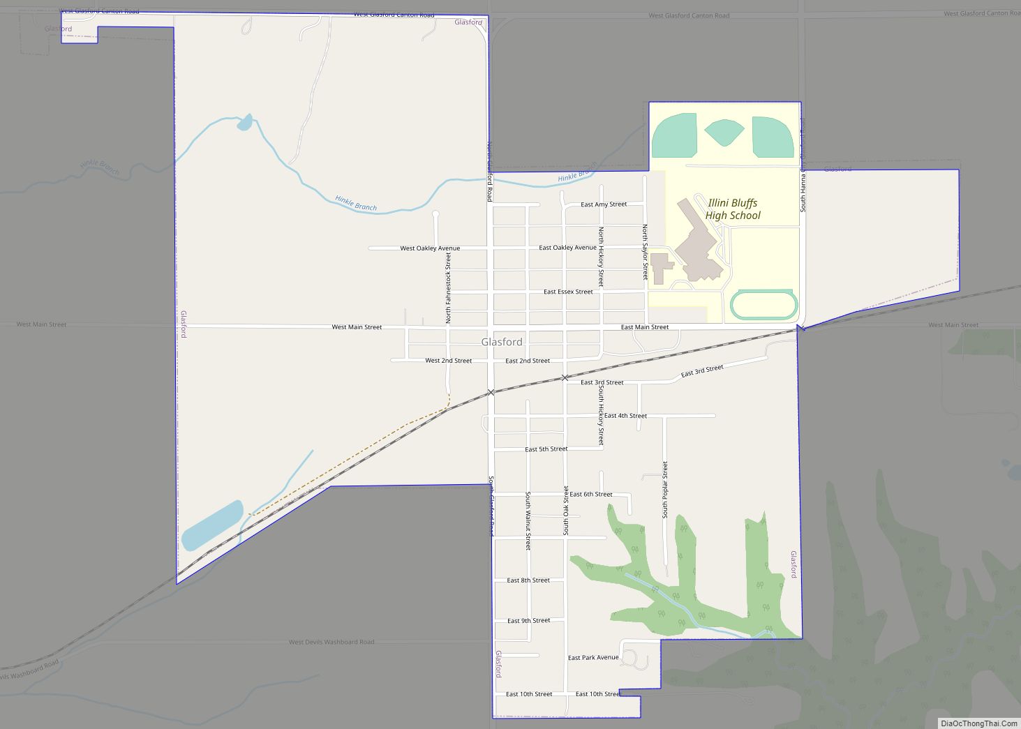
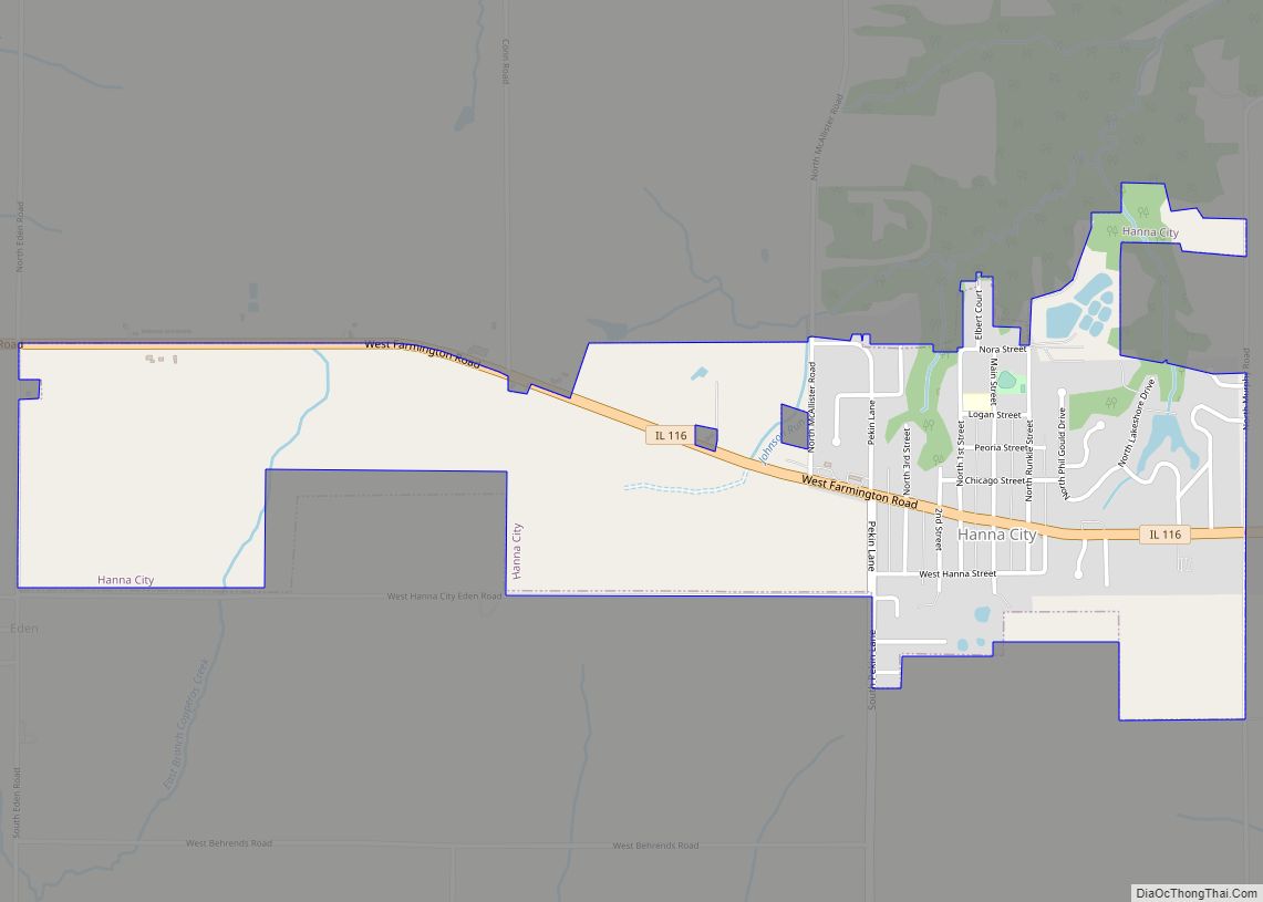
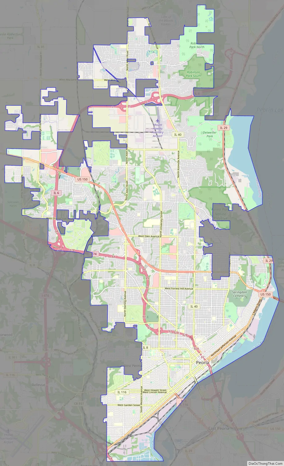
Online Interactive Map
Click on ![]() to view map in "full screen" mode.
to view map in "full screen" mode.
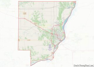
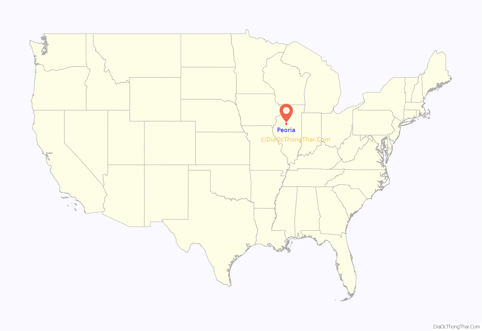
Peoria location map. Where is Peoria city?
History
Peoria is the oldest European settlement in Illinois, as explorers first ventured up the Illinois River from the Mississippi. The lands that eventually would become Peoria were first settled by Europeans in 1680, when French explorers René-Robert Cavelier, Sieur de La Salle and Henri de Tonti constructed Fort Crevecoeur. This fort would later burn to the ground, and in 1813, Fort Clark, Illinois was built. When the County of Peoria was organized in 1825, Fort Clark was officially named Peoria.
Peoria was named after the Peoria tribe, a member of the Illinois Confederation. The original meaning of the word is uncertain. A 21st-century proposal suggests a derivation from a Proto-Algonquian word meaning “to dream with the help of a manitou.”
Peoria was incorporated as a village on March 11, 1835. The city did not have a mayor, though they had a village president, Rudolphus Rouse, who served from 1835 to 1836. The first Chief of Police, John B Lishk, was appointed in 1837. The city was incorporated on April 21, 1845. This was the end of a village president and the start of the mayoral system, with the first mayor being William Hale.
Peoria, Arizona, a suburb of Phoenix, was named after Peoria, Illinois because the two men who founded it in 1890 − Joseph B. Greenhut and Deloss S. Brown − wished to name it after their hometown.
For much of the 20th century, a red-light district of brothels and bars known as the Merry-Go-Round was part of Peoria.
Richard Pryor got his start as a performer on North Washington Street in the early 1960s.
In 2021, Rita Ali became Peoria’s first female and African American mayor.
Notable events
- September 19 to October 21, 1813 – Peoria War
- 1844 – Abraham Lincoln came to Peoria to get involved in the Aquilla Wren divorce case and took it to the Supreme Court of Illinois
- April 15, 1926 – Charles Lindbergh’s first air mail route, Contract Air Mail route #2, began running mail from Chicago to Peoria to Springfield to St. Louis and back. There is nothing to substantiate the local legend that Lindbergh offered Peoria the chance to sponsor his trans-Atlantic flight and call his plane the “Spirit of Peoria,” but he does state that he first pondered the journey after taking off from the Peoria air mail field.
- 1942 – Penicillium chrysogenum, the fungus originally used to industrially produce penicillin, was first isolated from a mouldy cantaloupe found in a grocery store in Peoria.
- Local legend is that Theodore Roosevelt called Grandview Drive, a street on the bluffs overlooking the Illinois River “the world’s most beautiful drive” during his visit in 1910. However, no contemporaneous accounts of this story appeared, even in local papers and histories, for over two decades after it supposedly occurred. A related legend claims that the Peoria radio station and CBS television affiliate, WMBD, chose it’s call sign based on this story. In fact, the WMBD letters were assigned randomly and the meaning behind it was invented after the fact in 1927.
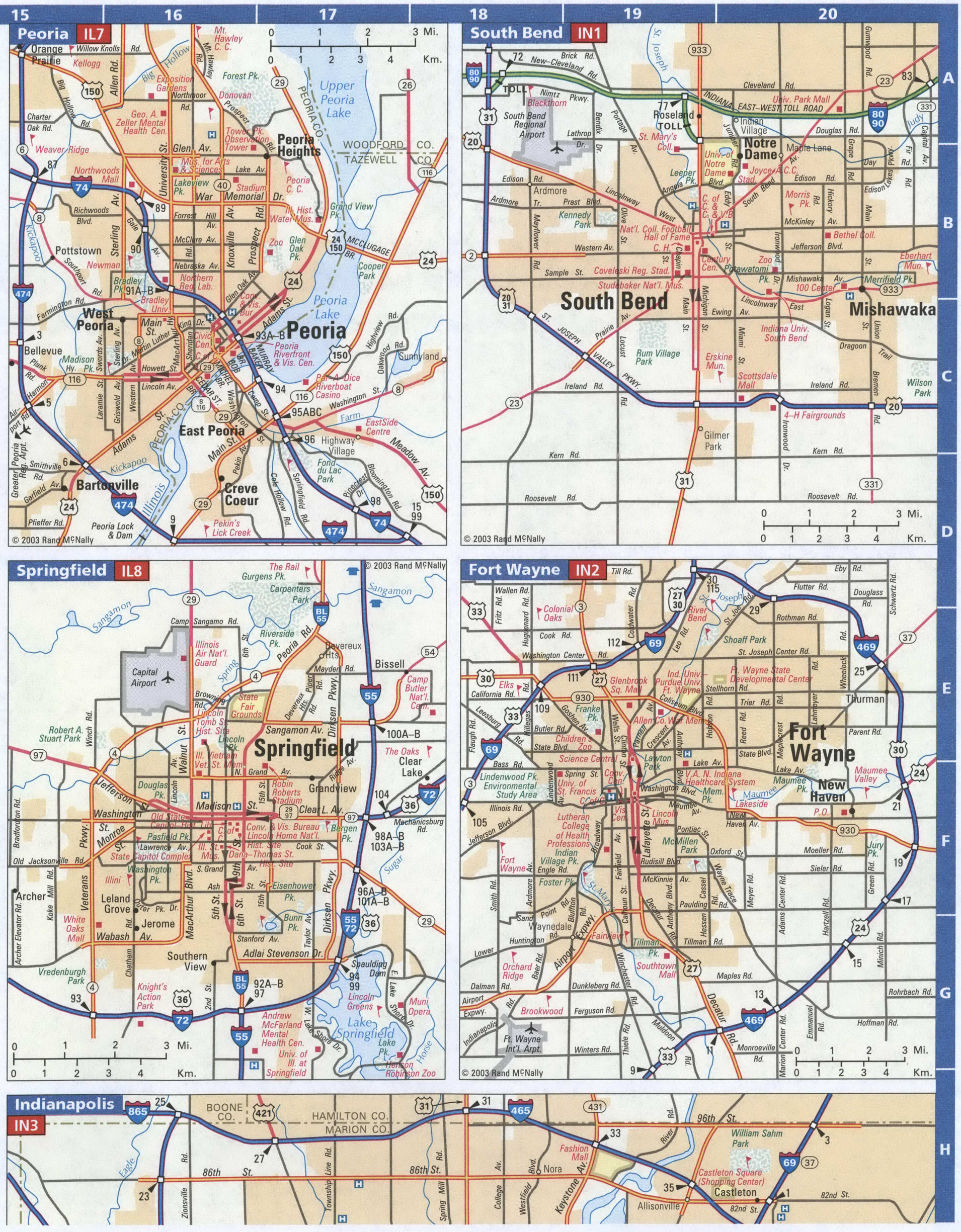
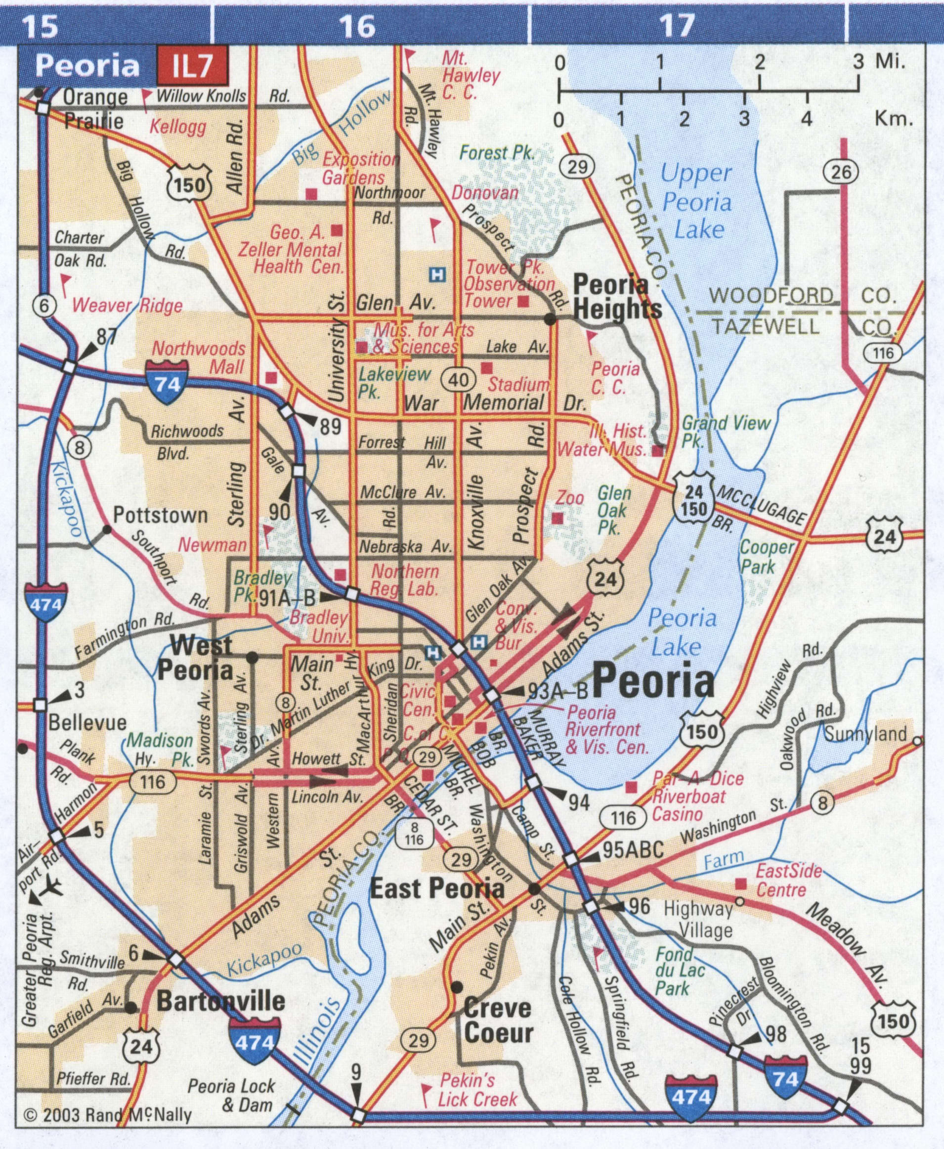
Peoria Road Map
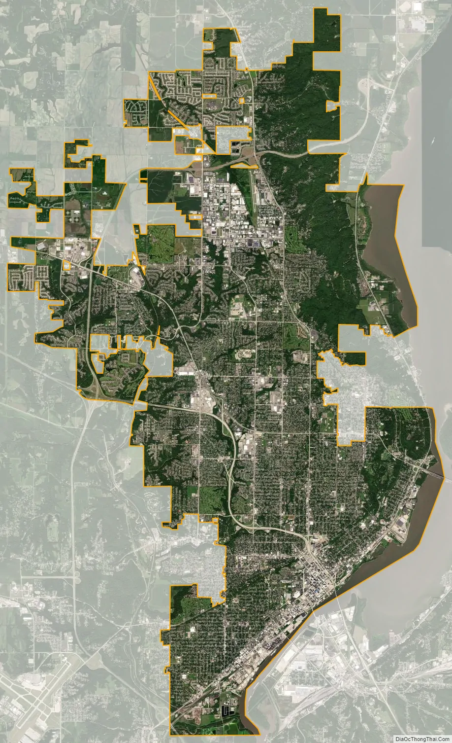
Peoria city Satellite Map
Geography
According to the 2010 census, Peoria has a total area of 50.23 square miles (130.10 km), of which 48.01 square miles (124.35 km) (or 95.58%) is land and 2.22 square miles (5.75 km) (or 4.42%) is water.
Climate
Peoria has a humid continental climate (Köppen Dfa), with cold, snowy winters, and hot, humid summers. Monthly daily mean temperatures range from 22.5 °F (−5.3 °C) to 75.2 °F (24.0 °C). Snowfall is common in the winter, averaging 26.3 inches (67 cm), but this figure varies considerably from year to year. Precipitation, averaging 36 inches (914 mm), peaks in the spring and summer, and is the lowest in winter. Extremes have ranged from −27 °F (−33 °C) in January 1884 to 113 °F (45 °C) in July 1936.
See also
Map of Illinois State and its subdivision:- Adams
- Alexander
- Bond
- Boone
- Brown
- Bureau
- Calhoun
- Carroll
- Cass
- Champaign
- Christian
- Clark
- Clay
- Clinton
- Coles
- Cook
- Crawford
- Cumberland
- De Kalb
- De Witt
- Douglas
- Dupage
- Edgar
- Edwards
- Effingham
- Fayette
- Ford
- Franklin
- Fulton
- Gallatin
- Greene
- Grundy
- Hamilton
- Hancock
- Hardin
- Henderson
- Henry
- Iroquois
- Jackson
- Jasper
- Jefferson
- Jersey
- Jo Daviess
- Johnson
- Kane
- Kankakee
- Kendall
- Knox
- La Salle
- Lake
- Lake Michigan
- Lawrence
- Lee
- Livingston
- Logan
- Macon
- Macoupin
- Madison
- Marion
- Marshall
- Mason
- Massac
- McDonough
- McHenry
- McLean
- Menard
- Mercer
- Monroe
- Montgomery
- Morgan
- Moultrie
- Ogle
- Peoria
- Perry
- Piatt
- Pike
- Pope
- Pulaski
- Putnam
- Randolph
- Richland
- Rock Island
- Saint Clair
- Saline
- Sangamon
- Schuyler
- Scott
- Shelby
- Stark
- Stephenson
- Tazewell
- Union
- Vermilion
- Wabash
- Warren
- Washington
- Wayne
- White
- Whiteside
- Will
- Williamson
- Winnebago
- Woodford
- Alabama
- Alaska
- Arizona
- Arkansas
- California
- Colorado
- Connecticut
- Delaware
- District of Columbia
- Florida
- Georgia
- Hawaii
- Idaho
- Illinois
- Indiana
- Iowa
- Kansas
- Kentucky
- Louisiana
- Maine
- Maryland
- Massachusetts
- Michigan
- Minnesota
- Mississippi
- Missouri
- Montana
- Nebraska
- Nevada
- New Hampshire
- New Jersey
- New Mexico
- New York
- North Carolina
- North Dakota
- Ohio
- Oklahoma
- Oregon
- Pennsylvania
- Rhode Island
- South Carolina
- South Dakota
- Tennessee
- Texas
- Utah
- Vermont
- Virginia
- Washington
- West Virginia
- Wisconsin
- Wyoming