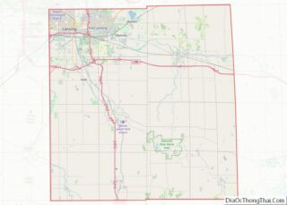
Lansing (/ˈlænsɪŋ/) is the capital of the U.S. state of Michigan. It is mostly in Ingham County, although portions of the city extend west into Eaton County and north into Clinton County. The 2020 census placed the city’s population at 112,644, making it the sixth largest city in Michigan. The population of its metropolitan statistical area (MSA) was 541,297 at the 2020 census, the third largest in the state after metropolitan Detroit and Grand Rapids. It was named the new state capital of Michigan in 1847, ten years after Michigan became a state.
The Lansing metropolitan area, colloquially referred to as “Mid-Michigan”, is an important center for educational, cultural, governmental, commercial, and industrial functions. Neighboring East Lansing is home to Michigan State University, a public research university with an enrollment of more than 50,000. The area features two medical schools, one veterinary school, two nursing schools, and two law schools. It is the site of the Michigan State Capitol, the state Supreme Court, the Court of Appeals, a federal court, the Library of Michigan and Historical Center, and headquarters of four national insurance companies.
Lansing is the only U.S. state capital (among the 47 located in counties) that is not also a county seat. The seat of government of Ingham County is Mason, but the county maintains some offices in Lansing.
| Name: | Lansing city |
|---|---|
| LSAD Code: | 25 |
| LSAD Description: | city (suffix) |
| State: | Michigan |
| County: | Eaton County, Ingham County |
| Incorporated: | 1859 |
| Elevation: | 853 ft (260 m) |
| Land Area: | 39.14 sq mi (101.38 km²) |
| Water Area: | 0.64 sq mi (1.65 km²) |
| Population Density: | 2,877.68/sq mi (1,111.09/km²) |
| Area code: | 517 |
| FIPS code: | 2646000 |
| GNISfeature ID: | 1625035 |
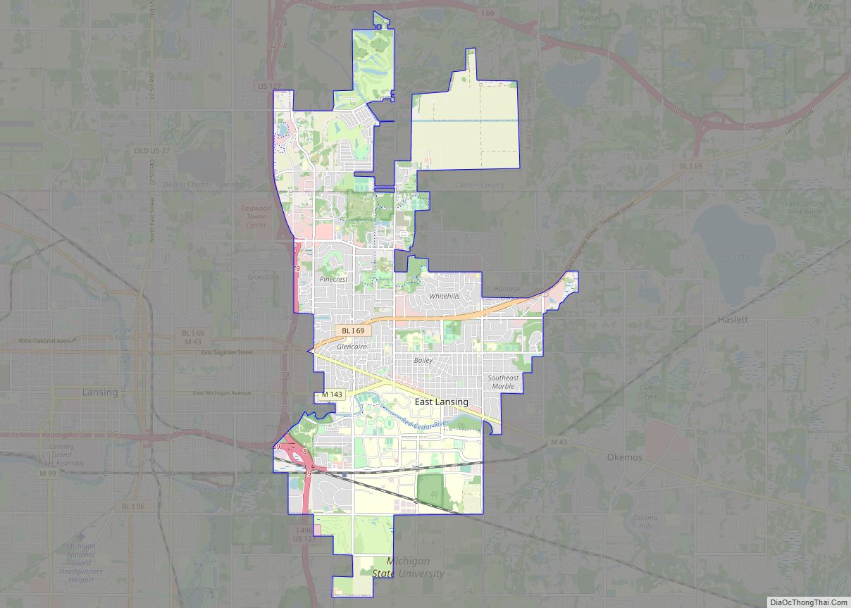
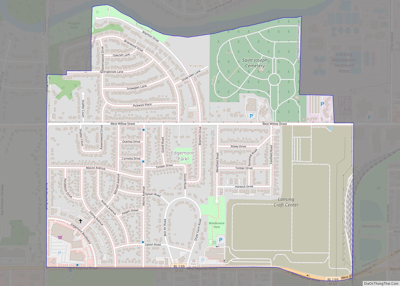
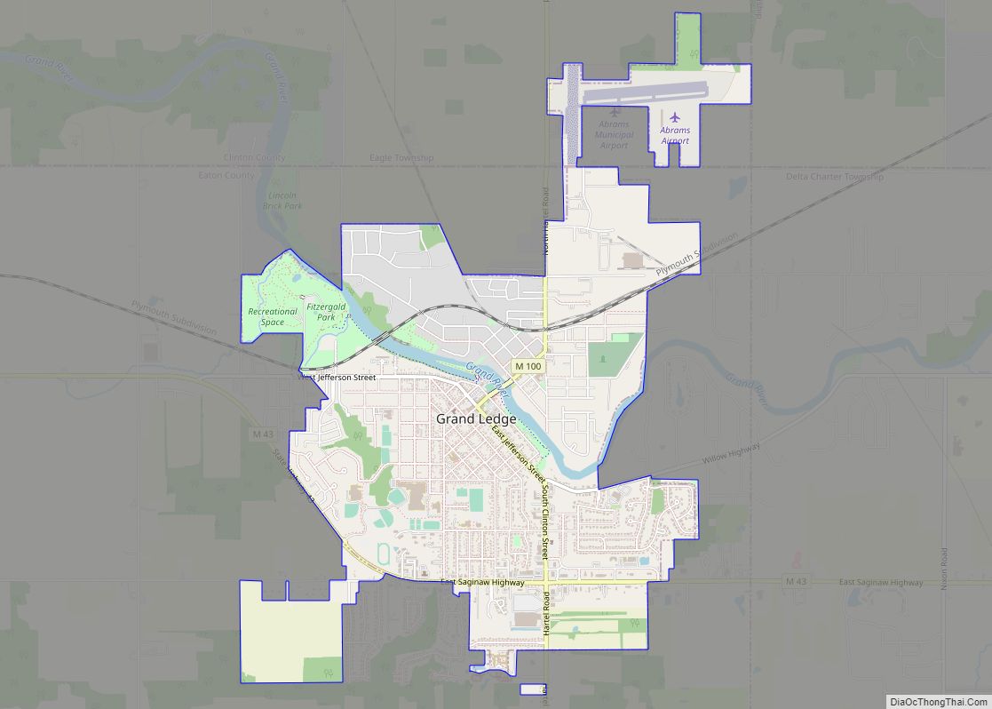
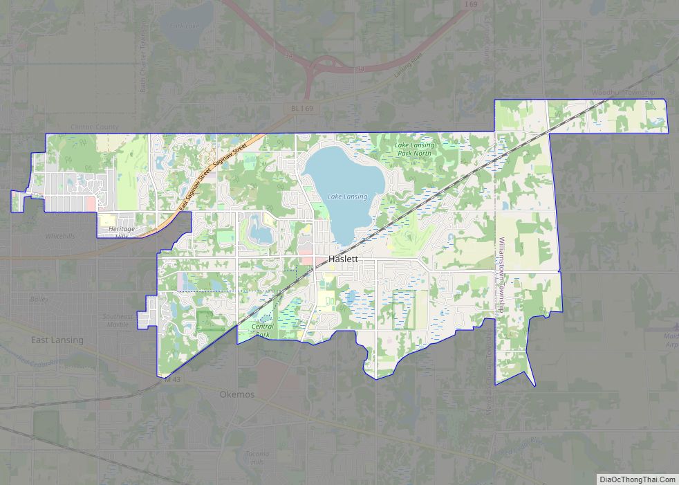
Online Interactive Map
Click on ![]() to view map in "full screen" mode.
to view map in "full screen" mode.
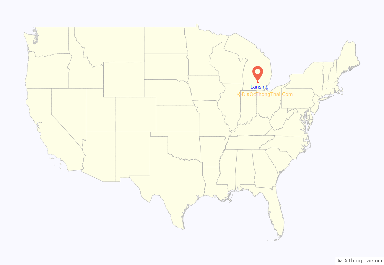
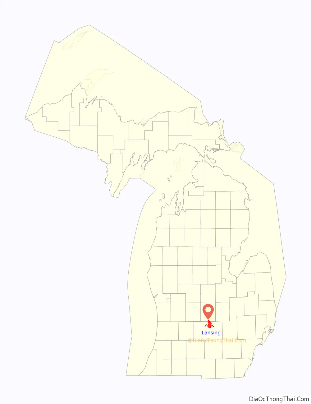
Lansing location map. Where is Lansing city?
History
Exploration by Europeans
The first recorded person of European descent to travel through the area that is now Lansing was British fur trader Hugh Heward and his French-Canadian team on April 24, 1790, while canoeing the Grand River. The land that was to become Lansing was surveyed as “Township 4 North Range 2 West” in February 1827 in what was then dense forest. It was the last of the county’s townships to be surveyed, and the land was not offered for sale until October 1830. There would be no roads to this area for decades to come.
Founding myth
Historians have lamented the persistence of a myth about Lansing’s founding.
The incorrect story of Lansing’s beginnings states that in the winter of 1835 and early 1836, two brothers from New York plotted the area now known as REO Town just south of downtown Lansing and named it “Biddle City”. This land lay in a floodplain and was underwater during the majority of the year. Nevertheless, the brothers went back to Lansing, New York, to sell plots for the town that did not exist. They told the New Yorkers this new “city” had an area of 65 blocks, a church and a public and academic square. 16 men bought plots in the nonexistent city, and upon reaching the area later that year found they were the victims of the scam. Many in the group, disappointed and now without funds to move on again, opted to stay and ended up settling around what is now metropolitan Lansing.
The story has persisted due to a 1904 newspaper article, which cited a memoir told by Daniel W. Buck, a respected Lansing mayor and son of one of the early pioneers. His story was cited in Michigan pioneer papers and retold in newspaper articles multiple times in the decades that followed. His characterization of the city as being born from a “land scam” was incorrect, though his story had some elements of truth as well.
Origins as a town
The brothers were William and Jerry Ford. Although they were originally from New York, they were well-respected businessmen who hailed from Jackson and were instrumental during its earliest years.
In 1836, they bought 290 acres in the northwest corner of Ingham County. They platted the land and hoped to build a community they named Biddle City, located south of the convergence of the Grand River and the Red Cedar River, in Lansing’s present-day REO Town neighborhood. Biddle City’s plat map included plans for a public square, church square and academy square. They sold 21 parcels of it — mostly to other Michiganders, not New Yorkers — and buyers understood that it was not yet a real city. Unfortunately, Biddle City never took off. The financial Panic of 1837 forced the brothers to heavily mortgage the property, and the city never materialized.
Biddle City was not Lansing’s original name, nor a precursor to it, as the plat was located outside of Lansing’s original city limits.
Originally, all that existed was Lansing Township, named in 1842 by an early settler, Joseph E. North, Sr., after Lansing in Tompkins County, NY, where he was from.
The settlement of fewer than 20 people that would become the City of Lansing remained quiet until the winter of 1847. The state constitution required the capital be moved from Detroit to a more central and safer location in the state’s interior in 1847; many were concerned about Detroit’s proximity to British-controlled Canada, which had captured Detroit in the War of 1812. The United States had recaptured the city in 1813, but these events led to the dire need to have the center of government relocated further away from hostile British territory. There was also concern with Detroit’s strong influence over Michigan politics, being the state’s largest city as well as the capital city.
During the multi-day session to determine a new location for the state capital, many cities, including Ann Arbor, Marshall, and Jackson, lobbied hard to win this designation. Unable to publicly reach a consensus because of constant political wrangling, the Michigan House of Representatives privately chose the Township of Lansing out of frustration. When announced, many present openly laughed that such an insignificant settlement was now Michigan’s capital. Two months later, Governor William L. Greenly signed into law the act of the legislature making Lansing Township the state capital.
With the announcement that Lansing Township had been made the capital, the small settlement quickly transformed into the seat of state government. Within months after it became the capital city, further individual settlements began to develop around it, along three key points along the Grand River in the township:
- “Lower Village/Town”, where present-day Old Town stands, was the oldest of the three villages. It was home to the first house built in Lansing in 1843 by pioneer James Seymour and his family. Lower Town began to develop in 1847 with the completion of the Franklin Avenue (now Grand River Avenue) covered bridge over the Grand River.
- “Upper Village/Town”, where present-day REO Town stands at the confluence of the Grand River and the Red Cedar River. It began to take off in 1847 when the Main Street Bridge was constructed over the Grand River. This village’s focal point was the Benton House, a 4-story hotel, which opened in 1848. It was the first brick building in Lansing and was later razed in 1900.
- “Middle Village/Town”, where downtown Lansing now stands, was the last of the three villages to develop in 1848 with the completion of the Michigan Avenue bridge across the Grand River and the completion of the temporary capitol building which sat where Cooley Law School stands today on Capitol Avenue between Allegan and Washtenaw Streets, and finally the relocation of the post office to the village in 1851. This area would grow to become larger than the other two villages up and down river.Michigan State Capitol
The collection of original settlements (“Upper Town”, “Lower Town” and “Middle Town”) had for some years been collectively referred to as the “Village of Michigan”. On February 16, 1842, Alaiedon township was split into the townships of Lansing, Delhi and Meridian (originally suggested as “Genoa”) based on a petition submitted in December 1841 by Henry North, Roswell Everett and Zalmon Holmes. Henry North proposed the name “Lansing” for the township at the request of his father, who wanted it named after their old town of Lansing, New York.
On February 15, 1859, the settlement, having grown to nearly 3,000 and encompassing about seven square miles (18 km) in area, was incorporated as a city, carving off a section of seven square miles from Lansing Township. The boundaries of the original city were Douglas Avenue to the north, Wood and Regent streets to the east, Mount Hope Avenue to the south, and Jenison Avenue to the west. These boundaries would remain until 1916. Lansing began to grow steadily over the next two decades with the completion of the railroads through the city, a plank road, and the completion of the current capitol building in 1878.
Most of what is known as Lansing today is the result of the city becoming an industrial powerhouse which began with the founding of Olds Motor Vehicle Company in August 1897. The company went through many changes, including a buyout, between its founding to 1905 when founder Ransom E. Olds started his new REO Motor Car Company, which would last in Lansing for another 70 years. Olds would be joined by the less successful Clarkmobile around 1903. Over the next decades, the city would be transformed into a major American industrial center for the manufacturing of automobiles and parts, among other industries. The city also continued to grow in area. By 1956, the city had grown to 15 square miles (39 km), and doubled in size over the next decade to its current size of roughly 33 square miles (85 km).
Today, the city’s economy is diversified among government service, healthcare, manufacturing, insurance, banking, and education.
Notable events
In the late 1840s to early 1850s, the citizens of Lansing were unified against slavery, and the city became a secondary stop on the Underground Railroad, as one of the last steps of an escape route that led through Battle Creek, Schoolcraft and Cassopolis. From Lansing, the route led to Durand, and then to either Port Huron or Detroit.
The Kerns Hotel fire on December 11, 1934, was the deadliest in the city’s history. Perhaps thirty-four people died in the fire, although the hotel register was also destroyed making an exact count impossible.
On February 8, 1951, the Elliott-Larsen Building was intentionally set on fire by a state office employee. The following morning, the seventh floor collapsed down to the next level, which destroyed a large number of state historical records.
On September 26, 1963, a 12-year-old, 3,000-pound female dancing elephant named Rajje (alternately reported as Raji and Little Rajjee, among other variations) rebelled against her trainer during a performance in a shopping-center circus near what was then Logan Street and Holmes Road in Lansing, and escaped into the streets, aggravated by the frenzied pursuit of nearly 4,000 local residents. The incident ended with the shooting of the elephant by Lansing police. Provoked by the growing crowd, Rajje’s rampage took her through the men’s wear, sporting goods and gift departments of a local Arlan’s discount store before leading police on a two-mile chase in which she knocked down and injured a 67-year-old man, tried to move a car, and caused thousands of dollars in damage before being killed.
Life Magazine quoted Rajje’s trainer, William Pratt, as shouting at the scene, “Damn these people […] They wouldn’t leave her alone.”
The incident was widely reported, including a photospread in Life. While the Lansing State Journal coverage stressed the danger of the incident, the Detroit Free Press noted that witnesses cried out “Murderers! Murderers!” as police fired eight shots.
Author Nelson Algren cites the injustice and sad end of the pursuit of “Raji, the Pixie-Eared Elephant” in continuity with the ambush of Bonnie Parker and Clyde Barrow in his introduction to a 1968 biography of the outlaws. Then teenage Lansing residents who had goaded the elephant later on recalled the incident with sober regret in a local newspaper retrospective in 2011.
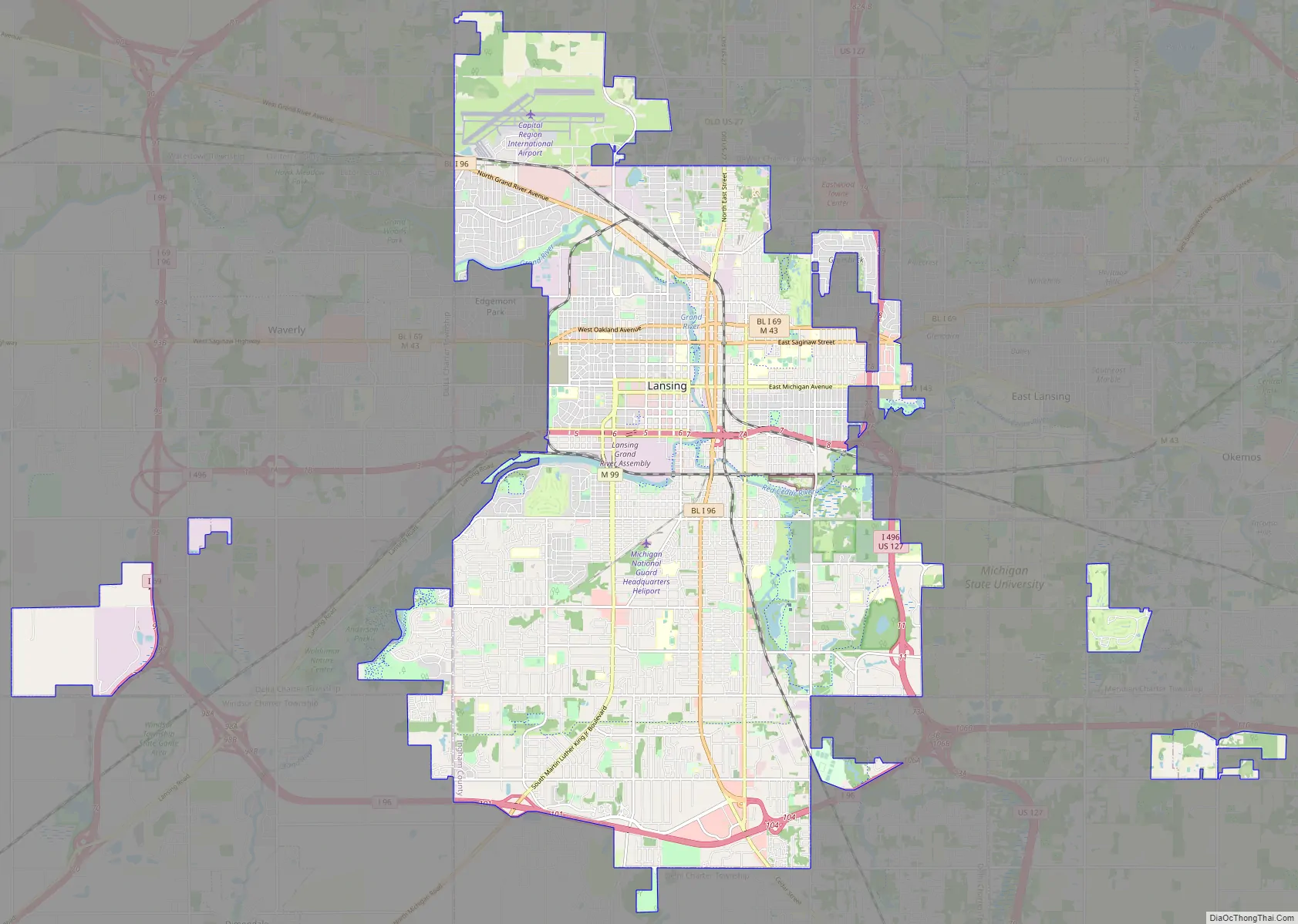
Lansing Road Map
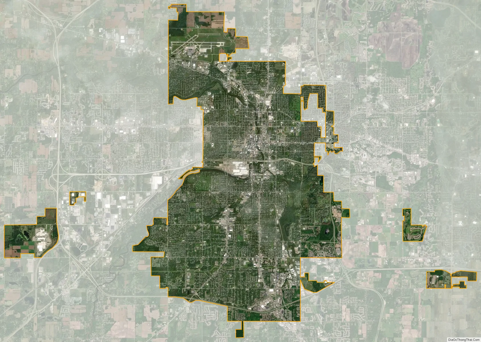
Lansing city Satellite Map
Geography
Lansing is the centerpiece of a region of Michigan known as Mid-Michigan.
According to the United States Census Bureau, the city has a total area of 36.68 square miles (95.00 km), of which 36.05 square miles (93.37 km) is land and 0.63 square miles (1.63 km) is water. This figure includes two 425 Agreements with Alaiedon Township and Meridian Township, and the four 425 Agreements with Delta Township since 2000.
Since the 2010 census, the city has entered into two additional 425 Agreements. The first agreement consisted of the temporary transfer of 1,888.2 acres of Lansing Capital Region International Airport to the city from DeWitt Township in 2011. The second agreement consisted of the temporary transfer of 41 acres (17 ha) in Alaiedon Township for the expansion of the headquarters of Jackson National Life Insurance Company in 2013 bringing the area either fully or conditionally under control of the city to 39.69 square miles (102.80 km).
Under Michigan law, 425 Agreements are only temporary land sharing agreements and do not count as official annexations. The Census Bureau, however, for statistical purposes does count these as annexations. Not counting the temporary 425 Agreements, Lansing administers 34.1 square miles (88 km) total.
Lansing is located in the south-central part of the Lower Peninsula of Michigan, where the Grand River meets the Red Cedar River. The city occupies most of what had formerly been part of Lansing Charter Township. It has also annexed adjacent tracts of land in Delta Charter Township and Windsor Township in Eaton County to the west, Delhi Charter Township in Ingham County to the south, and in DeWitt Charter Township in Clinton County to the north. The city also controls three non-contiguous tracts of land through 425 Agreements (conditional land transfer agreements) with Meridian Charter Township, Delta Charter Township, and Alaiedon Township in Ingham County to the southeast.
Lansing elevations range between 890 feet (271 m) above sea level on the far south side of Lansing along Northrup Street near the Cedar Street intersection, to 833 feet (254 m) to 805.5 feet (246 m) above sea level along the Grand River.
The Grand River, the largest river in Michigan, flows through downtown Lansing, and the Red Cedar River, a tributary of the Grand, flows through the campus of Michigan State University to its confluence with the Grand in Lansing. Sycamore Creek, a tributary of the Red Cedar, flows northward through the southeastern part of the city. There are two lakes in the area, Park Lake and Lake Lansing, both northeast of the city. Lake Lansing is approximately 500 acres (2.0 km) in size and is a summer favorite for swimmers, boaters, and fishermen. Michigan State University Sailing Club and the Lansing Sailing Club are located on Lake Lansing, where sailing regattas are hosted throughout the summer.
The City of Lansing operates a total of 3.55 square miles (9.2 km) of parkland, of which 2.80 square miles (7.3 km) is parkland, 0.43 square miles (1.1 km) are golflands, and 0.31 square miles (0.80 km) are cemetery lands. However, this figure includes the Waverly Hills Golf Course and adjacent Michigan Avenue Park, whose 0.18 square miles (0.47 km) are located within neighboring Lansing Township, but operated by the City of Lansing, and does not include the 0.18 square miles (0.47 km) of the combined Hawk Island County Park and adjacent Soldan Dog Park operated by Ingham County within the city of Lansing. All together then, 3.55 square miles (9.2 km) of the city (or approximately 10%) is publicly administered open space.
Climate
Lansing has a Midwestern humid continental climate (Köppen Dfb/Dfa) that is influenced by the Great Lakes, and is part of USDA Hardiness zone 5b. Winters are cold with moderate to heavy snowfall, while summers are very warm and humid. The monthly daily average temperature in July is 71.5 °F (21.9 °C), while the same figure for January is 23.4 °F (−4.8 °C); the annual mean is 48.21 °F (9.01 °C). On average, temperatures reach or exceed 90 °F (32.2 °C) on 8.8 days of the year and drop to or below 0 °F (−17.8 °C) on 10.5 nights. Precipitation is generally greatest during summer but still frequent and significant in winter. Snowfall, which normally occurs from November to April, averages 51.1 inches (130 cm) per season, significantly less than areas to the west such as Grand Rapids as Lansing is relatively immune to lake-effect snows; seasonal snowfall has historically ranged from 16.6 in (42 cm) in 1863−64 to 97.2 in (247 cm) in 1880−81. The highest and lowest officially recorded temperatures were 103 °F (39 °C) on July 6, 2012, and −37 °F (−38 °C) on February 2, 1868, with the last −20 °F (−29 °C) or colder reading occurred on February 27, 1994; the record low maximum is −4 °F (−20 °C) on January 22, 1883, while, conversely, the record high minimum is 78 °F (26 °C) on August 1, 2006, and July 18, 1942. Freezing temperatures in June are exceedingly rare and have not occurred in July or August since the 19th century; on average, they arrive on October 4 and depart on May 7, allowing a growing season of 149 days. The average window for measurable snow (≥0.1 in or 0.25 cm) is November 4 through April 6.
See also
Map of Michigan State and its subdivision:- Alcona
- Alger
- Allegan
- Alpena
- Antrim
- Arenac
- Baraga
- Barry
- Bay
- Benzie
- Berrien
- Branch
- Calhoun
- Cass
- Charlevoix
- Cheboygan
- Chippewa
- Clare
- Clinton
- Crawford
- Delta
- Dickinson
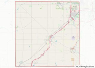
- Eaton
- Emmet
- Genesee
- Gladwin
- Gogebic
- Grand Traverse
- Gratiot
- Hillsdale
- Houghton
- Huron
- Ingham
- Ionia
- Iosco
- Iron
- Isabella
- Jackson
- Kalamazoo
- Kalkaska
- Kent
- Keweenaw
- Lake
- Lake Hurron
- Lake Michigan
- Lake St. Clair
- Lake Superior
- Lapeer
- Leelanau
- Lenawee
- Livingston
- Luce
- Mackinac
- Macomb
- Manistee
- Marquette
- Mason
- Mecosta
- Menominee
- Midland
- Missaukee
- Monroe
- Montcalm
- Montmorency
- Muskegon
- Newaygo
- Oakland
- Oceana
- Ogemaw
- Ontonagon
- Osceola
- Oscoda
- Otsego
- Ottawa
- Presque Isle
- Roscommon
- Saginaw
- Saint Clair
- Saint Joseph
- Sanilac
- Schoolcraft
- Shiawassee
- Tuscola
- Van Buren
- Washtenaw
- Wayne
- Wexford
- Alabama
- Alaska
- Arizona
- Arkansas
- California
- Colorado
- Connecticut
- Delaware
- District of Columbia
- Florida
- Georgia
- Hawaii
- Idaho
- Illinois
- Indiana
- Iowa
- Kansas
- Kentucky
- Louisiana
- Maine
- Maryland
- Massachusetts
- Michigan
- Minnesota
- Mississippi
- Missouri
- Montana
- Nebraska
- Nevada
- New Hampshire
- New Jersey
- New Mexico
- New York
- North Carolina
- North Dakota
- Ohio
- Oklahoma
- Oregon
- Pennsylvania
- Rhode Island
- South Carolina
- South Dakota
- Tennessee
- Texas
- Utah
- Vermont
- Virginia
- Washington
- West Virginia
- Wisconsin
- Wyoming