Pueblo (/ˈpwɛbloʊ/) is a home rule municipality that is the county seat and the most populous municipality of Pueblo County, Colorado, United States. The city population was 111,876 at the 2020 United States Census, making Pueblo the ninth most populous city in Colorado. Pueblo is the principal city of the Pueblo, CO Metropolitan Statistical Area and a major city of the Front Range Urban Corridor.
Pueblo is situated at the confluence of the Arkansas River and Fountain Creek, 112 miles (180 km) south of the Colorado State Capitol in Denver. The area is considered semi-arid desert land, with approximately 12 inches (304.80 mm) of precipitation annually. With its location in the “Banana Belt”, Pueblo tends to get less snow than the other major cities in Colorado.
Pueblo is one of the largest steel-producing cities in the United States, for which reason Pueblo is referred to as the “Steel City”. The Historic Arkansas River Project (HARP) is a riverwalk in the Union Avenue Historic Commercial District, and shows the history of the devastating Pueblo Flood of 1921.
| Name: | Pueblo city |
|---|---|
| LSAD Code: | 25 |
| LSAD Description: | city (suffix) |
| State: | Colorado |
| County: | Pueblo County |
| Incorporated: | November 15, 1885 |
| Elevation: | 4,692 ft (1,430 m) |
| Total Area: | 56.083 sq mi (145.254 km²) |
| Land Area: | 55.382 sq mi (143.439 km²) |
| Water Area: | 0.701 sq mi (1.815 km²) |
| Total Population: | 111,876 |
| Population Density: | 2,000/sq mi (770/km²) |
| Area code: | 719 |
| FIPS code: | 0862000 |
| GNISfeature ID: | 0204798 |
| Website: | pueblo.us |
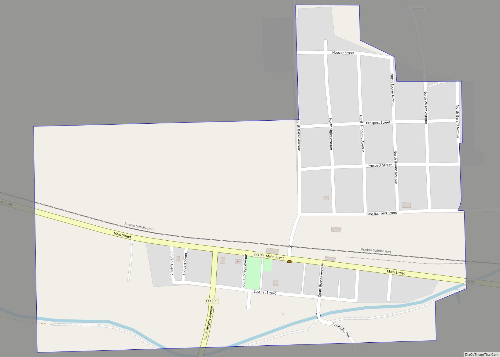
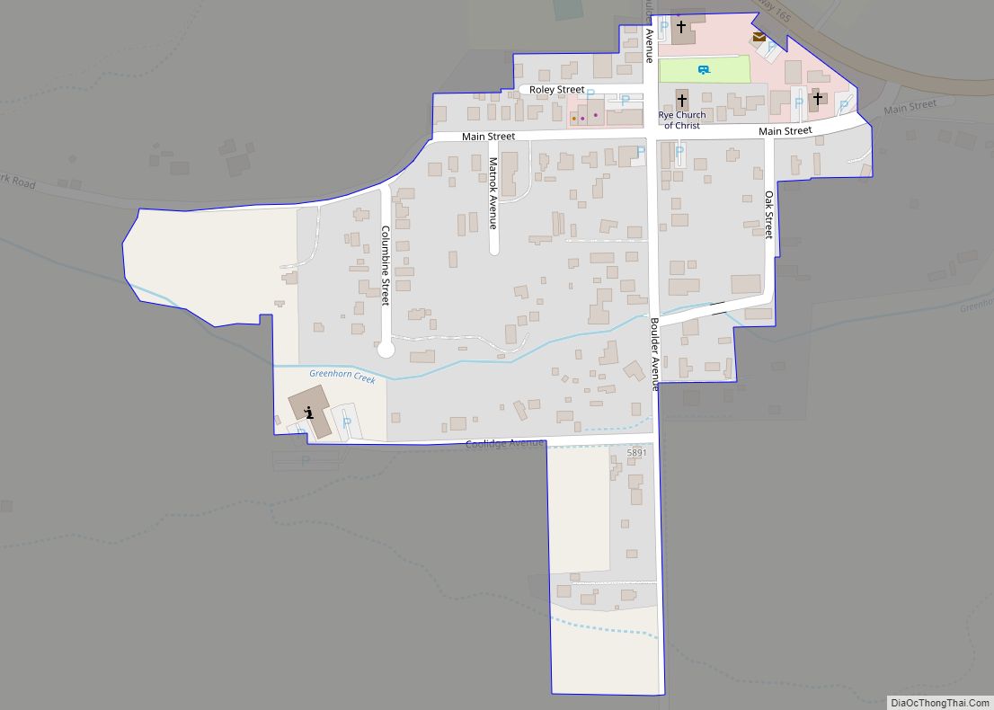
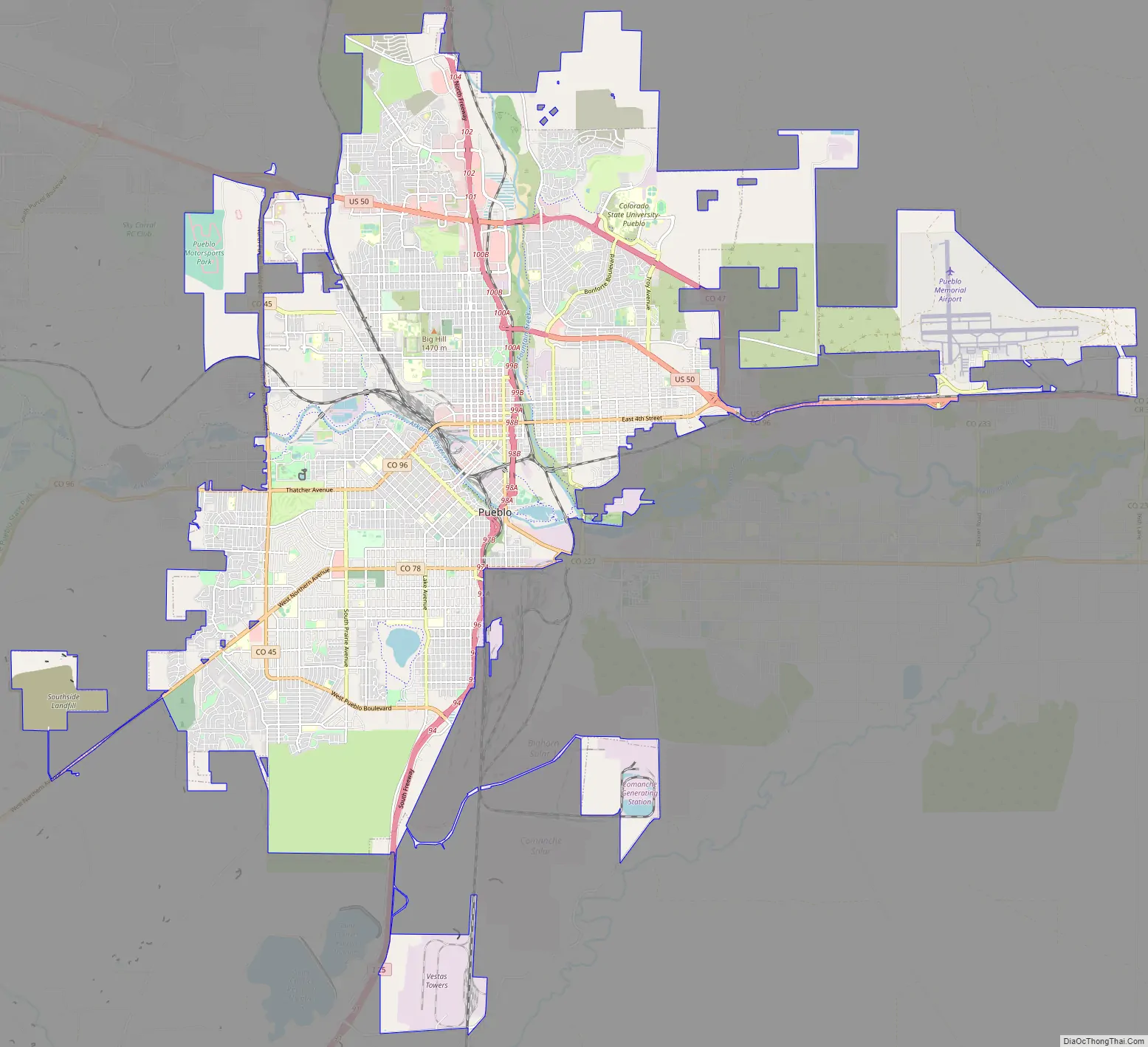
Online Interactive Map
Click on ![]() to view map in "full screen" mode.
to view map in "full screen" mode.
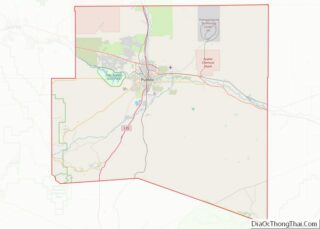
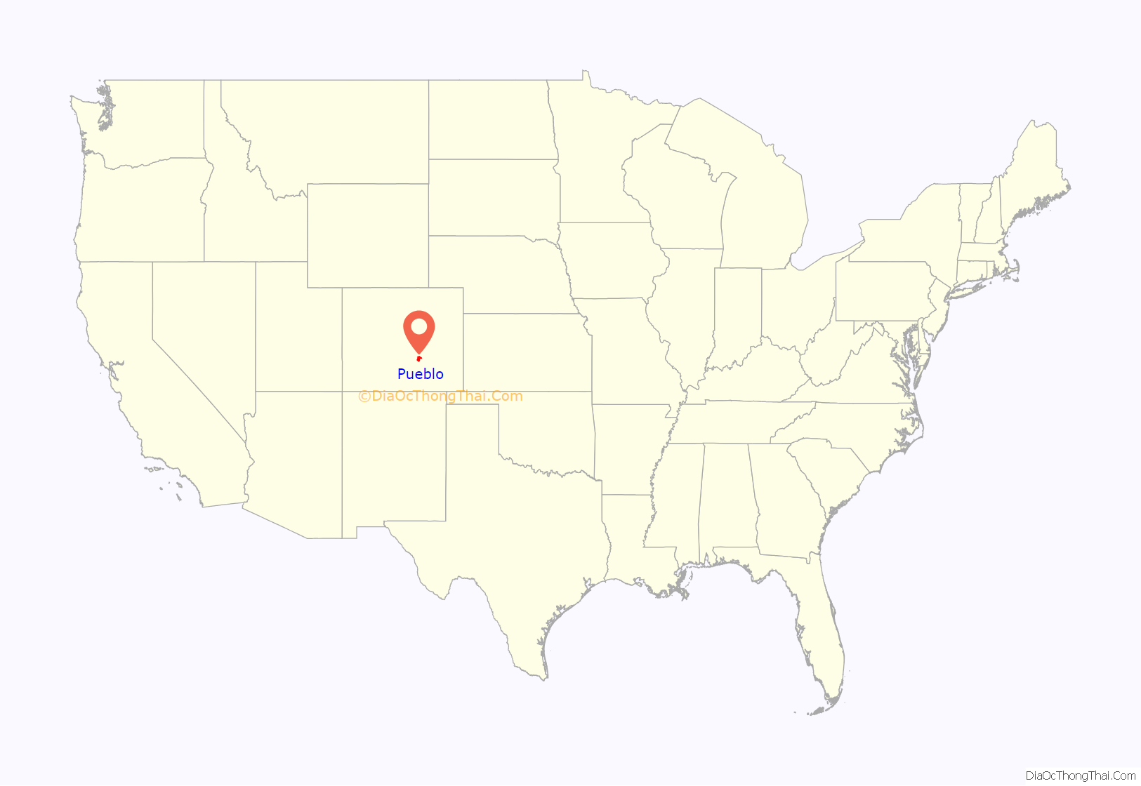
Pueblo location map. Where is Pueblo city?
History
El Pueblo
James Beckwourth, George Simpson, and other trappers such as Mathew Kinkead and John Brown, claimed to have helped construct the plaza that became known as El Pueblo around 1842. According to accounts of residents who traded at the plaza (including that of George Simpson), the Fort Pueblo Massacre happened sometime between December 23 and December 25, 1854, by a war party of Utes and Jicarilla Apaches under the leadership of Tierra Blanca, a Ute chief. They allegedly killed between fifteen and nineteen men, as well as captured two children and one woman. The trading post was abandoned after the raid, but it became important again between 1858 and 1859 during the Colorado Gold Rush of 1859.
Early development: railroads, steel, expansion, and orphanages
The current city of Pueblo represents the consolidation of four towns: Pueblo (incorporated 1870), South Pueblo (incorporated 1873), Central Pueblo (incorporated 1882), and Bessemer (incorporated 1886). Pueblo, South Pueblo, and Central Pueblo legally consolidated as the City of Pueblo between March 9 and April 6, 1886. Bessemer joined Pueblo in 1894.
The consolidated city became a major economic and social center of Colorado, and was home to important early Colorado families such as the Thatchers, the Ormans, and the Adams. By the early 1870s the city was being hailed as a beacon of development, with newspapers like the Chicago Tribune boasting of how the region’s lawless reputation was giving way to orderly agriculture with triumphalist rhetoric. One author crowed of Pueblo that “the necessity exists no longer for Sharp’s rifles and revolvers. These have been supplied by the plow and the mowing-machine.”
Pueblo’s development stretched beyond agriculture. Steel emerged as a key industry very early, and in 1909 the city was considered the only steel town west of the Mississippi River.
Until a series of major floods culminated in the Great Flood of 1921, Pueblo was considered the ‘Saddle-Making capital of the World’. Roughly one-third of Pueblo’s downtown businesses were lost in this flood, along with a substantial number of buildings. Pueblo struggled with this significant loss, but has had a resurgence in growth.
Historically, many people were influenced by the orphanages of Pueblo, and the homes are now all historical sites. The three orphanages in Pueblo were known as Sacred Heart, Lincoln, and McClelland. Lincoln was the first historically black orphanage in Colorado, and one of only seven in the country. Sacred Heart was run by the Catholic Welfare Bureau, while McClelland was run by the Lutheran Church. Several children from Cuba were placed at Sacred Heart as part of “Operation Pedro Pan”. Though the orphanages in Pueblo are no longer in service, the buildings still exist and have transformed with the times. According to the Rocky Mountain News, in 1988 the Sacred Heart Orphanage was bought by the Pueblo Housing Authority and turned into 40 small-family housing units.
Steel mill
The main industry in Pueblo for most of its history was the Colorado Fuel and Iron (CF&I) Steel Mill on the south side of town. For nearly a century the CF&I was the largest employer in the state of Colorado. The steel-market crash of 1982 led to the decline of the company. After several bankruptcies, the company was acquired by Oregon Steel Mills and changed its name to Rocky Mountain Steel Mills. The buyout, as well as the end of the union contract in 1997 led to a union strike over pension liabilities, as well as working conditions, wherein the union argued the new owners still needed to pay the pension liabilities provided by the previous owners. With the conclusion of the strike on December 30th, 1997, CF&I had replaced several hundred union workers with local employees.
In September 2004, both United Steelworkers locals 2102 and 3267 won the strike and the unfair labor practice charges. All of the striking steel workers returned to their jobs, and the company paid them the back pay owed for the seven years they were on strike. In 2007, shortly after Oregon Steel made amends with the union and its workers, Evraz Group, one of Russia’s biggest steel producers, agreed to buy the company for $2.3 billion.
Of the many production and fabrication mills that once existed on the site, only the steel production (electric furnaces, used for scrap recycling), rail, rod, bar, and seamless tube mills are still in operation. The wire mill was sold in the late 1990s to Davis Wire, which still produces products such as fence and nails under the CF&I brand name. The facility operated blast furnaces until 1982, when the steel market collapsed. The main blast furnace structures were torn down in 1989, but due to asbestos content, many of the adjacent stoves still remain. The stoves and foundations for some of the furnaces can be seen from Interstate 25, which runs parallel to the plant’s west boundary.
Several of the administration buildings, including the main office building, dispensary, and tunnel gatehouse were purchased in 2003 by the Bessemer Historical Society. In 2006, they underwent renovation. In addition to housing the historic CF&I Archives, they also house the Steelworks Museum of Industry and Culture.
“Melting Pot of the West”
Due to the growth of the CF&I steel mill and the employment that it offered, Pueblo in the early twentieth century attracted a large number of immigrant laborers. The groups represented led to Pueblo becoming the most ethnically and culturally diverse city in Colorado and the West. At one point, more than 40 languages were spoken in the steel mill and more than two-dozen foreign language newspapers were published in the city. Irish, Italian, German, Slovenian, Greek, Jewish, Lithuanian, Russian, Hungarian, Japanese, and African-American groups arrived in the area at the turn of the century and remain to the present time. The convergence of cultures led to a cosmopolitan character to the city that resulted in a number of ethnically-rooted neighborhoods that are typically not seen west of the Mississippi. Respective cultural groups maintain cultural festivals to the present, with the city being home to locations of the Order Sons of Italy, American Slovenian Catholic Union, and I.O.O.F., among others.
Colorado Mental Health Institute at Pueblo
Another major employer in Pueblo is Colorado State Hospital. The hospital is the preeminent mental health facility in the Rocky Mountain region. Established in 1879 as the Colorado State Insane Asylum, it was renamed as the Colorado State Hospital in 1917. In 1991, the name was changed to the Colorado Mental Health Institute at Pueblo (CMHIP). The Robert L. Hawkins High Security Forensic Institute opened in June 2009 and is a 200-bed, high-security facility.
Home of Heroes
Pueblo is the hometown of four Medal of Honor recipients (tied only with Holland, Michigan, also with four, each having more than any other municipality in the United States): William J. Crawford, Carl L. Sitter, Raymond G. Murphy, and Drew D. Dix. President Dwight D. Eisenhower, upon presenting Raymond G. “Jerry” Murphy with his medal in 1953, commented, “What is it… something in the water out there in Pueblo? All you guys turn out to be heroes!”
In 1993, Pueblo City Council adopted the tagline “Home of Heroes” for the city due to the fact that Pueblo can claim more recipients of the Medal per capita than any other city in the United States. On July 1, 1993, the Congressional Record recognized Pueblo as the “Home of Heroes.” A memorial to the recipients of the medal is at the Pueblo Convention Center. Central High School is known as the “School of Heroes,” as it is the alma mater of two recipients, Sitter and Crawford.
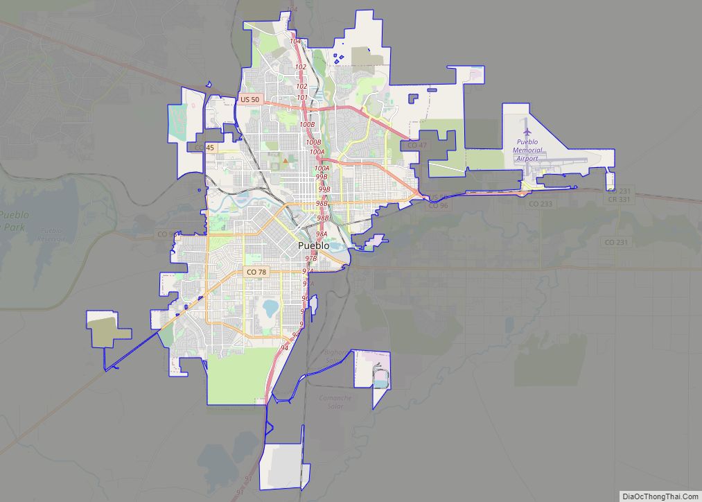
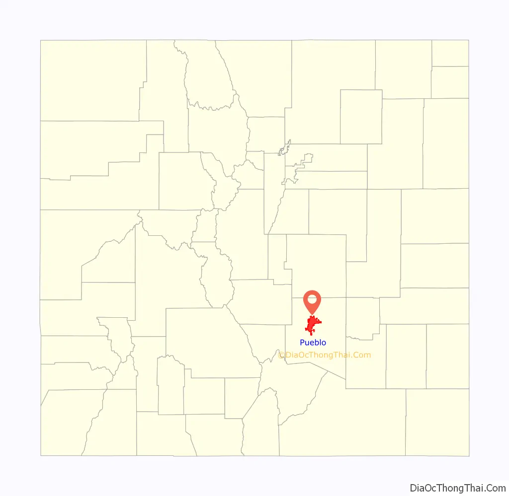
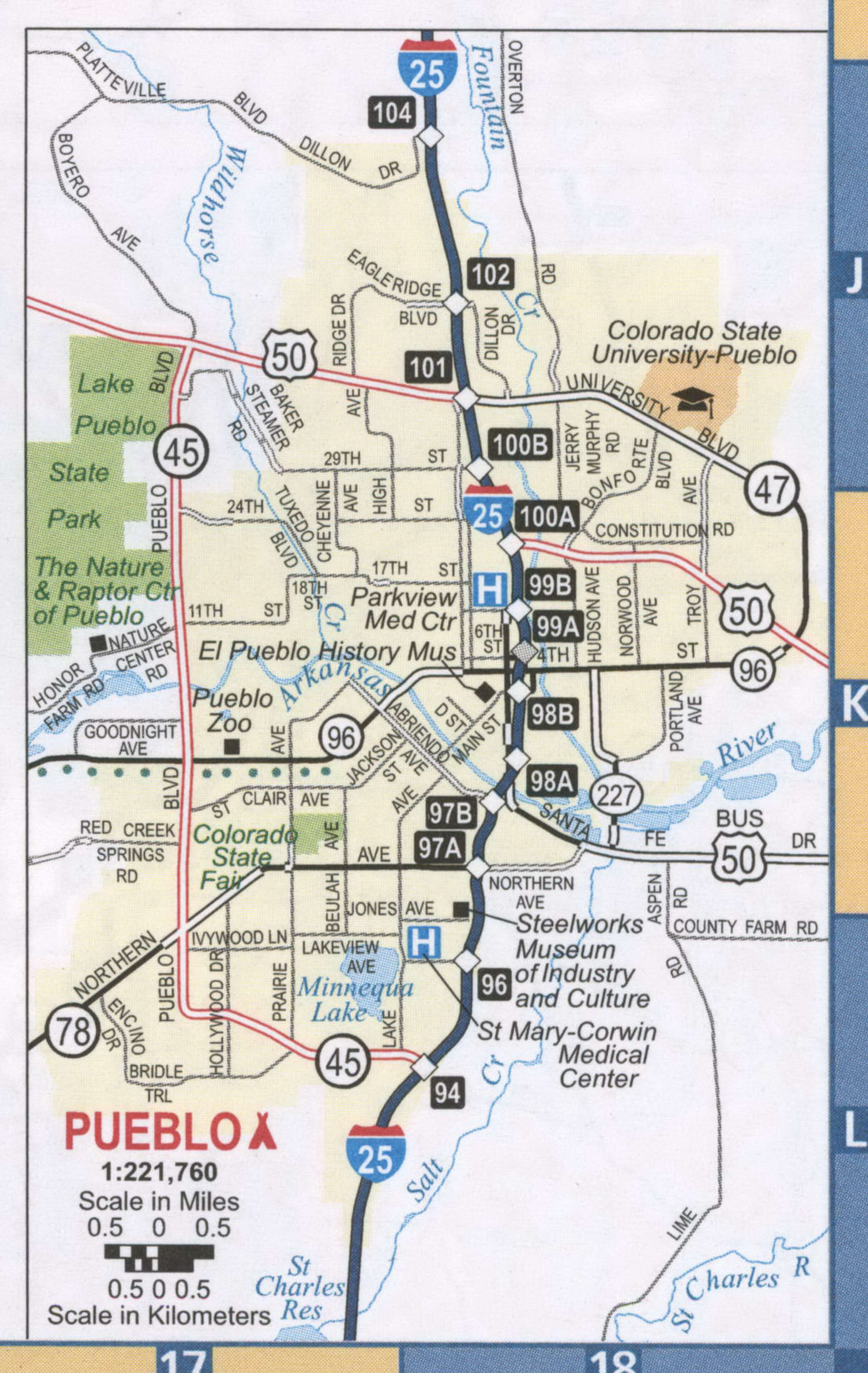
Pueblo Road Map
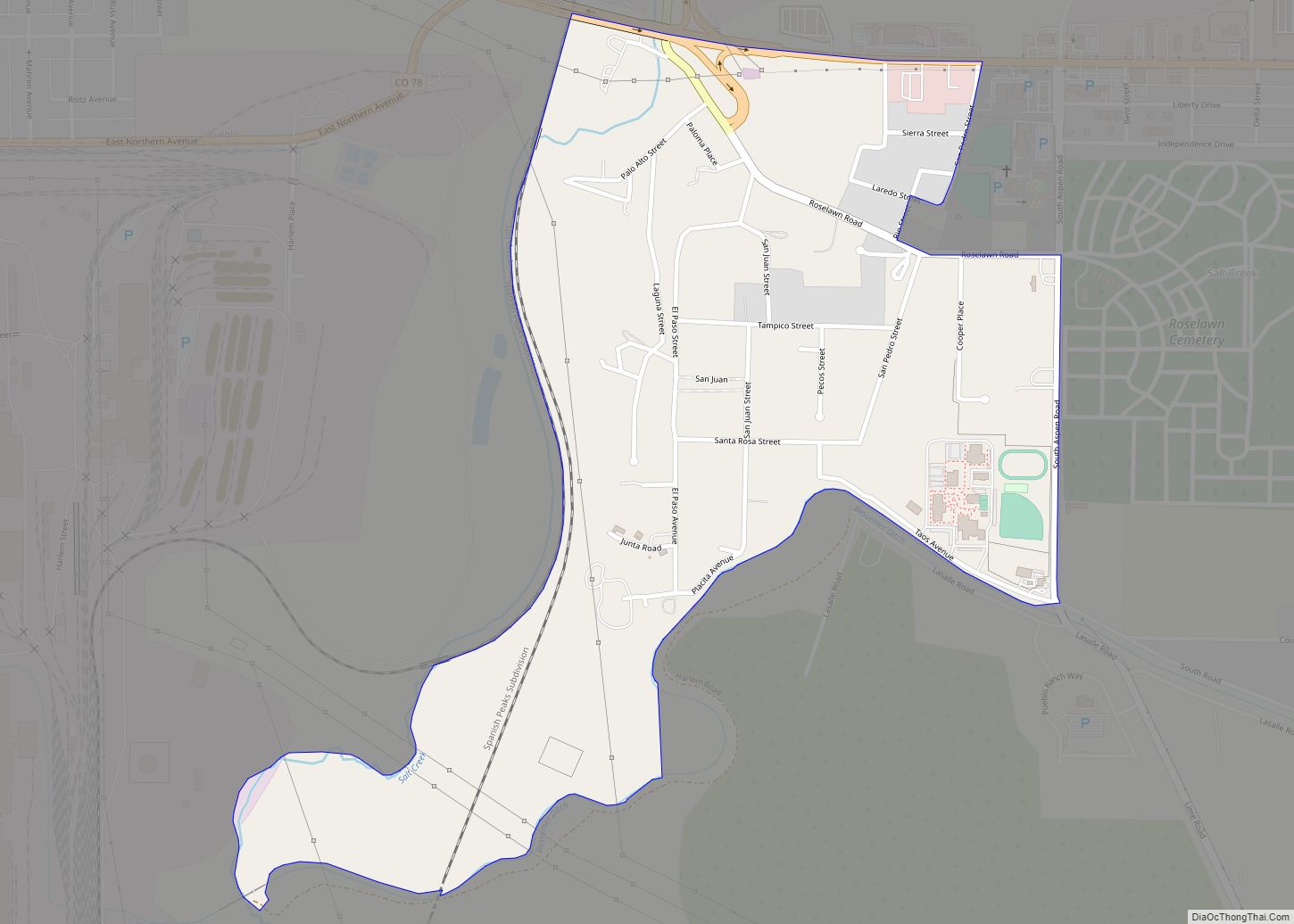
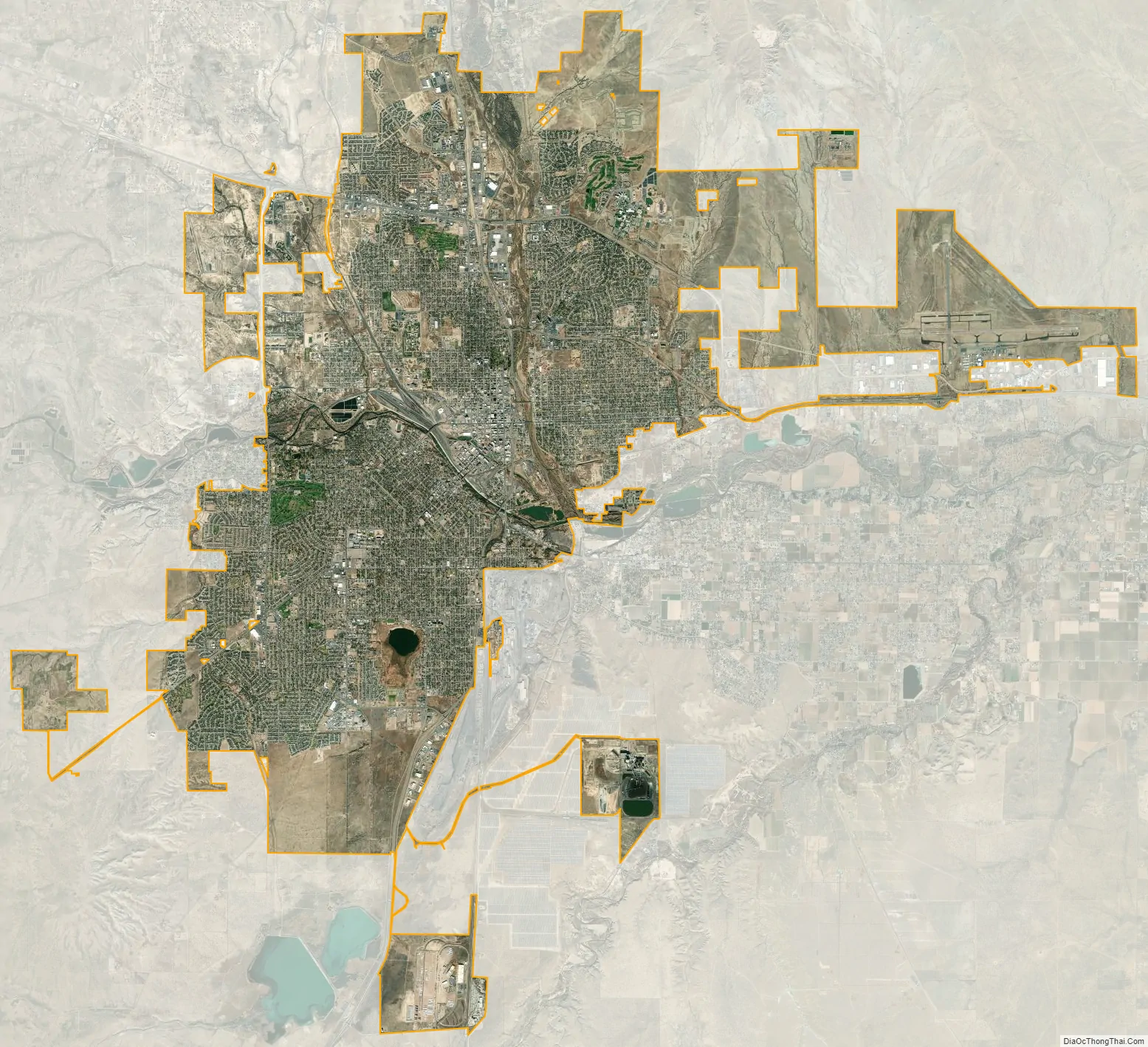
Pueblo city Satellite Map
Geography
Pueblo is 100 miles (160 km) south of Denver and is on the front range of the Rocky Mountains. Pueblo sits on the western edge of the Great Plains in a high desert area of terrain in southern Colorado and is near the western edge of the Southwestern Tablelands ecology region.
According to the 2020 United States Census, the city had a total area of 35,893 acres (145.254 km), including 448 acres (1.815 km) of water.
Climate
Pueblo has a steppe climate (Köppen BSk), with four distinct seasons. Winter days are usually mild, but the high does not surpass freezing on an average 14.4 days per year, and lows fall to 0 °F (−18 °C) or below on 6.2 nights. Snowfall usually falls in light amounts, and due to the high altitude, and the accompanying stronger sun, rarely remains on the ground for long (typically, for one or two days). January is the snowiest month, and the seasonal average is 28.3 inches (72 cm); however, snow is uncommon in October, and in May or September, snow is exceedingly rare, with an average first and last date of measurable (≥0.1 in or 0.25 cm) snowfall being November 4 and April 9, respectively. Summers are hot and dry, with 90 °F (32 °C) or greater highs are on average seen 71.6 days per year, with 100 °F (38 °C) or greater on 12.0 days. Diurnal temperature ranges are large throughout the year, averaging 32.5 °F (18.1 °C).
Precipitation is generally low, with the winter months receiving very little. Sunshine is abundant throughout the year, with an annual total of nearly 3,470 hours, or 78% of the possible total. Pueblo is considered a high desert climate, and sits on the desert lands in southern Colorado between Pueblo and the Royal Gorge.
See also
Map of Colorado State and its subdivision:- Adams
- Alamosa
- Arapahoe
- Archuleta
- Baca
- Bent
- Boulder
- Broomfield
- Chaffee
- Cheyenne
- Clear Creek
- Conejos
- Costilla
- Crowley
- Custer
- Delta
- Denver
- Dolores
- Douglas
- Eagle
- El Paso
- Elbert
- Fremont
- Garfield
- Gilpin
- Grand
- Gunnison
- Hinsdale
- Huerfano
- Jackson
- Jefferson
- Kiowa
- Kit Carson
- La Plata
- Lake
- Larimer
- Las Animas
- Lincoln
- Logan
- Mesa
- Mineral
- Moffat
- Montezuma
- Montrose
- Morgan
- Otero
- Ouray
- Park
- Phillips
- Pitkin
- Prowers
- Pueblo
- Rio Blanco
- Rio Grande
- Routt
- Saguache
- San Juan
- San Miguel
- Sedgwick
- Summit
- Teller
- Washington
- Weld
- Yuma
- Alabama
- Alaska
- Arizona
- Arkansas
- California
- Colorado
- Connecticut
- Delaware
- District of Columbia
- Florida
- Georgia
- Hawaii
- Idaho
- Illinois
- Indiana
- Iowa
- Kansas
- Kentucky
- Louisiana
- Maine
- Maryland
- Massachusetts
- Michigan
- Minnesota
- Mississippi
- Missouri
- Montana
- Nebraska
- Nevada
- New Hampshire
- New Jersey
- New Mexico
- New York
- North Carolina
- North Dakota
- Ohio
- Oklahoma
- Oregon
- Pennsylvania
- Rhode Island
- South Carolina
- South Dakota
- Tennessee
- Texas
- Utah
- Vermont
- Virginia
- Washington
- West Virginia
- Wisconsin
- Wyoming